
-
Federal
sylvia-20210827T1536
National Oceanic and Atmospheric Administration, Department of Commerce —
This project supports the deployment and realtime data delivery of autonomous underwater gliders in the coastal ocean to better resolve and understand essential ocean... -
Federal
ru30-20191015T1824 Delayed Mode Science Profiles
National Oceanic and Atmospheric Administration, Department of Commerce —
This project integrated a deep rated version of the Ion Sensitive Field Effect Transistor (ISFET)-based pH sensor, the Deep ISFET pH, into a Slocum Webb G2 glider.... -
Federal
maracoos_01-20210818T1454-delayed
National Oceanic and Atmospheric Administration, Department of Commerce —
This project supports the deployment and realtime data delivery of autonomous underwater gliders in the coastal ocean to better resolve and understand essential ocean... -
Federal
Section 108 Grantee Areas
Department of Housing and Urban Development —
This dataset provides the locations and pertinent information for Section 108 Loan Guarantee Program grantee areas. Section 108 of the Housing and Community... -
Federal
Aerial Photographs (from AMES Pilot Land Data System); USGS EDC, Sioux Falls
National Aeronautics and Space Administration —
The aerial photography inventoried by the Pilot Land Data System (PLDS) at NASA AMES Research Center has been transferred to the USGS EROS Data Center. The photos... -
Federal
Ground-Based Global Navigation Satellite System (GNSS)-based Upper Atmospheric Realtime Disaster Information and Alert Network (GUARDIAN) Galileo Earth Orientation Parameters (1-day sampling, 7-day files) from NASA CDDIS
National Aeronautics and Space Administration —
This product contains a time series of Earth orientation parameters from the IERS Bulletin A for the Galileo constellation of satellites. The product is generated at... -
Federal
Ground-Based GNSS-based Upper Atmospheric Realtime Disaster Information and Alert Network (GUARDIAN) Galileo daily accumulated real-time Precise Orbit Determination (POD) orbits (60-second sampling, 24-hour files) from NASA CDDIS
National Aeronautics and Space Administration —
This product contains a time series of position and velocity components for healthy satellites in the Galileo constellation that are accumulated every minute... -
Federal
Ground-Based GNSS-based Upper Atmospheric Realtime Disaster Information and Alert Network (GUARDIAN) GPS daily accumulated real-time Precise Orbit Determination (POD) Attitude Quaternions (30-second sampling, 24-hour files) from NASA CDDIS
National Aeronautics and Space Administration —
This product contains a time series of attitude quaternion components for healthy satellites in the GPS constellation that are accumulated every minute throughout the... -
Federal
Ground-Based GNSS-based Upper Atmospheric Realtime Disaster Information and Alert Network (GUARDIAN) Galileo daily accumulated real-time Precise Orbit Determination (POD) Clock Corrections (1-second sampling, 24-hour files) from NASA CDDIS
National Aeronautics and Space Administration —
This product contains a time series of clock biases for healthy satellites in the Galileo constellation that are accumulated every minute throughout the day. In... -
Federal
Ground-Based GNSS-based Upper Atmospheric Realtime Disaster Information and Alert Network (GUARDIAN) GLONASS daily accumulated real-time Precise Orbit Determination (POD) Attitude Quaternions (30-second sampling, 24-hour files) from NASA CDDIS
National Aeronautics and Space Administration —
This product contains a time series of attitude quaternion components for healthy satellites in the GLONASS constellation that are accumulated every minute throughout... -
Federal
Ground-Based GNSS-based Upper Atmospheric Realtime Disaster Information and Alert Network (GUARDIAN) GPS daily accumulated real-time Precise Orbit Determination (POD) Clock Corrections (1-second sampling, 24-hour files) from NASA CDDIS
National Aeronautics and Space Administration —
This product contains a high-rate time series of clock biases for healthy satellites in the GPS constellation that are accumulated every minute throughout the day. In... -
Federal
Ground-Based GNSS-based Upper Atmospheric Realtime Disaster Information and Alert Network (GUARDIAN) GLONASS daily accumulated real-time Precise Orbit Determination (POD) Clock Corrections (1-second sampling, 24-hour files) from NASA CDDIS
National Aeronautics and Space Administration —
This product contains a high-rate time series of clock biases for healthy satellites in the GLONASS constellation that are accumulated every minute throughout the... -
Federal
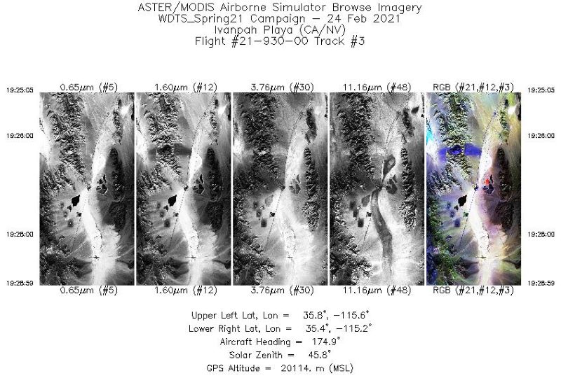
MASTER: Western Diversity Time Series Campaign, WDTS, California, USA, Spring 2021
National Aeronautics and Space Administration —
This dataset includes Level 1B (L1B) and Level 2 (L2) data products from the MODIS/ASTER Airborne Simulator (MASTER) instrument. The spectral data were collected as... -
Federal
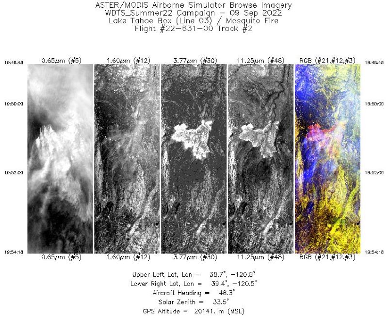
MASTER: Western Diversity Time Series Campaign, WDTS, September 2022
National Aeronautics and Space Administration —
This dataset includes Level 1B (L1B) and Level 2 (L2) data products from the MODIS/ASTER Airborne Simulator (MASTER) instrument. The spectral data were collected as... -
Federal
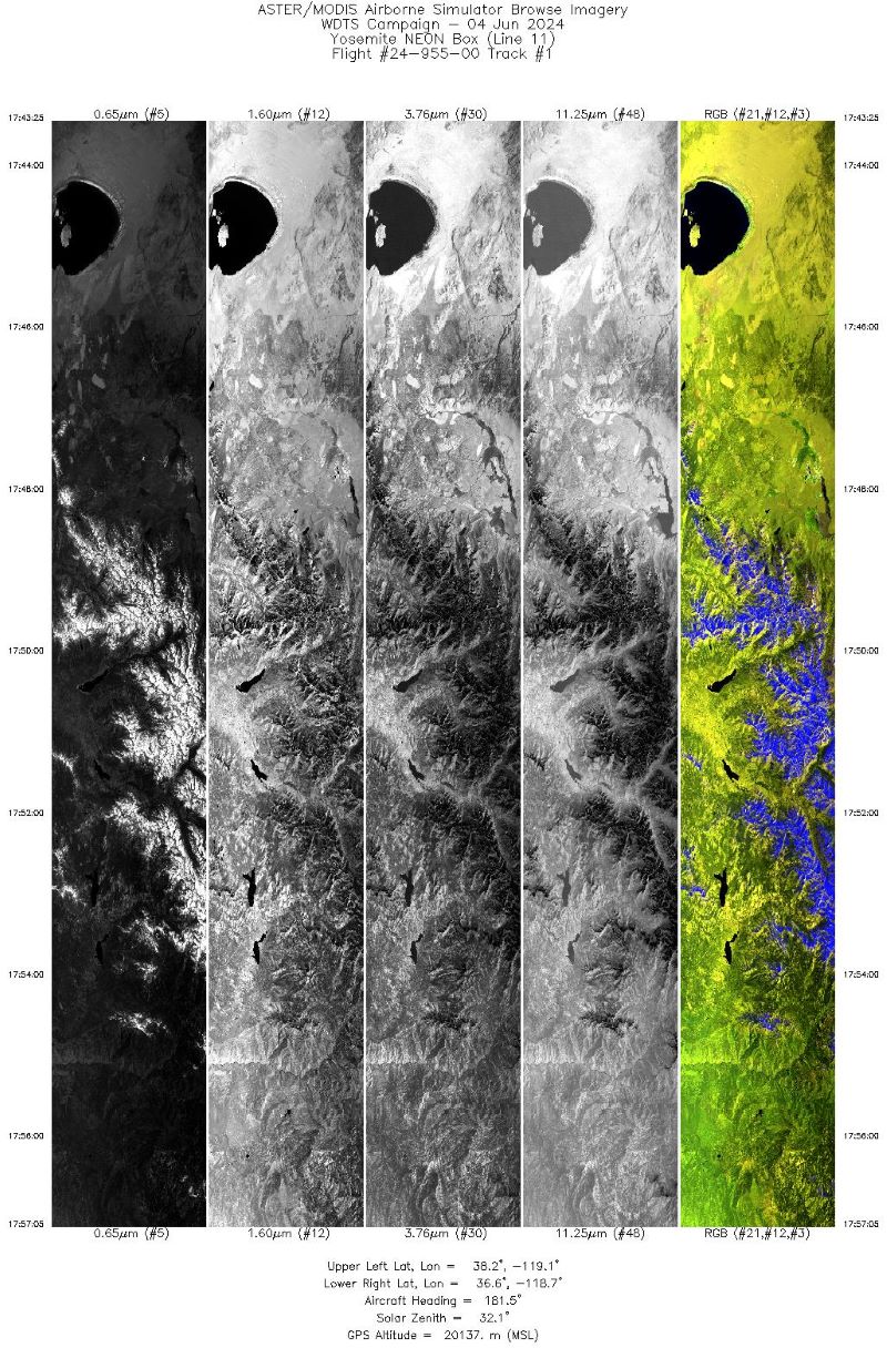
MASTER: Western Diversity Time Series Campaign, WDTS, Spring 2024
National Aeronautics and Space Administration —
This dataset includes Level 1B (L1B) data products from the MODIS/ASTER Airborne Simulator (MASTER) instrument. The spectral data were collected as part of the... -
Federal
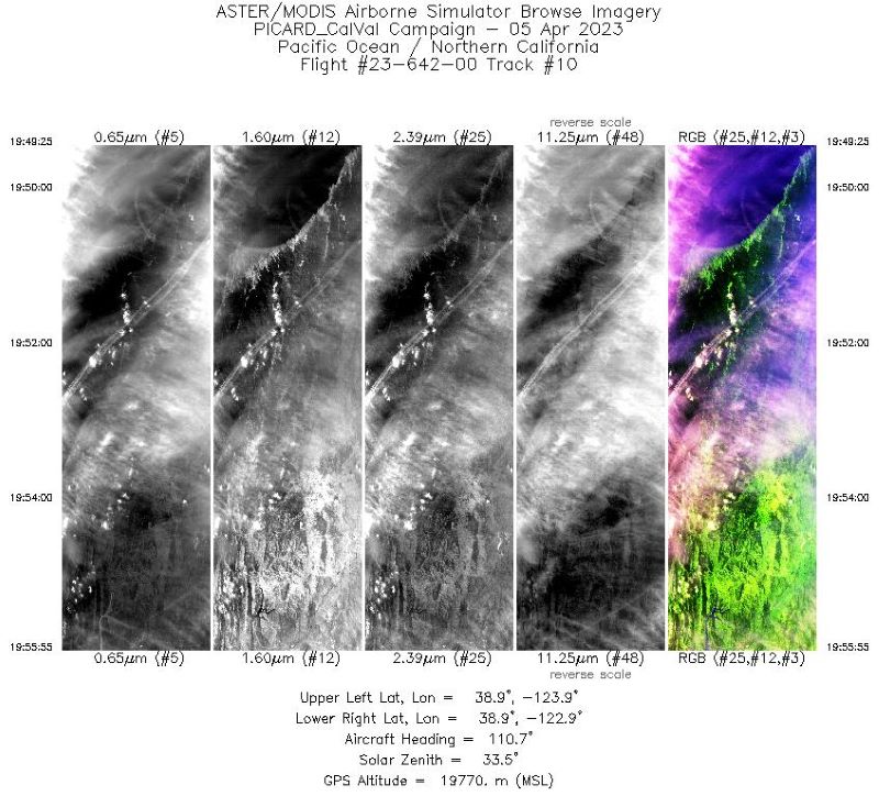
MASTER: Western Diversity Time Series Campaign, WDTS, Spring 2023
National Aeronautics and Space Administration —
This dataset includes Level 1B (L1B) and Level 2 (L2) data products from the MODIS/ASTER Airborne Simulator (MASTER) instrument. The spectral data were collected as... -
Federal
Ground-Based Global Navigation Satellite System (GNSS)-based Upper Atmospheric Realtime Disaster Information and Alert Network (GUARDIAN) GLONASS daily antenna phase centers (24-hour files) from NASA CDDIS
National Aeronautics and Space Administration —
This product contains antenna phase center locations relative to the GLONASS satellite's center of mass. The product is generated at JPL's Global Differential GPS... -
Federal
Ground-Based Global Navigation Satellite System (GNSS)-based Upper Atmospheric Realtime Disaster Information and Alert Network (GUARDIAN) GPS daily antenna phase centers (24-hour files) from NASA CDDIS
National Aeronautics and Space Administration —
This product ontains antenna phase center locations relative to the GPS satellite's center of mass. The product is generated at JPL's Global Differential GPS... -
Federal
Ground-Based GNSS-based Upper Atmospheric Realtime Disaster Information and Alert Network (GUARDIAN) GPS daily accumulated real-time Precise Orbit Determination (POD) Clock Corrections (60-second sampling, 24-hour files) from NASA CDDIS
National Aeronautics and Space Administration —
This product contains a time series of clock biases for healthy satellites in the GPS constellation that are accumulated every minute throughout the day. In addition,... -
Federal
Ground-Based GNSS-based Upper Atmospheric Realtime Disaster Information and Alert Network (GUARDIAN) GLONASS daily accumulated real-time Precise Orbit Determination (POD) orbits (60-second sampling, 24-hour files) from NASA CDDIS
National Aeronautics and Space Administration —
This product contains a time series of position and velocity components for healthy satellites in the GLONASS constellation that are accumulated every minute...

Official websites use .gov
A
.gov website belongs to an official government
organization in the United States.
Secure .gov websites use HTTPS
A
lock (
) or https:// means you’ve safely connected to
the .gov website. Share sensitive information only on official,
secure websites.