
-
Federal
Middle Bay Light, AL
National Oceanic and Atmospheric Administration, Department of Commerce —
GCOOS 52North Sensor Observation Service This station provides the following variables: Air pressure, Air temperature, Mass concentration of oxygen in sea water,... -
Federal
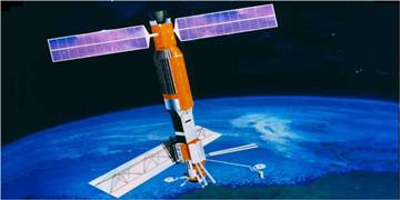
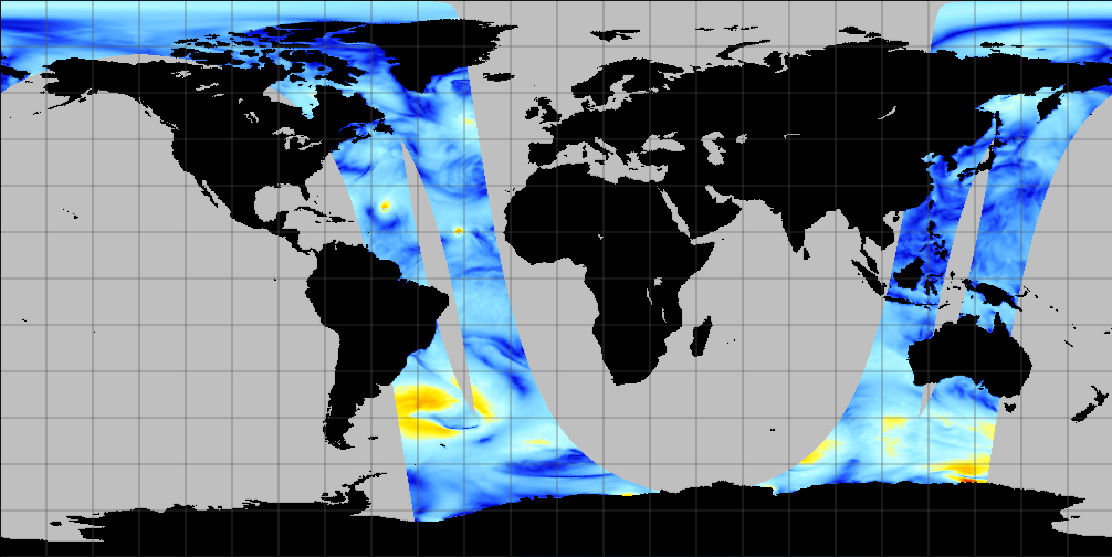
SEASAT SCATTEROMETER DEALIASED OCEAN WIND VECTORS (Wentz et al.)
National Aeronautics and Space Administration —
Contains Seasat-A Scatterometer (SASS) wind vector measurements for the entire Seasat mission, from July 1978 until October 1978. The data are global and presented... -
Federal
SEASAT SCATTEROMETER DEALIASED OCEAN WIND VECTORS (Atlas)
National Aeronautics and Space Administration —
Contains wind speeds and directions derived from the Seasat-A Scatterometer (SASS), presented chronologically by swath for the period between 7 July 1978 and 10... -
Federal
MetOp-B ASCAT ESDR Level 2 Ancillary Ocean Surface Fields Version 1.1
National Aeronautics and Space Administration —
This dataset contains model output interpolated in space and time to observations from the MetOp-B ASCAT (ASCAT-B) instrument (a satellite-based scatterometer),... -
Federal
Jason-1 SGDR version E NetCDF Geodetic
National Aeronautics and Space Administration —
The Sensory Geophysical Data Record (SGDR) files from the Geodetic Mission contain full accuracy altimeter data, with a high precision orbit. The instruments on... -
Federal
NSCAT Level 2 Ocean Wind Vector Geophysical Data Record
National Aeronautics and Space Administration —
The NASA Scatterometer (NSCAT) Level 2 ocean wind vectors in 50 km wind vector cell (WVC) swaths contain daily data from ascending and descending passes. Wind vectors... -
Federal
QuikSCAT Level 1C Averaged Sigma-0 and Winds from Non-spinning Antenna Version 2.0
National Aeronautics and Space Administration —
This dataset is Version 2 of the geo-located and averaged Level 1B Sigma-0 measurements and wind retrievals from the SeaWinds on QuikSCAT platform, initiated in the... -
Federal
Saildrone Arctic field campaign surface and ADCP measurements for NOPP-MISST project
National Aeronautics and Space Administration —
The Saildrone Arctic 2019 dataset presents a unique collection of high-quality, near real-time, multivariate surface ocean, and atmospheric observations obtained... -
Federal
Remote Sensing Systems Radiometer Rain Collocations with JPL RapidScat L2B Swath Grid
National Aeronautics and Space Administration —
This dataset contains the multi-sourced microwave radiometer wind speed, rain and cloud liquid water data collocated to RapidScat Level 2B wind vector cell (WVC)... -
Federal
QuikSCAT ESDR Level 2 Ancillary Ocean Surface Fields Version 1.1
National Aeronautics and Space Administration —
This dataset contains model output interpolated in space and time to the ESDR product from the scatterometer on the QuikSCAT satellite, representing the first science... -
Federal
RapidScat Level 2B Climate Ocean Wind Vectors in 12.5km Footprints
National Aeronautics and Space Administration —
This dataset contains the RapidScat Level 2B 12.5km Version 1.0 Climate quality ocean surface wind vectors. The Level 2B wind vectors are binned on a 12.5 km Wind... -
Federal
Saildrone field campaign surface and ADCP measurements for the Atlantic Tradewind Ocean-Atmosphere Mesoscale Interaction Campaign (ATOMIC) project
National Aeronautics and Space Administration —
Saildrone is a wind and solar powered unmanned surface vehicle (USV) capable of long distance deployments lasting up to 12 months and providing high quality, near... -
Federal
SPURS-1 research vessel Meteorological series data for N. Atlantic Endeavor cruises
National Aeronautics and Space Administration —
The SPURS (Salinity Processes in the Upper Ocean Regional Study) project is an oceanographic process study and associated field program that aim to elucidate key... -
Federal
NSCAT High Resolution R-MGDR, Selected Ocean Wind Vectors (JPL)
National Aeronautics and Space Administration —
The NASA Scatterometer (NSCAT) Level 2.5 high-resolution reduced MGDR contains only wind vector data (sigma-0 is excluded) in 25 km wind vector cell (WVC) swaths... -
Federal
GHRSST Level 2P Global Subskin Sea Surface Temperature version 8.2 (v8.2) from the Advanced Microwave Scanning Radiometer 2 (AMSR2) by REMSS
National Aeronautics and Space Administration —
This product provides a “Final” (Refined) Level-2 Sea Surface Temperature (SST) (currently identified by "v8.2" within the file name) for the Group for High... -
Federal
Aquarius CAP Level 3 Sea Surface Salinity Standard Mapped Image 7-Day Data V5.0
National Aeronautics and Space Administration —
Version 5.0 Aquarius CAP Level 3 products are the fourth release of the AQUARIUS/SAC-D mapped salinity and wind speed data based on the Combined Active Passive (CAP)... -
Federal
Aquarius CAP Level 2 Sea Surface Salinity, Wind Speed & Direction Data V5.0
National Aeronautics and Space Administration —
The version 5.0 Aquarius CAP Level 2 product contains the fourth release of the AQUARIUS/SAC-D orbital/swath data based on the Combined Active Passive (CAP)... -
Federal
Aquarius CAP Level 3 Sea Surface Salinity Rain Corrected Standard Mapped Image Monthly Data V5.0
National Aeronautics and Space Administration —
Version 5.0 Aquarius CAP Level 3 products are the fourth release of the AQUARIUS/SAC-D mapped salinity and wind speed data based on the Combined Active Passive (CAP)... -
Federal
ACT-America: L1 Meteorological and Aircraft Navigational Data
National Aeronautics and Space Administration —
This dataset provides aircraft navigational parameters and related meteorological data (often referred to as "housekeeping" data) in support of the research... -
Federal
ATom: Flight Dynamics and Environmental Parameters of the NASA DC-8 Aircraft
National Aeronautics and Space Administration —
This dataset contains flight dynamics and environmental parameters (often referred to as housekeeping) specific to the DC-8 aircraft as collected from an assortment...

Official websites use .gov
A
.gov website belongs to an official government
organization in the United States.
Secure .gov websites use HTTPS
A
lock (
) or https:// means you’ve safely connected to
the .gov website. Share sensitive information only on official,
secure websites.