
-
Federal
Pre-LBA Rondonia Boundary Layer Experiment (RBLE) Data
National Aeronautics and Space Administration —
The atmospheric boundary layer (ABL) is the layer of air closest to the ground which is directly influenced on a daily basis by the heating and cooling of the earth's... -
Federal
Radiant Temp. Multiangle Data (FIFE)
National Aeronautics and Space Administration —
The Surface Temperatures Measured at Multiple Angles Data Set was collected at two locations within the northwest quadrant of the FIFE study area during July and... -
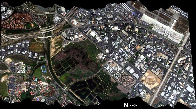
Federal
AVIRIS-Classic: L2 Calibrated Reflectance, Facility Instrument Collection, V1
National Aeronautics and Space Administration —
This dataset contains Level 2 (L2) orthocorrected reflectance from the Airborne Visible / Infrared Imaging Spectrometer (AVIRIS-Classic) instrument. This is the NASA... -
Federal
Ground-Based Vegetation Community Photos, Toolik Lake Area, Alaska, 2014-2015
National Aeronautics and Space Administration —
This dataset contains 731 ground-based nadir vegetation community and ground surface photographs of selected field plots taken as ground reference data for vegetation... -
Federal
Circumpolar Arctic Vegetation, Geobotanical, Physiographic Maps, 1982-2003
National Aeronautics and Space Administration —
This data set provides the spatial distributions of vegetation types, geobotanical characteristics, and physiographic features for the circumpolar Arctic tundra biome... -
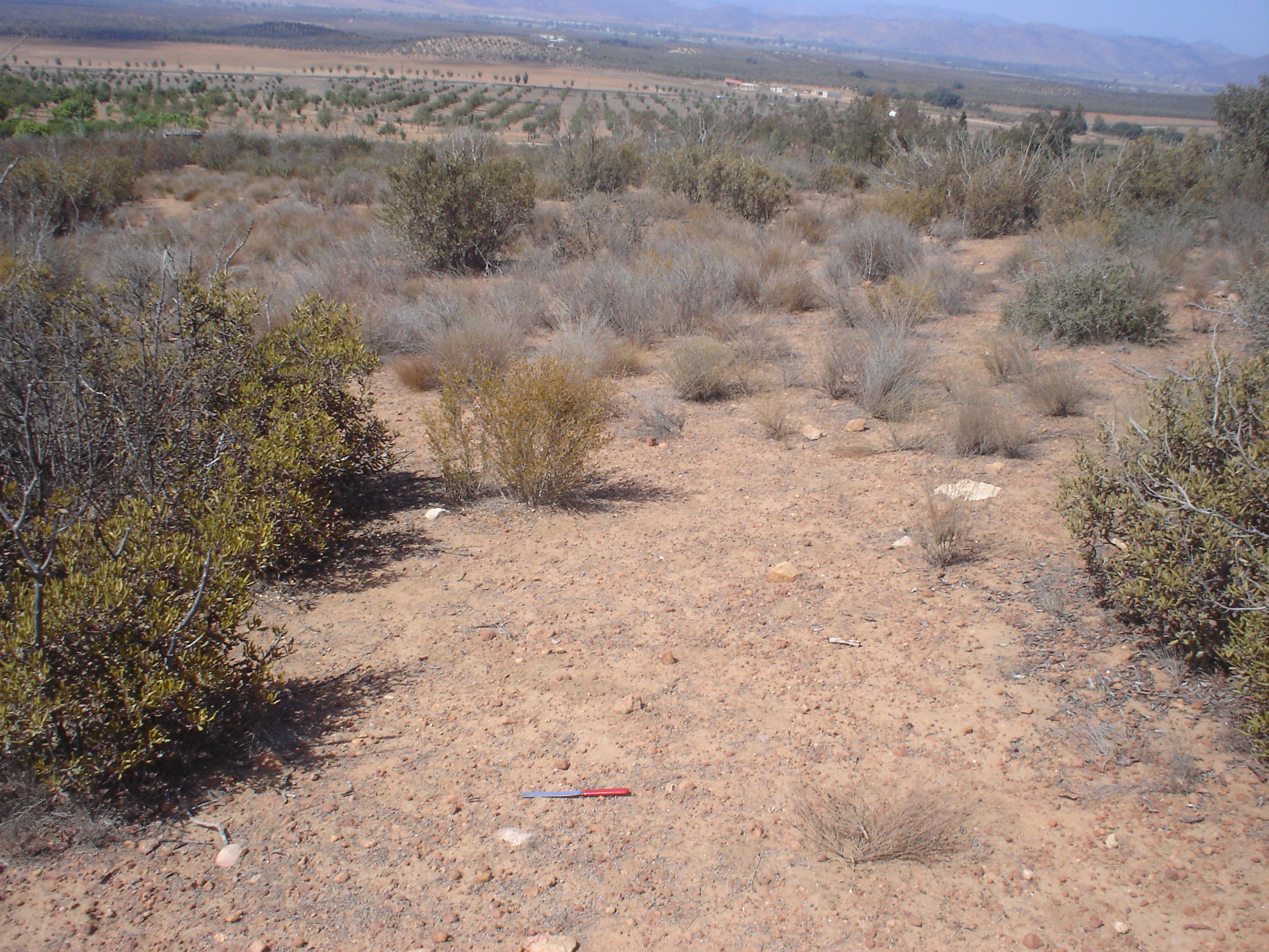
Federal
Arctic Vegetation Plots at Imnavait Creek, Alaska, 1984-1985
National Aeronautics and Space Administration —
This dataset provides environmental, soil, and vegetation data collected during the periods of August 1984 and August-September 1985 from 84 study plots at the... -
Federal
SHIFT: Photosynthetic and Leaf Traits, Santa Barbara County, 2022
National Aeronautics and Space Administration —
This dataset provides leaf images and measurements of leaf traits (area, wet weight, dry weight, leaf mass per area, leaf water content) and leaf pigments... -
Federal
Soil Moisture Release Data (FIFE)
National Aeronautics and Space Administration —
This data product was created based on the hypothesis that a variety of ground truth observations of soil moisture could be combined to estimate equal soil moisture... -
Federal
BOREAS Landsat TM Level-3p Imagery: Geocoded and Scaled At-Sensor Radiance
National Aeronautics and Space Administration —
For BOREAS, the level-3p Landsat TM data were used to supplement the level-3s Landsat TM products. Along with the other remotely sensed images, the Landsat TM images... -
Federal
BOREAS Level-1B MAS Imagery: At-Sensor Radiance, Relative X and Y Coordinates
National Aeronautics and Space Administration —
For BOREAS, the MAS images, along with the other remotely sensed data, were collected to provide spatially-extensive information over the primary study areas. This... -
Federal
CARVE: Monthly Atmospheric CO2 Concentrations (2009-2013) and Modeled Fluxes, Alaska
National Aeronautics and Space Administration —
This data set reports monthly averages of atmospheric CO2 concentration from satellite and airborne observations between 2009 and 2013 and simulated present and... -
Federal
LBA-ECO LC-01 Landsat MSS, TM, ETM+ Imagery, Northern Ecuadorian Amazon: 1973-2002
National Aeronautics and Space Administration —
This data set contains a time series of early Landsat-4 MSS satellite imagery as well as Landsat-5 TM and Landsat-7 ETM+ satellite imagery of the northern Ecuadorian... -
Federal
JERS-1 Synthetic Aperture Radar, 100-m Mosaics, South America: 1995-1996, R1
National Aeronautics and Space Administration —
This data set provides ~100-m resolution image mosaics of South America acquired during the low flood season between September and December 1995 and during the high... -
Federal
ACT-America: L1 Raw, Uncalibrated In-Situ CO2, CO, and CH4 Mole Fractions from Towers
National Aeronautics and Space Administration —
This dataset provides Level 1 (L1) in situ atmospheric carbon dioxide (CO2), carbon monoxide (CO), and methane (CH4) concentrations as measured on a network of... -
Federal
Site Averaged Neutron Soil Moisture: 1987 (Betts)
National Aeronautics and Space Administration —
The Site Averaged Neutron Soil Moisture Data: 1987 (Betts) Data Set contains the site averaged product data of the neutron probe soil moisture collected during the... -
Federal
Optical Thickness Data: Staff (FIFE)
National Aeronautics and Space Administration —
Aerosol optical thickness in conjunction with an atmospheric model can provide estimates of atmospheric effects on transmitted and reflected solar radiation. These... -
Federal
Blue Carbon-based Natural Climate Solutions, Priority Maps for the U.S., 2006-2011
National Aeronautics and Space Administration —
This dataset contains shapefiles showing location of tidal wetland parcels with the potential for net greenhouse gas removal if restored from current mapped condition... -
Federal
CMS: Soil CO2 Efflux and Properties, Site Vegetation Measurements, Mexico, 2011-2012
National Aeronautics and Space Administration —
This data set provides the results of (1) monthly measurements of soil CO2 efflux, volumetric water content, and temperature, and (2) seasonal measurements of soil... -
Federal
BOREAS TE-10 Leaf Optical Properties for SSA Species
National Aeronautics and Space Administration —
The BOREAS TE-10 team collected several data sets in support of its efforts to characterize and interpret information on the reflectance, transmittance, gas exchange,...

Official websites use .gov
A
.gov website belongs to an official government
organization in the United States.
Secure .gov websites use HTTPS
A
lock (
) or https:// means you’ve safely connected to
the .gov website. Share sensitive information only on official,
secure websites.