
-
Federal
Trident Pier, FL
National Oceanic and Atmospheric Administration, Department of Commerce —
GCOOS 52North Sensor Observation Service This station provides the following variables: Air pressure, Air temperature, Sea surface height above sea level, Wind speed,... -
Federal
Dauphin Island, AL
National Oceanic and Atmospheric Administration, Department of Commerce —
GCOOS 52North Sensor Observation Service This station provides the following variables: Air pressure, Air temperature, Mass concentration of oxygen in sea water, Sea... -
Federal
Lake Worth Pier, FL
National Oceanic and Atmospheric Administration, Department of Commerce —
GCOOS 52North Sensor Observation Service This station provides the following variables: Air pressure, Air temperature, Sea surface height above sea level, Wind speed,... -
Federal
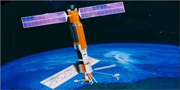
SEASAT SCATTEROMETER DERIVED GLOBAL GRIDDED MONTHLY OCEAN WIND STRESS (Chelton)
National Aeronautics and Space Administration —
Contains monthly averaged ocean surface wind stress derived from Seasat-A Scatterometer (SASS) wind retrievals, from July 1978 until October 1978, gridded on a... -
Federal
SEASAT SCATTEROMETER DEALIASED OCEAN WIND VECTORS (Wentz et al.)
National Aeronautics and Space Administration —
Contains Seasat-A Scatterometer (SASS) wind vector measurements for the entire Seasat mission, from July 1978 until October 1978. The data are global and presented... -
Federal
SEASAT SCATTEROMETER DEALIASED OCEAN WIND VECTORS (Atlas)
National Aeronautics and Space Administration —
Contains wind speeds and directions derived from the Seasat-A Scatterometer (SASS), presented chronologically by swath for the period between 7 July 1978 and 10... -
Federal
MetOp-B ASCAT ESDR Level 2 Ancillary Ocean Surface Fields Version 1.1
National Aeronautics and Space Administration —
This dataset contains model output interpolated in space and time to observations from the MetOp-B ASCAT (ASCAT-B) instrument (a satellite-based scatterometer),... -
Federal
JPL SMAP Level 2B Near Real-time CAP Sea Surface Salinity V5.0 Validated Dataset (2 hour latency)
National Aeronautics and Space Administration —
The SMAP-SSS V5.0, level 2B (NRT CAP) dataset produced by the Jet Propulsion Laboratory Combined Active-Passive (CAP) project , is a validated product that provides... -
Federal
Jason-1 SGDR version E NetCDF Geodetic
National Aeronautics and Space Administration —
The Sensory Geophysical Data Record (SGDR) files from the Geodetic Mission contain full accuracy altimeter data, with a high precision orbit. The instruments on... -
Federal
Jason-1 GDR version E NetCDF Geodetic
National Aeronautics and Space Administration —
The Jason-1 Geophysical Data Records (GDR) Geodetic Mission contain full accuracy altimeter data, with a high precision orbit, provided approximately 35 days after... -
Federal
Jason-1 GDR SSHA version E NetCDF
National Aeronautics and Space Administration —
These Sea Surface Height Anomalies (SSHA) are derived from the Jason-1 Geophysical Data Record (GDR). Jason-1 is an altimetric mission whose instruments make direct... -
Federal
Jason-1 SGDR version E NetCDF
National Aeronautics and Space Administration —
The Sensory Geophysical Data Record (SGDR) files contain full accuracy altimeter data, with a high precision orbit (accuracy ~1.5 cm). The instruments on Jason-1 make... -
Federal
Jason-1 GDR version E NetCDF
National Aeronautics and Space Administration —
The Jason-1 Geophysical Data Records (GDR) contain full accuracy altimeter data to measure sea surface height, with a high precision orbit (accuracy ~1.5 cm). The... -
Federal
MetOp-A ASCAT ESDR Level 2 Ancillary Ocean Surface Fields Version 1.1
National Aeronautics and Space Administration —
This dataset contains model output interpolated in space and time to observations from the MetOp-A ASCAT (ASCAT-A) instrument (a satellite-based scatterometer),... -
Federal
NSCAT Level 2 Ocean Wind Vector Geophysical Data Record
National Aeronautics and Space Administration —
The NASA Scatterometer (NSCAT) Level 2 ocean wind vectors in 50 km wind vector cell (WVC) swaths contain daily data from ascending and descending passes. Wind vectors... -
Federal
QuikSCAT Level 1C Averaged Sigma-0 and Winds from Non-spinning Antenna Version 2.0
National Aeronautics and Space Administration —
This dataset is Version 2 of the geo-located and averaged Level 1B Sigma-0 measurements and wind retrievals from the SeaWinds on QuikSCAT platform, initiated in the... -
Federal
Saildrone Arctic field campaign surface and ADCP measurements for NOPP-MISST project
National Aeronautics and Space Administration —
The Saildrone Arctic 2019 dataset presents a unique collection of high-quality, near real-time, multivariate surface ocean, and atmospheric observations obtained... -
Federal
Remote Sensing Systems Radiometer Rain Collocations with JPL RapidScat L2B Swath Grid
National Aeronautics and Space Administration —
This dataset contains the multi-sourced microwave radiometer wind speed, rain and cloud liquid water data collocated to RapidScat Level 2B wind vector cell (WVC)... -
Federal
QuikSCAT ESDR Level 2 Ancillary Ocean Surface Fields Version 1.1
National Aeronautics and Space Administration —
This dataset contains model output interpolated in space and time to the ESDR product from the scatterometer on the QuikSCAT satellite, representing the first science... -
Federal
RapidScat Level 2B Climate Ocean Wind Vectors in 12.5km Footprints
National Aeronautics and Space Administration —
This dataset contains the RapidScat Level 2B 12.5km Version 1.0 Climate quality ocean surface wind vectors. The Level 2B wind vectors are binned on a 12.5 km Wind...

Official websites use .gov
A
.gov website belongs to an official government
organization in the United States.
Secure .gov websites use HTTPS
A
lock (
) or https:// means you’ve safely connected to
the .gov website. Share sensitive information only on official,
secure websites.