
-
Federal
CERES and GEO-Enhanced TOA, Within-Atmosphere and Surface Fluxes, Clouds and Aerosols Daily Terra-NPP Edition1A NGDA recent views
National Aeronautics and Space Administration —
CER_SYN1deg-Day_Terra-NPP_Edition1A is the Clouds and the Earth's Radiant Energy System (CERES) and geostationary (GEO)-Enhanced Top-of-Atmosphere (TOA) and Surface... -
Federal
TROPESS CrIS-SNPP L2 for Los Angeles Megacity, Standard Product V1 (TRPSDL2ALLCRSMGLOS) at GES DISC recent views
National Aeronautics and Space Administration —
The TROPESS CrIS-SNPP L2 for Los Angeles Megacity, Standard Product contains the vertical distribution of seven retrieved atmospheric gases (CH4, CO, H2O, HDO, NH3,... -
Federal
Water temperature, salinity, nutrient samples, and other data taken by CTD and Niskin bottles from the fishing vessel Aquila, cruise AQ16-01, in the Bering, Chukchi, and Beaufort Seas from 2016-09-04 to 2016-09-29 (NCEI Accession 0281203) recent views
National Oceanic and Atmospheric Administration, Department of Commerce —
This CTD and Niskin bottles data set, consisting of 71 casts, was collected in the Chukchi Sea from the F/V Aquila (AQ16-01, September 4 - 29, 2016) within the Arctic... -
Federal
Aquarius Official Release Level 3 Sea Surface Salinity Standard Mapped Image Ascending Monthly Data V5.0 recent views
National Aeronautics and Space Administration —
Aquarius Level 3 sea surface salinity (SSS) standard mapped image data contains gridded 1 degree spatial resolution SSS averaged over daily, 7 day, monthly, and... -
Federal
Bayesian Separation of Non-Stationary Mixtures of Dependent Gaus recent views
National Aeronautics and Space Administration —
In this work, we propose a novel approach to perform Dependent Component Analysis (DCA). DCA can be thought as the separation of latent, dependent sources from their... -
Federal
ATom: Measurements of Soluble Acidic Gases and Aerosols (SAGA) recent views
National Aeronautics and Space Administration —
Soluble acidic gases and aerosols (SAGA) were collected with two related installations; a mist chamber/ion chromatography (MC/IC) system and a paired bulk aerosol... -
Federal
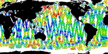
NSCAT Level 3 Daily Gridded Ocean Surface Wind Vector Browse Images (JPL) recent views
National Aeronautics and Space Administration —
This dataset provides browse images of the NASA Scatterometer (NSCAT) Level 3 daily gridded ocean wind vectors, which are provided at 0.5 degree spatial resolution... -
Federal
AfriSAR: Polarimetric Height Profiles by TomoSAR, Lope and Rabi Forests, Gabon, 2016 recent views
National Aeronautics and Space Administration —
This dataset provides height profiles derived from UAVSAR (Uninhabited Aerial Vehicle Synthetic Aperture Radar; JPL) data acquired over Lope National Park and Rabi... -
Federal
2020 Cartographic Boundary File (SHP), Current Elementary School District for Connecticut, 1:500,000 recent views
U.S. Census Bureau, Department of Commerce —
The 2020 cartographic boundary shapefiles are simplified representations of selected geographic areas from the U.S. Census Bureau's Master Address File /... -
Federal
H12494: NOS Hydrographic Survey , Portland Harbor, ME, 2012-07-19 recent views
National Oceanic and Atmospheric Administration, Department of Commerce —
The National Oceanic and Atmospheric Administration (NOAA) has the statutory mandate to collect hydrographic data in support of nautical chart compilation for safe... -
State
Iowa Board of Parole FY 2020 Performance Report recent views
State of Iowa —
This document is the FY 2020 Performance Report for the Iowa Board of Parole covering the period from July 1, 2019 through June 30, 2020. -
Federal
Academy of Program/Project & Engineering Leadership: APPEL Case Studies recent views
National Aeronautics and Space Administration —
Case studies illustrate the kinds of decisions and dilemmas managers face every day, and as such provide an effective learning tool for project management. Due to the... -
Federal
CarbonTracker-Lagrange North America GOSAT Vertical Profile of Footprints V1 (CMS_CTL_NA_GOSAT_FOOTPRINTS) recent views
National Aeronautics and Space Administration —
This data set provides Weather Research and Forecasting (WRF) Stochastic Time-Inverted Lagrangian Transport (STILT) particle trajectory data products for particle... -
Federal
2020 Cartographic Boundary File (KML), Current Unified School District for North Carolina, 1:500,000 recent views
U.S. Census Bureau, Department of Commerce —
The 2020 cartographic boundary KMLs are simplified representations of selected geographic areas from the U.S. Census Bureau's Master Address File / Topologically... -
Federal
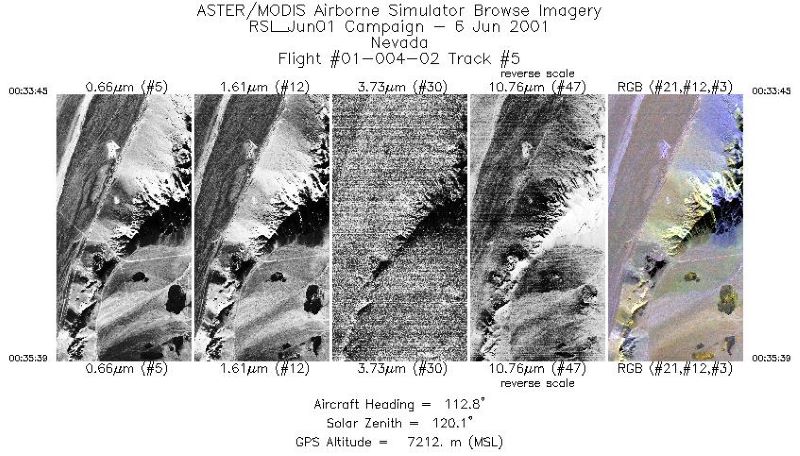
MASTER: Airborne Science, California-Nevada, June, 2001 recent views
National Aeronautics and Space Administration —
This dataset includes Level 1B (L1B) data products from the MODIS/ASTER Airborne Simulator (MASTER) instrument. The spectral data were collected during seven flights... -
State
Iowa Homeland Security and Emergency Management Department FY 2023 Performance Plan recent views
State of Iowa —
This document is the FY 2023 Performance Plan for the Iowa Homeland Security and Emergency Management Department covering the period from July 1, 2022 through June... -
Federal
2020 Cartographic Boundary File (SHP), Current Unified School District for South Carolina, 1:500,000 recent views
U.S. Census Bureau, Department of Commerce —
The 2020 cartographic boundary shapefiles are simplified representations of selected geographic areas from the U.S. Census Bureau's Master Address File /... -
Federal
SASSIE Arctic Field Campaign L1 Wave Glider Data Fall 2022 recent views
National Aeronautics and Space Administration —
The Salinity and Stratification at the Sea Ice Edge (SASSIE) project is a NASA experiment that aims to understand how salinity anomalies in the upper ocean generated... -
Federal
2020 Cartographic Boundary File (KML), Current Block Group for New Hampshire, 1:500,000 recent views
U.S. Census Bureau, Department of Commerce —
The 2020 cartographic boundary KMLs are simplified representations of selected geographic areas from the U.S. Census Bureau's Master Address File / Topologically... -
Federal
F00837: NOS Hydrographic Survey , 2021-09-05 recent views
National Oceanic and Atmospheric Administration, Department of Commerce —
The National Oceanic and Atmospheric Administration (NOAA) has the statutory mandate to collect hydrographic data in support of nautical chart compilation for safe...

Official websites use .gov
A
.gov website belongs to an official government
organization in the United States.
Secure .gov websites use HTTPS
A
lock (
) or https:// means you’ve safely connected to
the .gov website. Share sensitive information only on official,
secure websites.