
-
Federal
TROPESS AIRS-Aqua L2 Ozone for Reanalysis Stream, Summary Product V1 (TRPSYL2O3AIRSORS) at GES DISC
National Aeronautics and Space Administration —
The TROPESS AIRS-Aqua L2 Ozone for Reanalysis Stream, Summary Product contains the vertical distribution of the retrieved atmospheric state of ozone (O3), and formal... -
Federal
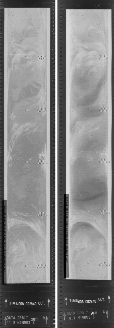
THIR/Nimbus-6 Images of Daytime and Nighttime Brightness Temperature on 70 mm Film V001 (THIRN6IM) at GES DISC
National Aeronautics and Space Administration —
The THIRN6IM data product consists of daily montages of brightness temperatures on 70 mm photofacsimile film strips from the Nimbus-6 Temperature-Humidity Infrared... -
Federal
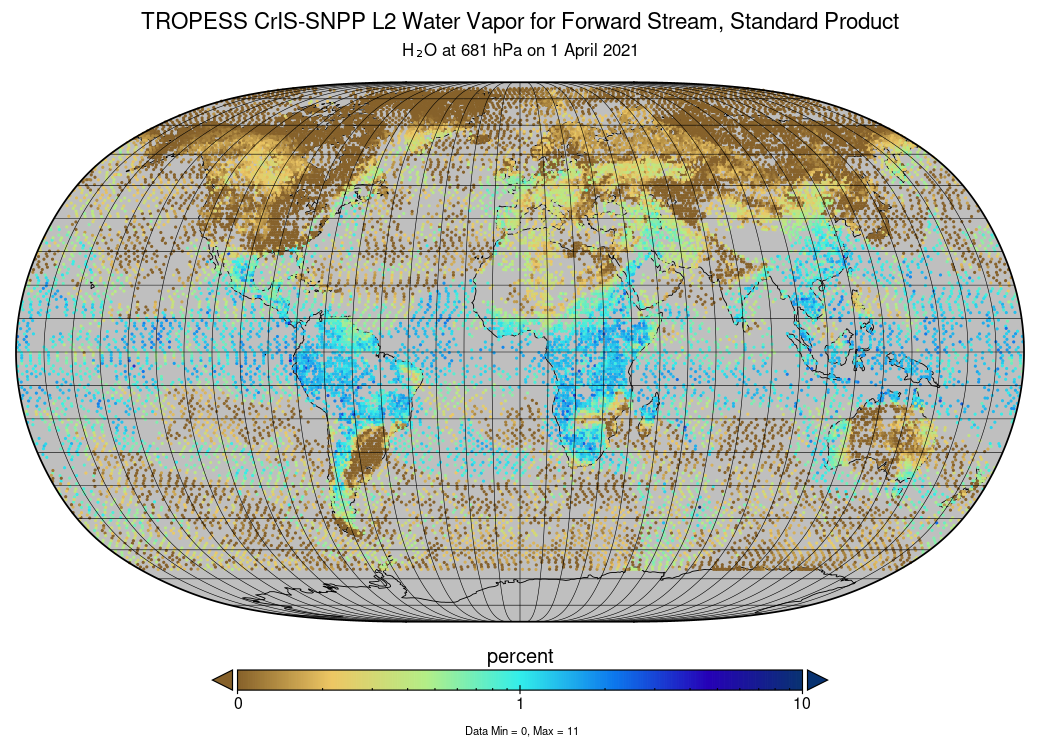
TROPESS CrIS-SNPP L2 Water for Forward Stream, Standard Product V1 (TRPSDL2H2OCRSFS) at GES DISC
National Aeronautics and Space Administration —
The TROPESS CrIS-SNPP L2 Water for Forward Stream, Standard Product contains the vertical distribution of the retrieved atmospheric state of water vapor (H2O), formal... -
Federal
TROPESS CrIS-SNPP L2 Carbon Monoxide for Reanalysis Stream, Summary Product V1 (TRPSYL2COCRSRS) at GES DISC
National Aeronautics and Space Administration —
The TROPESS CrIS-SNPP L2 Carbon Monoxide for Reanalysis Stream, Summary Product contains the vertical distribution of the retrieved atmospheric state of carbon... -
Federal
TROPESS CrIS-SNPP L2 Carbon Monoxide for Forward Stream, Summary Product V1 (TRPSYL2COCRSFS) at GES DISC
National Aeronautics and Space Administration —
The TROPESS CrIS-SNPP L2 Carbon Monoxide for Forward Stream, Summary Product contains the vertical distribution of the retrieved atmospheric state of carbon monoxide... -
Federal
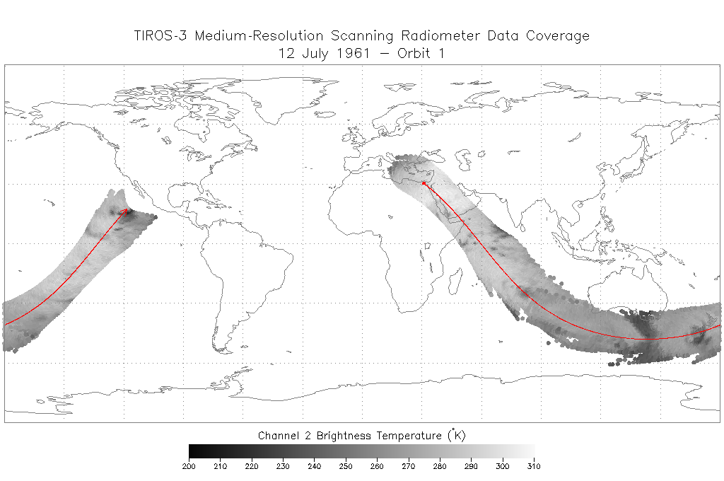
TIROS-3 Medium-Resolution Scanning Radiometer Level 1 Final Meteorological Radiation Data V001 (TIROS3L1FMRT) at GES DISC
National Aeronautics and Space Administration —
TIROS-3 Medium-Resolution Scanning Radiometer Level 1 Final Meteorological Radiation Data (FMRT) product contains radiances expressed in five infrared/visible... -
Federal
TES/Aura L2 Instantaneous Radiative Kernel Nadir Special Observation V008
National Aeronautics and Space Administration —
TL2IRKNS_8 is the Tropospheric Emission Spectrometer (TES)/Aura Level 2 Instantaneous Radiative Kernel Nadir Special Observation Version 8 data product. TES was an... -
Federal
TEMPO geolocated Earth radiances V03 (PROVISIONAL)
National Aeronautics and Space Administration —
Level 1 radiance files provide radiance information at TEMPO’s native spatial resolution, ~10 km^2 at the center of the Field of Regard (FOR), for individual... -
Federal
PISTON 2018 Research Vessel (RV) Mirai Ship Data
National Aeronautics and Space Administration —
PISTON-ONR-NOAA_RVMirai_2018 is the Propagation of Intra-Seasonal Tropical Oscillations (PISTON) 2018 Research Vessel (RV) Mirai data product. This product is the... -
Federal
Optical Thickness Data: Bruegge (FIFE)
National Aeronautics and Space Administration —
The NIPS and Reagan Sunphotometer Optical Thickness study compared various ground and image-based techniques used to characterize the atmosphere. These data are used... -
Federal
Optical Thickness Data: C-130 (FIFE)
National Aeronautics and Space Administration —
The data in the Sunphotometer Optical Thickness Data from C130 Aircraft data set were collected in June, July and August 1987, and in August 1989. The data was... -
Federal
OMPS-NPP L1G LP Radiance EV Wavelength-Altitude Grid swath orbital 3slit V2.6 (OMPS_NPP_LP_L1G_EV) at GES DISC
National Aeronautics and Space Administration —
The OMPS-NPP L1G LP Radiance EV Wavelength-Altitude Grid swath orbital 3slit product contains the calibrated earth-viewing radiances measured by the Ozone Mapping and... -
Federal
OMPS-NPP L2 NM Aerosol Index swath orbital
National Aeronautics and Space Administration —
The OMPS-NPP L2 NM Aerosol Index swath orbital product provides aerosol index values from the Ozone Mapping and Profiling Suite (OMPS) Nadir-Mapper (NM) instrument on... -
Federal
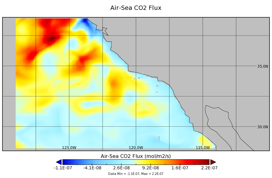
Ocean Biogeochemistry in the California Current System 2007-2010 L4 Monthly
National Aeronautics and Space Administration —
A coupled physical-biogeochemical ocean model (the MITgcm with BLING biogeochemistry) is a least squares fit to all available ocean observations in the region of the... -
Federal
OMI/Aura NO2 Cloud-Screened Total and Tropospheric Column L3 Global Gridded 0.25 degree x 0.25 degree V004 (OMNO2d) at GES DISC
National Aeronautics and Space Administration —
This is Level-3 daily global gridded (0.25x0.25 degree) Nitrogen Dioxide Product (OMNO2d). OMNO2d data product is a Level-3 Gridded Product where pixel level data of... -
Federal
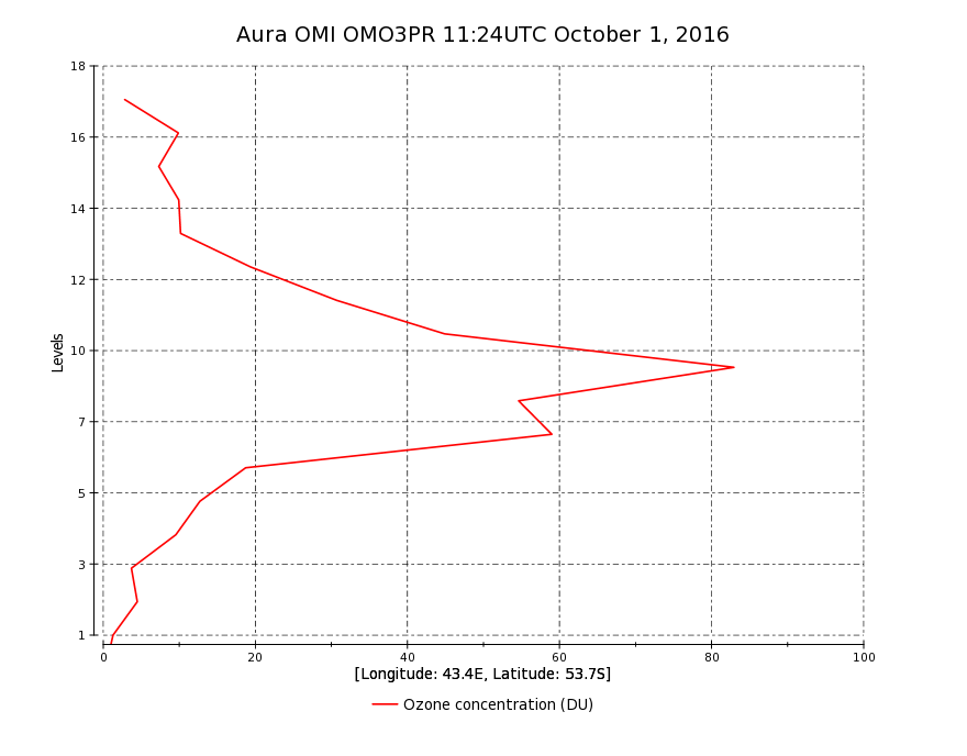
OMI/Aura Ozone (O3) Profile 1-Orbit L2 Swath 13x48km V003 (OMO3PR) at GES DISC
National Aeronautics and Space Administration —
The Aura Ozone Monitoring Instrument Level-2 Ozone Profile data product OMO3PR (Version 003) is now available from the NASA Goddard Earth Sciences Data and... -
Federal
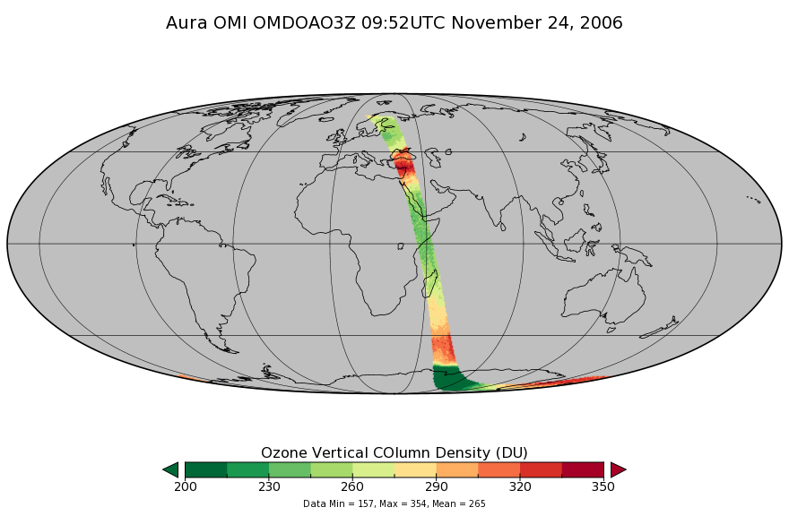
OMI/Aura DOAS Total Column Ozone Zoomed 1-Orbit L2 Swath 13x12km V003 (OMDOAO3Z) at GES DISC
National Aeronautics and Space Administration —
The reprocessed Aura Ozone Monitoring Instrument (OMI) Level-2 Zoomed Ozone data product OMDOAO3Z at 13x12 km resolution is now available from the NASA Goddard Earth... -
Federal
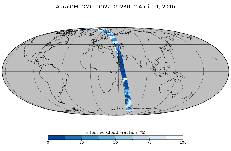
OMI/Aura Cloud Pressure and Fraction (O2-O2 Absorption) Zoomed 1-Orbit L2 Swath 13x12km V003 (OMCLDO2Z) at GES DISC
National Aeronautics and Space Administration —
The reprocessed Aura Ozone Monitoring Instrument (OMI) Level-2 zoomed cloud data product OMCLDO2Z at 13x12 km resolution is now available from the NASA Goddard Earth... -
Federal
OWLETS-2 Ozonesonde Data
National Aeronautics and Space Administration —
OWLETS2_Sondes_Data_1 is the Ozone Water-Land Environmental Transition Study (OWLETS-1) ozone data collected via synchronous ozonesonde launches at the Howard...

Official websites use .gov
A
.gov website belongs to an official government
organization in the United States.
Secure .gov websites use HTTPS
A
lock (
) or https:// means you’ve safely connected to
the .gov website. Share sensitive information only on official,
secure websites.