
-
Federal
ABoVE: Dall Sheep Response to Snow and Landscape Covariates, Alaska, 2005-2008
National Aeronautics and Space Administration —
This dataset provides daily estimates of snow depth and snow density for the study area in Lake Clark National Park and Preserve (LCNPP), Alaska. The data were... -
Federal
LMOS Illinois EPA (IEPA) Ground Site Data
National Aeronautics and Space Administration —
LMOS_Ground_IEPA_Data_1 is the Lake Michigan Ozone Study (LMOS) ground site data collected at the Illinois EPA (IEPA) ground site during the LMOS field campaign. This... -
Federal
MMS 4 Hot Plasma Composition Analyzer (HPCA) Time of Flight, TOF, Counts, Level 2 (L2), Survey Mode, 0.625 s Data
National Aeronautics and Space Administration —
Hot Plasma Composition Analyzer (HPCA) Time of Flight, TOF, Counts, Level 2, Survey 10 s Data. The MMS HPCA instruments measure the energy and composition of... -
Federal
Wind SMS Suite SupraThermal Ion Composition Spectrometer (SMS/STICS) Ion Angular Flux Maps (AFMs), Level 2 (L2), 30-minute Data in Solar Wind
National Aeronautics and Space Administration —
The data include Wind STICS 30-minute Angular Flux Maps (AFMs) for selected ion species using triple coincidence (H+, He+, He2+, C5+, O+, O6+, and Fe10+) and double... -
Federal
VEMAP 2: Monthly Ecosystem Model Responses to U.S. Climate Change, 1994-2100
National Aeronautics and Space Administration —
The Vegetation-Ecosystem Modeling and Analysis Project (VEMAP) was a large, collaborative, multi-institutional, international effort whose goal was to evaluate the... -
Federal
Ground-Based Global Navigation Satellite System (GNSS) Mixed Observation Data (30-second sampling, hourly files) from NASA CDDIS
National Aeronautics and Space Administration —
This dataset consists of ground-based Global Navigation Satellite System (GNSS) Observation Data (30-second sampling, hourly files) from the NASA Crustal Dynamics... -
Federal
BOREAS Regional DEM in Raster Format and AEAC Projection
National Aeronautics and Space Administration —
This data set is based on the GTOPO30 DEM produced by the USGS EDC. The BOREAS region (1,000km x 1000km) was extracted from the GTOPO30 data and reprojected by BOREAS... -
Federal
Global Navigation Satellite System (GNSS) IGS Rapid Daily Ionosphere Vertical Total Electron Content (VTEC) Grid Product from NASA CDDIS
National Aeronautics and Space Administration —
This derived product set consists of Global Navigation Satellite System Rapid Ionosphere Vertical Total Electron Content (VTEC) product (daily files) from the NASA... -
Federal
Root transcriptome remodeling of Arabidopsis in response to high levels of magnesium sulfate
National Aeronautics and Space Administration —
Martian regolith (unconsolidated surface material) is a potential medium for plant growth in bioregenerative life support systems during manned missions on Mars.... -
Federal
GLAS/ICESat 1 km Laser Altimetry Digital Elevation Model of Greenland, Version 1
National Aeronautics and Space Administration —
The Geoscience Laser Altimeter System (GLAS) instrument on the Ice, Cloud, and land Elevation Satellite (ICESat) provides global measurements of elevation, and... -
Federal
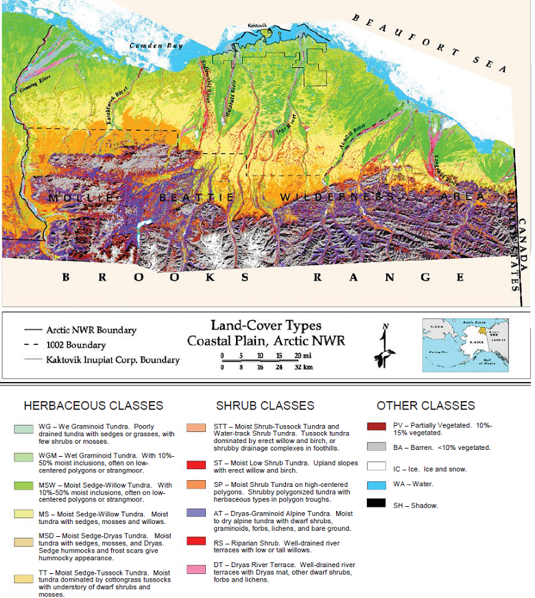
Land Cover and Vegetation Map, Arctic National Wildlife Refuge
National Aeronautics and Space Administration —
This data set provides a landcover map with 16 landcover classes for the northern coastal plain of the the Arctic National Wildlife Refuge (ANWR) on the North Slope... -
Federal
IceBridge GPS L1B Time-Tagged Real-Time Position and Attitude Solution, Version 1
National Aeronautics and Space Administration —
This data set contains elevation, roll, pitch, and heading measurements over Antarctica using the Ashtech GG24 GPS+ receiver and the Systron and Donner MMQ-50... -
Federal
Combined space stressors induce independent behavioral deficits predicted by early peripheral blood monocytes (Behavioral Assays)
National Aeronautics and Space Administration —
Interplanetary space travel poses many hazards to the human body. To protect astronaut health and performance on critical missions, there is first a need to... -
Federal
Global Navigation Satellite System (GNSS) IGS Combined Rapid Clock Solution Comparison Summary Product from NASA CDDIS
National Aeronautics and Space Administration —
This derived product set consists of Global Navigation Satellite System Rapid Clock Product Summary from the NASA Crustal Dynamics Data Information System (CDDIS).... -
Federal
Inventory of Rock Glaciers along the Ghunsa Valley, Kanchanjunga Himal, Eastern Nepal, Version 1
National Aeronautics and Space Administration —
This dataset provides information on a number of Nepali rock glaciers distributed above 4250 m ASL along the Ghunsa valley and the Kanchanjunga glacier (originating... -
Federal
Ground-Based Global Navigation Satellite System (GNSS) Combined Broadcast Ephemeris Data (30-second sampling, hourly files) from NASA CDDIS
National Aeronautics and Space Administration —
This dataset consists of ground-based Global Navigation Satellite System (GNSS) Combined Broadcast Ephemeris Data (hourly files of all distinct navigation messages... -
Federal
Global Food Security Support Analysis Data (GFSAD) Crop Mask 2010 Global 1 km V001
National Aeronautics and Space Administration —
The NASA Making Earth System Data Records for Use in Research Environments (MEaSUREs) Global Food Security Support Analysis Data (GFSAD) Crop Mask Global 1 kilometer... -
Federal
MISR Derived Case Study Data for Kilauea Volcanic Eruptions Including Geometric Plume Height and Qualitative Radiometric Particle Property Information
National Aeronautics and Space Administration —
The KILVOLC_FlowerKahn2021_1 dataset is the MISR Derived Case Study Data for Kilauea Volcanic Eruptions Including Geometric Plume Height and Qualitative Radiometric... -
Federal
LBA-ECO LC-07 Bathymetric Survey of Floodplain Lake, Lago Curuai, Para, Brazil: 2004
National Aeronautics and Space Administration —
The bathymetry data provided represent a continuous surface of interpolated point measurements of depth values of Lago Curuai, an Amazon River floodplain lake,... -
Federal
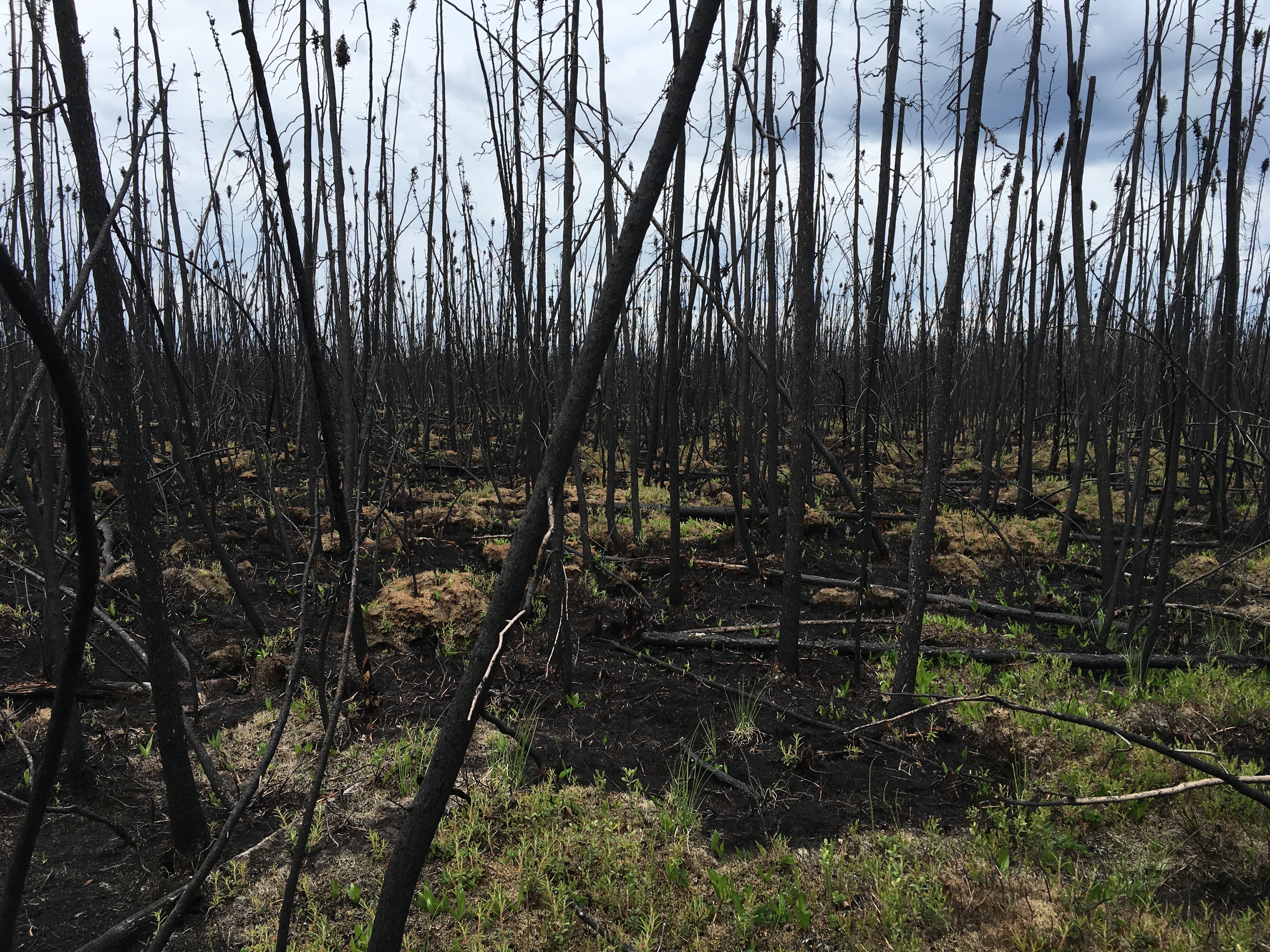
ABoVE: Characterization of Burned and Unburned Boreal Forest Stands, SK, Canada, 2016
National Aeronautics and Space Administration —
This dataset provides the results of field measurements and estimates of carbon stocks and combustion rates that characterize burned and unburned southern boreal...

Official websites use .gov
A
.gov website belongs to an official government
organization in the United States.
Secure .gov websites use HTTPS
A
lock (
) or https:// means you’ve safely connected to
the .gov website. Share sensitive information only on official,
secure websites.