
-
Federal
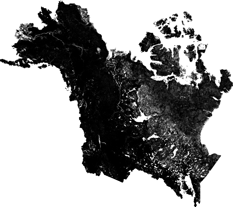
NACP: Forest Carbon Stocks, Fluxes and Productivity Estimates, Western USA, 1979-2099
National Aeronautics and Space Administration —
This dataset contains annual estimates of carbon stocks, fluxes, and productivity over forested land in 11 states of the western USA (Arizona, California, Colorado,... -
Federal
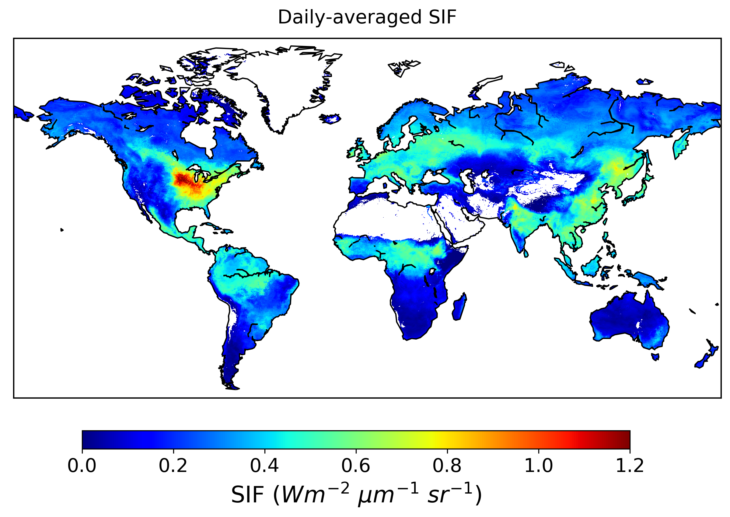
High Resolution Global Contiguous SIF Estimates from OCO-2 SIF and MODIS, Version 2
National Aeronautics and Space Administration —
This dataset provides spatially-contiguous global mean daily solar-induced chlorophyll fluorescence (SIF) estimates at 0.05 degree (approximately 5 km at the equator)... -
Federal
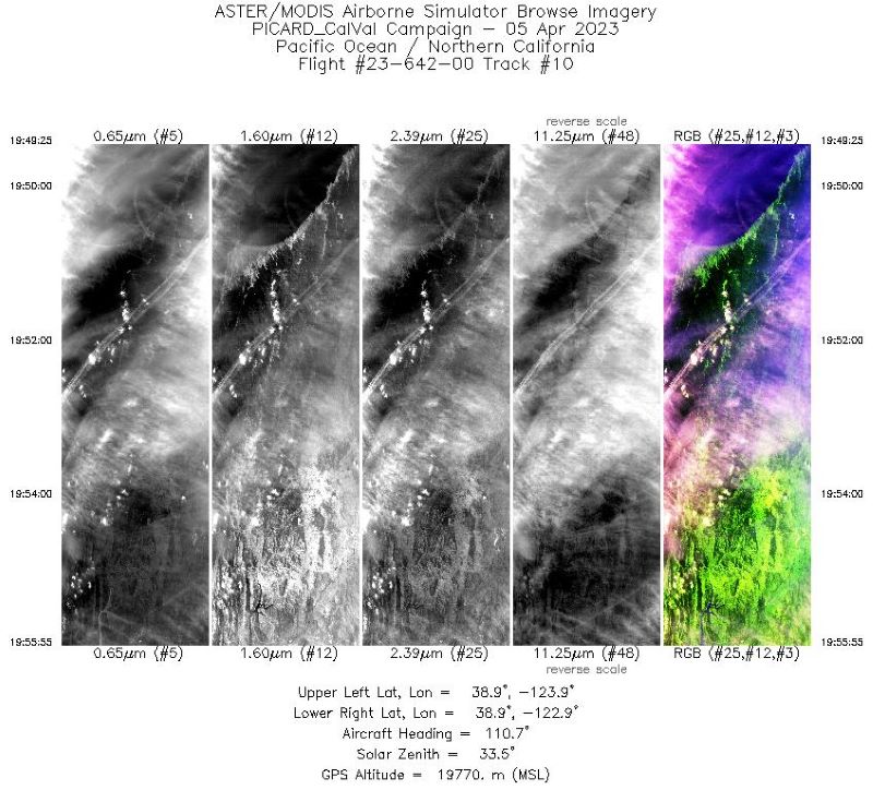
MASTER: Western Diversity Time Series Campaign, WDTS, Spring 2023
National Aeronautics and Space Administration —
This dataset includes Level 1B (L1B) and Level 2 (L2) data products from the MODIS/ASTER Airborne Simulator (MASTER) instrument. The spectral data were collected as... -
Federal
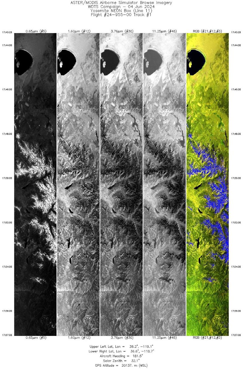
MASTER: Western Diversity Time Series Campaign, WDTS, Spring 2024
National Aeronautics and Space Administration —
This dataset includes Level 1B (L1B) data products from the MODIS/ASTER Airborne Simulator (MASTER) instrument. The spectral data were collected as part of the... -
Federal
SAFARI 2000 FEWS 10-day Rainfall Estimate, 8-Km, 1999-2001
National Aeronautics and Space Administration —
The U.S. Agency for International Development (USAID) Famine Early Warning System (FEWS) has been supporting the production of 10-day Rainfall Estimate (RFE) data for... -
Federal
The ARID Scoping Study Final Report
National Aeronautics and Space Administration —
This dataset provides the final report from the Adaptation and Response in Drylands (ARID) scoping study. ARID is one of the two scoping studies funded by NASA in... -
Federal
NPP Cropland: Gridded Estimates For the Central USA, 1982-1996, R1
National Aeronautics and Space Administration —
This data set contains a single data file (.csv format) that provides gridded values of net primary productivity (NPP) for cropland in eight counties in the central... -
Federal
ECOSTRESS Evapotranspiration dis-ALEXI USDA Daily L3 Global 30m V001
National Aeronautics and Space Administration —
The ECOsystem Spaceborne Thermal Radiometer Experiment on Space Station (ECOSTRESS) mission measures the temperature of plants to better understand how much water... -
Federal
ECOSTRESS Evaporative Stress Index PT-JPL Daily L4 Global 70m V001
National Aeronautics and Space Administration —
The ECOsystem Spaceborne Thermal Radiometer Experiment on Space Station (ECOSTRESS) mission measures the temperature of plants to better understand how much water... -
Federal
Global High-Resolution Estimates of SIF from Fused SCIAMACHY and GOME-2, V2
National Aeronautics and Space Administration —
This dataset provides global solar-induced chlorophyll fluorescence (SIF) estimates at a 0.05-degree resolution (approximately 5 km at the equator) for each month... -
Federal
CMS: Forest Carbon Stocks, Emissions, and Net Flux for the Conterminous US: 2005-2010
National Aeronautics and Space Administration —
This data set provides maps of estimated carbon in forests of the 48 continental states of the US for the years 2005-2010. Carbon (termed committed carbon) stocks... -
Federal
CMS: Fire Weather Indices for Interior Alaska, 2001-2010
National Aeronautics and Space Administration —
This dataset provides daily fire weather indices for interior Alaska during the active fire seasons from 2001 to 2010. Data are gridded at 60-m resolution. The active... -
Federal
ABoVE: Fractional Open Water Cover for Pan-Arctic and ABoVE-Domain Regions, 2002-2015
National Aeronautics and Space Administration —
This data set provides land surface fractional open water cover maps for two overlapping regions: the entire pan-Arctic region (latitude > 45 degrees) and the... -
Federal
ABoVE: Ignitions, Burned Area, and Emissions of Fires in AK, YT, and NWT, 2001-2018
National Aeronautics and Space Administration —
This dataset provides estimates of daily burned area, carbon emissions, and uncertainty, and daily fire ignition locations for boreal fires in Alaska, U.S., and in... -
Federal
Beaver monitoring data from the Chequamegon-Nicolet National Forest, Wisconsin
Department of Agriculture —
The primary raw data are aerial counts of beaver (Castor canadensis) colonies on streams across the Chequamegon-Nicolet National Forest (CNNF). These aerial counts... -
Federal
UAVSAR_POLSAR_ML_COMPLEX_GRD_5X5
National Aeronautics and Space Administration —
UAVSAR PolSAR Scene Projected Multilook 5x5 -
Federal
Kentucky bluegrass growth curves and nutritive values
Department of Agriculture —
Dataset describes Kentucky bluegrass production and height throughout two growing seasons in a rangeland system in the northern Great Plains. One year of sampling was... -
Federal
UAVSAR_POLSAR_SLOPE
National Aeronautics and Space Administration —
UAVSAR PolSAR Scene Slope -
State
Point Count Survey - Terrestrial Species Stressor Monitoring [ds2829]
State of California —
Avian point count surveys were conducted at 184 Great Valley study sites, and 107 Mojave Desert sites, between March and June 2017. Whenever possible, three... -
Federal
Long-term site responses to season and interval of underburns on the Georgia Piedmont
Department of Agriculture —
Between 1987 and 1988, twenty-four approximately 2-acre plots were established in Jones County, Georgia on the Hitchiti Experimental Forest which is also known as the...

Official websites use .gov
A
.gov website belongs to an official government
organization in the United States.
Secure .gov websites use HTTPS
A
lock (
) or https:// means you’ve safely connected to
the .gov website. Share sensitive information only on official,
secure websites.