
-
Federal
MERRA-2 tavg1_2d_lfo_Nx: 2d,1-Hourly,Time-Averaged,Single-Level,Assimilation,Land Surface Forcings 0.625 x 0.5 degree V5.12.4 (M2T1NXLFO) at GES DISC
National Aeronautics and Space Administration —
M2T1NXLFO (or tavg1_2d_lfo_Nx) is an hourly time-averaged 2-dimensional data collection in Modern-Era Retrospective analysis for Research and Applications version 2... -
Federal
MERRA-2 tavgU_2d_ocn_Nx: 2d,diurnal,Time-Averaged,Single-Level,Assimilation,Ocean Surface Diagnostics 0.625 x 0.5 degree V5.12.4 (M2TUNXOCN) at GES DISC
National Aeronautics and Space Administration —
M2TUNXOCN (or tavgU_2d_ocn_Nx) is a time-averaged 2-dimensional monthly diurnal means data collection in Modern-Era Retrospective analysis for Research and... -
Federal
High Mountain Asia COAWST 6-Hourly 4km Regional Climate Model Simulations V001
National Aeronautics and Space Administration —
This data product contains either 6-hourly accumulated or 6-hourly snapshots of modeled data in the High Mountain Asia region, generated by the Coupled-Ocean-... -
Federal
GLDAS VIC Land Surface Model L4 3 hourly 1.0 x 1.0 degree V2.0 (GLDAS_VIC10_3H) at GES DISC
National Aeronautics and Space Administration —
NASA Global Land Data Assimilation System Version 2 (GLDAS-2) has three components: GLDAS-2.0, GLDAS-2.1, and GLDAS-2.2. GLDAS-2.0 is forced entirely with the... -
Federal
Moderate Resolution Imaging Spectroradiometer (MODIS) - Terra NGDA
National Aeronautics and Space Administration —
This dataset represents multiple products archived at the multiple archive centers for the MODIS (Moderate Resolution Imaging Spectroradiometer) instrument aboard the... -
Federal
Moderate Resolution Imaging Spectroradiometer (MODIS) - Aqua NGDA
National Aeronautics and Space Administration —
This dataset represents multiple products archived at the multiple archive centers for the MODIS (Moderate Resolution Imaging Spectroradiometer) instrument aboard the... -
Federal
Moderate Resolution Imaging Spectroradiometer (MODIS) - Terra NGDA
National Aeronautics and Space Administration —
This dataset represents multiple products archived at the multiple archive centers for the MODIS (Moderate Resolution Imaging Spectroradiometer) instrument aboard the... -
Federal
NLDAS Mosaic Land Surface Model L4 Monthly 0.125 x 0.125 degree V002 (NLDAS_MOS0125_M) at GES DISC
National Aeronautics and Space Administration —
This data set contains a series of land surface parameters simulated from the Mosaic land-surface model (LSM) for Phase 2 of the North American Land Data Assimilation... -
Federal
Moderate Resolution Imaging Spectroradiometer (MODIS) - Aqua NGDA
National Aeronautics and Space Administration —
This dataset represents multiple products archived at the multiple archive centers for the MODIS (Moderate Resolution Imaging Spectroradiometer) instrument aboard the... -
Federal
Daymet: Monthly Climate Summaries on a 1-km Grid for North America, Version 4 R1
National Aeronautics and Space Administration —
This dataset provides Daymet Version 4 R1 monthly climate summaries derived from Daymet Version 4 R1 daily data at a 1 km x 1 km spatial resolution for five Daymet... -
Federal
NLDAS VIC Land Surface Model L4 Monthly 0.125 x 0.125 degree V2.0 (NLDAS_VIC0125_M) at GES DISC
National Aeronautics and Space Administration —
This data set contains forty-three fields simulated from the VIC land-surface model (LSM) for Phase 2 of the North American Land Data Assimilation System (NLDAS-2).... -
Federal
GLDAS Catchment Land Surface Model L4 daily 0.25 x 0.25 degree V2.0 (GLDAS_CLSM025_D) at GES DISC
National Aeronautics and Space Administration —
NASA Global Land Data Assimilation System Version 2 (GLDAS-2) has three components: GLDAS-2.0, GLDAS-2.1, and GLDAS-2.2. GLDAS-2.0 is forced entirely with the... -
Federal
FLDAS2 Noah-MP GDAS Land Surface Model L4 Central Asia Daily 0.01 degree x 0.01 degree V001 (FLDAS_NOAHMP001_G_CA_D)
National Aeronautics and Space Administration —
This dataset contains a series of land surface parameters simulated from the Noah 3.6.1 model in the Famine Early Warning Systems Network (FEWS NET) Land Data... -
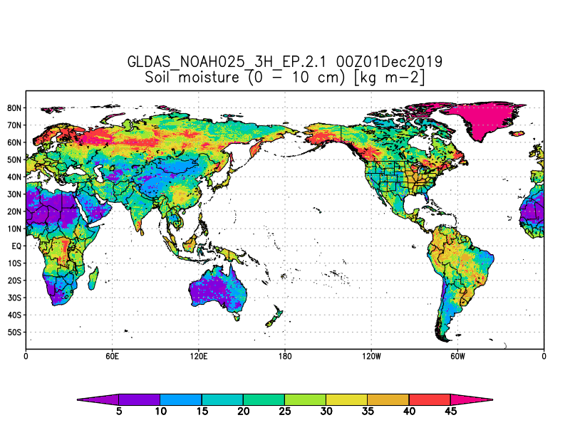
Federal
GLDAS Noah Land Surface Model L4 3 hourly 0.25 x 0.25 degree Early Product V2.1 (GLDAS_NOAH025_3H_EP) at GES DISC
National Aeronautics and Space Administration —
NASA Global Land Data Assimilation System Version 2 (GLDAS-2) has three components: GLDAS-2.0, GLDAS-2.1, and GLDAS-2.2. GLDAS-2.0 is forced entirely with the... -
Federal
MERRA-2 tavgU_2d_lnd_Nx: 2d,diurnal,Time-Averaged,Single-Level,Assimilation,Land Surface Diagnostics 0.625 x 0.5 degree V5.12.4 (M2TUNXLND) at GES DISC
National Aeronautics and Space Administration —
M2TUNXLND (or tavgU_2d_lnd_Nx) is a time-averaged 2-dimensional monthly diurnal means data collection in Modern-Era Retrospective analysis for Research and... -
Federal
BOREAS/SRC AMS Suite A Surface Meteorological and Radiation Data: 1995
National Aeronautics and Space Administration —
Contains the data collected in 1995 by the AMS suite A instrument set operated by SRC and provided to BORIS. -
Federal
BOREAS Follow-On HMet-04 1996-1998 NSA Meteorological Data
National Aeronautics and Space Administration —
As part of the BOREAS Follow-on, an extended period of data collection was supported in the NSA because of the continued efforts at the NSA-OBS site. This data set... -
Federal
Near Real-Time MODIS/Terra L3 Global Daily 500m SIN Grid Snow Cover, Grain Size, and Dust Radiative Forcing, Version 1 NGDA
National Aeronautics and Space Administration —
This data set represents an updated version of the MODIS Snow Covered Area and Grain-size (MODSCAG) and MODIS Dust Radiative Forcing in Snow (MODDRF) data sets...

Official websites use .gov
A
.gov website belongs to an official government
organization in the United States.
Secure .gov websites use HTTPS
A
lock (
) or https:// means you’ve safely connected to
the .gov website. Share sensitive information only on official,
secure websites.