
-
Federal
SMEX03 Ancillary Soil Characteristics Data, Georgia, Version 1
National Aeronautics and Space Administration —
The SMEX03 Ancillary Soil Characteristics data set contains data for the regional study areas of Alabama, Georgia, and Oklahoma, USA as part of the 2003 Soil Moisture... -
Federal
NASA Web-Enabled Landsat Data CONUS 30m Composite Pixel Center Lat/Longs V001
National Aeronautics and Space Administration —
WELDUSLL.015 was decommissioned on December 2, 2019. Users are encouraged to use the improved monthly Global Web-Enabled Landsat Data (GWELD) Version 3, 3.1, and 3.2... -
Federal
NARSTO EPA Supersite (SS) Pittsburgh Meteorological Data
National Aeronautics and Space Administration —
NARSTO_EPA_SS_PITTSBURGH_MET_DATA is the North American Research Strategy for Tropospheric Ozone (NARSTO) Environmental Protection Agency (EPA) Supersite (SS)... -
Federal
NARSTO EPA_SS_LOS_ANGELES PM2.5 Particulate Nitrate
National Aeronautics and Space Administration —
The NARSTO_EPA_SS_LOS_ANGELES_PM25_NITRATE data were collected between July 2001 and January 2002. At Claremont and Rubidoux (Los Angeles County, California),... -
Federal
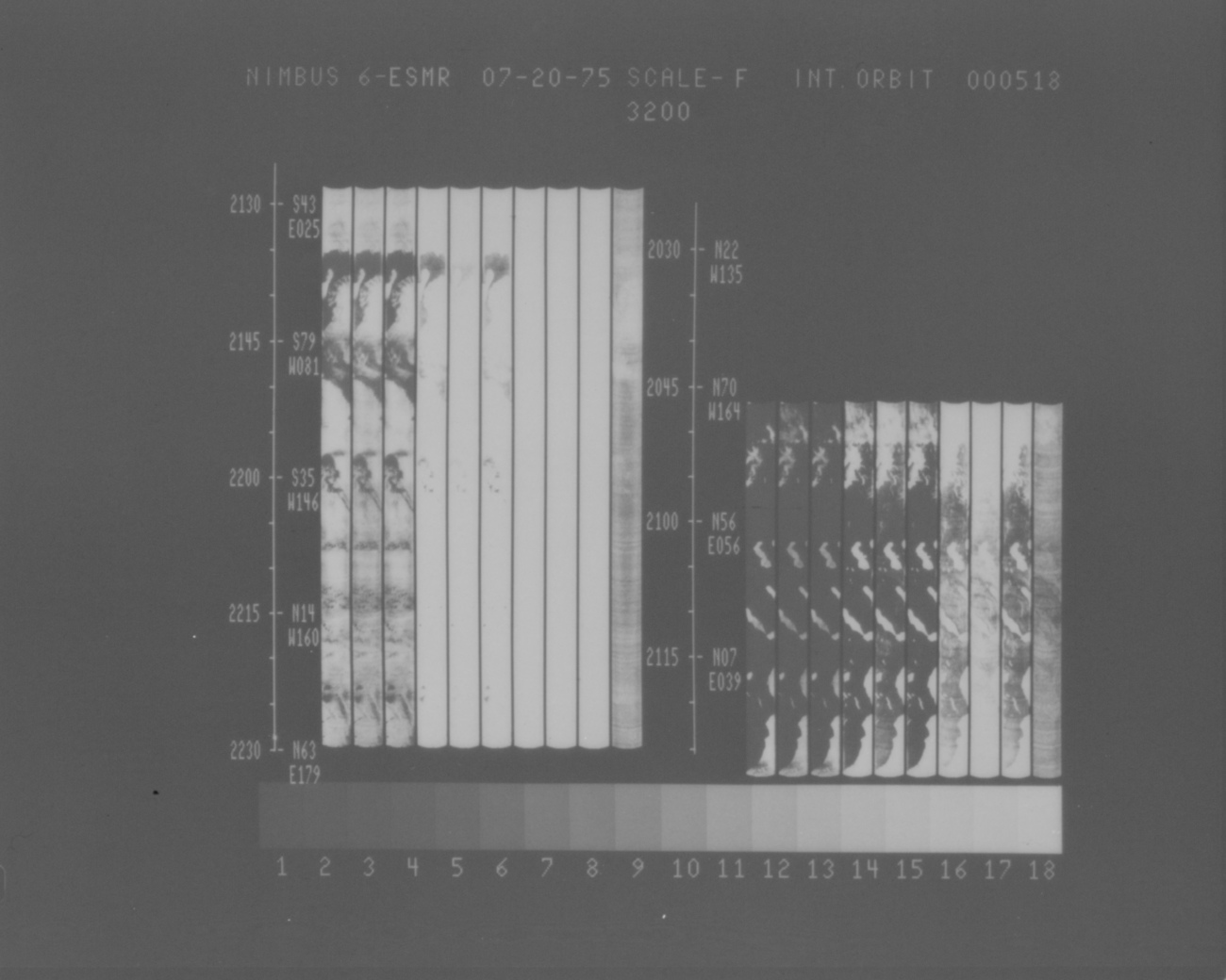
ESMR/Nimbus-6 Images of Brightness Temperature on 70 mm Film V001 (ESMRN6IM) at GES DISC
National Aeronautics and Space Administration —
ESMRN6IM is the Nimbus-6 Electrically Scanning Microwave Radiometer (ESMR) data product containing daily brightness temperature images from 70-mm photofacsimile film... -
Federal
Remote Sensing Derived Topsoil and Agricultural Economic Losses, Midwestern USA
National Aeronautics and Space Administration —
This dataset provides estimates of topsoil loss and economic loss associated with decreased crop productivity resulting from topsoil loss at county- and state-levels... -
Federal
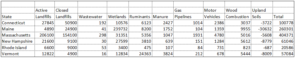
Natural and Anthropogenic Methane Sources, New England, USA, 1990-1994
National Aeronautics and Space Administration —
This data set contains an inventory of natural and anthropogenic methane emissions for all counties in the six New England states of Connecticut, Rhode Island,... -
Federal
NARSTO EPA Supersite (SS) Baltimore, Johns Hopkins University Meteorolgical Data
National Aeronautics and Space Administration —
The NARSTO_EPA_SS_BALTIMORE_JHU_MET_DATA is the North American Research Strategy for Tropospheric Ozone (NARSTO) Environmental Protection Agency (EPA) Supersite (SS)... -
Federal
Tidal Wetland Soil Carbon Stocks for the Conterminous United States, 2006-2010
National Aeronautics and Space Administration —
This dataset provides modeled estimates of soil carbon stocks for tidal wetland areas of the Conterminous United States (CONUS) for the period 2006-2010. Wetland... -
Federal
PnET-BGC: Modeling Biogeochemical Processes in a Northern Hardwood Forest Ecosystem
National Aeronautics and Space Administration —
This archived model product contains the directions, executables, and procedures for running PnET-BGC to recreate the results of Gbondo-Tugbawa, S.S., C.T. Driscoll ,... -
Federal
LBA-ECO ND-01 Fractional Land Cover Images, Rondonia, Brazil: 1984-2000
National Aeronautics and Space Administration —
This data set provides fractional land cover type images for shade, green vegetation (GV), non-photosynthetic vegetation (NPV), and soil for the regions of JiParana,... -
Federal
MODIS/Aqua Land Surface Temperature/Emissivity Monthly L3 Global 0.05Deg CMG V006
National Aeronautics and Space Administration —
The MYD11C3 Version 6 data product was decommissioned on July 31, 2023. Users are encouraged to use the MYD11C3 Version 6.1 data product.The MYD11C3 Version 6 product... -
Federal
SMEX03 Ancillary Soil Characteristics Data, Oklahoma, Version 1
National Aeronautics and Space Administration —
The SMEX03 Ancillary Soil Characteristics data set contains data for the regional study areas of Alabama, Georgia, and Oklahoma, USA as part of the 2003 Soil Moisture... -
Federal
LBA-ECO ND-04 Secondary Forest Carbon and Nutrient Stocks, Central Amazonia, Brazil
National Aeronautics and Space Administration —
This data set reports the carbon and nutrient stocks of above-ground vegetation and soil pools at three locations where post-pasture secondary forest recovery ranged... -
Federal
RSS SMAP Level 2C Sea Surface Salinity NRT V5.0 Validated Dataset
National Aeronautics and Space Administration —
The SMAP-SSS level 2C near real-time (NRT) V5.0 dataset produced by the Remote Sensing Systems (RSS) and sponsored by the NASA Ocean Salinity Science Team, is a... -
Federal
NARSTO EPA Supersite (SS) Fresno, Elemental Carbon in 2.5 um Aerosol Fraction Data
National Aeronautics and Space Administration —
NARSTO_EPA_SS_FRESNO_EC_PM25_FRACTION is the North American Research Strategy for Tropospheric Ozone (NARSTO) Environmental Protection Agency (EPA) Supersite (SS)... -
Federal
Integrated Biosphere Simulator Model (IBIS), Version 2.5
National Aeronautics and Space Administration —
The Integrated Biosphere Simulator (or IBIS) is designed to be a comprehensive model of the terrestrial biosphere; the model represents a wide range of processes,... -
Federal
LPJ-EOSIM L2 Global Simulated Daily Wetland Methane Flux Low Latency V001
National Aeronautics and Space Administration —
The Lund-Potsdam-Jena Earth Observation SIMulator (LPJ-EOSIM) model estimates global wetland methane (CH4) emissions using simulated wetland extent and... -
Federal
NACP MCI: CO2 Emissions Inventory, Upper Midwest Region, USA., 2007
National Aeronautics and Space Administration —
This data set provides a bottom-up CO2 emissions inventory for the mid-continent region of the United States for the year 2007. The study was undertaken as part of... -
Federal
LBA-ECO LC-21 Selective Logging Activity in the Brazilian Amazon: 1999-2002
National Aeronautics and Space Administration —
This data set provides the results of analyses of Landsat Enhanced Thematic Mapper Plus (ETM+) images for selective logging activity in the Brazilian states of Para,...

Official websites use .gov
A
.gov website belongs to an official government
organization in the United States.
Secure .gov websites use HTTPS
A
lock (
) or https:// means you’ve safely connected to
the .gov website. Share sensitive information only on official,
secure websites.