
-
Federal
Low Elevation Coastal Zone (LECZ) Urban-Rural Population and Land Area Estimates, Version 3
National Aeronautics and Space Administration —
The Low Elevation Coastal Zone (LECZ) Urban-Rural Population and Land Area Estimates, Version 3 data set contains land areas with urban, quasi-urban, rural, and total... -
Federal
Gridded Population of the World, Version 4 (GPWv4): Population Density Adjusted to Match 2015 Revision UN WPP Country Totals, Revision 11
National Aeronautics and Space Administration —
The Gridded Population of the World, Version 4 (GPWv4): Population Density Adjusted to Match 2015 Revision of UN WPP Country Totals, Revision 11 consists of estimates... -
Federal
China Dimensions Data Collection: Chinese County-Level Data on Hospitals and Epidemiology Stations, 1950-1985
National Aeronautics and Space Administration —
The China Dimensions Data Collection: Chinese County-Level Data on Hospitals and Epidemiology Stations, 1950-1985 consists of hospital and epidemiological station... -
Federal
Global Rural-Urban Mapping Project, Version 1 (GRUMPv1): National Administrative Boundaries
National Aeronautics and Space Administration —
The Global Rural-Urban Mapping Project, Version 1 (GRUMPv1): National Administrative Boundaries are derived from the land area grid to show the outlines of pixels... -
Federal
West Africa Coastal Vulnerability Mapping: Commercial Crop Production, 2000
National Aeronautics and Space Administration —
The West Africa Coastal Vulnerability Mapping: Commercial Crop Production, 2000 data set includes 5-minute rasters of crop production in metric tons per grid cell for... -
Federal
Archive of Census Related Products (ACRP): 1990 Street Intersections
National Aeronautics and Space Administration —
The 1990 Street Intersections portion of the Archive of Census Related Products (ACRP) contains the latitude and longitude of street intersections for each county in... -
Federal
Global 1-km Downscaled Population Base Year and Projection Grids Based on the Shared Socioeconomic Pathways, Revision 01
National Aeronautics and Space Administration —
The Global 1-km Downscaled Population Base Year and Projection Grids Based on the Shared Socioeconomic Pathways, Revision 01, data set consists of global urban,... -
Federal
West Africa Coastal Vulnerability Mapping: GPW Version 4 Population Density, Preliminary Release 1, 2010
National Aeronautics and Space Administration —
The West Africa Coastal Vulnerability Mapping: GPW Version 4 Population Density, Preliminary Release 1, 2010, represents the number of persons per square kilometer,... -
Federal
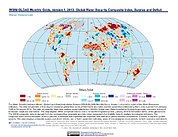
Water Security Indicator Model - Global Land Data Assimilation System (WSIM-GLDAS) Monthly Grids, Version 1
National Aeronautics and Space Administration —
The Water Security Indicator Model - Global Land Data Assimilation System (WSIM-GLDAS) Monthly Grids, Version 1 data set identifies and characterizes surpluses and... -
Federal
Millennium Ecosystem Assessment: MA Population
National Aeronautics and Space Administration —
The Millennium Ecosystem Assessment: MA Population provides data and information on baseline population as one of the drivers of ecosystem change. The data was used... -
Federal
Natural Resource Management Index (NRMI), 2010 Release
National Aeronautics and Space Administration —
The Natural Resource Management Index (NRMI), 2010 Release is a composite index for 157 countries derived from the average of four proximity-to-target indicators for... -
Federal
Central American Vegetation/Land Cover Classification and Conservation Status
National Aeronautics and Space Administration —
The Central American Vegetation/Land Cover Classification and Conservation Status consists of GIS coverages of vegetation classes (forests, woodlands, savannas,... -
Federal
Global Rural-Urban Mapping Project, Version 1 (GRUMPv1): Population Count Grid
National Aeronautics and Space Administration —
The Global Rural-Urban Mapping Project, Version 1 (GRUMPv1): Population Count Grid estimates human population for the years 1990, 1995, and 2000 by 30 arc-second (1... -
Federal
Millennium Ecosystem Assessment: MA Climate and Land Cover
National Aeronautics and Space Administration —
The Millennium Ecosystem Assessment: MA Climate and Land Cover provides data and information on global gridded climatological variables, global land cover maps, and... -
Federal
Millennium Ecosystem Assessment: MA Ecosystems
National Aeronautics and Space Administration —
The Millennium Ecosystem Assessment: MA Ecosystems provides data and information on the extent and classification of ecosystems circa 2000, including coastal,... -
Federal
China Dimensions Data Collection: Priority Programme for China's Agenda 21
National Aeronautics and Space Administration —
The Priority Programme for China's Agenda 21 consists of full-text program descriptions supporting China's economic and social development. The descriptions represent... -
Federal
Georeferenced Population Datasets of Mexico (GEO-MEX): Raster Based GIS Coverage of Mexican Population
National Aeronautics and Space Administration —
The Raster Based GIS Coverage of Mexican Population is a gridded coverage (1 x 1 km) of Mexican population. The data were converted from vector into raster. The... -
Federal
2012 Environmental Performance Index and Pilot Trend Environmental Performance Index
National Aeronautics and Space Administration —
The 2012 Environmental Performance Index (EPI) ranks 132 countries on 22 performance indicators in the following 10 policy categories: environmental burden of... -
Federal
Millennium Ecosystem Assessment: MA Scenarios
National Aeronautics and Space Administration —
The Millennium Ecosystem Assessment: MA Scenarios provides data and information on population, income, cereal production and consumption, meat production and... -
Federal
Compendium of Environmental Sustainability Indicator Collections: Ancillary Data
National Aeronautics and Space Administration —
The Ancillary Data portion of the Compendium of Environmental Sustainability Indicator Collections contains 38 variables (time series data on population and gross...

Official websites use .gov
A
.gov website belongs to an official government
organization in the United States.
Secure .gov websites use HTTPS
A
lock (
) or https:// means you’ve safely connected to
the .gov website. Share sensitive information only on official,
secure websites.