
-
Federal
Daily and Annual NO2 Concentrations for the Contiguous United States, 1-km Grids, v1 (2000 - 2016)
National Aeronautics and Space Administration —
The Daily and Annual NO2 Concentrations for the Contiguous United States, 1-km Grids, v1 (2000-2016) data set contains daily predictions of Nitrogen Dioxide (NO2)... -
Federal
Gridded Population of the World, Version 3 (GPWv3): Population Density Grid
National Aeronautics and Space Administration —
The Gridded Population of the World, Version 3 (GPWv3): Population Density Grid consists of estimates of human population for the years 1990, 1995, and 2000 by 2.5... -
Federal
Global One-Eighth Degree Population Base Year and Projection Grids Based on the Shared Socioeconomic Pathways, Revision 01
National Aeronautics and Space Administration —
The Global One-Eighth Degree Population Base Year and Projection Grids Based on the Shared Socioeconomic Pathways, Revision 01, data set consists of global urban,... -
Federal
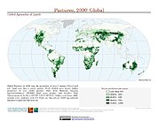
Global Agricultural Lands: Pastures, 2000
National Aeronautics and Space Administration —
The Global Pastures data set represents the proportion of land areas used as pasture land (land used to support grazing animals) in the year 2000. Satellite data from... -
Federal
Annual PM2.5 Concentrations for Countries and Urban Areas, 1998-2016 NGDA
National Aeronautics and Space Administration —
The Annual PM2.5 Concentrations for Countries and Urban Areas, 1998-2016, consists of mean concentrations of particulate matter (PM2.5) for countries and urban areas.... -
Federal
IPCC Special Report on Emissions Scenarios (SRES) Fluor-Gases Emissions Dataset
National Aeronautics and Space Administration —
The Intergovernmental Panel on Climate Change (IPCC) Special Report Emissions Scenarios (SRES) Fluor-Gases Emissions Dataset consists of global and regional emissions... -
Federal
Global Flood Proportional Economic Loss Risk Deciles
National Aeronautics and Space Administration —
The Global Flood Proportional Economic Loss Risk Deciles is a 2.5 minute grid of flood hazard economic loss as proportions of Gross Domestic Product (GDP) per... -
Federal
Natural Resource Protection and Child Health Indicators, 2015 Release
National Aeronautics and Space Administration —
The Natural Resource Protection and Child Health Indicators, 2015 Release, are produced in support of the U.S. Millennium Challenge Corporation as selection criteria... -
Federal
Global Drought Proportional Economic Loss Risk Deciles
National Aeronautics and Space Administration —
The Global Drought Proportional Economic Loss Risk Deciles is a 2.5 minute grid of drought hazard economic loss as proportions of Gross Domestic Product (GDP) per... -
Federal
West Africa Coastal Vulnerability Mapping: GPW Version 4 Population Density, Preliminary Release 1, 2010
National Aeronautics and Space Administration —
The West Africa Coastal Vulnerability Mapping: GPW Version 4 Population Density, Preliminary Release 1, 2010, represents the number of persons per square kilometer,... -
Federal
Global Summer Land Surface Temperature (LST) Grids, 2013
National Aeronautics and Space Administration —
The Global Summer Land Surface Temperature (LST) Grids, 2013, represent daytime maximum temperature and nighttime minimum temperature in degree Celsius at a spatial... -
Federal
Effects of Climate Change on Global Food Production from SRES Emissions and Socioeconomic Scenarios
National Aeronautics and Space Administration —
The Effects of Climate Change on Global Food Production from SRES Emissions and Socioeconomic Scenarios is an update to a major crop modeling study by the NASA... -
Federal
IPCC Fourth Assessment Report (AR4) Observed Climate Change Impacts Database
National Aeronautics and Space Administration —
The Intergovernmental Panel on Climate Change (IPCC) Fourth Assessment Report (AR4) Observed Climate Change Impacts Database contains observed responses to climate... -
Federal
National Aggregates of Geospatial Data Collection: Population, Landscape, And Climate Estimates, Version 2 (PLACE II)
National Aeronautics and Space Administration —
The National Aggregates of Geospatial Data Collection: Population, Landscape, And Climate Estimates, Version 2 (PLACE II) data set contains estimates of national-... -
Federal
Global 3-Year Running Mean Ground-Level Nitrogen Dioxide (NO2) Grids from GOME, SCIAMACHY and GOME-2
National Aeronautics and Space Administration —
The Global 3-Year Running Mean Ground-Level Nitrogen Dioxide (NO2) Grids from GOME, SCIAMACHY and GOME-2 represent a series of three-year running mean grids... -
Federal
Compendium of Environmental Sustainability Indicator Collections: 2004 Environmental Vulnerability Index (EVI)
National Aeronautics and Space Administration —
The 2004 Environmental Vulnerability Index (EVI) portion of the Compendium of Environmental Sustainability Indicator Collections contains 111 variables for 235... -
Federal
IPCC Special Report on Emissions Scenarios (SRES) Emissions Scenarios Dataset Version 1.1
National Aeronautics and Space Administration —
The Intergovernmental Panel on Climate Change (IPCC) Special Report on Emissions Scenarios (SRES) Emissions Scenarios Dataset Version 1.1 consists of 40 global and... -
Federal
Gridded Population of the World, Version 3 (GPWv3): Centroids
National Aeronautics and Space Administration —
The Gridded Population of the World, Version 3 (GPWv3): Centroids consists of estimates of human population counts and densities for the years 1990, 1995, 2000, 2005,... -
Federal
Georeferenced Population Datasets of Mexico (GEO-MEX): Urban Place Time-Series Population of Mexico
National Aeronautics and Space Administration —
The Urban Place Time-Series Population of Mexico contains population counts for more than 700 urban centers every 10 years from 1921 through 1990. The urban centers...

Official websites use .gov
A
.gov website belongs to an official government
organization in the United States.
Secure .gov websites use HTTPS
A
lock (
) or https:// means you’ve safely connected to
the .gov website. Share sensitive information only on official,
secure websites.