
-
Federal
Soil Matric Potential, Dielectric, and Physical Properties, Arctic Alaska, 2018
National Aeronautics and Space Administration —
This dataset provides lab-measured soil properties, including soil water matric potential, soil dielectric properties, soil electrical conductivity, corresponding... -
Federal
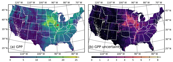
MODIS-based GPP, PAR, fC4, and SANIRv estimates from SLOPE for CONUS, 2000-2019
National Aeronautics and Space Administration —
This dataset contains estimated gross primary productivity (GPP), photosynthetically active radiation (PAR), soil adjusted near infrared reflectance of vegetation... -
Federal
LBA-ECO CD-32 LBA Model Intercomparison Project (LBA-MIP) Forcing Data
National Aeronautics and Space Administration —
The source meteorological observations for the forcing data, from the nine Brazilian flux towers, were recently published as Saleska, et al. (2013). See related data... -
Federal
LBA-ECO LC-09 Daily Precipitation for Altamira and Santarem, Para, Brazil: 1961-1998
National Aeronautics and Space Administration —
This data set reports daily total precipitation data retrieved from Brazilian National Institute of Meteorology (INMET) network for three stations near two Amazonian... -
Federal
LBA-ECO ND-11 Litter Decomposition, Carbon, and Nitrogen Dynamics in Agroforestry
National Aeronautics and Space Administration —
It has been proposed that the C/N ratio, or quality, of litter or mulch mixtures affects N release. Although total N release from these mixtures and the effects on... -
Federal
MASTER: BP Oil Spill Mapping, Louisiana-Gulf of America-Wisconsin, Fall, 2010
National Aeronautics and Space Administration —
This dataset includes Level 1B (L1B) and Level 2 (L2) data products from the MODIS/ASTER Airborne Simulator (MASTER) instrument. The raw data were collected during 9... -
Federal
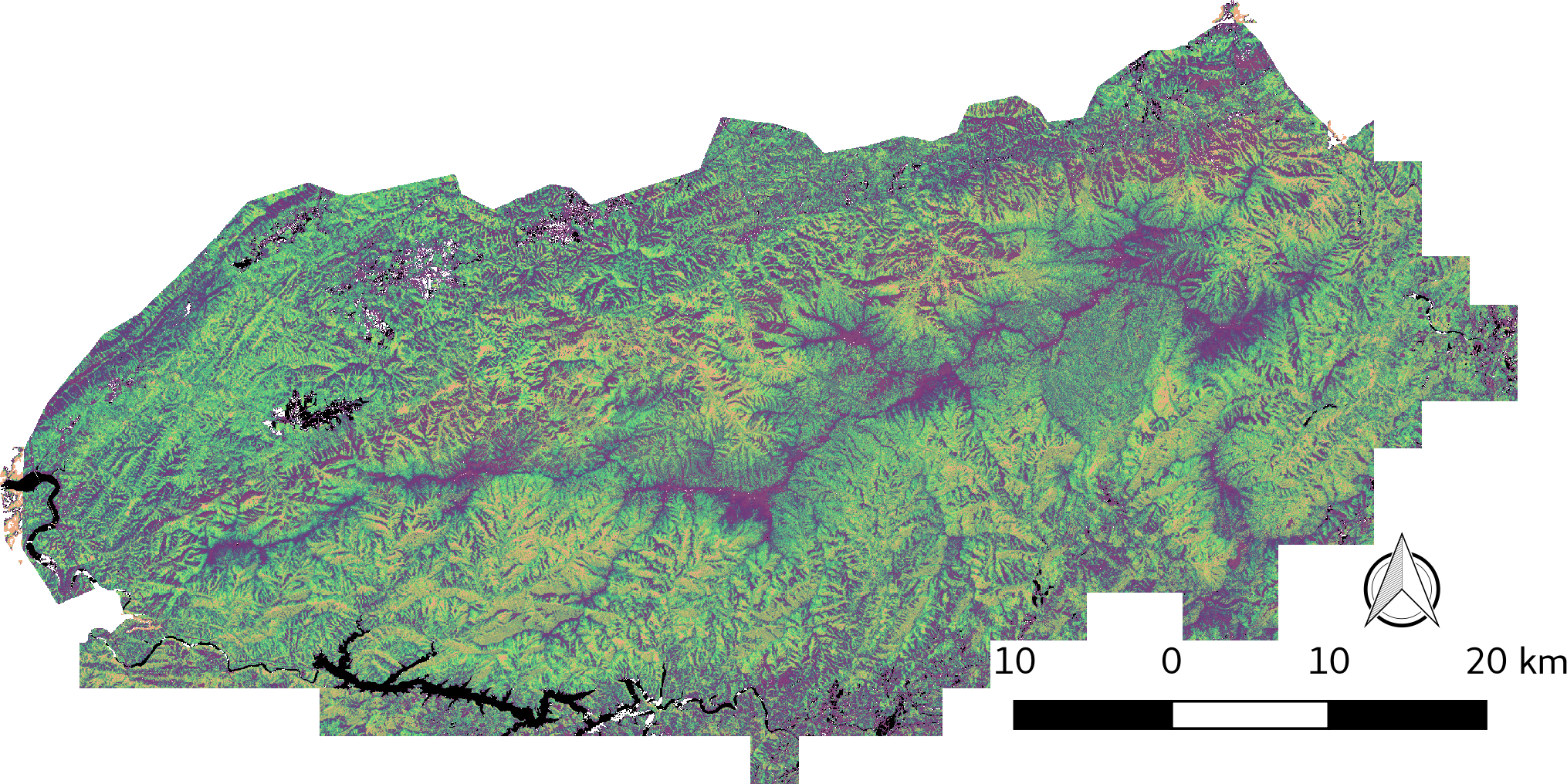
LiDAR-derived Vegetation Canopy Structure, Great Smoky Mountains National Park, 2011
National Aeronautics and Space Administration —
This dataset provides multiple-return LiDAR-derived vegetation canopy structure at 30-meter spatial resolution for the Great Smoky Mountains National Park (GSMNP).... -
Federal
VEMAP 1: U.S. Soil
National Aeronautics and Space Administration —
The Vegetation/Ecosystem Modeling and Analysis Project (VEMAP) is an ongoing multiinstitutional, international effort addressing the response of biogeography and... -
Federal
VEMAP 2: U.S. Monthly Climate, 1895-1993, Version 2
National Aeronautics and Space Administration —
The Vegetation/Ecosystem Modeling and Analysis Project (VEMAP) Phase 2 has developed a data set of ~100-year gridded monthly and daily time series of climate for the... -
Federal
SAFARI 2000 AERONET-derived Diffuse Spectral Irradiance for Eight Core Sites
National Aeronautics and Space Administration —
This data set contains monthly mean values of diffuse irradiance fraction [f(Ediff), or ratio of diffuse-to-total irradiance] at ground level for a 30-degree solar... -
Federal
SAFARI 2000 Freshwater Wetlands, 1-Deg (Stillwell-Soller et al.)
National Aeronautics and Space Administration —
The data set consists of a southern Africa subset of the Global Distribution of Freshwater Wetlands database 1-degree data and are available in ASCII GRID and binary... -
Federal
SAFARI 2000 Vegetation and Soils, 1-Deg (Wilson and Henderson-Sellers)
National Aeronautics and Space Administration —
This data set contains a subset for southern Africa of Wilson and Henderson-Sellers' Global Vegetation & Soils 1-degree data. The data are available in both ASCII... -
Federal
Resilience of Coastal Wetlands to Sea Level Rise, CONUS, 1996-2100
National Aeronautics and Space Administration —
This dataset provides information about the resilience of tidal wetlands to sea-level rise under three scenarios of global change. With rising seas, regularly... -
Federal
Phenoregions For Monitoring Vegetation Responses to Climate Change
National Aeronautics and Space Administration —
The overall purpose in this research was to identify the regions of the world best suited for long-term monitoring of biospheric responses to climate change, i.e.... -
Federal
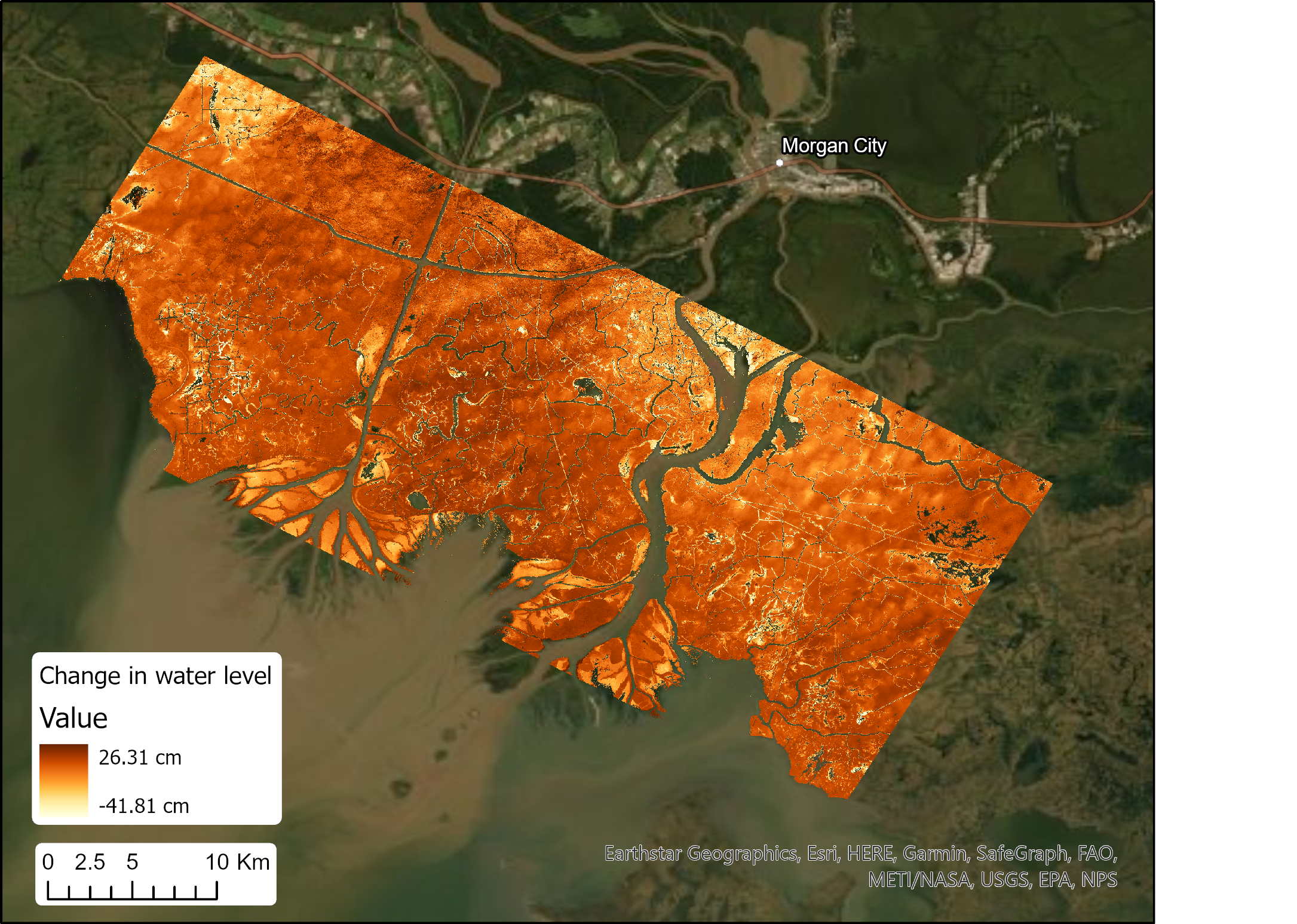
Pre-Delta-X: UAVSAR-derived Water Level Change Maps, Atchafalaya Basin, LA, USA, 2016
National Aeronautics and Space Administration —
This dataset contains five maps of cumulative changes in water levels at 30-minute intervals over a 150-minute period on 2016-10-16 in the Atchafalaya Basin in... -
Federal
NWS Daily Climatology Data: 1980 (SNF)
National Aeronautics and Space Administration —
Weather data were collected by the National Weather Service in International Falls, Minnesota. International Falls is about 80 miles from the SNF, but the weather... -
Federal
Soil Moisture Gravimetric Data (FIFE)
National Aeronautics and Space Administration —
The gravimetrical soil moisture data were collected from many stations spread over the FIFE study area. These data were collected to characterize the spatial and... -
Federal
NOAA Regional Surface Data (FIFE)
National Aeronautics and Space Administration —
The FIFE Staff Science effort included the acquisition, processing and archiving of meteorological parameters of the atmosphere above the FIFE study area, which would...

Official websites use .gov
A
.gov website belongs to an official government
organization in the United States.
Secure .gov websites use HTTPS
A
lock (
) or https:// means you’ve safely connected to
the .gov website. Share sensitive information only on official,
secure websites.