
-
Federal
CARVE: Fire-Related Aerosol and Soil Elemental and Isotopic Composition, Alaska, 2013
National Aeronautics and Space Administration —
This data set provides measurements of the isotopic composition of black carbon and organic carbon aerosols collected at two locations in interior Alaska during the... -
Federal
PnET-BGC: Modeling Biogeochemical Processes in a Northern Hardwood Forest Ecosystem
National Aeronautics and Space Administration —
This archived model product contains the directions, executables, and procedures for running PnET-BGC to recreate the results of Gbondo-Tugbawa, S.S., C.T. Driscoll ,... -
Federal
BOREAS CanSIS Regional Soils Data in Vector Format, V2
National Aeronautics and Space Administration —
This data set contains soils data from the Canada Soil Information System (CanSIS) in ESRI Shapefile format for the provinces of Saskatchewan and Manitoba. They are... -
Federal
Global Forest Ecosystem Structure and Function Data For Carbon Balance Research
National Aeronautics and Space Administration —
A comprehensive global database has been assembled to quantify CO2 fluxes and pathways across different levels of integration (from photosynthesis up to net ecosystem... -
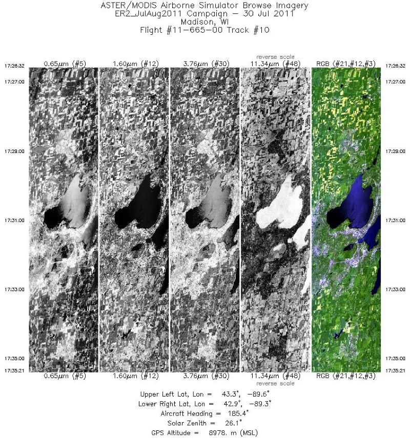
Federal
MASTER: Airborne Science, California-Colorado-Central US, 2011
National Aeronautics and Space Administration —
This dataset includes Level 1B (L1B) and Level 2 (L2) data products from the MODIS/ASTER Airborne Simulator (MASTER) instrument. The spectral data were collected... -
Federal
NWS Daily Climatology Data: 1990 (SNF)
National Aeronautics and Space Administration —
Weather data were collected by the National Weather Service in International Falls, Minnesota. International Falls is about 80 miles from the SNF, but the weather... -
Federal
Satellite Landsat TM Extr. Data (FIFE)
National Aeronautics and Space Administration —
The Thematic Mapper sensor system was used to collect the original data between February 1987 and October 1989 from which this data set was produced. Landsat TM... -
Federal
Daily SnowModel Outputs Covering the ABoVE Core Domain, 3-km Resolution, 1980-2020
National Aeronautics and Space Administration —
This dataset provides daily SnowModel simulation outputs on a 3-km grid for the period 1 September 1980 through 31 August 2020, covering the Core ABoVE Domain. The... -
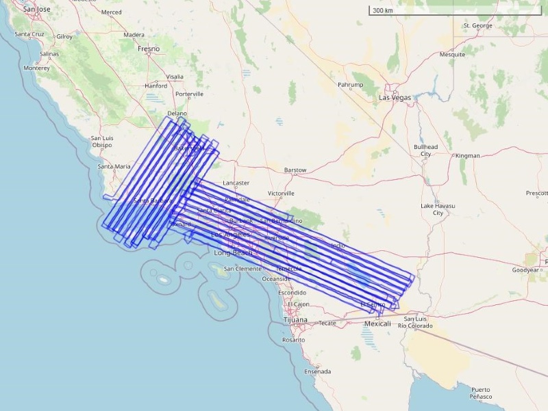
Federal
COMEX: AVIRIS-Classic Facility Instrument Associated Flights and Information, 2014
National Aeronautics and Space Administration —
This dataset lists flight lines and provides data access links and contextual flight information for a subset of the AVIRIS-Classic Facility Instrument Collection... -
Federal
CMS: LiDAR-derived Biomass, Canopy Height and Cover, Sonoma County, California, 2013
National Aeronautics and Space Administration —
This data set provides estimates of above-ground biomass (AGB), canopy height, and percent tree cover at 30-m spatial resolution for Sonoma County, California, USA,... -
Federal
CMS: Mangrove Canopy Height Estimates from Remote Imagery, Zambezi Delta, Mozambique
National Aeronautics and Space Administration —
This data set provides high resolution canopy height estimates for mangrove forests in the Zambezi Delta, Mozambique, Africa. The estimates were derived from three... -
Federal
CMS: Forest Carbon Stocks, Emissions, and Net Flux for the Conterminous US: 2005-2010
National Aeronautics and Space Administration —
This data set provides maps of estimated carbon in forests of the 48 continental states of the US for the years 2005-2010. Carbon (termed committed carbon) stocks... -
Federal
CMS: Forest Inventory and Biophysical Measurements, Para, Brazil, 2012-2014
National Aeronautics and Space Administration —
This data set provides measurements for diameter at breast height (DBH), commercial tree height, and total tree height for forest inventories taken at the Fazenda... -
Federal
BOREAS HYD-06 Ground Gravimetric Soil Moisture Data
National Aeronautics and Space Administration —
This data set contains percent soil moisture ground measurements. These data were collected on the ground along the various flight lines flown in the Southern and... -
Federal
BOREAS HYD-06 Moss/Humus Moisture Data
National Aeronautics and Space Administration —
This data set contains water content measurements of the moss/humus layer, where it existed. These data were collected along various flight lines in the Southern and... -
Federal
BOREAS Derived Surface Meteorological Data
National Aeronautics and Space Administration —
In 1995, the BOREAS science teams identified the need for a continuous surface meteorological and radiation data set to support flux and surface process modeling... -
Federal
BOREAS ER2 Aircraft Flight Logs
National Aeronautics and Space Administration —
During 1994 and 1996, digital and analog imaging instruments mounted on the NASA ER2 aircraft collected various remotely sensed data from the atmosphere and earth?s... -
Federal
Bowen Ratio Surface Flux: USGS (FIFE)
National Aeronautics and Space Administration —
The Bowen Ratio Surface Flux Observations (USGS) Data Set contains surface flux and micrometeorological collected from one location within the Northwest quadrant of... -
Federal
Bowen Ratio Surface Flux: GSFC (FIFE)
National Aeronautics and Space Administration —
The Bowen Ratio Surface Flux Observations (GSFC) Data Set contains data collected using the Bowen Ratio Techniques. The major data collection effort was conducted in... -
Federal
BOREAS TE-21 Daily Surface Meteorological Data
National Aeronautics and Space Administration —
The BOREAS TE-21 team collected data sets in support of its efforts to characterize and interpret information on the meteorology of boreal forest areas. Daily...

Official websites use .gov
A
.gov website belongs to an official government
organization in the United States.
Secure .gov websites use HTTPS
A
lock (
) or https:// means you’ve safely connected to
the .gov website. Share sensitive information only on official,
secure websites.