
-
Federal
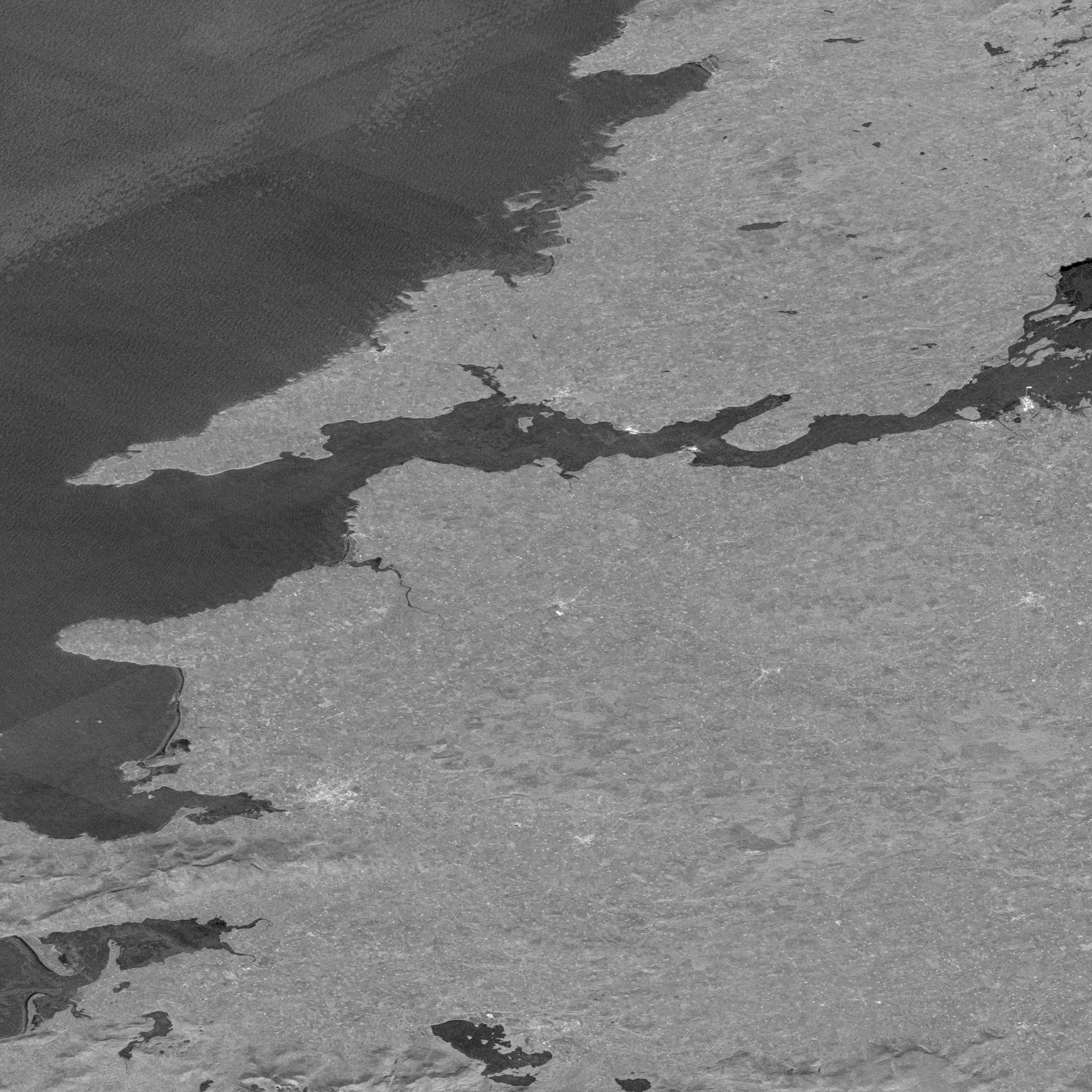
NASADEM SRTM Image Mosaic Global 1 arc second V001
National Aeronautics and Space Administration —
The Land Processes Distributed Active Archive Center (LP DAAC) is responsible for the archive and distribution of NASA Making Earth System Data Records for Use in... -
Federal
SAFARI 2000 Upper Air Meteorological Profiles, South Africa, Dry Season 2000
National Aeronautics and Space Administration —
The University of Wyoming has a series of balloonborne radiosonde measurements from all around the world, from the surface to 30 km. This data set contains upper air... -
Federal
GRIP DC-8 DROPSONDE V3
National Aeronautics and Space Administration —
The GRIP DC-8 Dropsonde V3 dataset consists of atmospheric pressure, dry-bulb temperature, dew point temperature, relative humidity, wind direction, wind speed, and... -
Federal
MODIS/Terra L2G Daytime Pointers, Daily 250m NRT
National Aeronautics and Space Administration —
The MODIS/Terra L2G Daytime Pointers, Daily 250m Near Real Time (NRT) product, short name MODPTQKM, stores information about the spatial relationship between each... -
Federal
VOYAGER 1 SOLAR WIND MAGNETIC FIELD HGCOORDS 48SEC AVG V1.0
National Aeronautics and Space Administration —
This dataset contains Voyager 1 magnetometer data from the interplanetary cruise averaged to 48 second samples in Heliographic coordinates. -
Federal
BOREAS Level-2 MAS Surface Reflectance and Temperature Images in BSQ Format
National Aeronautics and Space Administration —
The BOREAS Staff Science Aircraft Data Acquisition Program focused on providing the research teams with the remotely sensed aircraft data products they needed to... -
Federal
NRT AMSR2 Unified L3 Daily 6.25 km Polar Gridded 89 GHz Brightness Temperatures V4
National Aeronautics and Space Administration —
The Advanced Microwave Scanning Radiometer 2 (AMSR2) instrument on the Global Change Observation Mission - Water 1 (GCOM-W1) provides global passive microwave... -
Federal
Ocean Surface Current Analyses Real-time (OSCAR) Surface Currents - Final 0.25 Degree (Version 2.0)
National Aeronautics and Space Administration —
Ocean Surface Current Analyses Real-time (OSCAR) is a global surface current database and NASA funded research project. OSCAR ocean mixed layer velocities are... -
Federal
VIIRS/JPSS1+JPSS2 Hourly Cumulative L3 Global Flood Composite 250m Linear Lat Lon Grid - NRT
National Aeronautics and Space Administration —
The VIIRS/JPSS1+JPSS2 Hourly Cumulative L3 Global Flood Composite 250m Linear Lat Lon Grid Near Real Time (NRT) Product, short-name VCDWDG_L3_NRT provides hourly... -
Federal
GEWEX SRB Integrated Product (Rel-4) Shortwave 3-Hourly Monthly Average by UTC Fluxes
National Aeronautics and Space Administration —
GEWEXSRB_Rel4-IP_Shortwave_3hrlymonthly_utc is the Global Energy and Water Exchanges (GEWEX) Surface Radiation Budget (SRB) Integrated Product (Rel-4) Shortwave... -
Federal
ISLSCP II Global Sea Ice Concentration
National Aeronautics and Space Administration —
This International Satellite Land Surface Climatology Project (ISLSCP) Initiative II data set, ISLSCP II Global Sea Ice Concentration, is based on the Goddard Space... -
Federal
LBA-ECO CD-04 CO2 and Heat Flux, km 83 Gap Tower Site, Tapajos National Forest
National Aeronautics and Space Administration —
This data set reports 30-minute values for above-canopy meteorology and fluxes of momentum, heat, and carbon dioxide, and within-canopy carbon dioxide and water vapor... -
Federal
CERES Single Scanner Footprint (SSF) TOA/Surface Fluxes, Clouds and Aerosols Terra-FM1 Edition4A
National Aeronautics and Space Administration —
CER_SSF_Terra-FM1-MODIS_Edition4A is the Clouds and the Earth's Radiant Energy System (CERES) Single Scanner Footprint (SSF) Top-of-the-Atmosphere (TOA)/Surface... -
Federal
NASA MEASURES Precipitation Ensemble based on SSM/I DMSP F13 NASA PPS L1C V06 Tbs 1-orbit L2 Swath 12x12km V1 (PRECIP_SSMI_F13) at GES DISC
National Aeronautics and Space Administration —
The data presented in this level 2 orbital product are rain rate estimates expressed as mm/hour determined from brightness temperatures (Tbs) obtained from the... -
Federal
SatCORPS CERES GEO Edition 4 Meteosat-8 Southern Hemisphere Version 1.4
National Aeronautics and Space Administration —
CER_GEO_Ed4_MET08_SH_V01.4 is the Satellite Cloud and Radiation Property retrieval System (SatCORPS) Clouds and the Earth's Radiant Energy System (CERES)... -
Federal
CERES Regionally Averaged Computed TOA, within the Atmosphere, and Surface Fluxes Hourly Terra Edition4A
National Aeronautics and Space Administration —
CER_CRS1deg-Hour_Terra-MODIS_Edition4A is the Terra Clouds and the Earth's Radiant Energy System (CERES) Level 3 computed flux Edition4A data product. The Cloud and... -
Federal
Nimbus-6 Level 3 NMC Data Systems Test for the Global Atmospheric Research Program (GARP) V001 (NMCN6L3GARP) at GES DISC
National Aeronautics and Space Administration —
The NMCN6L3GARP is the Nimbus-6 Level 3 NMC Data Systems Test for the Global Atmospheric Research Program (GARP) product. The product consists of meterological... -
Federal
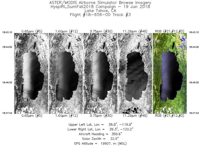
MASTER: HyspIRI Airborne Campaign, Western USA, Summer 2018
National Aeronautics and Space Administration —
This dataset includes Level 1B (L1B) and Level 2 (L2) data products from the MODIS/ASTER Airborne Simulator (MASTER) instrument. The spectral data were collected as...

Official websites use .gov
A
.gov website belongs to an official government
organization in the United States.
Secure .gov websites use HTTPS
A
lock (
) or https:// means you’ve safely connected to
the .gov website. Share sensitive information only on official,
secure websites.