
-
Federal
CAMEX-4 DC-8 INFORMATION COLLECTION AND TRANSMISSION SYSTEM V1
National Aeronautics and Space Administration —
The CAMEX-4 DC-8 Information Collection and Transmission System dataset was collected by the Information Collection and Transmission System (ICATS), which is designed... -
Federal
Alpha Jet Atmospheric eXperiment Ozone Data
National Aeronautics and Space Administration —
The Alpha Jet Atmospheric eXperiment (AJAX) is a partnership between NASA's Ames Research Center and H211, L.L.C., facilitating routine in-situ measurements over... -
Federal
LMOS UC-12 Aircraft Remote Sensing Data
National Aeronautics and Space Administration —
LMOS_AircraftRemoteSensing_UC12_Data_1 is the Lake Michigan Ozone Study (LMOS) remote sensing data collected onboard the NASA UC-12 aircraft during the LMOS field... -
Federal
Delta-X: NUMAR Predictive Model for Marsh Accretion Rates and Chemical Properties
National Aeronautics and Space Administration —
This dataset provides input data and model code to run the Marsh Accretion Rates (NUMAR) process model used to predict soil accretion rates and chemical properties... -
Federal
GOES-R PLT Scanning High-Resolution Interferometer Sounder (S-HIS) V1
National Aeronautics and Space Administration —
The GOES-R PLT Field Campaign Scanning High-Resolution Interferometer Sounder (S-HIS) dataset consists of emitted thermal radiances measured by the Scanning High-... -
Federal
University of Southern Mississippi (USM) - partial pressure of carbon dioxide (pCO2) project
National Aeronautics and Space Administration —
Measurements of pCO2 taken by the University of Southern Mississippi in the Gulf of Mexico near the Louisiana coast in 2005 and 2006 -
Federal
MODIS/Terra Aerosol Cloud Water Vapor Ozone 8-Day L3 Global 1Deg CMG
National Aeronautics and Space Administration —
The MODIS/Terra Aerosol Cloud Water Vapor Ozone 8-Day L3 Global 1Deg CMG product (MOD08_E3) contains 8-Day 1 x 1 degree grid average values of atmospheric parameters... -
Federal
NPP Tropical Forest: Atherton, Australia, 1974-1985, R1
National Aeronautics and Space Administration —
This data set contains eight data files (.txt format): three net primary productivity (NPP) data files and five climate data files. The NPP estimates are based on... -
Federal
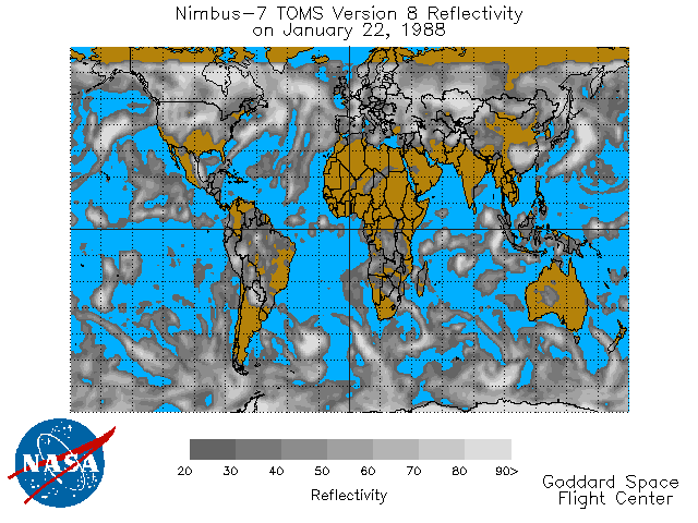
TOMS Nimbus-7 UV Reflectivity Daily L3 Global 1 deg x 1.25 deg Lat/Lon Grid V008 (TOMSN7L3dref) at GES DISC
National Aeronautics and Space Administration —
This Nimbus-7 Total Ozone Mapping Spectrometer (TOMS) version 8 daily global gridded data product contains Lambertian effective surface reflectivity values (Rayleigh... -
Federal
MiCASA Monthly NPP Rh ATMC NEE FIRE FUEL Fluxes 0.1 degree x 0.1 degree
National Aeronautics and Space Administration —
MiCASA is an extensive revision of CASA-GFED3. CASA-GFED3 derives from Potter et al. (1993), diverging in development since Randerson et al. (1996). CASA is a light... -
Federal
VIIRS/NPP BRDF/Albedo Model Parameters Daily L3 Global 500 m SIN Grid NRT
National Aeronautics and Space Administration —
The VIIRS/NPP BRDF/Albedo Model Parameters Daily L3 Global 500 m SIN Grid NRT (VNP43IA1N) product provides BRDF/Albedo model parameters at 500 meter (m) resolution.... -
Federal
Geostationary Lightning Mapper (GLM) Cluster Integrity, Exception Resolution, and Reclustering Algorithm (CIERRA)
National Aeronautics and Space Administration —
The Geostationary Lightning Mapper (GLM) Cluster Integrity, Exception Resolution, and Reclustering Algorithm (CIERRA) dataset consists of a hierarchy of earth-located... -
Federal
MERRA-2 tavg1_2d_int_Nx: 2d,1-Hourly,Time-Averaged,Single-Level,Assimilation,Vertically Integrated Diagnostics 0.625 x 0.5 degree V5.12.4 (M2T1NXINT) at GES DISC
National Aeronautics and Space Administration —
M2T1NXINT (or tavg1_2d_int_Nx) is an hourly time-averaged 2-dimensional data collection in Modern-Era Retrospective analysis for Research and Applications version 2... -
Federal
LBA-ECO TG-05 NPP, Carbon Pool, Soil Characteristics, Soil Gas Flux Maps of Brazil
National Aeronautics and Space Administration —
This data set provides maps produced from model output data from the National Aeronautics and Space Administration-Carnegie Ames Stanford Approach (NASA-CASA) model... -
Federal
KORUS-AQ DC-8 Aircraft In Situ Trace Gas Data
National Aeronautics and Space Administration —
KORUSAQ_TraceGas_AircraftInSitu_DC8_Data are in-situ trace gas data collected onboard the DC-8 aircraft during the KORUS-AQ field campaign. Data were collected using... -
Federal
Portable Remote Imaging SpectroMeter (PRISM) from Elkhorn Slough to Monterey Bay, California
National Aeronautics and Space Administration —
The estuarine waters of Elkhorn Slough terminating in Monterey Bay, California present an excellent study site for testing the limits of hyperspectral imaging... -
Federal
Monthly Frequency of Dust Storm over Land for Varying Intensities, Based on MODIS Aqua Deep Blue Level 2 Aerosol Products MYD04_L2 Collection 6.1, on a Global 0.1 by 0.1 Degree Grid, Level 3 Version 1 (MYDFDS_MON_GLB_L3) at GES DISC
National Aeronautics and Space Administration —
Version 1 is the current version of the dataset. This collection MYDFDS_MON_GLB_L3 provides level 3 monthly frequency of dust storms (FDS) over land from 175°W to... -
Federal
BOREAS AFM-01 NOAA/ATDD Long-EZ Aircraft Flux Data over the SSA
National Aeronautics and Space Administration —
This data set contains measurements from the NOAA/ATDD Long-EZ Aircraft collected during the 1994 IFCs at the SSA. These measurements were made from various... -
Federal
ECCO Sea-Ice and Snow Concentration and Thickness - Snapshot llc90 Grid (Version 4 Release 4)
National Aeronautics and Space Administration —
This dataset provides instantaneous sea-ice and snow concentration, thickness, and pressure loading on the native Lat-Lon-Cap 90 (LLC90) model grid from the ECCO...

Official websites use .gov
A
.gov website belongs to an official government
organization in the United States.
Secure .gov websites use HTTPS
A
lock (
) or https:// means you’ve safely connected to
the .gov website. Share sensitive information only on official,
secure websites.