

887 datasets found for "Sample Sites"
-
Federal
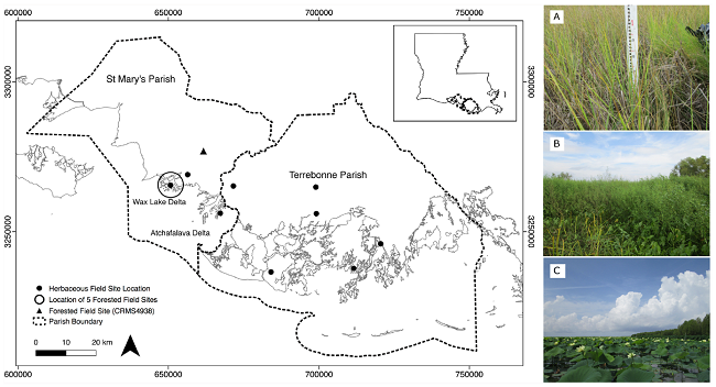
Pre-Delta-X: Vegetation Species, Structure, Aboveground Biomass, MRD, LA, USA, 2015
National Aeronautics and Space Administration —
This dataset provides vegetation species, height, stem density and diameter, and species aboveground biomass (AGB) measurements collected at herbaceous and forested... -
Federal
NARSTO EPA Supersite (SS) Fresno, Beta Attenuation Monitors (BAM), Particulate Mass Concentration Data
National Aeronautics and Space Administration —
NARSTO_EPA_SS_FRESNO_BAM_PM_MASS FRACTION is the North American Research Strategy for Tropospheric Ozone (NARSTO) Environmental Protection Agency (EPA) Supersite (SS)... -
Federal
NARSTO EPA Supersite (SS) Houston, Texas Air Quality Study 2000 (TexAQS2000) Formaldehyde and Hydrogen Peroxide Data
National Aeronautics and Space Administration —
NARSTO_EPA_SS_HOUSTON_TEXAQS2000_PM_SIZE_MASS is North American Research Strategy for Tropospheric Ozone (NARSTO) Environmental Protection Agency (EPA) Supersite (SS)... -
Federal
LBA-ECO ND-07 Hydrochemistry of Natural and Developed Land Cover, Brasilia, Brazil
National Aeronautics and Space Administration —
This data set reports on dissolved nutrient concentrations, as well as dissolved oxygen, alkalinity, conductivity, turbidity, and pH measured in water samples... -
Federal
Digital Surficial Geologic-GIS Map of American Camp Area, San Juan Island National Historical Park, Washington (NPS, GRD, GRI, SAJH, SJIS_surficial digital map) adapted from a Washington Division of Geology and Earth Resources Open File Report map by Dethier, White and Brookfield (1996)
Department of the Interior —
The Digital Surficial Geologic-GIS Map of American Camp Area, San Juan Island National Historical Park, Washington is composed of GIS data layers and GIS tables, and... -
Federal
The Ephemeroptera, Odonata, Plecoptera, Megaloptera, and Trichoptera of Abraham Lincoln Birthplace National Historic Site
Department of the Interior —
The U.S. Geological Survey conducted an inventory of aquatic insects of the orders Ephemeroptera (mayflies), Odonata (dragonflies, damselflies), Plecoptera... -
Federal
Digital Geologic-GIS Map of Yellowstone National Park and Vicinity, Wyoming, Montana, and Idaho (NPS, GRD, GRI, YELL, YELL digital map) adapted from U.S. Geological Survey published and unpublished maps and digital data (1956-2007), a Montana Bureau of Mines and Geology Open-File Reports map by Berg et al. (1999), and a Montana State University unpublished master's thesis map by Kragh, N. and M. Myers (2023)
Department of the Interior —
The Digital Geologic-GIS Map of Yellowstone National Park and Vicinity, Wyoming, Montana, and Idaho is composed of GIS data layers and GIS tables, and is available in... -
Federal
Digital Surficial Geologic-GIS Map of the Mesa Verde National Park, Colorado (NPS, GRD, GRI, MEVE, MEVE_surficial digital map) adapted from a U.S. Geological Survey Scientific Investigations Map by Carrara (2012)
Department of the Interior —
The Digital Surficial Geologic-GIS Map of the Mesa Verde National Park, Colorado is composed of GIS data layers and GIS tables, and is available in the following GRI-... -
Federal
Digital Geologic-GIS Map of Guilford Courthouse National Military Park and Vicinity, North Carolina (NPS, GRD, GRI, GUCO, GUCO digital map) adapted from a North Carolina Geological Survey Regional Geology Series (discontinued) map by Carpenter (1982)
Department of the Interior —
The Digital Geologic-GIS Map of Guilford Courthouse National Military Park and Vicinity, North Carolina is composed of GIS data layers and GIS tables, and is... -
Federal
Digital Surficial Geologic-GIS Map of Upper Delaware Scenic and Recreational River, NY and PA (NPS, GRD, GRI, UPDE, UPDE_surficial digital map) adapted from PA Geological Survey County Report maps by Sevon, Berg, Schultz and Crowl (1989) and Sevon, Berg and Schultz (1989), NY State Geological Survey unpublished maps by Leone, Backhaus and Kowzlowski (2019) and Kowzlowski (2017), PA Geological Survey Open-File Report maps by Braun (2006, 2008, 2010, 2011) and a U.S.G.S National Hydrography Dataset map (2018)
Department of the Interior —
The Digital Surficial Geologic-GIS Map of Upper Delaware Scenic and Recreational River, New York and Pennsylvania is composed of GIS data layers and GIS tables, and... -
Federal
Appalachian Trail Visitor Impact Assessments to Enhance Sustainability and Improve Visitor Experiences.
Department of the Interior —
We will visit two 5k segments within GRSM as part of a larger research study on the Appalachian Trail to take an array of measurements on the condition of the A.T.... -
Federal
Digital Geologic-GIS Map of the Brian Head Quadrangle, Utah (NPS, GRD, GRI, CEBR, BRHE digital map) adapted from a Utah Geological Survey Map by Rowley, Biek, Sable, Boswell, Vice, Hatfield, Maxwell and Anderson (2013)
Department of the Interior —
The Digital Geologic-GIS Map of the Brian Head Quadrangle, Utah is composed of GIS data layers and GIS tables, and is available in the following GRI-supported GIS... -
Federal
Digital Bedrock Geologic-GIS Map of the Saint-Gaudens National Historical Park and Vicinity, New Hampshire (NPS, GRD, GRI, SAGA, SAGA_bedrock digital map) adapted from U.S. Geological Survey Scientific Investigations Maps by Walsh, Valley, Thompson, Ratcliffe, Proctor and Sicard (2020), and Walsh (2016)
Department of the Interior —
The Digital Bedrock Geologic-GIS Map of the Saint-Gaudens National Historical Park and Vicinity, New Hampshire is composed of GIS data layers and GIS tables, and is... -
Federal
Digital Geologic-GIS Map of Cedar Breaks National Monument and Vicinity, Utah (NPS, GRD, GRI, CEBR, CEBR digital map) adapted from a Utah Geological Survey Map by Biek, Rowley, Anderson, Maldonado, Moore, Hacker, Eaton, Hereford, Sable, Filkorn and Matyjasik (2015)
Department of the Interior —
The Digital Geologic-GIS Map of Cedar Breaks National Monument and Vicinity, Utah is composed of GIS data layers and GIS tables, and is available in the following... -
Federal
Digital Geologic-GIS Map of the Brooks Range and Vicinity, Alaska (NPS, GRD, GRI, CAKR, GAAR, NOAT, KOVA, ARCN digital map) adapted from a U.S. Geological Survey Scientific Investigations Map by Wilson, Hults, Mull and Karl (2015)
Department of the Interior —
The Digital Geologic-GIS Map of the Brooks Range and Vicinity, Alaska is composed of GIS data layers and GIS tables, and is available in the following GRI-supported... -
Federal
Digital Geologic-GIS Map of Fredericksburg and Spotsylvania County Battlefields Memorial National Military Park and Vicinity, Virginia (NPS, GRD, GRI, FRSP, FRSP digital map) adapted from a U.S. Geological Survey Geologic Investigations Series Map by Mixon, Pavlides, Powars, Froelich, Weems, Schindler, Newell, Edwards and Ward (2000)
Department of the Interior —
The Digital Geologic-GIS Map of Fredericksburg and Spotsylvania County Battlefields Memorial National Military Park and Vicinity, Virginia is composed of GIS data...
887 datasets found for "Sample Sites"