
-
Federal
Sensitivity of Coastal Environments and Wildlife to Spilled Oil: Northwest Arctic, Alaska: FISH (Fish Polygons) recent views
National Oceanic and Atmospheric Administration, Department of Commerce —
This data set contains sensitive biological resource data for marine, estuarine, freshwater, and anadromous fish species in Northwest Arctic, Alaska. Vector polygons... -
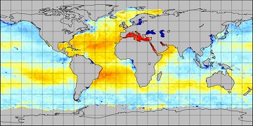
Federal
HadISST Average Sea Surface Temperature, 1°, Global, Monthly, 1870-present recent views
National Oceanic and Atmospheric Administration, Department of Commerce —
The Met Office Hadley Centre's sea ice and sea surface temperature (SST) data set, HadISST1, replaces the Global sea Ice and Sea Surface Temperature (GISST) data... -
Federal
RSS SMAP Level 3 Sea Surface Salinity Standard Mapped Image Monthly V4.0 Validated Dataset recent views
National Aeronautics and Space Administration —
The version 4.0 SMAP-SSS level 3, monthly gridded product is based on the fourth release of the validated standard mapped sea surface salinity (SSS) data from the... -
Federal
GLAS/ICESat L1B Global Waveform-based Range Corrections Data (HDF5) V034 recent views
National Aeronautics and Space Administration —
GLAH05 Level-1B waveform parameterization data include output parameters from the waveform characterization procedure and other parameters required to calculate... -
Federal
MERRA-2 tavg1_2d_flx_Nx: 2d,1-Hourly,Time-Averaged,Single-Level,Assimilation,Surface Flux Diagnostics 0.625 x 0.5 degree V5.12.4 (M2T1NXFLX) at GES DISC recent views
National Aeronautics and Space Administration —
M2T1NXFLX (or tavg1_2d_flx_Nx) is an hourly time-averaged 2-dimensional data collection in Modern-Era Retrospective analysis for Research and Applications version 2... -
Federal
ATLAS/ICESat-2 L3A Sea Ice Freeboard V006 recent views
National Aeronautics and Space Administration —
This data set (ATL10) contains estimates of sea ice freeboard, calculated using three different approaches. Sea ice leads used to establish the reference sea surface... -
Federal
NCEP-GTS Marine Observations in BUFR format recent views
National Oceanic and Atmospheric Administration, Department of Commerce —
The Global Telecommunications System (GTS) is a major component of transmitting global meteorological data, consisting of both in situ and satellite observations.... -
Federal
Near-Real-Time SSM/I-SSMIS EASE-Grid Daily Global Ice Concentration and Snow Extent V004 recent views
National Aeronautics and Space Administration —
The Near-real-time Ice and Snow Extent (NISE) data set provides daily, global maps of sea ice concentrations and snow extent. These data are not suitable for time... -
Federal
NCDC feed of Global Telecommunication System (GTS) marine observations in International Maritime Meteorological Archive (IMMA) Format recent views
National Oceanic and Atmospheric Administration, Department of Commerce —
The data contained here are surface marine observations from many different sources via the NCDC Global Telecommunication System (GTS) Marine in International... -
Federal
Moderate Resolution Imaging Spectroradiometer (MODIS) - Aqua NGDA recent views
National Aeronautics and Space Administration —
This dataset represents multiple products archived at the multiple archive centers for the MODIS (Moderate Resolution Imaging Spectroradiometer) instrument aboard the... -
Federal
Sensitivity of Coastal Environments and Wildlife to Spilled Oil: Northwest Arctic, Alaska: FISHL (Fish Lines) recent views
National Oceanic and Atmospheric Administration, Department of Commerce —
This data set contains sensitive biological resource data for anadromous fish species in Northwest Arctic, Alaska. Vector arcs in this data set represent species... -
Federal
International Comprehensive Ocean-Atmosphere Data Set (ICOADS) Release 3.0 - Monthly Summary Groups (MSG) recent views
National Oceanic and Atmospheric Administration, Department of Commerce —
This dataset, the International Comprehensive Ocean-Atmosphere Data Set (ICOADS), is the most widely-used freely available collection of surface marine observations,... -
Federal
NOAA-CIRES 20th Century Reanalysis (V2c) recent views
National Oceanic and Atmospheric Administration, Department of Commerce —
The 20th Century Reanalysis version 2c (20CRV2c)is an effort led by PSD and the CIRES at the University of Colorado to produce a reanalysis dataset spanning the... -
Federal
GLAS/ICESat L1B Global Waveform-based Range Corrections Data (HDF5) V034 recent views
National Aeronautics and Space Administration —
GLAH05 Level-1B waveform parameterization data include output parameters from the waveform characterization procedure and other parameters required to calculate... -
Federal
NOAA Optimum Interpolation 1/4 Degree Daily Sea Surface Temperature (OISST) Analysis, Version 2 recent views
National Oceanic and Atmospheric Administration, Department of Commerce —
This high-resolution sea surface temperature (SST) analysis product was developed using an optimum interpolation (OI) technique. The SST analysis has a spatial grid... -
Federal
Global Sentinel-1 Burst ID Map recent views
National Aeronautics and Space Administration —
Sentinel-1 performs systematic acquisition of bursts in both IW and EW modes. The bursts overlap almost perfectly between different passes and are always located at... -
Federal
SST, Pathfinder Ver 5.3 (L3C), Night, Global, 0.0417°, 1981-present, Science Quality (8 Day Composite) recent views
National Oceanic and Atmospheric Administration, Department of Commerce —
This dataset contains 8-day-composites of nighttime sea surface temperature (SST) data produced as part of the AVHRR Pathfinder SST Project. The source data were... -
Federal
Climate Forecast System Reanalysis (CFSR), for 1979 to 2011 recent views
National Oceanic and Atmospheric Administration, Department of Commerce —
The NCEP Climate Forecast System Reanalysis (CFSR) was initially completed for the 31-year period from 1979 to 2009, in January 2010. The CFSR was designed and... -
Federal
Oceanographic temperature and salinity measurements collected using drifting buoys in the Arctic Ocean from 2003 to 2006 (NCEI Accession 0014672) recent views
National Oceanic and Atmospheric Administration, Department of Commerce —
Oceanographic temperature and salinity measurements collected using drifting buoys in the Arctic Ocean. Data from JAMSTEC drifting buoys which were deployed both as...

Official websites use .gov
A
.gov website belongs to an official government
organization in the United States.
Secure .gov websites use HTTPS
A
lock (
) or https:// means you’ve safely connected to
the .gov website. Share sensitive information only on official,
secure websites.