

75 datasets found for "Index Maps"
-
Federal
LBA Regional Land Cover from AVHRR, 1-km, 1992-1993 (Hansen et al.)
National Aeronautics and Space Administration —
This data set is a subset of Hansen et al. (1999), "1 km Global Land Cover Data Set Derived from AVHRR," which was developed at the Laboratory for Global Remote... -
Federal
ISLSCP II IGBP DISCover and SiB Land Cover, 1992-1993
National Aeronautics and Space Administration —
This data set describes the geographic distributions of 17 classes of land cover based on the International Geosphere-Biosphere DISCover land cover legend (Loveland... -
Federal
LBA-ECO ND-11 Soil Properties of Forested Headwater Catchments, Mato Grosso, Brazil
National Aeronautics and Space Administration —
The northwestern region of Mato Grosso State consists of complex landscapes due to ongoing geomorphologic activity that contributes to the occurrence of different... -
Federal
Long-Term Arctic Growing Season NDVI Trends from GIMMS 3g, 1982-2012
National Aeronautics and Space Administration —
This data set provides normalized difference vegetation index (NDVI) data for the arctic growing season derived primarily with data from Advanced Very High Resolution... -
Federal
SAFARI 2000 Land Cover from AVHRR, 1-km, 1992-1993 (Hansen et al.)
National Aeronautics and Space Administration —
The data set consists of a southern African subset of the 1-km Global Land Cover Data Set Derived from AVHRR developed at the Laboratory for Global Remote Sensing... -
Federal
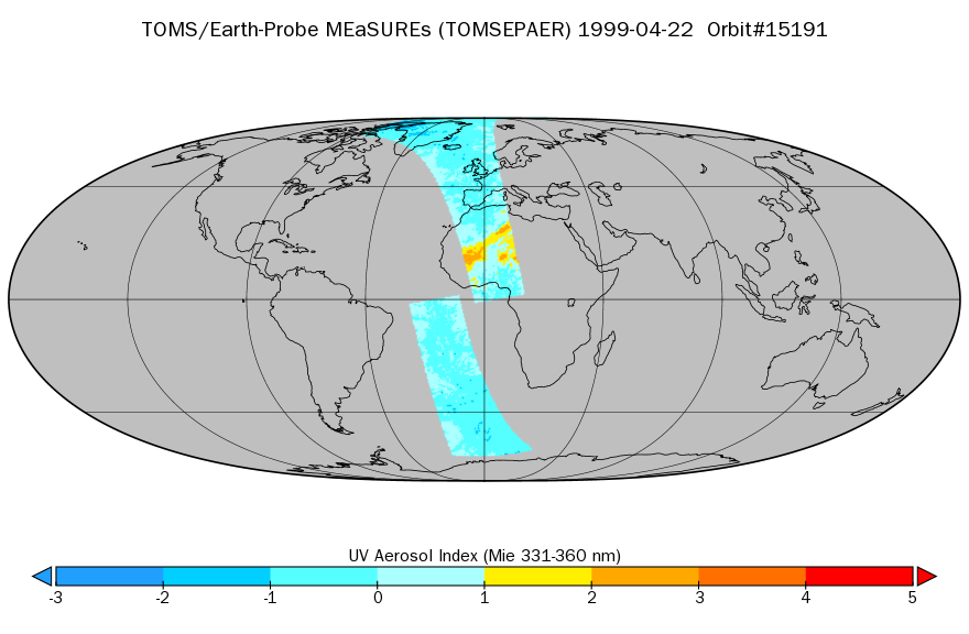
TOMS/EP Near UV Aerosol Index and LER 1-Orbit L2 40x40km at GES DISC
National Aeronautics and Space Administration —
As part of the NASA's Making Earth System Data Records for Use in Research Environments (MEaSUREs) program, this projects describes a multi-decadal Fundamental... -
Federal
Siberian Boreal Forest Aboveground Biomass and Fire Scar Maps, Russia, 1969-2007
National Aeronautics and Space Administration —
This data set provides 30-meter resolution mapped estimates of Cajander larch (Larix cajanderi) aboveground biomass (AGB), circa 2007, and a map of burn perimeters... -
Federal
ECOSTRESS Gridded Downscaled Soil Moisture Instantaneous L3 Global 70 m V002
National Aeronautics and Space Administration —
The ECOsystem Spaceborne Thermal Radiometer Experiment on Space Station (ECOSTRESS) mission measures the temperature of plants to better understand how much water... -
Federal
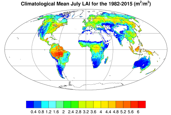
Global Monthly Mean Leaf Area Index Climatology, 1981-2015
National Aeronautics and Space Administration —
This dataset provides a global 0.25 degree x 0.25 degree gridded monthly mean leaf area index (LAI) climatology as averaged over the period from August 1981 to August... -
Federal
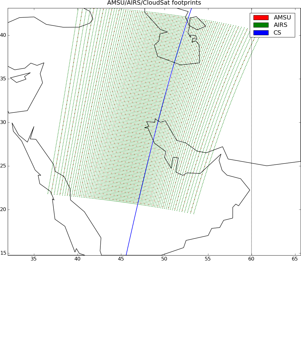
AIRS-CloudSat cloud mask and radar reflectivities collocation indexes V4.0 (AIRS_CPR_IND) at GES_DISC
National Aeronautics and Space Administration —
Version 4.1 is the current version of the data set. Previous versions are no longer available and have been superseded by Version 4.1.This is AIRS-AMSU-CloudSat... -
Federal
Gross Primary Production Maps of Tidal Wetlands across Conterminous USA, 2000-2019
National Aeronautics and Space Administration —
This dataset provides mapped tidal wetland gross primary production (GPP) estimates (g C/m2/day) derived from multiple wetland types at 250-m resolution across the... -
Federal
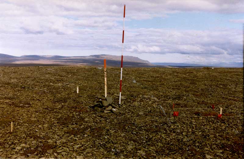
Arctic Vegetation Plots at Imnavait Creek, Alaska, 1984-1985
National Aeronautics and Space Administration —
This dataset provides environmental, soil, and vegetation data collected during the periods of August 1984 and August-September 1985 from 84 study plots at the... -
Federal
CALIPSO Lidar Level 1B profile data, V4-11
National Aeronautics and Space Administration —
CAL_LID_L1-Standard-V4-11 is the Cloud-Aerosol Lidar and Infrared Pathfinder Satellite Observation (CALIPSO) Lidar Level 1B profile data, Version 4-10 data product.... -
Federal
BOREAS Level-1B MAS Imagery: At-Sensor Radiance, Relative X and Y Coordinates
National Aeronautics and Space Administration —
For BOREAS, the MAS images, along with the other remotely sensed data, were collected to provide spatially-extensive information over the primary study areas. This...
75 datasets found for "Index Maps"