
-
Federal
BOREAS TE-11 Surface Meteorological Data
National Aeronautics and Space Administration —
The BOReal Ecosystem-Atmosphere Study (BOREAS) Terrestrial Ecology (TE)-11 team collected several data sets in support of its efforts to characterize and interpret... -
Federal
BOREAS TE-18, 30-m, Radiometrically Rectified Landsat TM Imagery
National Aeronautics and Space Administration —
The BOREAS TE-18 team used a radiometric rectification process to produce standardized digital number (DN) values for a series of Landsat TM images of the BOREAS SSA... -
Federal
BOREAS RSS-15 SIR-C and TM Biomass and Landcover Maps of the NSA and SSA
National Aeronautics and Space Administration —
As part of BOREAS, the RSS-15 team conducted an investigation using SIR-C , X-SAR and Landsat TM data for estimating total above-ground dry biomass for the SSA and... -
Federal
BOREAS Regional Soils Data in Raster Format and AEAC Projection
National Aeronautics and Space Administration —
This data set was gridded by BORIS staff from a vector data set received from Canadian Soil Information System (CanSIS). The original data came in two parts that... -
Federal
BOREAS SERM Forest Cover Data of Saskatchewan in Vector Format
National Aeronautics and Space Administration —
This data set is a condensed forest cover type digital map of Saskatchewan and is a product of the Saskatchewan Environment and Resource Management, Forestry Branch -... -
Federal
LBA-ECO LC-07 CO2 and CH4 Flux from Wetlands, Negro River Basin, Brazil: 2004-2006
National Aeronautics and Space Administration —
This data set provides estimates of daily and monthly carbon dioxide (CO2) and methane (CH4) diffusive and ebullitive flux for dry and flooded areas from two study... -
Federal
BOREAS RSS-08 SSA IFC-3 Digitized Stereo Imagery at the OBS, OA, and OJP Sites
National Aeronautics and Space Administration —
The RSS08 team acquired stereo photography from the double-scaffold towers at the Southern Study Area (SSA) Old Black Spruce (OBS), Old Aspen (OA), and Old Jack Pine... -
Federal
BOREAS Follow-On FLX-01 NSA-OBS Tower Flux, Meteorological, and Soil Temp. Data
National Aeronautics and Space Administration —
The BOREAS Follow-On FLX-01 team collected tower flux, surface meteorological, and soil temperature data at the BOREAS NSA-OBS site continuously from March 1994... -
Federal
BOREAS TGB-08 Starch Concentration Data over the SSA-OBS and the SSA-OJP
National Aeronautics and Space Administration —
The TGB-08 team collected data to investigate the controls over non-methane hydrocarbon (NMHC) fluxes from boreal forest tree species. This data set includes... -
Federal
BOREAS RSS-17 Stem, Soil, and Air Temperature Data
National Aeronautics and Space Administration —
The BOREAS RSS-17 team collected several data sets in support of its research in monitoring and analyzing environmental and phenological states using radar data. This... -
Federal
BOREAS RSS-14 Level-3 Gridded Radiometer and Satellite Surface Radiation Images
National Aeronautics and Space Administration —
The BOREAS RSS-14 team collected and processed GOES-7 and -8 images of the BOREAS region as part of their effort to characterize the incoming, reflected and emitted... -
Federal
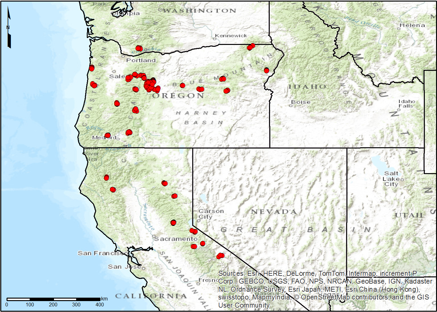
NACP TERRA-PNW: Forest Plant Traits, NPP, Biomass, and Soil Properties, 1999-2014
National Aeronautics and Space Administration —
This data set contains measurements and estimates of leaf, tree, and soil data from six projects conducted by the Terrestrial Ecosystem Research and Regional... -
Federal
LBA-ECO CD-06 Physical, Political, and Hydrologic Maps, Ji-Parana River Basin, Brazil
National Aeronautics and Space Administration —
This data set contains physical, hydrologic, political, demographic, and societal maps for the Ji-Parana River Basin, in the state of Rondonia, Brazil. These data... -
Federal
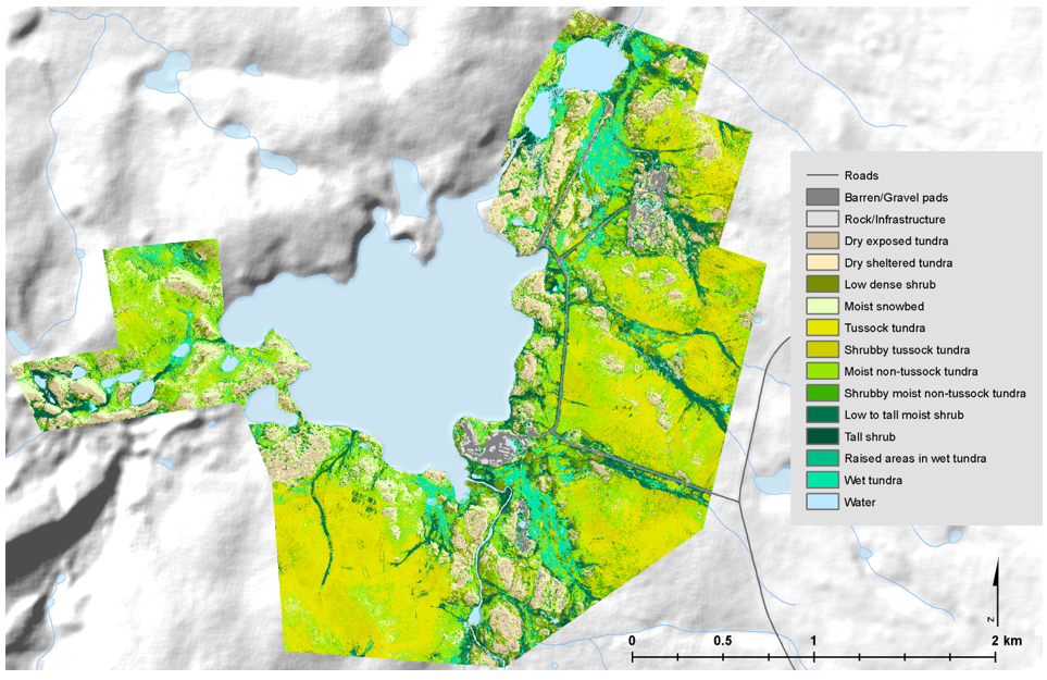
High-Resolution Vegetation Community Maps, Toolik Lake Area, Alaska, 2013-2015
National Aeronautics and Space Administration —
This dataset contains vegetation community maps at 20 cm resolution for three landscapes near the Toolik Lake research area in the northern foothills of the Brooks... -
Federal
NPP Multi-Biome: Gridded Estimates for Selected Regions Worldwide, 1954-1998, R3
National Aeronautics and Space Administration —
This data set provides two data files (.csv format) containing gridded (0.5-degree) estimates of net primary productivity (NPP), elevation, temperature,... -
Federal
BOREAS TGB-08 Monoterpene Concentration Data over the SSA-OBS and the SSA-OJP
National Aeronautics and Space Administration —
The TGB-08 team collected data to investigate the controls over non-methane hydrocarbon (NMHC) fluxes from boreal forest tree species. This data set contains... -
Federal
BOREAS TF-04 SSA-YJP Tower Flux, Meteorological, and Canopy Condition Data, R1
National Aeronautics and Space Administration —
The BOREAS TF-04 team collected energy, carbon dioxide, and water vapor flux data at the BOREAS SSA-YJP site during the growing season of 1994. In addition,... -
Federal
BOREAS TGB-03 CH4 and CO2 Chamber Flux Data over NSA Upland Sites
National Aeronautics and Space Administration —
The BOREAS TGB-03 team collected methane and carbon dioxide (CH4, CO2) chamber flux measurements at the NSA Fen site, OBS, YJP, and auxiliary sites along Gillam Road... -
Federal
BOREAS AFM-08 ECMWF Hourly Surface and Upper Air Data for the SSA and NSA
National Aeronautics and Space Administration —
The BOREAS AFM-08 team focused on modeling efforts to improve the understanding of the diurnal evolution of the convective boundary layer over the boreal forest. This... -
Federal
BOREAS/SRC AMS Suite A Surface Meteorological and Radiation Data: 1996
National Aeronautics and Space Administration —
The Saskatchewan Research Council (SRC) collected surface meteorological and radiation data from December, 1993 until Decemb er 1996. The data set is comprised of the...

Official websites use .gov
A
.gov website belongs to an official government
organization in the United States.
Secure .gov websites use HTTPS
A
lock (
) or https:// means you’ve safely connected to
the .gov website. Share sensitive information only on official,
secure websites.