
-
Federal
Sounder SIPS: Suomi NPP CrIMSS Level 2 CHART Normal Spectral Resolution: Cloud Cleared Radiances V1
National Aeronautics and Space Administration —
The objective of this limited edition data collection is to examine products generated by the Climate Heritage AIRS Retrieval Technique (CHART) algorithm to analyze... -
Federal
Sounder SIPS: Suomi NPP ATMS Level 3 RAMSES2 Standard Gridded Monthly V3 at GES DISC
National Aeronautics and Space Administration —
This level 3 monthly product is generated from the RAMSES (Retrieval Algorithm for Microwave Sounders in Earth Science) II algorithm.The RAMSES II algorithm is a... -
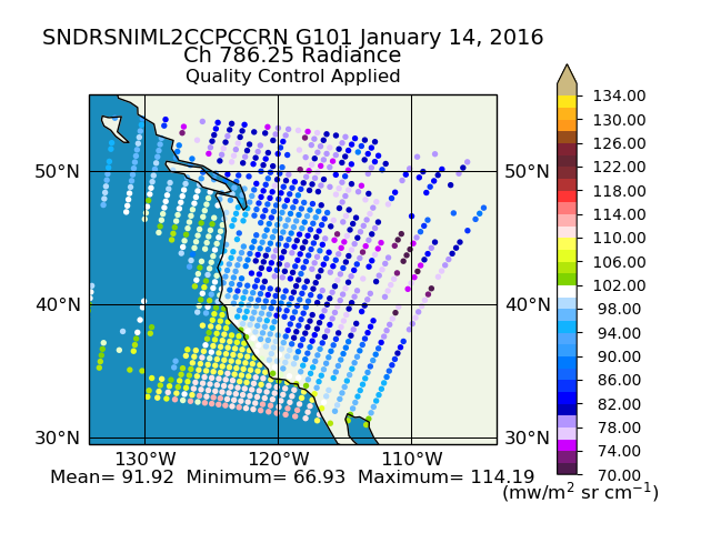
Federal
Sounder SIPS: Suomi NPP CrIMSS Level 2 CLIMCAPS Normal Spectral Resolution: Cloud Cleared Radiances V2 (SNDRSNIML2CCPCCRN) at GES DISC
National Aeronautics and Space Administration —
The CLIMCAPS (Community Long-term Infrared Microwave Coupled Product System) algorithm is used to analyze data from the Cross-track Infrared Sounder/Advanced... -
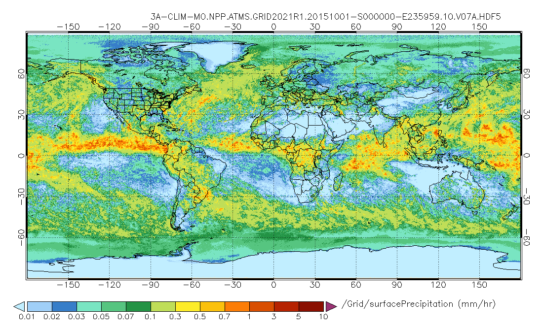
Federal
GPM ATMS on SUOMI-NPP (GPROF) Radiometer Precipitation Profiling L3 1 month 0.25 degree x 0.25 degree V07 (GPM_3GPROFNPPATMS_CLIM) at GES DISC
National Aeronautics and Space Administration —
Version 07 is the current version of the data set. Older versions are no longer available and have been superseded by Version 07.The "CLIM" products differ from their... -
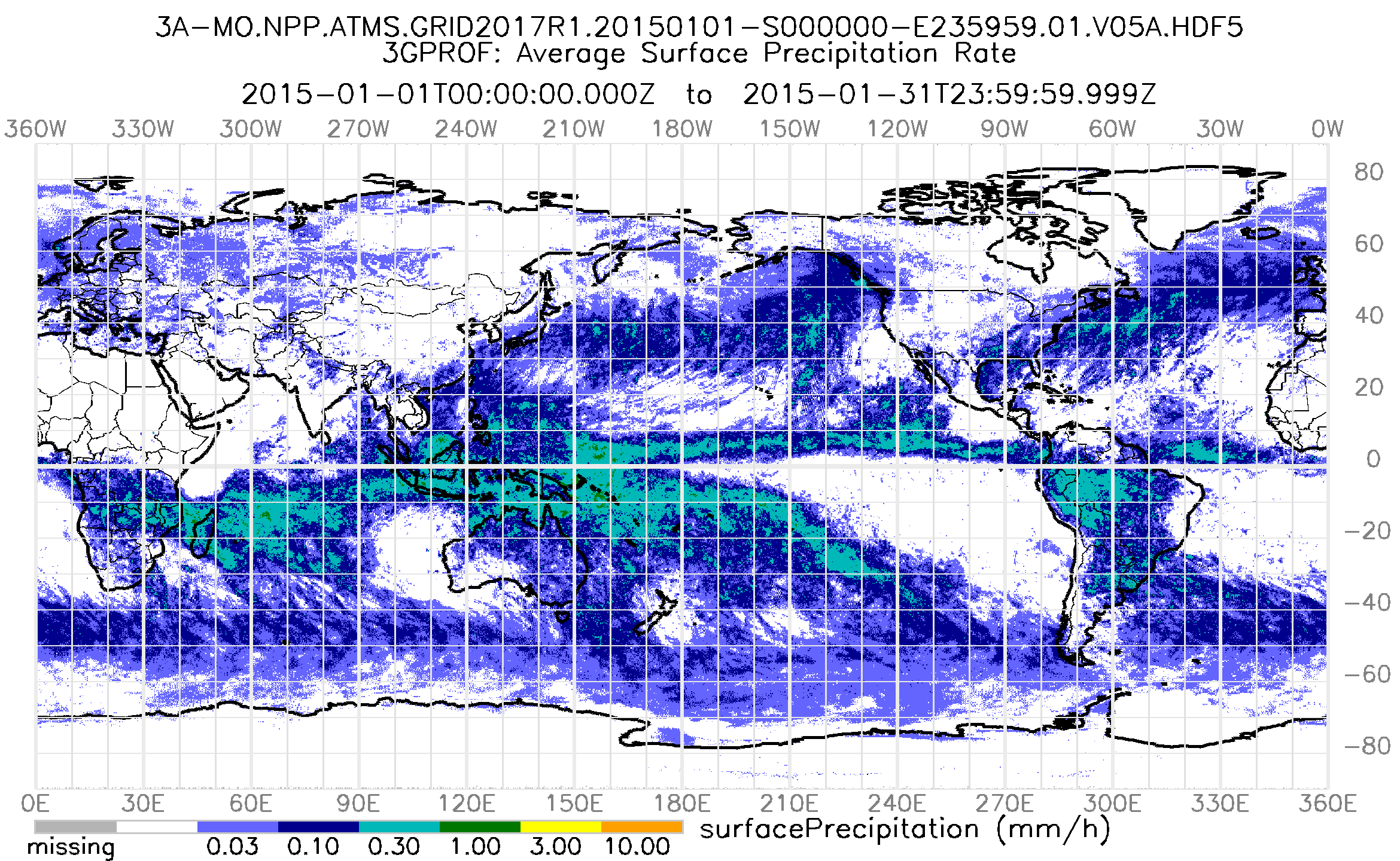
Federal
GPM ATMS on SUOMI-NPP (GPROF) Radiometer Precipitation Profiling L3 1 month 0.25 degree x 0.25 degree V07 (GPM_3GPROFNPPATMS) at GES DISC
National Aeronautics and Space Administration —
3GPROF products provide global gridded monthly/daily precipitation averages from multiple satellites that can be used for climate studies. The 3GPROF products are... -
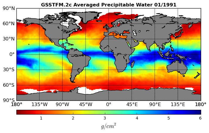
Federal
Goddard Satellite-Based Surface Turbulent Fluxes, 0.25 x 0.25 deg, Monthly Grid V3 (GSSTFM) at GES DISC
National Aeronautics and Space Administration —
These data are the Goddard Satellite-based Surface Turbulent Fluxes Version-3 Dataset recently produced through a MEaSUREs funded project led by Dr. Chung-Lin Shie... -
Federal
GEOS-5 FP-IT 3D Time-Averaged Model-Layer Assimilated Data Geo-Colocated to OMI/Aura VIS 1-Orbit L2 Swath 13x24km V4 (OMVFPMET) at GES DISC
National Aeronautics and Space Administration —
The GEOS-5 FP-IT 3D Time-Averaged Model-Layer Assimilated Data Geo-Colocated to OMI/Aura VIS 1-Orbit L2 Swath 13x24km (OMVFPMET) product provides selected... -
Federal
GEOS-Carb CASA-GFED 3-hourly Ecosystem Exchange Fluxes 0.5 degree x 0.625 degree V3 (GEOS_CASAGFED_3H_NEE) at GES DISC
National Aeronautics and Space Administration —
This product provides 3 hourly average net ecosystem exchange (NEE) and gross ecosystem exchange (GEE)of Carbon derived from the Carnegie-Ames-Stanford-Approach –... -
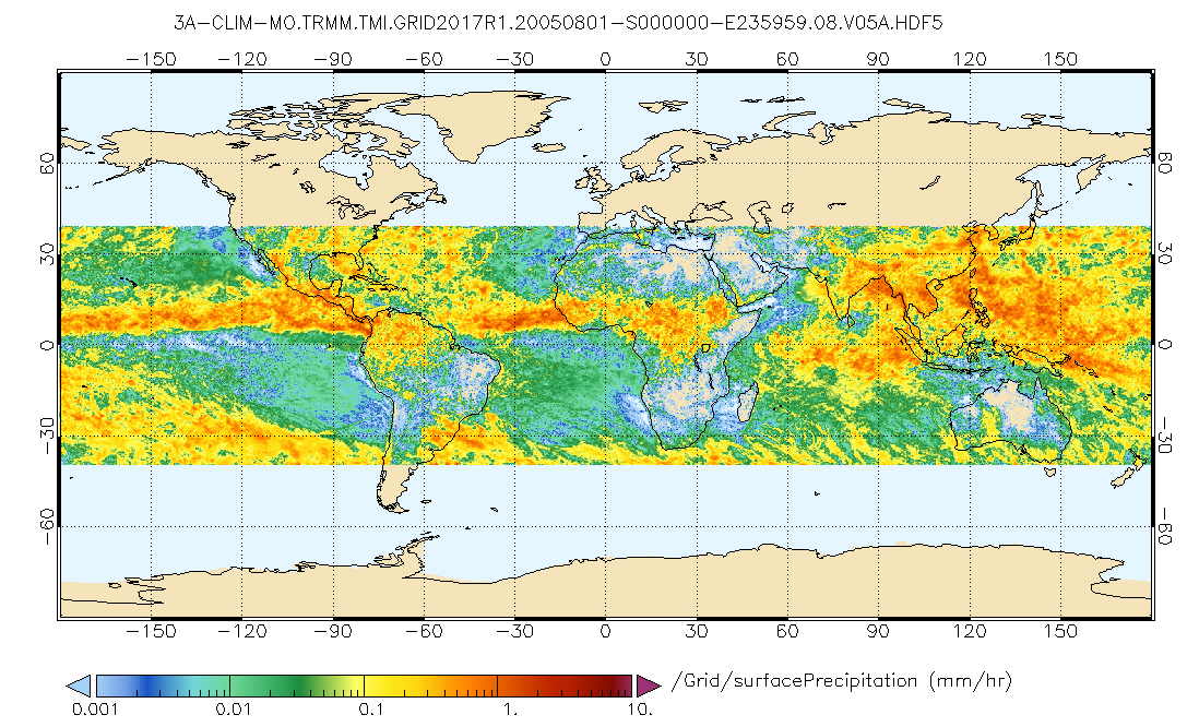
Federal
GPM TMI on TRMM (GPROF) Climate-based Radiometer Precipitation Profiling L3 1 month 0.25 degree x 0.25 degree V07 (GPM_3GPROFTRMMTMI_CLIM) at GES DISC
National Aeronautics and Space Administration —
This is the new (GPM-formated) TRMM product. It replaces the old TRMM_3A12,3A11 Version 07 is the current version of the data set. Older versions will no longer be... -
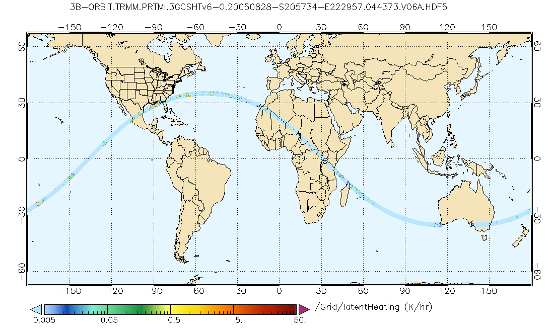
Federal
GPM PR and TMI on TRMM Combined Gridded Orbital Convective-Stratiform Latent Heating Profiles L3 1.5 hours 0.25x0.25 degree V07 (GPM_3GCSH_TRMM) at GES DISC
National Aeronautics and Space Administration —
This is the new (GPM-formated) TRMM product. It replaces the old TRMM legacy product TRMM_3G31.Version 07 is the current version of the data set. Older versions will... -
Federal
GPM PR and TMI on TRMM Combined Convective-Stratiform Latent Heating Profiles L3 1 month 0.25x0.25 degree V07 (GPM_3HCSH_TRMM) at GES DISC
National Aeronautics and Space Administration —
This is the new (GPM-formated) TRMM product. It replaces the old TRMM legacy TRMM_3H31Version 07 is the current version of the data set. Older versions will no longer... -
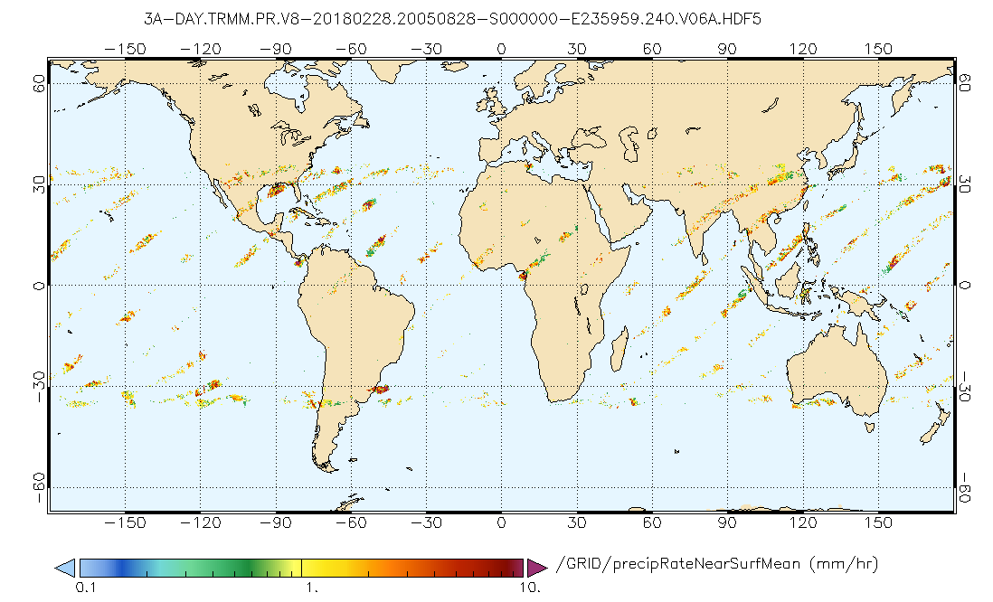
Federal
GPM PR on TRMM Precipitation Statistics, at Surface and Fixed Heights 1 day 0.25x0.25 degree V07 (GPM_3PRD) at GES DISC
National Aeronautics and Space Administration —
This a new (GPM-formated) TRMM product. There is no equivalent in the old TRMM suite of products.Version 07 is the current version of the data set. Older versions... -
Federal
GPM SSMIS on F18 (GPROF) Climate-based Radiometer Precipitation Profiling L3 1 day 0.25 degree x 0.25 degree V07 (GPM_3GPROFF18SSMIS_DAY_CLIM) at GES DISC
National Aeronautics and Space Administration —
Version 07 is the current version of the data set. Older versions will no longer be available and have been superseded by Version 07. The 'CLIM' products differ from... -
Federal
GPM SSMIS on F18 (GPROF) Climate-based Radiometer Precipitation Profiling L3 1 month 0.25 degree x 0.25 degree V07 (GPM_3GPROFF18SSMIS_CLIM) at GES DISC
National Aeronautics and Space Administration —
Version 07 is the current version of the data set. Older versions will no longer be available and have been superseded by Version 07. The "CLIM" products differ from... -
Federal
GPM SSMIS on F18 Common Calibrated Brightness Temperatures L1C 1.5 hours 12 km V07 (GPM_1CF18SSMIS) at GES DISC
National Aeronautics and Space Administration —
Version 07 is the current version of the data set. Older versions will no longer be available and have been superseded by Version 07.All 1C products have a common L1C... -
Federal
GPM SSMIS on F18 (GPROF) Radiometer Precipitation Profiling L3 1 day 0.25 degree x 0.25 degree V07 (GPM_3GPROFF18SSMIS_DAY) at GES DISC
National Aeronautics and Space Administration —
Version 07 is the current version of the data set. Older versions will no longer be available and have been superseded by Version 07.3GPROF products provide global... -
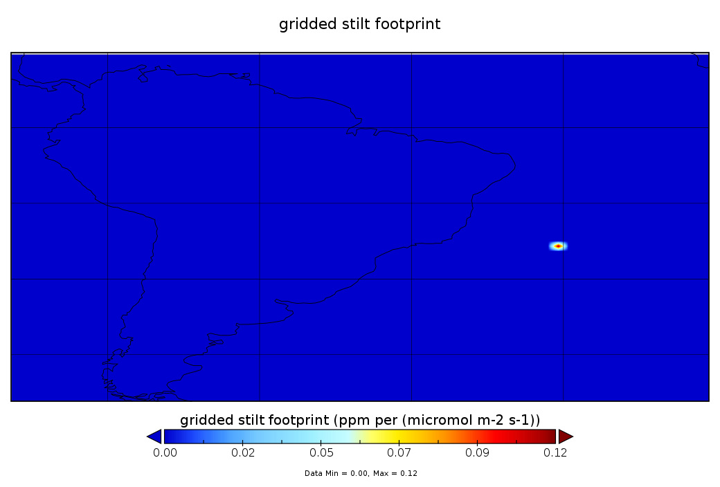
Federal
CarbonTracker-Lagrange South America OCO-2 Vertical Profile of Footprints V1 (CMS_CTL_SA_OCO2_FOOTPRINTS)
National Aeronautics and Space Administration —
This data set provides Weather Research and Forecasting (WRF) Stochastic Time-Inverted Lagrangian Transport (STILT) particle trajectory data products for particle... -
Federal
BUV/Nimbus-4 Dark Current Study Master Data V001 (BUVN4L1DCM) at GES DISC
National Aeronautics and Space Administration —
The Nimbus-4 BUV Level-1 Dark Current Study Master Data is derived from the BUV Level 1 Radiance (RUT) product and contains the geophysical indices and... -
Federal
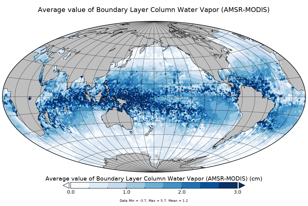
AMSR-MODIS Boundary Layer Water Vapor L3 Monthly 1 degree x 1 degree V2 (AMMBLWV) at GES DISC
National Aeronautics and Space Administration —
Version 2 is the current version of this dataset. Version 2 uses an improved methodology to screen out high clouds.This data set provides an estimate the marine... -
Federal
CAR CLAMS BRDF Measurements V2 (CAR_CLAMS_BRDF) at GES DISC
National Aeronautics and Space Administration —
CLAMS is the Chesapeake Lighthouse and Aircraft Measurements for Satellites field campaign sponsored by CERES, MISR, MODIS-Atmospheres and the NASA/GEWEX Global...

Official websites use .gov
A
.gov website belongs to an official government
organization in the United States.
Secure .gov websites use HTTPS
A
lock (
) or https:// means you’ve safely connected to
the .gov website. Share sensitive information only on official,
secure websites.