
-
Federal
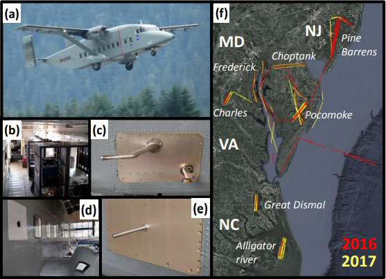
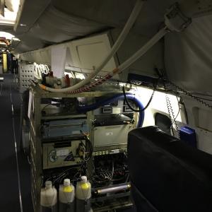
CARAFE: Regional Airborne Greenhouse Gases Eddy Covariance Measurements, 2016-2017
National Aeronautics and Space Administration —
This dataset provides airborne eddy covariance (EC) fluxes of carbon dioxide, methane, sensible heat, and latent heat at high spatial resolution collected during the... -
Federal
BOREAS TGB-03 Plant Species Composition Data over the NSA Fen
National Aeronautics and Space Administration —
The BOREAS TGB-03 team collected several data sets that contributed to understanding the measured trace gas fluxes over sites in the NSA. This data set contains... -
Federal
BOREAS TGB-04 NSA-BVP Tower Flux and Meteorological Data
National Aeronautics and Space Administration —
The BOREAS TGB-04 team measured the exchange of heat, water, and CO2 between a boreal forest beaver pond and the atmosphere in the NSA for the ice-free period of... -
Federal
BOREAS TF-11 SSA-FEN Tower Flux and Meteorological Data
National Aeronautics and Space Administration —
The BOREAS TF-11 team collected energy, carbon dioxide, and methane flux data at the BOREAS SSA-Fen site during the growing seasons of 1994 and 1995. -
Federal
BOREAS TGB-01/TGB-03 Water Table and Peat Temperature Data over the NSA
National Aeronautics and Space Administration —
The BOREAS TGB-01 and TGB-03 teams collected several data sets that contributed to understanding the measured trace gas fluxes over sites in the NSA. This data set... -
Federal
BOREAS AFM-06 Mean Wind Profile Data
National Aeronautics and Space Administration —
The BOREAS AFM-06 team from the National Oceanic and Atmospheric Administration Environment Technology Laboratory (NOAA/ETL) operated a 915 MHz wind/Radio Acoustic... -
Federal
ATom: In Situ Data from Caltech Chemical Ionization Mass Spectrometer (CIT-CIMS), V2
National Aeronautics and Space Administration —
This dataset provides the concentrations of gas-phase organic and inorganic analytes measured by the California Institute of Technology (CIT) Chemical Ionization Mass... -
Federal
ATom: L2 In Situ Measurements of Aerosol Microphysical Properties (AMP)
National Aeronautics and Space Administration —
This dataset provides the number, surface area, and volume concentrations and size distributions of dry aerosol particles measured by the Aerosol Microphysical... -
Federal
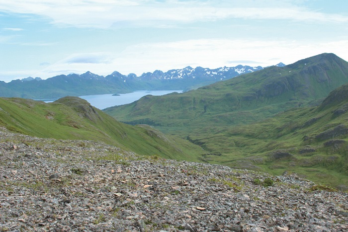
Arctic Vegetation Plots on Unalaska Island, Aleutian Islands, Alaska, 2007
National Aeronautics and Space Administration —
This data set provides environmental, soil, and vegetation data collected during August 2007 from 69 study plots at the Unalaska Island research site, and one plot on... -
Federal
BOREAS Level-0 AOCI Imagery: Digital Counts in BIL Format
National Aeronautics and Space Administration —
The level-0 AOCI imagery, along with the other remotely sensed images, was collected to provide spatially extensive information about radiant energy over the primary... -
Federal
BOREAS Level-1B TIMS Imagery: At Sensor Radiance in BSQ Format
National Aeronautics and Space Administration —
The BOREAS Staff Science Aircraft Data Acquisition Program focused on providing the research teams with the remotely sensed satellite data products they needed to... -
Federal
BOREAS HYD-03 Snow Water Equivalent Data
National Aeronautics and Space Administration —
The BOREAS HYD-03 team collected several data sets related to the hydrology of forested areas. This data set contains measurements of snow depth, snow density in 3-cm... -
Federal
Blue Carbon-based Natural Climate Solutions, Priority Maps for the U.S., 2006-2011
National Aeronautics and Space Administration —
This dataset contains shapefiles showing location of tidal wetland parcels with the potential for net greenhouse gas removal if restored from current mapped condition... -
Federal
ATom: Measurements of Soluble Acidic Gases and Aerosols (SAGA)
National Aeronautics and Space Administration —
Soluble acidic gases and aerosols (SAGA) were collected with two related installations; a mist chamber/ion chromatography (MC/IC) system and a paired bulk aerosol... -
Federal
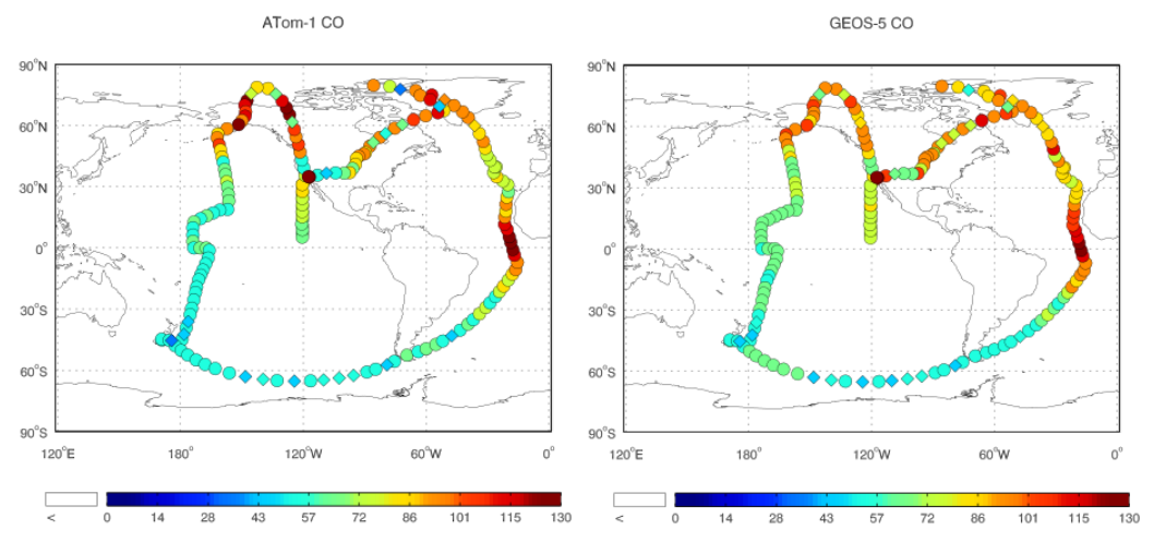
ATom: Observed and GEOS-5 Simulated CO Concentrations with Tagged Tracers for ATom-1
National Aeronautics and Space Administration —
This dataset contains carbon monoxide (CO) observations at 10-second intervals from flights during the ATom-1 campaign in 2016 and simulated CO concentrations from... -
Federal
BOREAS Level-1B MAS Imagery: At-Sensor Radiance, Relative X and Y Coordinates
National Aeronautics and Space Administration —
For BOREAS, the MAS images, along with the other remotely sensed data, were collected to provide spatially-extensive information over the primary study areas. This... -
Federal
Delta-X: Delft3D Sediment Model, Site 421, Terrebonne Basin, MRD, Louisiana, USA
National Aeronautics and Space Administration —
This dataset contains the Delft3D model of the intensive site 421 in the Terrebonne Basin along the Mississippi River Delta (MRD) in coastal Louisiana. Simulations...

Official websites use .gov
A
.gov website belongs to an official government
organization in the United States.
Secure .gov websites use HTTPS
A
lock (
) or https:// means you’ve safely connected to
the .gov website. Share sensitive information only on official,
secure websites.