
-
Federal
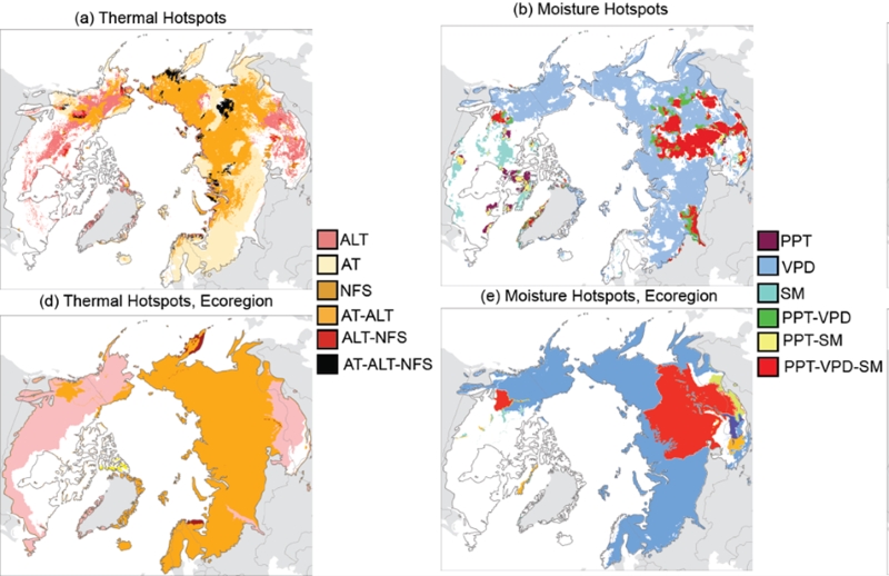
Trends of Thermal, Wetness, and Vegetative Change in the Circumpolar Arctic
National Aeronautics and Space Administration —
This dataset provides estimates of trends in temperature, moisture, and vegetation changes over the circumpolar Arctic. Time series trends were measured by the Theil-... -
Federal
Pre-Delta-X: Channel Bathymetry of the Atchafalaya Basin, LA, USA, 2016
National Aeronautics and Space Administration —
This dataset provides water depths and water surface elevations collected during bathymetric surveys of the main channel of the Wax Lake Delta within the Mississippi... -
Federal
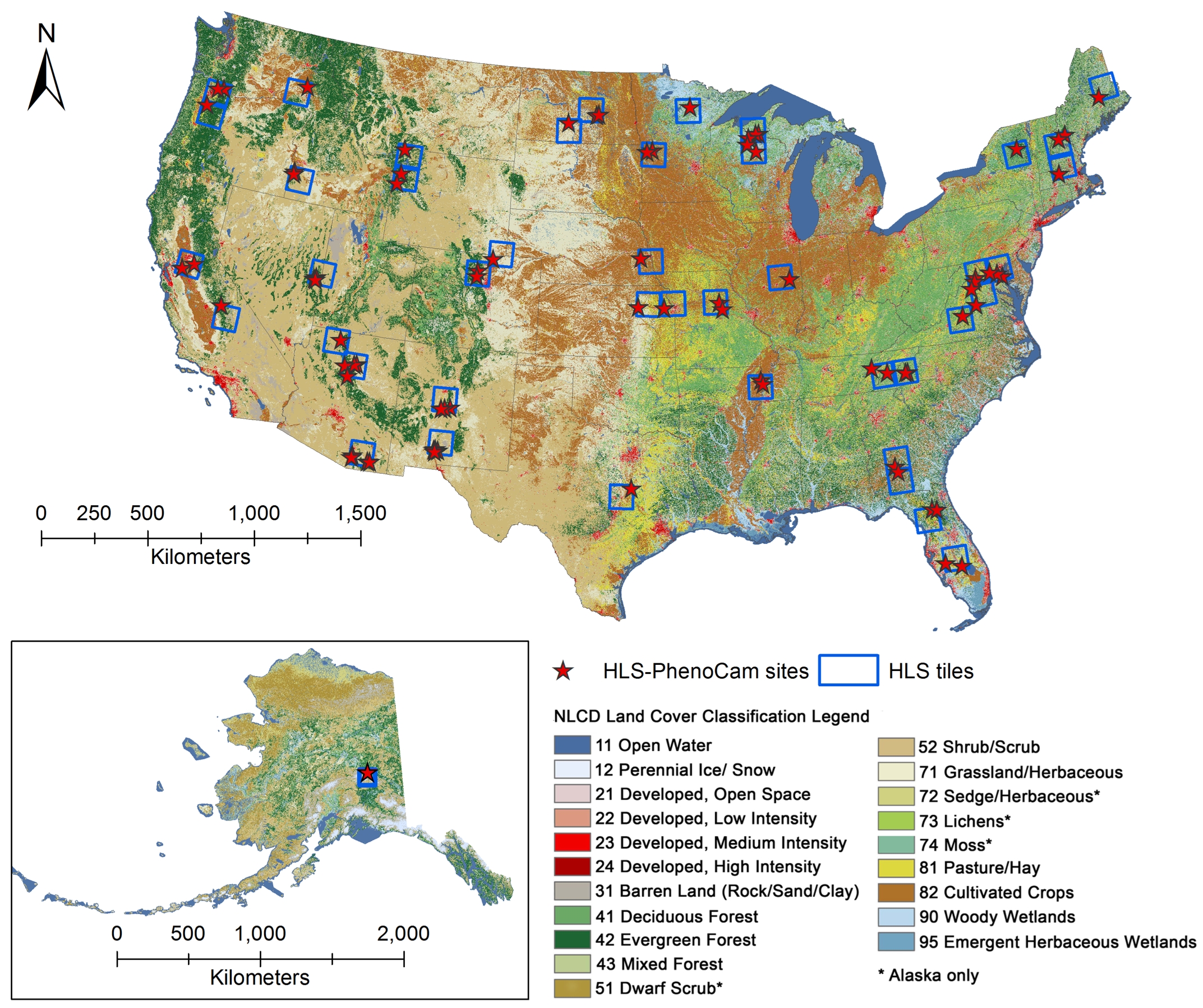
Phenology derived from Satellite Data and PhenoCam across CONUS and Alaska, 2019-2020
National Aeronautics and Space Administration —
This dataset provides a reference of land surface phenology (LSP) at 30-m pixels for 78 regions of 10 x 10 km2 across a wide range of ecological and climatic regions... -
Federal
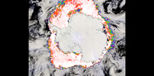
Standard Deviation of Monthly Frequency of Dust Storm over Land for Varying Intensities, Based on MODIS Terra Deep Blue Level 2 Aerosol Products MOD04_L2 Collection 6.1, on a Global 0.1 by 0.1 Degree Grid, Level 3 Version 1 (MODFDS_SDV_GLB_L3) at GES DISC
National Aeronautics and Space Administration —
Version 1 is the current version of the dataset.This collection MODFDS_SDV_GLB_L3 provides level 3 standard deviation of climatological monthly frequency of dust... -
Federal
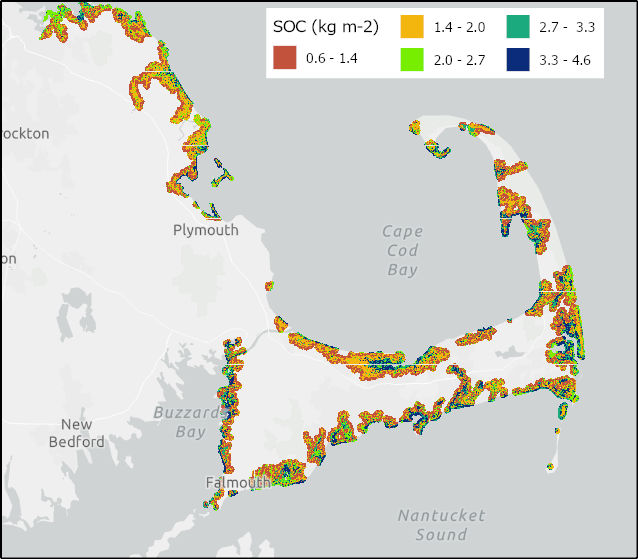
Soil Organic Carbon Distributions in Tidal Wetlands of the Northeastern USA
National Aeronautics and Space Administration —
This dataset provides estimates of soil organic carbon (SOC) in tidal wetlands for the northeastern United States. The data cover the period 1998-2018. Northeastern... -
Federal
NRT AMSR2 Unified L3 Global Daily 25 km EASE-Grid Snow Water Equivalent V2
National Aeronautics and Space Administration —
The Advanced Microwave Scanning Radiometer 2 (AMSR2) instrument on the Global Change Observation Mission - Water 1 (GCOM-W1) provides global passive microwave... -
Federal
NSCAT High Resolution R-MGDR, Selected Ocean Wind Vectors (JPL)
National Aeronautics and Space Administration —
The NASA Scatterometer (NSCAT) Level 2.5 high-resolution reduced MGDR contains only wind vector data (sigma-0 is excluded) in 25 km wind vector cell (WVC) swaths... -
Federal
NASA Global Web-Enabled Landsat Data Monthly Global 30 m V031
National Aeronautics and Space Administration —
The NASA Making Earth System Data Records for Use in Research Environments (MEaSUREs) Global Web-Enabled Landsat Data Monthly (GWELDMO) Version 3.1 data product... -
Federal
NRT AMSR2 Unified L3 Daily 25 km Brightness Temperature & Sea Ice Concentration Polar Grids V4
National Aeronautics and Space Administration —
The Advanced Microwave Scanning Radiometer 2 (AMSR2) instrument on the Global Change Observation Mission - Water 1 (GCOM-W1) provides global passive microwave... -
Federal
NRT AMSR2 Unified L3 Daily 12.5 km Brightness Temperature & Sea Ice Concentration V4
National Aeronautics and Space Administration —
The Advanced Microwave Scanning Radiometer 2 (AMSR2) instrument on the Global Change Observation Mission - Water 1 (GCOM-W1) provides global passive microwave... -
Federal
NASADEM Merged DEM Global 1 arc second nc V001
National Aeronautics and Space Administration —
The Land Processes Distributed Active Archive Center (LP DAAC) is responsible for the archive and distribution of the NASA Making Earth System Data Records for Use in... -
Federal
NASA Shuttle Radar Topography Mission Global 1 arc second V003
National Aeronautics and Space Administration —
The Land Processes Distributed Active Archive Center (LP DAAC) is responsible for the archive and distribution of the NASA Making Earth System Data Records for Use in... -
Federal
NASA Shuttle Radar Topography Mission Global 1 arc second number V003
National Aeronautics and Space Administration —
The Land Processes Distributed Active Archive Center (LP DAAC) is responsible for the archive and distribution of NASA Making Earth System Data Records for Use in... -
Federal
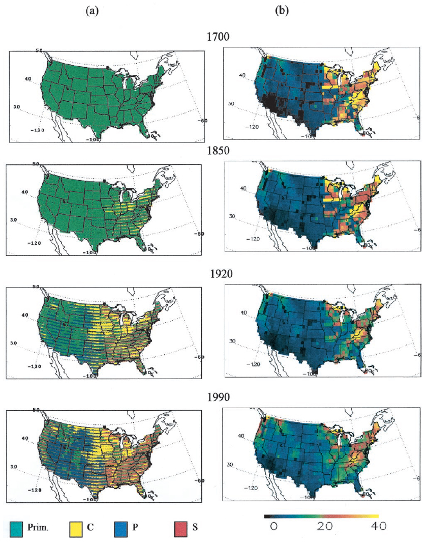
Ecosystem Demography Model: U.S. Ecosystem Carbon Stocks and Fluxes, 1700-1990
National Aeronautics and Space Administration —
This model product contains the source code for the Ecosystem Demography Model (ED version 1.0) as well as model input and output data files for the conterminous... -
Federal
ECOSTRESS Tiled Water Use Efficiency Instantaneous L4 Global 70 m V002
National Aeronautics and Space Administration —
The ECOsystem Spaceborne Thermal Radiometer Experiment on Space Station (ECOSTRESS) mission measures the temperature of plants to better understand how much water... -
Federal
GHRSST Level 2P NOAA STAR SST v2.80 from VIIRS on NOAA-20 Satellite
National Aeronautics and Space Administration —
NOAA-20 (N20/JPSS-1/J1) is the second satellite in the US NOAA latest generation Joint Polar Satellite System (JPSS), launched on November 18, 2017. NOAA is... -
Federal
Global Food Security-support Analysis Data (GFSAD) Cropland Extent 2010 North America product 30 m V001
National Aeronautics and Space Administration —
The NASA Making Earth System Data Records for Use in Research Environments (MEaSUREs) Global Food Security-support Analysis Data (GFSAD) data product provides... -
Federal
GHRSST Level 2P Global Sea Surface Skin Temperature from the Moderate Resolution Imaging Spectroradiometer (MODIS) on the NASA Aqua satellite (GDS2)
National Aeronautics and Space Administration —
NASA produces skin sea surface temperature (SST) products from the Infrared (IR) channels of the Moderate-resolution Imaging Spectroradiometer (MODIS) onboard the... -
Federal
GHRSST Level 2P Global Sea Surface Skin Temperature from the Moderate Resolution Imaging Spectroradiometer (MODIS) on the NASA Terra satellite (GDS2)
National Aeronautics and Space Administration —
NASA produces skin sea surface temperature (SST) products from the Infrared (IR) channels of the Moderate-resolution Imaging Spectroradiometer (MODIS) onboard the... -
Federal
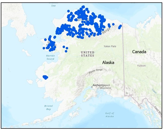
Field Data on Soils, Vegetation, and Fire History for Alaska Tundra Sites, 1972-2020
National Aeronautics and Space Administration —
This dataset, titled the Synthesized Alaskan Tundra Field Database (SATFiD), provides a comprehensive collection of in-situ field data compiled from 37 existing...

Official websites use .gov
A
.gov website belongs to an official government
organization in the United States.
Secure .gov websites use HTTPS
A
lock (
) or https:// means you’ve safely connected to
the .gov website. Share sensitive information only on official,
secure websites.