
-
Federal
United States Climate Reference Network (USCRN) Quality Controlled Datasets
National Oceanic and Atmospheric Administration, Department of Commerce —
USCRN Products are available on public FTP and derived from the USCRN processed data. Available parameters include averages and calculated values for precipitation,... -
Federal
Summary of the Day Observations - Misawa Japan
National Oceanic and Atmospheric Administration, Department of Commerce —
Summary of the Day Observations - Misawa Japan is a collection of data summarizing daily weather observations taken at Misawa Naval Air Station, near the north end of... -
Federal
International Comprehensive Ocean-Atmosphere Data Set (ICOADS) with Enhanced Trimming, Release 3
National Oceanic and Atmospheric Administration, Department of Commerce —
This dataset contains the latest official release of International Comprehensive Ocean-Atmosphere Data Set (ICOADS) with Enhanced Trimming, provided in a common... -
Federal
United States Climate Reference Network (USCRN) Processed Data from the Version 2 USCRN Database
National Oceanic and Atmospheric Administration, Department of Commerce —
USCRN Processed data are interpreted values and derived geophysical parameters processed from raw data by the USCRN Team. Data were interpreted and ingested into a... -
Federal
Oregon Crest-to-Coast Environmental Monitoring Transect Dataset, including climatic observations and tree growth data
National Oceanic and Atmospheric Administration, Department of Commerce —
The US Environmental Protection Agency - Western Ecology Division (EPA) has been monitoring above- and belowground climate data from 23 locations along an Oregon... -
Federal
Sounder SIPS: Suomi NPP CrIMSS Level 2 CLIMCAPS Full Spectral Resolution: Atmospheric state at Standard Pressure Levels derived from CLIMCAPS V2.1 (SNDRSNIML2PLEVCPS) at GES DISC
National Aeronautics and Space Administration —
The CLIMCAPS (Community Long-term Infrared Microwave Coupled Product System) algorithm is used to analyze data from the Cross-track Infrared Sounder/Advanced... -
Federal
SAFARI 2000 JRB Aerocommander Trace Gas and Aerosol Data, Dry Season 2000
National Aeronautics and Space Administration —
As part of the 3rd Intensive Campaign of SAFARI 2000, the South African Weather Bureau Aerocommander, JRB, flew 19 missions, for a total of 28 separate flights... -
Federal
Pre-LBA Rondonia Boundary Layer Experiment (RBLE) Data
National Aeronautics and Space Administration —
The atmospheric boundary layer (ABL) is the layer of air closest to the ground which is directly influenced on a daily basis by the heating and cooling of the earth's... -
Federal
Tropospheric Aerosol Radiative Forcing Observational eXperiment (TARFOX) - meteorological data from Wallops ground station
National Aeronautics and Space Administration —
TARFOX_WALLOPS_MET is the Tropospheric Aerosol Radiative Forcing Observational eXperiment (TARFOX) Surface Meteorological data set Wallops ground station.The TARFOX... -
Federal
TROPICS07 L2B Neural-network Atmospheric Vertical Temperature & Moisture Profiles V0.2
National Aeronautics and Space Administration —
The "Time-Resolved Observations of Precipitation structure and storm Intensity with a Constellation of Smallsats" (TROPICS) mission has a goal of providing nearly... -
Federal
TROPICS07 L2B Tropical Cyclone Intensity Estimate (TCIE) Algorithm V1.0
National Aeronautics and Space Administration —
The "Time-Resolved Observations of Precipitation structure and storm Intensity with a Constellation of Smallsats" (TROPICS) mission has a goal of providing nearly... -
Federal
TROPICS07 L1B Orbital Geolocated Native-Resolution Brightness Temperatures V0.2
National Aeronautics and Space Administration —
The "Time-Resolved Observations of Precipitation structure and storm Intensity with a Constellation of Smallsats" (TROPICS) mission has a goal of providing nearly... -
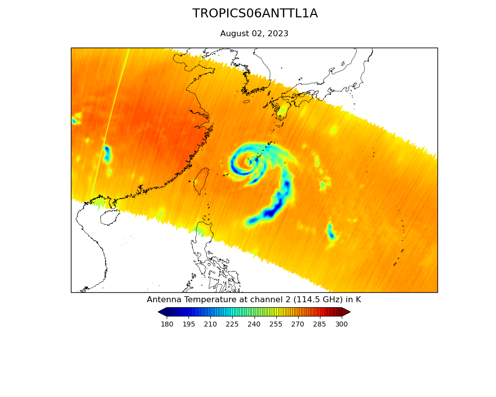
Federal
TROPICS07 L1A Orbital Geolocated Native-Resolution Antenna Temperatures V0.2
National Aeronautics and Space Administration —
The "Time-Resolved Observations of Precipitation structure and storm Intensity with a Constellation of Smallsats" (TROPICS) mission has a goal of providing nearly... -
Federal
TROPICS06 L2B Atmospheric Vertical Temperature and Moisture Profiles (AVTP, AVMP) V1.0
National Aeronautics and Space Administration —
The "Time-Resolved Observations of Precipitation structure and storm Intensity with a Constellation of Smallsats" (TROPICS) mission has a goal of providing nearly... -
Federal
TROPICS03 L2B Deep Multispectral INtensity (DMIN) of Tropical cyclones estimator Algorithm V1.0
National Aeronautics and Space Administration —
The "Time-Resolved Observations of Precipitation structure and storm Intensity with a Constellation of Smallsats" (TROPICS) mission has a goal of providing nearly... -
Federal
TROPICS01 Pathfinder L2B Atmospheric Vertical Temperature and Moisture Profiles (AVTP, AVMP) V1.0
National Aeronautics and Space Administration —
The "Time-Resolved Observations of Precipitation structure and storm Intensity with a Constellation of Smallsats" (TROPICS) mission has a goal of providing nearly... -
Federal
NAAMES R/V Atlantis Navigational and Meteorological In Situ Data, Version 1
National Aeronautics and Space Administration —
NAAMES_MetNav_ShipInSitu_Data are in situ meteorological and navigational measurements collected onboard the R/V Atlantis vessel during the North Atlantic Aerosols...

Official websites use .gov
A
.gov website belongs to an official government
organization in the United States.
Secure .gov websites use HTTPS
A
lock (
) or https:// means you’ve safely connected to
the .gov website. Share sensitive information only on official,
secure websites.