
-
Federal
CERES Regionally Averaged TOA Fluxes, Clouds and Aerosols Hourly NOAA-20 Edition 1B
National Aeronautics and Space Administration —
The Clouds and the Earth's Radiant Energy System (CERES) Single Scanner Footprint One Degree (SSF1deg) Hour provides regional averages of CERES Top of Atmosphere... -
Federal
CERES Monthly Gridded Single Satellite Fluxes and Clouds Terra FM2 Edition2C
National Aeronautics and Space Administration —
CER_FSW_Terra-FM2-MODIS_Edition2C is the Clouds and the Earth's Radiant Energy System (CERES) Fixed Swath Width (FSW) Monthly Gridded Single Satellite Fluxes (SSF)... -
Federal
SAFARI 2000 GPCP Daily Precipitation, 1-Deg, 1999-2001
National Aeronautics and Space Administration —
The Global Precipitation Climatology Project (GPCP) is an international project designed to provide improved long-record estimates of precipitation over the globe.... -
Federal
ROY HAYNES PARK RAINFALL NEAR SULPHUR SPRINGS FL (USGS 280353082283400)
National Oceanic and Atmospheric Administration, Department of Commerce —
Timeseries data from 'ROY HAYNES PARK RAINFALL NEAR SULPHUR SPRINGS FL (USGS 280353082283400)' (gov_usgs_nwis_280353082283400) -
Federal
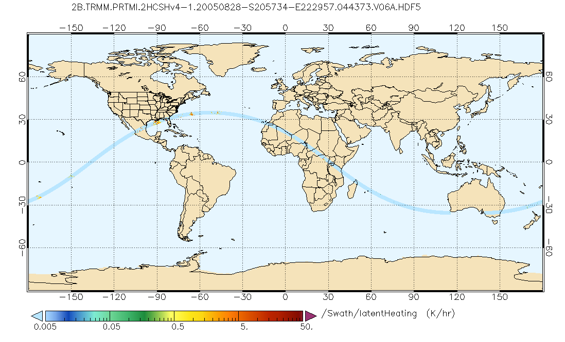
GPM PR and TMI on TRMM Combined Convective-Stratiform Latent Heating Profiles L2 1.5 hours 5 km V07 (GPM_2HCSH_TRMM) at GES DISC
National Aeronautics and Space Administration —
This is a new (GPM-formated) TRMM product. The equivalent old TRMM legacy product is TRMM_2H31.Version 07 is the current version of the data set. Older versions will... -
Federal
OOI Coastal Pioneer MAB: Northern Surface Mooring: Surface Buoy: Bulk Meteorology Instrument
National Oceanic and Atmospheric Administration, Department of Commerce —
Timeseries data from 'Coastal Pioneer MAB: Northern Surface Mooring: Surface Buoy: Bulk Meteorology Instrument ' (ooi-cp11nosm-sbd11-06-metbka000) -
Federal
OOI Coastal Pioneer MAB: Southern Surface Mooring: Surface Buoy: Bulk Meteorology Instrument
National Oceanic and Atmospheric Administration, Department of Commerce —
Timeseries data from 'Coastal Pioneer MAB: Southern Surface Mooring: Surface Buoy: Bulk Meteorology Instrument ' (ooi-cp11sosm-sbd11-06-metbka000) -
Federal
EAST LAKE RAINFALL AT ORIENT ROAD NEAR TAMPA FL (USGS 275917082222500)
National Oceanic and Atmospheric Administration, Department of Commerce —
Timeseries data from 'EAST LAKE RAINFALL AT ORIENT ROAD NEAR TAMPA FL (USGS 275917082222500)' (gov_usgs_nwis_275917082222500) -
Federal
Cillaput: Our Weather, Yukon-Kuskowim Delta Weather Station Network, Version 1
National Aeronautics and Space Administration —
Cillaput: Our Weather, Yukon-Kuskowim Delta Weather Station Network provides access to current weather conditions in the villages of Chevak and Kotlik located in the... -
Federal
GPM Ground Validation Precipitation Video Imager (PVI) LPVEx V1
National Aeronautics and Space Administration —
The GPM Ground Validation Precipitation Video Imager (PVI) LPVEx dataset consists of precipitation particle images and drop size distribution (DSD) data collected by... -
Federal
GPM PR on TRMM Reflectivity, Precipitation Characteristics and Rate, at Surface and Profile L2 1.5 hours V07 (GPM_2APR) at GES DISC
National Aeronautics and Space Administration —
This is the new, GPM-like, format for TRMM Precipitation Radar L2 data that now incorporates what was known as 2A21, 2A23 and 2A25 datasets.The primary purpose of... -
Federal
GPM Ground Validation Joss-Waldvogel Disdrometer (JW) LPVEx V1
National Aeronautics and Space Administration —
The GPM Ground Validation Joss-Waldvogel Disdrometer (JW) LPVEx dataset consists of precipitation drop size distribution (DSD) data collected by the Joss-Waldvogel... -
Federal
CERES and GEO-Enhanced TOA, Within-Atmosphere and Surface Fluxes, Clouds and Aerosols Daily Terra-NOAA20 Edition4A
National Aeronautics and Space Administration —
CER_SYN1deg-Day_Terra-NOAA20_Edition4A is the Clouds and the Earth's Radiant Energy System (CERES) and geostationary (GEO)-Enhanced Top-of-Atmosphere (TOA), Within-... -
Federal
SatCORPS CERES GEO Edition 4 GOES-8 Southern Hemisphere Version 1.0
National Aeronautics and Space Administration —
CER_GEO_Ed4_GOE08_SH_V01 is the Satellite Cloud and Radiation Property retrieval System (SatCORPS) Clouds and the Earth's Radiant Energy System (CERES) Geostationary...

Official websites use .gov
A
.gov website belongs to an official government
organization in the United States.
Secure .gov websites use HTTPS
A
lock (
) or https:// means you’ve safely connected to
the .gov website. Share sensitive information only on official,
secure websites.