
-
Federal
Evaluating Oyster Reefs as Habitat: Comparing the Utility of Ecological Metrics to Assess Ecosystem Function - NERRS/NSC(NERRS Science Collaborative)
National Oceanic and Atmospheric Administration, Department of Commerce —
This multi-reserve catalyst project compared established and emerging methods for assessing intertidal oyster reef community structure and ecosystem function. With... -
Federal
A novel sea surface partial pressure of carbon dioxide (pCO2) data product for the global coastal ocean resolving trends over the 1982-2020 period (NCEI Accession 0279118)
National Oceanic and Atmospheric Administration, Department of Commerce —
This dataset contains continuous monthly maps of sea surface partial pressure of CO2 (pCO2) in the coastal ocean from 1982 to 2020. This product is an updated version... -
Federal
2024 Cartographic Boundary File (KML), County Subdivision for South Carolina, 1:500,000
U.S. Census Bureau, Department of Commerce —
The 2024 cartographic boundary KMLs are simplified representations of selected geographic areas from the U.S. Census Bureau's Master Address File / Topologically... -
Federal
Near-real-time surface ocean velocities derived from HF-radar stations located along coastal waters of North Slope Alaska, Gulf of Alaska, Puerto Rico/Virgin Islands, eastern U.S./Gulf of America, Hawaii, Great Lakes, and western U.S.
National Oceanic and Atmospheric Administration, Department of Commerce —
This dataset contains near-real-time ocean surface velocities, also known as total vector velocities, derived from high-frequency (HF) radar stations. The velocities... -
Federal
Raw Data for U. S. Department of Energy (DOE) Categorical Exclusion(CX) Determinations Under the National Environmental Policy Act (NEPA)
Department of Energy —
To further transparency and openness, DOE established a policy to document and post online all CX determinations involving classes of actions listed in Appendix B to... -
Federal
TIGER/Line Shapefile, 2021, County, Richland County, SC, All Roads
U.S. Census Bureau, Department of Commerce —
The TIGER/Line shapefiles and related database files (.dbf) are an extract of selected geographic and cartographic information from the U.S. Census Bureau's Master... -
Federal
2023 Cartographic Boundary File (SHP), Secondary School District for South Carolina, 1:500,000
U.S. Census Bureau, Department of Commerce —
The 2023 cartographic boundary shapefiles are simplified representations of selected geographic areas from the U.S. Census Bureau's Master Address File /... -
Federal
2023 Cartographic Boundary File (KML), 118th Congressional Districts for South Carolina, 1:500,000
U.S. Census Bureau, Department of Commerce —
The 2023 cartographic boundary KMLs are simplified representations of selected geographic areas from the U.S. Census Bureau's Master Address File / Topologically... -
Federal
2024 Cartographic Boundary File (SHP), State Legislative District (SLD) Upper Chamber for South Carolina, 1:500,000
U.S. Census Bureau, Department of Commerce —
The 2024 cartographic boundary shapefiles are simplified representations of selected geographic areas from the U.S. Census Bureau's Master Address File /... -
Federal
TIGER/Line Shapefile, 2021, County, Georgetown County, SC, All Roads
U.S. Census Bureau, Department of Commerce —
The TIGER/Line shapefiles and related database files (.dbf) are an extract of selected geographic and cartographic information from the U.S. Census Bureau's Master... -
Federal
2023 Cartographic Boundary File (SHP), Block Group for South Carolina, 1:500,000
U.S. Census Bureau, Department of Commerce —
The 2023 cartographic boundary shapefiles are simplified representations of selected geographic areas from the U.S. Census Bureau's Master Address File /... -
Federal
F00783: NOS Hydrographic Survey , 2019-08-13
National Oceanic and Atmospheric Administration, Department of Commerce —
The National Oceanic and Atmospheric Administration (NOAA) has the statutory mandate to collect hydrographic data in support of nautical chart compilation for safe... -
Federal
TIGER/Line Shapefile, 2022, State, South Carolina, SC, Block Group
U.S. Census Bureau, Department of Commerce —
The TIGER/Line shapefiles and related database files (.dbf) are an extract of selected geographic and cartographic information from the U.S. Census Bureau's Master... -
Federal
TIGER/Line Shapefile, 2023, State, South Carolina, SC, 2020 Census Public Use Microdata Area (PUMA)
U.S. Census Bureau, Department of Commerce —
The TIGER/Line shapefiles and related database files (.dbf) are an extract of selected geographic and cartographic information from the U.S. Census Bureau's Master... -
Federal
Metabolism estimates for 356 U.S. rivers (2007-2017): 2a. Site coordinates
Department of the Interior —
This dataset provides site locations as shapefile points. The format is a shapefile for all sites combined (.shp, .shx, .dbf, and .prj files). This dataset is part of... -
Federal
Metabolism estimates for 356 U.S. rivers (2007-2017): 1. Site data
Department of the Interior —
This dataset provides site identifiers, details, and quality indicators. The format is a table with 1 row per site (tab-delimited file). This dataset is part of a... -
Federal
3 Model Forcings: Deep learning approaches for improving prediction of daily stream temperature in data-scarce, unmonitored, and dammed basins
Department of the Interior —
This data release component contains model inputs including river basin attributes, weather forcing data, and simulated and observed river discharge. -
Federal
TIGER/Line Shapefile, 2021, County, Chester County, SC, All Roads
U.S. Census Bureau, Department of Commerce —
The TIGER/Line shapefiles and related database files (.dbf) are an extract of selected geographic and cartographic information from the U.S. Census Bureau's Master... -
Federal
2020 Cartographic Boundary File (KML), 2020 Public Use Microdata Areas for South Carolina, 1:500,000
U.S. Census Bureau, Department of Commerce —
The 2020 cartographic boundary KMLs are simplified representations of selected geographic areas from the U.S. Census Bureau's Master Address File / Topologically... -
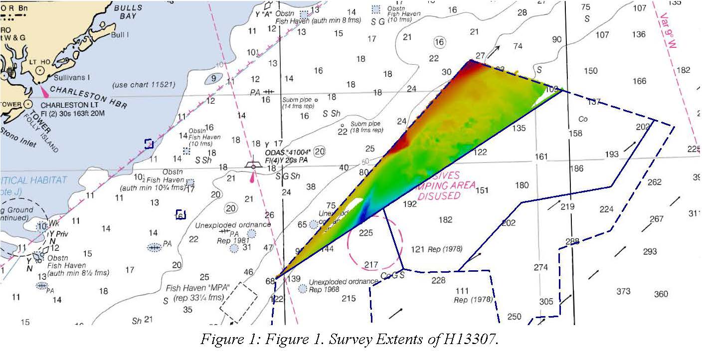
Federal
H13307: NOS Hydrographic Survey , 2019-08-30
National Oceanic and Atmospheric Administration, Department of Commerce —
The National Oceanic and Atmospheric Administration (NOAA) has the statutory mandate to collect hydrographic data in support of nautical chart compilation for safe...

Official websites use .gov
A
.gov website belongs to an official government
organization in the United States.
Secure .gov websites use HTTPS
A
lock (
) or https:// means you’ve safely connected to
the .gov website. Share sensitive information only on official,
secure websites.