
-
Federal
MODIS Terra Level 3 SST Thermal IR Monthly 4km Daytime V2019.0 NGDA
National Aeronautics and Space Administration —
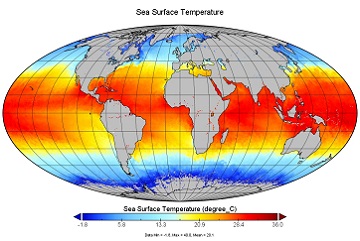
Day and night spatially gridded global NASA skin sea surface temperature (SST) products from the Moderate-resolution Imaging Spectroradiometer (MODIS) onboard the... -
Federal
MODIS Aqua Level 3 SST MID-IR 8 Day 4km Nighttime V2019.0 NGDA
National Aeronautics and Space Administration —
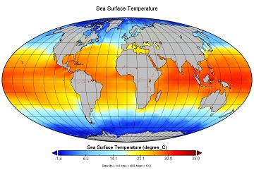
Day and night spatially gridded (L3) global NASA skin sea surface temperature (SST) products from the Moderate-resolution Imaging Spectroradiometer (MODIS) onboard... -
Federal
MODIS Terra Level 3 SST MID-IR 8 Day 9km Nighttime V2019.0 NGDA
National Aeronautics and Space Administration —
Day and night spatially gridded (L3) global NASA skin sea surface temperature (SST) products from the Moderate-resolution Imaging Spectroradiometer (MODIS) onboard... -
Federal
MODIS Aqua Level 3 SST Thermal IR 8 Day 9km Daytime V2019.0 NGDA
National Aeronautics and Space Administration —
Day and night spatially gridded (L3) global NASA skin sea surface temperature (SST) products from the Moderate-resolution Imaging Spectroradiometer (MODIS) onboard... -
Federal
MODIS Terra Level 3 SST Thermal IR Monthly 9km Nighttime V2019.0 NGDA
National Aeronautics and Space Administration —
Day and night spatially gridded global NASA skin sea surface temperature (SST) products from the Moderate-resolution Imaging Spectroradiometer (MODIS) onboard the... -
Federal
GHRSST Level 4 MW_IR_OI Global Foundation Sea Surface Temperature analysis version 5.0 from REMSS NGDA
National Aeronautics and Space Administration —
A Group for High Resolution Sea Surface Temperature (GHRSST) global Level 4 sea surface temperature analysis produced daily on a 0.09-degree grid at Remote Sensing... -
Federal
MODIS Aqua Level 3 SST MID-IR Daily 9km Nighttime V2019.0 NGDA
National Aeronautics and Space Administration —
Day and night spatially gridded (L3) global NASA skin sea surface temperature (SST) products from the Moderate-resolution Imaging Spectroradiometer (MODIS) onboard... -
Federal
MODIS Aqua Level 3 SST Thermal IR Monthly 9km Nighttime V2019.0 NGDA
National Aeronautics and Space Administration —
Day and night spatially gridded (L3) global NASA skin sea surface temperature (SST) products from the Moderate-resolution Imaging Spectroradiometer (MODIS) onboard... -
Federal
MODIS Terra Level 3 SST Mid-IR Daily 4km Nighttime V2019.0 NGDA
National Aeronautics and Space Administration —
Day and night spatially gridded (L3) global NASA skin sea surface temperature (SST) products from the Moderate-resolution Imaging Spectroradiometer (MODIS) onboard... -
Federal
MODIS Terra Level 3 SST MID-IR Annual 9km Nighttime V2019.0 NGDA
National Aeronautics and Space Administration —
Day and night spatially gridded (L3) global NASA skin sea surface temperature (SST) products from the Moderate-resolution Imaging Spectroradiometer (MODIS) onboard... -
Federal
MODIS Aqua Level 3 SST Thermal IR Annual 4km Daytime V2019.0 NGDA
National Aeronautics and Space Administration —
Day and night spatially gridded (L3) global NASA skin sea surface temperature (SST) products from the Moderate-resolution Imaging Spectroradiometer (MODIS) onboard... -
Federal
MODIS Terra Level 3 SST Thermal IR Annual 4km Daytime V2019.0 NGDA
National Aeronautics and Space Administration —
Day and night spatially gridded (L3) global NASA skin sea surface temperature (SST) products from the Moderate-resolution Imaging Spectroradiometer (MODIS) onboard... -
Federal
MODIS Terra Level 3 SST MID-IR Monthly 4km Nighttime V2019.0 NGDA
National Aeronautics and Space Administration —
Day and night spatially gridded (L3) global NASA skin sea surface temperature (SST) products from the Moderate-resolution Imaging Spectroradiometer (MODIS) onboard... -
Federal
MODIS Terra Level 3 SST MID-IR Annual 4km Nighttime V2019.0 NGDA
National Aeronautics and Space Administration —
Day and night spatially gridded (L3) global NASA skin sea surface temperature (SST) products from the Moderate-resolution Imaging Spectroradiometer (MODIS) onboard... -
Federal
MODIS Aqua Level 3 SST Thermal IR Monthly 9km Daytime V2019.0 NGDA
National Aeronautics and Space Administration —
Day and night spatially gridded (L3) global NASA skin sea surface temperature (SST) products from the Moderate-resolution Imaging Spectroradiometer (MODIS) onboard... -
Federal
GHRSST Level 4 MW_IR_OI Global Foundation Sea Surface Temperature analysis version 5.1 from REMSS NGDA
National Aeronautics and Space Administration —
A Group for High Resolution Sea Surface Temperature (GHRSST) global Level 4 sea surface temperature analysis produced daily on a 0.09-degree grid at Remote Sensing... -
Federal
MODIS Terra Level 3 SST Thermal IR 8 Day 4km Nighttime V2019.0 NGDA
National Aeronautics and Space Administration —
Day and night spatially gridded (L3) global NASA skin sea surface temperature (SST) products from the Moderate-resolution Imaging Spectroradiometer (MODIS) onboard... -
Federal
Mediterranean Sea Ultra High Resolution SST L4 Analysis 0.01 deg Resolution NGDA
National Aeronautics and Space Administration —
CNR MED Sea Surface Temperature provides daily gap-free maps (L4) at 0.01 deg. x 0.01deg. horizontal resolution over the Mediterranean Sea. The data are obtained from... -
Federal
MODIS Terra Level 3 SST Thermal IR 8 Day 9km Nighttime V2019.0 NGDA
National Aeronautics and Space Administration —
Day and night spatially gridded (L3) global NASA skin sea surface temperature (SST) products from the Moderate-resolution Imaging Spectroradiometer (MODIS) onboard... -
Federal
Black Sea Ultra High Resolution SST L4 Analysis 0.01 deg Resolution NGDA
National Aeronautics and Space Administration —
CNR MED Sea Surface Temperature provides daily gap-free maps (L4) at 0.01 deg. x 0.01 deg. horizontal resolution over the Black Sea. The data are obtained from infra-...

Official websites use .gov
A
.gov website belongs to an official government
organization in the United States.
Secure .gov websites use HTTPS
A
lock (
) or https:// means you’ve safely connected to
the .gov website. Share sensitive information only on official,
secure websites.