
-
Federal
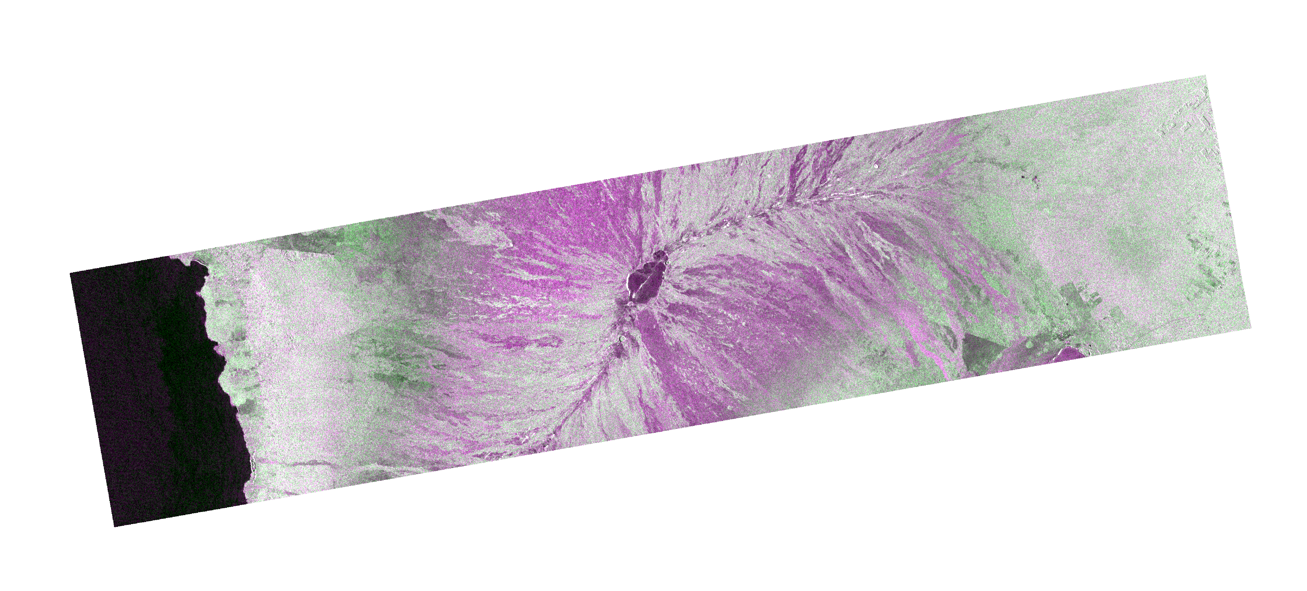
Sentinel-1 Single Look Complex (SLC) Bursts recent views
National Aeronautics and Space Administration —
Sentinel-1 Interferometric Wide (IW) and Extra Wide (EW) swath modes are collected using a form of ScanSAR imaging called Terrain Observation with Progressive Scans... -
Federal
SENTINEL-1B_SINGLE_POL_METADATA_GRD_HIGH_RES recent views
National Aeronautics and Space Administration —
Sentinel-1B Single-pol ground projected high and full resolution metadata -
Federal
Sentinel-3A OLCI Global Binned CyAN Project, True Color (TC) Data, version 5.0 recent views
National Aeronautics and Space Administration —
Cyanobacteria Assessment Network (CyAN) is a multi-agency project among EPA, the National Aeronautics and Space Administration (NASA), the National Oceanic and... -
Federal
Antarctic 1 km Digital Elevation Model (DEM) from Combined ERS-1 Radar and ICESat Laser Satellite Altimetry, Version 1 recent views
National Aeronautics and Space Administration —
This data set provides a 1 km resolution Digital Elevation Model (DEM) of Antarctica. The DEM combines measurements from the European Remote Sensing Satellite-1... -
Federal
CMS: Mangrove Canopy Height Estimates from Remote Imagery, Zambezi Delta, Mozambique recent views
National Aeronautics and Space Administration —
This data set provides high resolution canopy height estimates for mangrove forests in the Zambezi Delta, Mozambique, Africa. The estimates were derived from three... -
Federal
Delta-X: UAVSAR L2 Interferometric Products, MRD, Louisiana, 2021 recent views
National Aeronautics and Space Administration —
This dataset contains georeferenced UAVSAR Level 2 (L2) interferometric products for Delta-X flight lines acquired during the spring (2021-03-27 to 2021-04-18) and... -
Federal
OPERA Coregistered Single-Look Complex from Sentinel-1 Static Layers validated product (Version 1) recent views
National Aeronautics and Space Administration —
The Observational Products for End-Users from Remote Sensing Analysis (OPERA) Coregistered Single-Look Complex (CSLC) from Sentinel-1 (S1) Static Layers... -
Federal
OPERA Radiometric Terrain Corrected SAR Backscatter from Sentinel-1 validated product (Version 1) recent views
National Aeronautics and Space Administration —
The Observational Products for End-Users from Remote Sensing Analysis (OPERA) Radiometric Terrain Corrected (RTC) SAR Backscatter from Sentinel-1 (S1) validated... -
Federal
ALOS_PALSAR_LEVEL2.2 recent views
National Aeronautics and Space Administration —
ALOS PALSAR Level 2.2 -
Federal
Sentinel-3B OLCI Inland Waters (ILW) Data, version 4 recent views
National Aeronautics and Space Administration —
The Inland Waters dataset (ILW) provides data for lakes and other water bodies across the contiguous United States (CONUS) and Alaska. ILW significantly reduces the... -
Federal
ENVISAT MERIS Global Mapped Cyanobacteria Index (CI) Data, version 5.0 recent views
National Aeronautics and Space Administration —
Cyanobacteria Assessment Network (CyAN) is a multi-agency project among EPA, the National Aeronautics and Space Administration (NASA), the National Oceanic and... -
Federal
Global Mangrove Forests Distribution, 2000 recent views
National Aeronautics and Space Administration —
The Global Mangrove Forests Distribution, 2000 data set is a compilation of the extent of mangroves forests from the Global Land Survey and the Landsat archive with... -
Federal
Ocean Surface pCO2 and Air-Sea CO2 Flux in the Northern Gulf of Mexico, 2006-2010 NGDA recent views
National Aeronautics and Space Administration —
This dataset provides 1 km gridded monthly estimates of surface ocean partial pressure of CO2 (pCO2) and air-sea flux of CO2 (CO2 flux) for the northern Gulf of... -
Federal
Sentinel-3A OLCI Inland Waters (ILW) Data, version 4 recent views
National Aeronautics and Space Administration —
The Inland Waters dataset (ILW) provides data for lakes and other water bodies across the contiguous United States (CONUS) and Alaska. ILW significantly reduces the... -
Federal
Delta-X: Digital Elevation Model, MRD, LA, USA, 2021 recent views
National Aeronautics and Space Administration —
This dataset provides an updated digital elevation model (DEM) for the Atchafalaya and Terrebonne basins in coastal Louisiana, USA. The DEM is updated from the Pre-... -
Federal
Merged Sentinel-3A and Sentinel-3B OLCI Global Binned CyAN Project, True Color (TC) - Near Real-Time (NRT) Data, version 5.0 recent views
National Aeronautics and Space Administration —
The Ocean Biology DAAC produces near real-time (quicklook) products using the best-available combination of ancillary data from meteorological and ozone data. As... -
Federal
SEDIMENT ANALYSIS NETWORK FOR DECISION SUPPORT (SANDS) LANDSAT GEOLOGICAL SURVEY OF AL (GSA) ANALYSIS V1 recent views
National Aeronautics and Space Administration —
The Sediment Analysis Network for Decision Support (SANDS) Landsat Geological Survey of AL (GSA) Analysis dataset analyzed changes in the coastal shoreline and... -
Federal
SEDIMENT ANALYSIS NETWORK FOR DECISION SUPPORT (SANDS) MODIS GULF SUBSETTED V1 NGDA recent views
National Aeronautics and Space Administration —
Sediment Analysis Network for Decision Support (SANDS) MODIS Gulf Subsetted dataset consists of daytime images for Terra and Aqua MODIS Reflectance bands 8-16,... -
Federal
Sentinel-3B OLCI Global Binned CyAN Project, True Color (TC) - Near Real-Time (NRT) Data, version 5.0 recent views
National Aeronautics and Space Administration —
The Ocean Biology DAAC produces near real-time (quicklook) products using the best-available combination of ancillary data from meteorological and ozone data. As... -
Federal
ENVISAT MERIS Global Mapped CyAN Project, True Color (TC) Data, version 5.0 recent views
National Aeronautics and Space Administration —
Cyanobacteria Assessment Network (CyAN) is a multi-agency project among EPA, the National Aeronautics and Space Administration (NASA), the National Oceanic and...

Official websites use .gov
A
.gov website belongs to an official government
organization in the United States.
Secure .gov websites use HTTPS
A
lock (
) or https:// means you’ve safely connected to
the .gov website. Share sensitive information only on official,
secure websites.