
-
Federal
GLDAS Noah Land Surface Model L4 3 hourly 1.0 x 1.0 degree V2.1 (GLDAS_NOAH10_3H) at GES DISC
National Aeronautics and Space Administration —
NASA Global Land Data Assimilation System Version 2 (GLDAS-2) has three components: GLDAS-2.0, GLDAS-2.1, and GLDAS-2.2. GLDAS-2.0 is forced entirely with the... -
Federal
CAR SnowEx17 Snow Mass and Energy Measurements L1 V1 (CAR_SNOWEX17_L1C) at GES DISC
National Aeronautics and Space Administration —
SnowEx is a multi-year airborne project to help advance capabilities, and plan for a near-future space mission to monitor global seasonal snow water equivalent —... -
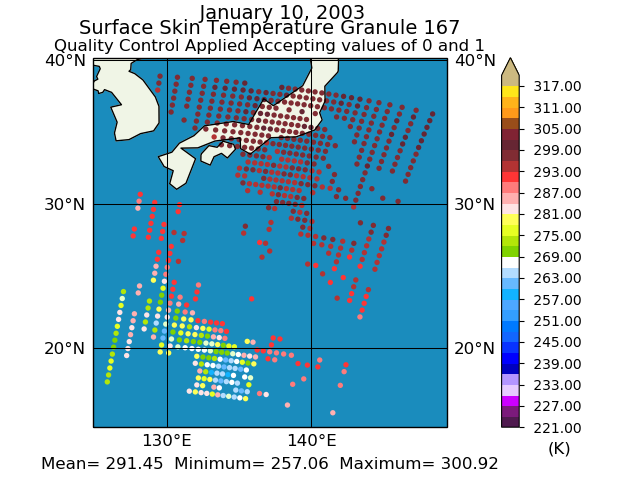
Federal
TOVS GLA 5 DAY GRIDS from NOAA-10 V01 (TOVSA5NG) at GES DISC
National Aeronautics and Space Administration —
This dataset (TOVSA5NG) contains the TIROS Operational Vertical Sounder (TOVS) level 3 geophysical parameters derived using data from NOAA-10 and the physical... -
Federal
AIRS/Aqua L3 Daily Support Daily Product (AIRS+AMSU+HSB) 1 degree x 1 degree V006 (AIRH3SPD) at GES DISC
National Aeronautics and Space Administration —
The Atmospheric Infrared Sounder (AIRS) is a grating spectrometer (R = 1200) aboard the second Earth Observing System (EOS) polar-orbiting platform, EOS Aqua. In... -
Federal
GPM GROUND VALIDATION SATELLITE SIMULATED ORBITS MC3E V1
National Aeronautics and Space Administration —
The GPM Ground Validation Satellite Simulated Orbits MC3E dataset is available in the Orbital database , which takes account for the atmospheric profiles, the... -
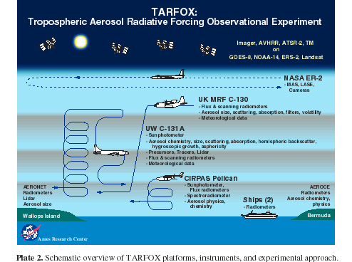
Federal
CAR TARFOX Tropospheric Aerosol Experiment BRDF V2 (CAR_TARFOX_BRDF) at GES DISC
National Aeronautics and Space Administration —
CAR TARFOX mission collected data in the western Atlantic Ocean on the effects of tropospheric aerosols on radiation budgets in cloud free skies. The mission also... -
Federal
AVIRIS-NG L2 Surface Reflectance, Facility Instrument Collection, V1
National Aeronautics and Space Administration —
This dataset contains Level 2 (L2) orthocorrected reflectance from the Airborne Visible / Infrared Imaging Spectrometer-Next Generation (AVIRIS-NG) instrument. This... -
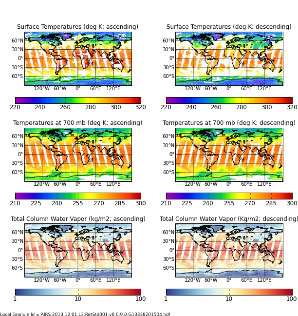
Federal
Aqua/AIRS L2 Standard Physical Retrieval (AIRS+AMSU+HSB) V7.0 at GES DISC
National Aeronautics and Space Administration —
The Atmospheric Infrared Sounder (AIRS) is a grating spectrometer (R = 1200) aboard the second Earth Observing System (EOS) polar-orbiting platform, EOS Aqua. In... -
Federal
CERES Clouds and Radiative Swath Terra FM1 MODIS Edition2G
National Aeronautics and Space Administration —
CER_CRS_Terra-FM1-MODIS_Edition2G is the Clouds and the Earth's Radiant Energy System (CERES) Clouds and Radiative Swath (CRS) Terra Flight Model 1 (FM1) Moderate-... -
Federal
Sounder SIPS: Suomi NPP CrIMSS Level 3 Comprehensive Quality Control Gridded Monthly CLIMCAPS Full Spectral Resolution V2 at GES DISC
National Aeronautics and Space Administration —
WARNING: To users of the derived product “co_mmr_midtrop” (carbon monoxide mass mixing ratio to dry air [kg/kg] at ~500 hPa). This variable has a significant bias due... -
Federal
Sounder SIPS: AQUA AIRS IR + MW Level 3 CLIMCAPS: Specific Quality Control Gridded Monthly V2 at GES DISC
National Aeronautics and Space Administration —
WARNING: To users of the derived product “co_mmr_midtrop” (carbon monoxide mass mixing ratio to dry air [kg/kg] at ~500 hPa). This variable has a significant bias due... -
Federal
WLDAS Noah-MP 3.6 Land Surface Model L4 Daily 0.01 degree x 0.01 degree Version D1.0 (WLDAS_NOAHMP001_DA1) at GES DISC
National Aeronautics and Space Administration —
The Western Land Data Assimilation System (WLDAS), developed at Goddard Space Flight Center (GSFC) and funded by the NASA Western Water Applications Office, provides... -
Federal
GLDAS Catchment Land Surface Model L4 monthly 1.0 x 1.0 degree V2.1 (GLDAS_CLSM10_M) at GES DISC
National Aeronautics and Space Administration —
NASA Global Land Data Assimilation System Version 2 (GLDAS-2) has three components: GLDAS-2.0, GLDAS-2.1, and GLDAS-2.2. GLDAS-2.0 is forced entirely with the... -
Federal
NLDAS Primary Forcing Data L4 Monthly 0.125 x 0.125 degree V2.0 (NLDAS_FORA0125_M) at GES DISC
National Aeronautics and Space Administration —
This data product contains the monthly primary forcing data "File A" for Phase 2 of the North American Land Data Assimilation System (NLDAS-2). The data are in 1/8th... -
Federal
Landsat Surface Reflectance - L8 OLI/TIRS
National Aeronautics and Space Administration —
Landsat satellite data have been produced, archived, and distributed by the U.S. Geological Survey (USGS) since 1972. Users rely on these data for historical study of... -
Federal
Pre-Delta-X: Spectral Reflectance of Water Surface, Atchafalaya Basin, LA, USA, 2016
National Aeronautics and Space Administration —
This dataset provides measurements of in situ remote-sensing reflectance (Rrs; per steradian) of surface water across Atchafalaya Basin, southern coastal Louisiana,... -
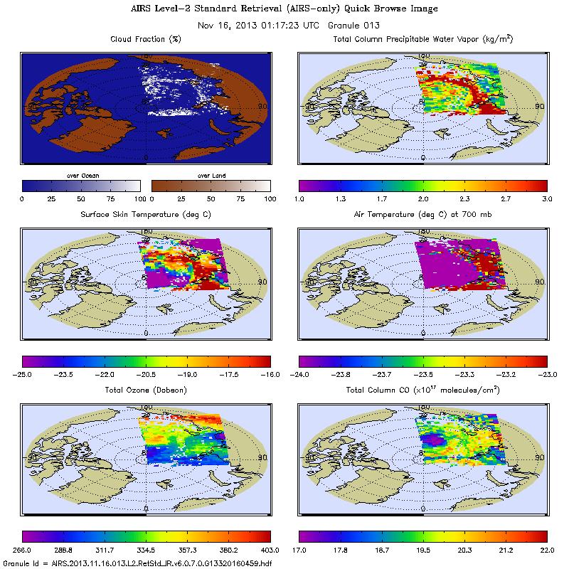
Federal
AIRS/Aqua L2 Standard Physical Retrieval (AIRS-only) V006 (AIRS2RET) at GES DISC
National Aeronautics and Space Administration —
The Atmospheric Infrared Sounder (AIRS) is a grating spectrometer (R = 1200) aboard the second Earth Observing System (EOS) polar-orbiting platform, EOS Aqua. In... -
Federal
MODIS/Terra+Aqua Downward Shortwave Radiation Daily/3-Hour L3 Global 0.05Deg CMG V061 NGDA
National Aeronautics and Space Administration —
The MCD18C1 Version 6.1 is a Moderate Resolution Imaging Spectroradiometer (MODIS) Terra and Aqua combined Downward Shortwave Radiation (DSR) Level 3 product produced... -
Federal
BOREAS RSS-14 Level-3 Gridded Radiometer and Satellite Surface Radiation Images
National Aeronautics and Space Administration —
The BOREAS RSS-14 team collected and processed GOES-7 and -8 images of the BOREAS region as part of their effort to characterize the incoming, reflected and emitted... -
Federal
MERRA-2 tavgU_2d_lnd_Nx: 2d,diurnal,Time-Averaged,Single-Level,Assimilation,Land Surface Diagnostics 0.625 x 0.5 degree V5.12.4 (M2TUNXLND) at GES DISC
National Aeronautics and Space Administration —
M2TUNXLND (or tavgU_2d_lnd_Nx) is a time-averaged 2-dimensional monthly diurnal means data collection in Modern-Era Retrospective analysis for Research and...

Official websites use .gov
A
.gov website belongs to an official government
organization in the United States.
Secure .gov websites use HTTPS
A
lock (
) or https:// means you’ve safely connected to
the .gov website. Share sensitive information only on official,
secure websites.