
-
Federal
Optically-Selected QSOS NVSS-Detected Source Catalog
National Aeronautics and Space Administration —
The authors used the 1.4-GHz NRAO VLA Sky Survey (NVSS) to study radio sources in two color-selected QSO samples: a volume-limited sample of 1,313 QSOs defined by Mi... -
Federal
GHRSST Level 3U Global Subskin Sea Surface Temperature version 8a from the Advanced Microwave Scanning Radiometer 2 on the GCOM-W satellite
National Aeronautics and Space Administration —
GDS2 Version -The Advanced Microwave Scanning Radiometer 2 (AMSR2) was launched on 18 May 2012, onboard the Golbal Change Observation Mission - Water (GCOM-W)... -
Federal
IBEX High Energy Neutral Atom Imager (Hi) Data Release 16, not Compton-Getting corrected, not Survival Probability corrected, Ram direction, West Longitude Ecliptic Maps, Level H3 (H3), eleven year average Data
National Aeronautics and Space Administration —
1: The Interstellar Boundary Explorer (IBEX) has operated in space since 2008 updating our knowledge of the outer heliosphere and its interaction with the local... -
Federal
6dFGS Galaxy Survey Final Redshift Release Catalog
National Aeronautics and Space Administration —
The final redshift release of the 6dF Galaxy Survey (6dFGS) is a combined redshift and peculiar velocity survey over the southern sky (|b| > 10 degrees). Its... -
Federal
MODIS/Terra Land Surface Temperature/Emissivity Daily L3 Global 1km SIN Grid V006
National Aeronautics and Space Administration —
The MOD11A1 Version 6 data product was decommissioned on July 31, 2023. Users are encouraged to use the MOD11A1 Version 6.1 data product.The MOD11A1 Version 6 product... -
Federal
Process-structure-properties investigations for laser powder bed fused IN718 in the as-built condition
National Institute of Standards and Technology —
This data repository provides a central location for a body of work using one build of nickel-based alloy 718 (IN718) material and resulted in three different... -
Federal
Geostationary Lightning Mapper (GLM) Thunder Hour Data Product
National Aeronautics and Space Administration —
The Geostationary Lightning Mapper (GLM) is the first optical lightning detector in geostationary orbit, and GLM sensors operate aboard the National Oceanic and... -
Federal
Extrapolated Orbital data files to be read via SDP toolkit, Binary Format
National Aeronautics and Space Administration —
AM1EPHNE is the Terra Near Real Time (NRT) 2-hour spacecraft Extrapolated ephemeris data file in native format. The file name format is the following:... -
Federal
GPM GROUND VALIDATION DUAL-FREQUENCY DUAL-POLARIZED DOPPLER RADAR (D3R) GCPEX
National Aeronautics and Space Administration —
The GPM Ground Validation Dual-frequency Dual-polarized Doppler Radar (D3R) GCPEx and IFloodS data sets contain radar reflectivity and doppler velocity measurements.... -
Federal
GPM SSMIS on F16 (GPROF) Climate-based Radiometer Precipitation Profiling 1.5 hours 12 km V07 (GPM_2AGPROFF16SSMIS_CLIM) at GES DISC
National Aeronautics and Space Administration —
Version 07 is the current version of the data set. Older versions will no longer be available and have been superseded by Version 07.The 'CLIM' products differ from... -
Federal
Global Space-based Stratospheric Aerosol Climatology Version 2.2
National Aeronautics and Space Administration —
The Global Space-based Stratospheric Aerosol Climatology, or GloSSAC, is a 43-year climatology of stratospheric aerosol properties focused on extinction coefficient... -
Federal
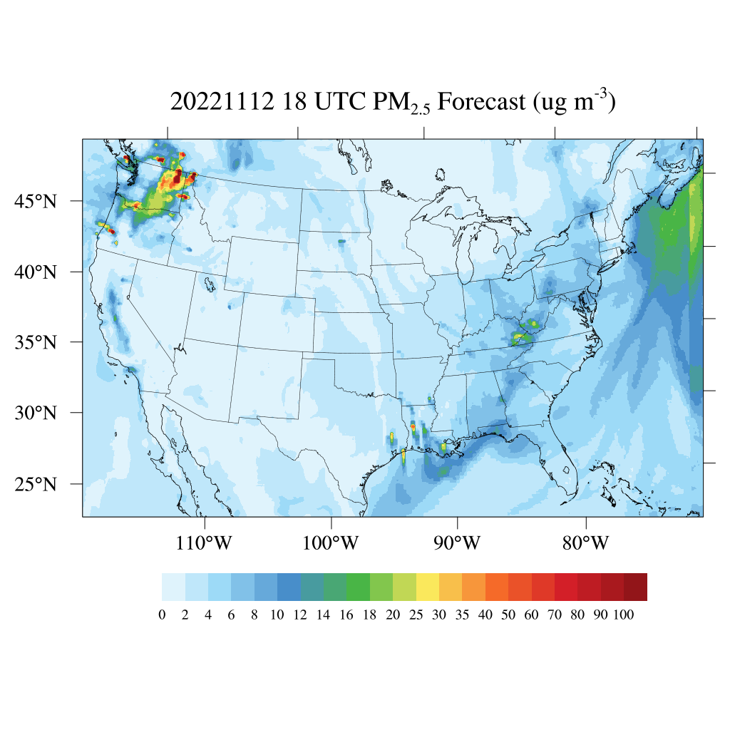
HAQES 3-Hourly Ensemble mean surface total PM2.5 concentration, North America V1 (HAQES_NA_PM25_TOT) at GES DISC
National Aeronautics and Space Administration —
This product provides HAQES 3-hourly ensemble mean surface total PM2.5 concentration over the continental United States (CONUS) and surrounding regions. The data is... -
Federal
MERRA-2 instU_2d_asm_Nx: 2d,diurnal,Instantaneous,Single-Level,Assimilation,Single-Level Diagnostics 0.625 x 0.5 degree V5.12.4 (M2IUNXASM) at GES DISC
National Aeronautics and Space Administration —
M2IUNXASM (or instU_2d_asm_Nx) is an instantaneous 2-dimensional monthly diurnal means data collection in Modern-Era Retrospective analysis for Research and... -
Federal
VST Atlas ConeSearch
National Aeronautics and Space Administration —
All MAST catalog holdings are available via Cone Search endpoints. This service provides access to the MAST copy of the VST Atlas:This survey is targeting 4500 square... -
Federal
CERES Monthly Gridded Single Satellite Fluxes and Clouds TRMM Edition2C
National Aeronautics and Space Administration —
CER_FSW_TRMM-PFM-VIRS_Edition2C is the Clouds and the Earth's Radiant Energy System (CERES) Fixed Swath Width (FSW) Monthly Gridded Single Satellite Fluxes (SSF) and... -
Federal
BOREAS TGB-08 Starch Concentration Data over the SSA-OBS and the SSA-OJP
National Aeronautics and Space Administration —
The TGB-08 team collected data to investigate the controls over non-methane hydrocarbon (NMHC) fluxes from boreal forest tree species. This data set includes... -
Federal
CERES and GEO-Enhanced TOA, Within-Atmosphere and Surface Fluxes, Clouds and Aerosols Monthly Terra-NPP Edition1A
National Aeronautics and Space Administration —
CER_SYN1deg-Month_Terra-NPP_Edition1A is the Clouds and the Earth's Radiant Energy System (CERES) and geostationary (GEO)-Enhanced Top-of-Atmosphere (TOA) Within-... -
Federal
CYGNSS Level 3 MRG Science Data Record Near Real Time Version 3.2.1
National Aeronautics and Space Administration —
This dataset contains the version 3.2.1 CYGNSS Level 3 Merged (MRG) Science Data Record Near Real Time (NRT) Storm Wind Speed derived from the Delay Doppler Mapping... -
Federal
GHRSST Level 4 DMI_OI Global Foundation Sea Surface Temperature Analysis (GDS version 2)
National Aeronautics and Space Administration —
A Group for High Resolution Sea Surface Temperature (GHRSST) Level 4 sea surface temperature analysis produced daily on an operational basis by the Danish... -
Federal
Chandra Deep Field South 1-Megasecond Catalog
National Aeronautics and Space Administration —
The Chandra Deep Field South (CDFS) 1-Megasecond Catalog is the source catalog obtained from a 942 kilosecond exposure, using the Advanced CCD Imaging Spectrometer...

Official websites use .gov
A
.gov website belongs to an official government
organization in the United States.
Secure .gov websites use HTTPS
A
lock (
) or https:// means you’ve safely connected to
the .gov website. Share sensitive information only on official,
secure websites.