

46 datasets found for "organization:nasa-gov AND type:dataset"
-
Federal
TOVS GLA MONTHLY GRIDS from NOAA-10 V01 (TOVSAMNG) at GES DISC
National Aeronautics and Space Administration —
This dataset (TOVSAMNG) contains the TIROS Operational Vertical Sounder (TOVS) level 3 geophysical parameters derived using data from NOAA-10 and the physical... -
Federal
GPM TMI on TRMM Common Calibrated Brightness Temperatures L1C 1.5 hours 13 km V07 (GPM_1CTRMMTMI) at GES DISC
National Aeronautics and Space Administration —
This a new (GPM-formated) TRMM product. There is no equivalent in the old TRMM suite of products. All 1C products have a common L1C data structure, simple and... -
Federal
SAFARI 2000 Daily Rainfall Estimates, 0.1-Deg, Southern Africa, 1993-2001
National Aeronautics and Space Administration —
The Microwave InfraRed Algorithm (MIRA) is used to produce an imagery data set of daily mean rain rates at 0.1 degree spatial resolution over southern Africa for the... -
Federal
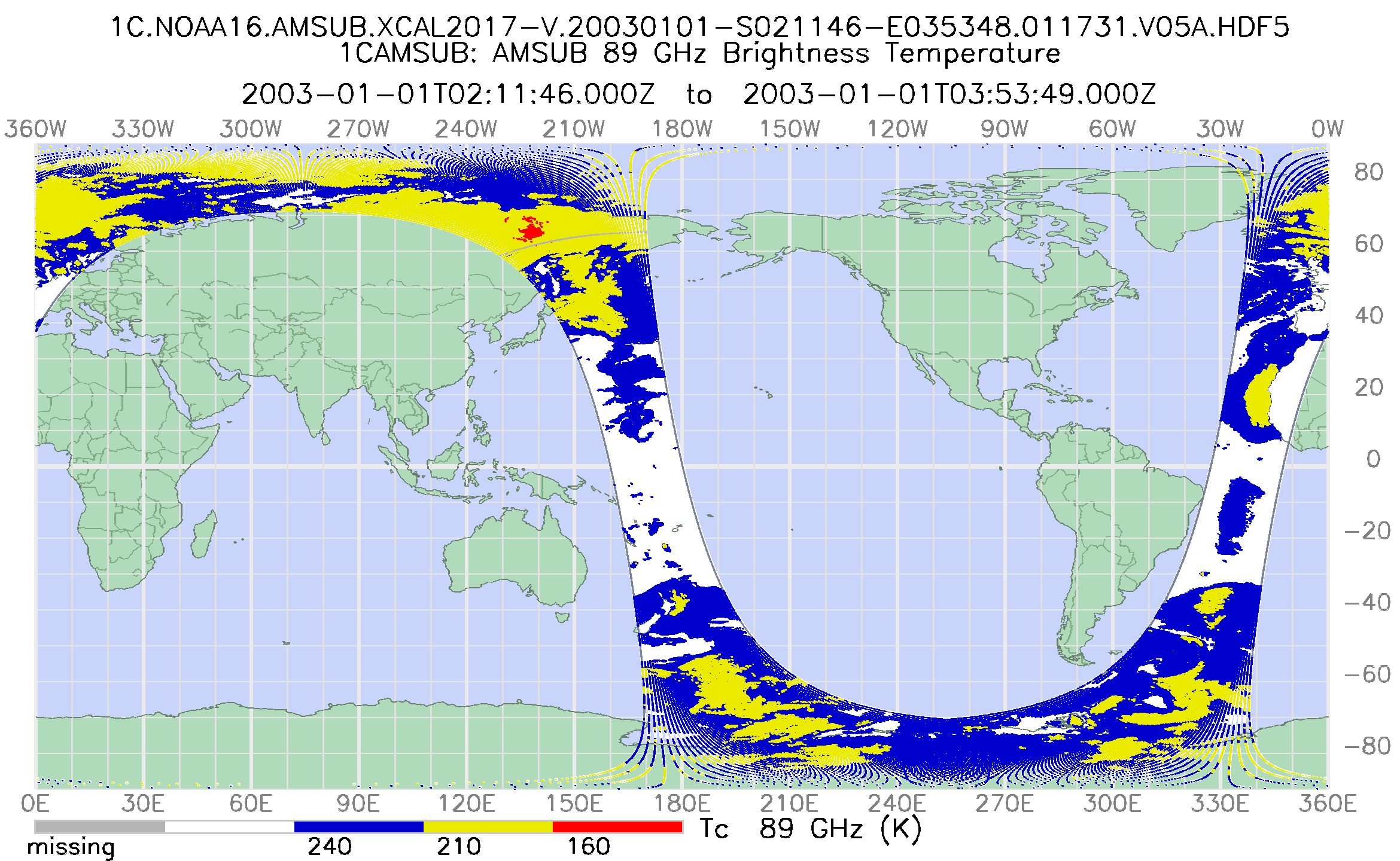
GPM AMSU-B on NOAA 16 Common Calibrated Brightness Temperatures L1C 1.5 hours 16 km V07 (GPM_1CNOAA16AMSUB) at GES DISC
National Aeronautics and Space Administration —
Version 07 is the current version of the data set. Older versions will no longer be available and have been superseded by Version 07. All 1C products have a common... -
Federal
Aqua/AIRS L2 Support Retrieval (AIRS+AMSU) V7.0 at GES DISC
National Aeronautics and Space Administration —
The Atmospheric Infrared Sounder (AIRS) is a grating spectrometer (R = 1200) aboard the second Earth Observing System (EOS) polar-orbiting platform, EOS Aqua. In... -
Federal
Aqua/AIRS L2 Support Retrieval (AIRS+AMSU+HSB) V7.0 at GES DISC
National Aeronautics and Space Administration —
The Atmospheric Infrared Sounder (AIRS) is a grating spectrometer (R = 1200) aboard the second Earth Observing System (EOS) polar-orbiting platform, EOS Aqua. In...
46 datasets found for "organization:nasa-gov AND type:dataset"