
-
Federal
MISR OBC Data V002
National Aeronautics and Space Administration —
MI1AOBC_2 is the Multi-angle Imaging SpectroRadiometer (MISR) OBC Data version 2. This file contains the output for the Level 1A On-board Calibrator Data, and it... -
Federal
MISR Level 2 FIRSTLOOK Surface parameters V002
National Aeronautics and Space Administration —
This Level 2 FIRSTLOOK Land Surface product contains directional reflectance properties, albedo(spectral and PAR integrated), FPAR, radiation parameters, and terrain-... -
Federal
MASTER: HyspIRI Airborne Campaign, California, Spring 2015
National Aeronautics and Space Administration —
This dataset includes Level 1B (L1B) and Level 2 (L2) data products from the MODIS/ASTER Airborne Simulator (MASTER) instrument. The spectral data were collected as... -
Federal
MASTER: HyspIRI Airborne Campaign, California, Summer 2014
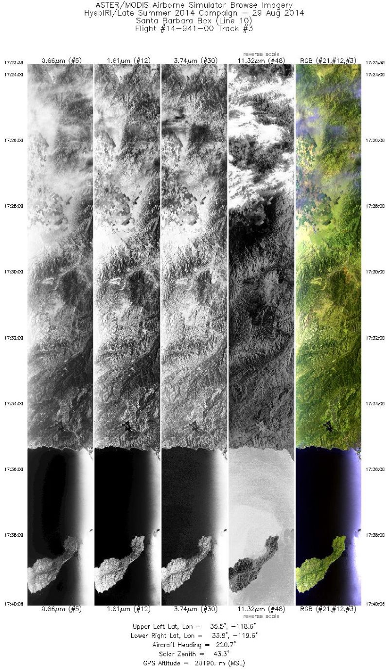
National Aeronautics and Space Administration —
This dataset includes Level 1B (L1B) and Level 2 (L2) data products from the MODIS/ASTER Airborne Simulator (MASTER) instrument. The spectral data were collected as... -
Federal
MISR Level 3 Component Global Radiance Regional public Product covering a day V002
National Aeronautics and Space Administration —
MI3DRDR_2 is the Multi-angle Imaging SpectroRadiometer (MISR) Level 3 Component Global Radiance Regional public Product covering a day version 2. It contains a global... -
Federal
MASTER: HyspIRI Airborne Campaign, California and Nevada, Summer 2016
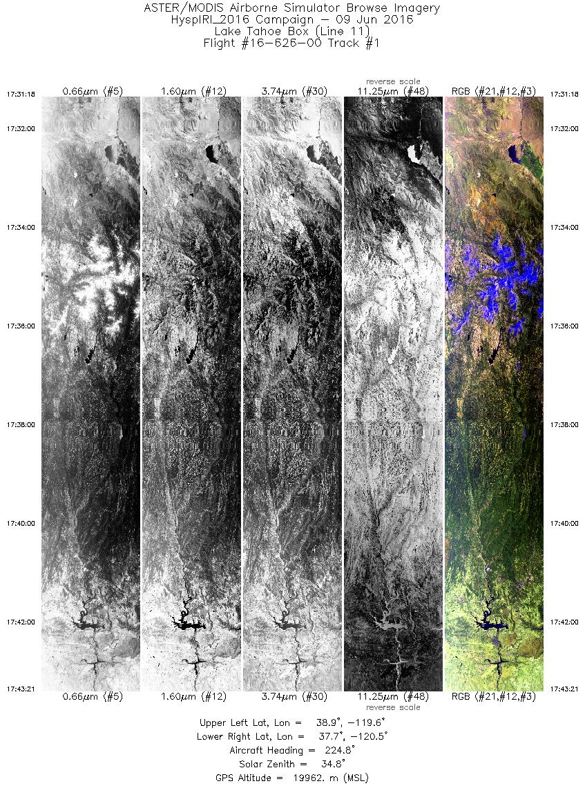
National Aeronautics and Space Administration —
This dataset includes Level 1B (L1B) and Level 2 (L2) data products from the MODIS/ASTER Airborne Simulator (MASTER) instrument. The data were collected as part of... -
Federal
MASTER: Airborne Science, Baja Mexico-Nevada, April-May, 1999
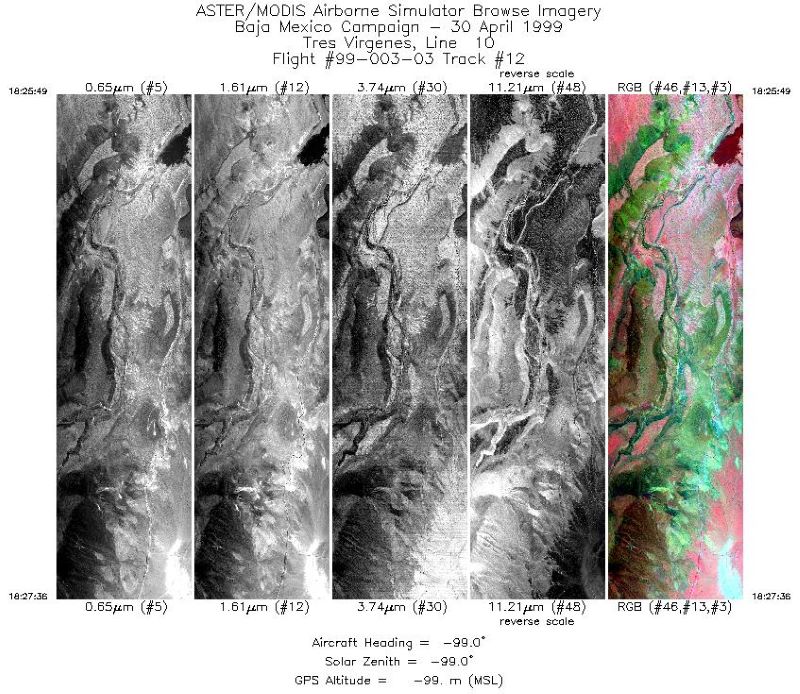
National Aeronautics and Space Administration —
This dataset includes Level 1B (L1B) data products from the MODIS/ASTER Airborne Simulator (MASTER) instrument. The spectral data were collected during 7 flights... -
Federal
MASTER: Airborne Science, California-Nevada, May-June, 2008
National Aeronautics and Space Administration —
This dataset includes Level 1B (L1B) and Level 2 (L2) data products from the MODIS/ASTER Airborne Simulator (MASTER) instrument. The spectral data were collected as... -
Federal
MASTER: Airborne Science, Nevada, May 2006
National Aeronautics and Space Administration —
This dataset includes Level 1B (L1B) data products from the MODIS/ASTER Airborne Simulator (MASTER) instrument. The spectral data were collected during five flights... -
Federal
MISR Level 1A Calibration Data V002
National Aeronautics and Space Administration —
MI1AC_2 is the Multi-angle Imaging SpectroRadiometer (MISR) Level 1A Calibration data in DN. The data numbers have been commuted from 12-bit to 16-bit, byte-aligned... -
Federal
NASA Shuttle Radar Topography Mission United States 1 arc second number
National Aeronautics and Space Administration —
The SRTMUS1N collection was retired on November 20, 2014, when global SRTM data became available at a resolution of 1 arc second. The data for the United States are... -
Federal
NASA Shuttle Radar Topography Mission Swath Image Data V003
National Aeronautics and Space Administration —
The Land Processes Distributed Active Archive Center (LP DAAC) is responsible for the archive and distribution of NASA Making Earth System Data Records for Use in... -
Federal
VIIRS/JPSS1 Moderate Resolution 6-Min L1B Swath 750m NRT
National Aeronautics and Space Administration —
The VIIRS Level 1 and Level 2 swath products are generated from the processing of 6 minutes of VIIRS data acquired during the JPSS1 satellite overpass. The VIIRS... -
Federal
VIIRS/NPP BRDF/Albedo Quality Daily L3 Global 500m SIN Grid V001
National Aeronautics and Space Administration —
The VNP43IA2 Version 1 data product was decommissioned on July 31, 2025. Users are encouraged to use the VNP43IA2 and VJ143IA2 Version 2 data products.The NASA/NOAA... -
Federal
VIIRS/JPSS1 Moderate-Resolution Dual Gain Bands Calibrated Radiance 6-Min L1B Swath 750 m NRT
National Aeronautics and Space Administration —
The VIIRS/JPSS1 Moderate-Resolution Dual Gain Bands Calibrated Radiance 6-Min L1B Swath 750m Near Real Time (NRT) product, short-name VJ102GDC_NRT contains... -
Federal
VIIRS/JPSS1 Nadir BRDF-Adjusted Reflectance Daily L3 Global 500 m SIN Grid NRT
National Aeronautics and Space Administration —
The VIIRS/JPSS1 Nadir BRDF-Adjusted Reflectance Daily L3 Global 500 m SIN Grid Near Real Time (NRT), short-name VJ143IA4N product provides NBAR estimates at 500 meter... -
Federal
VIIRS/JPSS1 Day/Night Band 6-Min L1B Swath 750m NRT
National Aeronautics and Space Administration —
The VIIRS Level 1 and Level 2 swath products are generated from the processing of 6 minutes of VIIRS data acquired during the Joint Polar Satellite System - 1 (JPSS1)... -
Federal
VIIRS/NPP BRDF/Albedo Model Parameters Daily L3 Global 500m SIN Grid V001
National Aeronautics and Space Administration —
The VNP43IA1 Version 1 data product was decommissioned on July 31, 2025. Users are encouraged to use the VNP43IA1 and VJ143IA1 Version 2 data products.The NASA/NOAA... -
Federal
VIIRS/JPSS1 Surface Reflectance 8-Day L3 Global 500m SIN Grid V002
National Aeronautics and Space Administration —
The 8-day Visible Infrared Imaging Radiometer Suite (VIIRS) Surface Reflectance (VJ109H1) Version 2 composite product provides an estimate of land surface reflectance... -
Federal
VIIRS/JPSS1 Imagery Resolution 6 Min L1B Swath 375m NRT
National Aeronautics and Space Administration —
The VIIRS/JPSS1 Imagery Resolution 6-Min L1B Swath 375m Near REal Time (NRT), short-name VJ102IMG_NRT is among the VIIRS Level 1 and Level 2 swath products that are...

Official websites use .gov
A
.gov website belongs to an official government
organization in the United States.
Secure .gov websites use HTTPS
A
lock (
) or https:// means you’ve safely connected to
the .gov website. Share sensitive information only on official,
secure websites.