
-
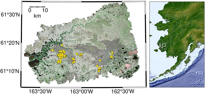
Federal
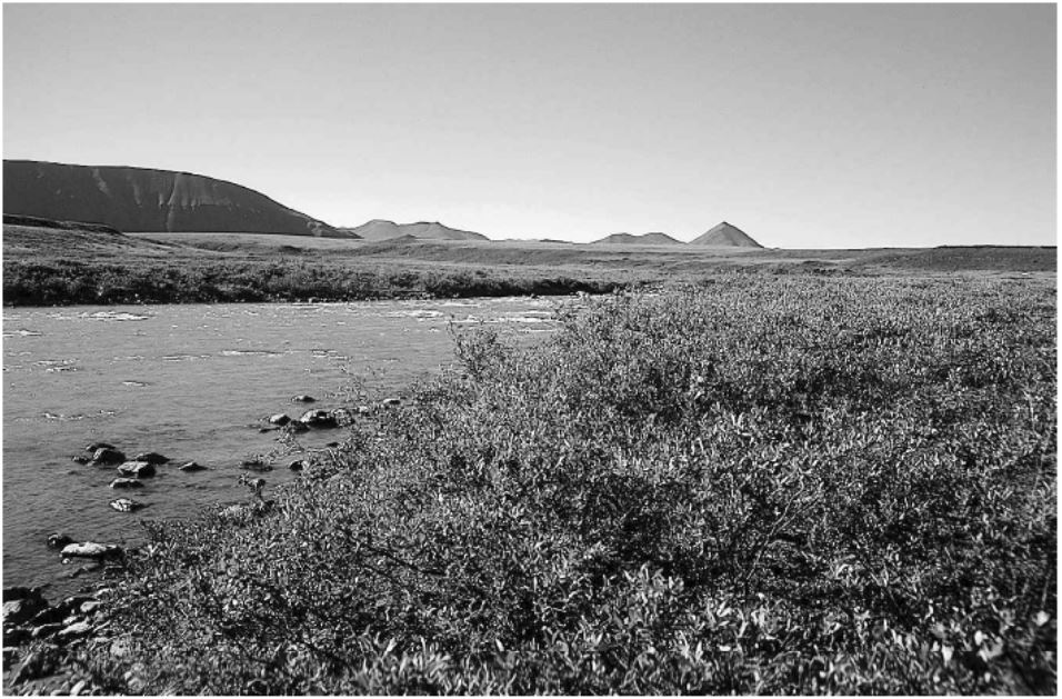
Arctic Vegetation Plots in Willow Communities, North Slope, Alaska, 1997
National Aeronautics and Space Administration —
This data set provides environmental, soil, and vegetation data collected in July and August 1997 from 85 study plots in willow shrub communities located along a... -
Federal
Data and Code from: Smart vision-based monitoring system for AI-driven moth population estimation using camera-equipped trap imaging
Department of Agriculture —
Real-time, image-based monitoring for stored product insect pests could increase timely treatments and protection for postharvest products throughout the supply... -
Federal
Resilience of Coastal Wetlands to Sea Level Rise, CONUS, 1996-2100
National Aeronautics and Space Administration —
This dataset provides information about the resilience of tidal wetlands to sea-level rise under three scenarios of global change. With rising seas, regularly... -
Federal
SAFARI 2000 Estimated BVOC Emissions for Southern African Land Cover Types
National Aeronautics and Space Administration —
Improved vegetation distribution and emission data for Africa south of the equator were developed for the Southern African Regional Science Initiative (SAFARI 2000)... -
Federal
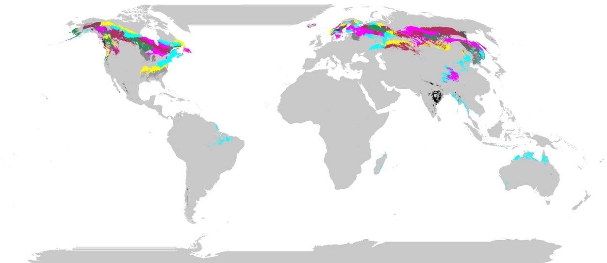
Phenoregions For Monitoring Vegetation Responses to Climate Change
National Aeronautics and Space Administration —
The overall purpose in this research was to identify the regions of the world best suited for long-term monitoring of biospheric responses to climate change, i.e.... -
Federal
Snow Properties and Wildlife Tracks in Washington and Alaska
National Aeronautics and Space Administration —
This dataset contains three field seasons of snow-wildlife observations conducted at 707 sites from January 2021 to March 2023 in Washington and Alaska, spanning a... -
Federal
Classification of Global Forests for IPCC Aboveground Biomass Tier 1 Estimates, 2020
National Aeronautics and Space Administration —
This dataset provides classes of global forests delineated by status/condition in 2020 at approximately 30-m resolution. The data support generating Tier 1 estimates... -
Federal
ASTER Global Water Bodies Database NetCDF V001
National Aeronautics and Space Administration —
The Terra Advanced Spaceborne Thermal Emission and Reflection Radiometer (ASTER) Global Water Bodies Database (ASTWBD) Version 1 data product provides global coverage... -
Federal
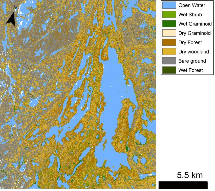
ABoVE: Lake and Wetland Classification from L-band SAR, Alaska and Canada, 2017-2019
National Aeronautics and Space Administration —
This dataset contains a high-resolution land cover classification focused on water and wetland vegetation classes over three NASA ABoVE Campaign regions: Yukon Flats,... -
Federal
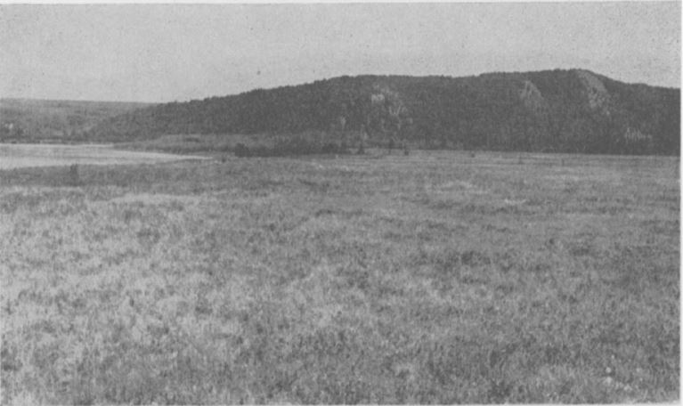
Arctic Vegetation Plots at Nome, Alaska, 1951
National Aeronautics and Space Administration —
This data set provides environmental, soil, and vegetation data collected in July and August 1951 from 80 study plots in the Nome River Valley about 10 miles... -
Federal
OPERA Dynamic Surface Water Extent from Sentinel-1 (Version 1)
National Aeronautics and Space Administration —
This dataset contains Level-3 Dynamic OPERA Surface Water Extent from Sentinel-1 (DSWx-S1) product version 1. DSWx-S1 provides near-global geographical mapping of... -
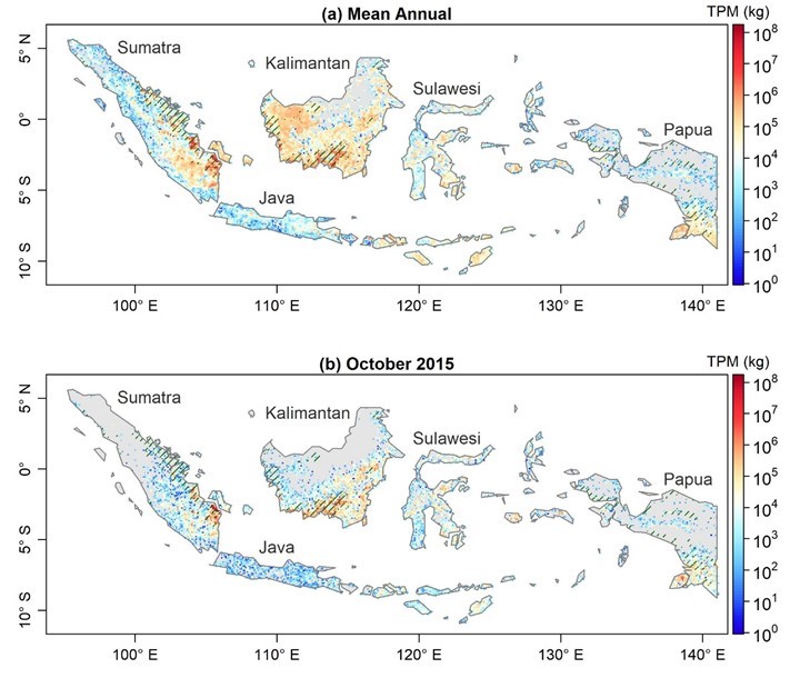
Federal
Fire Particulate Emissions from Combined VIIRS and AHI Data for Indonesia, 2015-2020
National Aeronautics and Space Administration —
This dataset provides 10-minute fire emissions within 0.1-degree regularly spaced intervals across Indonesia from July 2015 to December 2020. The dataset was produced... -
Federal
Headwall Hyperspectral Reflectance LTER Cedar Creek Minnesota Multi-Year 1 mm
National Aeronautics and Space Administration —
The Headwall Hyperspectral Reflectance data are for the Long-Term Ecological Research (LTER) at Cedar Creek Ecosystem Science Reserve (CCESR), Minnesota... -
Federal
Data from: Pyrosequencing-Based Analysis of the Microbiome Associated with the Horn Fly, Haematobia irritans
Department of Agriculture —
The bacterial 16S tag-encoded FLX-titanium amplicon pyrosequencing (bTEFAP) method was used to carry out the classification analysis of bacterial flora in adult... -
Federal
RLC Vegetative Cover of the Former Soviet Union, 1990
National Aeronautics and Space Administration —
This dataset is a 1:4 million scale vegetation map for the land area of the Former Soviet Union. Three hundred seventy-three cover classes are distinguished, of which... -
Federal
Data from: Visualizing Plant Responses: Novel Insights Possible through Affordable Imaging Techniques in the Greenhouse
Department of Agriculture —
Data of image calculation averages, coefficient of variations, and experimental measurements that were presented in the manuscript, Visualizing Plant Responses: Novel... -
Federal
BOREAS CanSIS Regional Soils Data in Vector Format, V2
National Aeronautics and Space Administration —
This data set contains soils data from the Canada Soil Information System (CanSIS) in ESRI Shapefile format for the provinces of Saskatchewan and Manitoba. They are... -
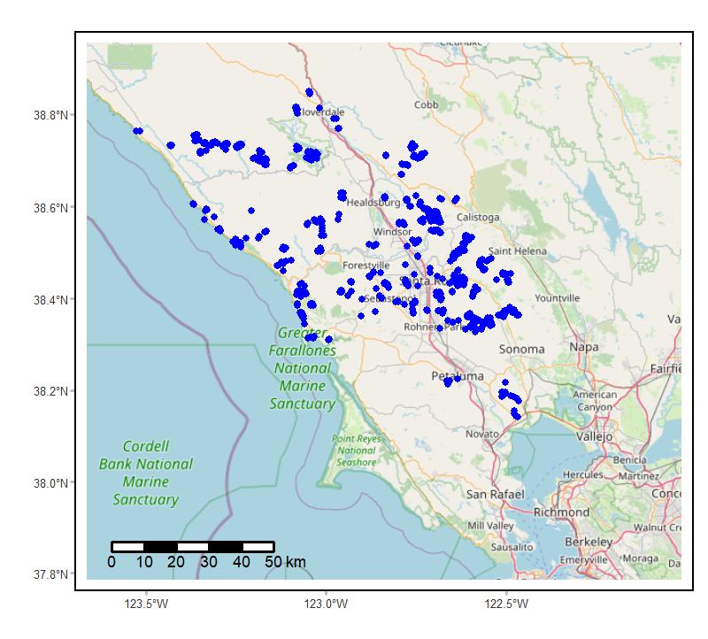
Federal
Soundscapes to Landscapes Acoustic Recordings, Sonoma County, CA, 2017-2022
National Aeronautics and Space Administration —
This dataset holds in situ sound recordings from sites in Sonoma County, California, USA as part of the Soundscapes to Landscapes citizen science project. Recordings... -
Federal
Imagery data for the Vegetation Mapping Inventory Project of Lava Beds National Monument
Department of the Interior —
This reference contains the imagery data used in the completion of the baseline vegetation inventory project for the NPS park unit. Orthophotos, raw imagery, and... -
Federal
CO2 and CH4 Fluxes from Waterbodies, Yukon-Kuskokwim Delta, Alaska, 2016-2019
National Aeronautics and Space Administration —
This dataset provides estimates of carbon dioxide (CO2) and methane (CH4) diffusive fluxes from waterbodies, and watershed landcover data for the central-interior of...

Official websites use .gov
A
.gov website belongs to an official government
organization in the United States.
Secure .gov websites use HTTPS
A
lock (
) or https:// means you’ve safely connected to
the .gov website. Share sensitive information only on official,
secure websites.