
-
Federal
LBA-ECO LC-15 SRTM30 Digital Elevation Model Data, Amazon Basin: 2000
National Aeronautics and Space Administration —
This dataset provides a subset of the SRTM30 Digital Elevation Model (DEM) elevation and standard deviation data for the Amazon Basin. SRTM30 is a near-global digital... -
Federal
LBA-ECO LC-01 Topographic Data for Intensive Study Areas, Northern Ecuadorian Amazon
National Aeronautics and Space Administration —
This data set contains topographic/geomorphological data associated with the four Intensive Study Areas (ISAs) in the Northern Ecuadorian Amazon (northern Oriente)... -
Federal
LBA-ECO CD-36 South American Land Data Assimilation System Atmospheric Forcing Data
National Aeronautics and Space Administration —
This data set provides South American Land Data Assimilation System (SALDAS) forcing data including atmospheric fields necessary for land surface modeling for South... -
Federal
LBA Regional Derived Soil Properties, 0.5-Deg (ISRIC-WISE)
National Aeronautics and Space Administration —
The data set consists of a subset of the ISRIC-WISE global data set of derived soil properties for the study area of the Large Scale Biosphere-Atmosphere Experiment... -
Federal
ISLSCP II River Routing Data (STN-30p)
National Aeronautics and Space Administration —
The Simulated Topological Network (STN-30p) data set provides the large-scale hydrological modeling community an accurate representation of the global river system at... -
Federal
Land Cover and Land Use Classification for the State of New Hampshire, 1996-2001
National Aeronautics and Space Administration —
The New Hampshire Geographically Referenced Analysis and Information Transfer System (GRANIT) land cover data set provides a land cover and land use product at 30-m... -
Federal
ISLSCP II Gauge-Based Analyses of Daily Precipitation over Global Land Areas
National Aeronautics and Space Administration —
The objective of this work was to construct a long-term data set of daily precipitation on half degree and one degree latitude/longitude grids over the global land... -
Federal
ISLSCP II ECMWF Near-Surface Meteorology Parameters
National Aeronautics and Space Administration —
This data set for the ISLSCP Initiative II data collection provides meteorology data with fixed, monthly, monthly-6-hourly, 6-hourly, and 3-hourly temporal... -
Federal
MAPSS: Mapped Atmosphere-Plant-Soil System Model, Version 1.0
National Aeronautics and Space Administration —
MAPSS (Mapped Atmosphere-Plant-Soil System) is a landscape to global vegetation distribution model that was developed to simulate the potential biosphere impacts and... -
Federal
LBA-ECO ND-11 Litter Decomposition, Carbon, and Nitrogen Dynamics in Agroforestry
National Aeronautics and Space Administration —
It has been proposed that the C/N ratio, or quality, of litter or mulch mixtures affects N release. Although total N release from these mixtures and the effects on... -
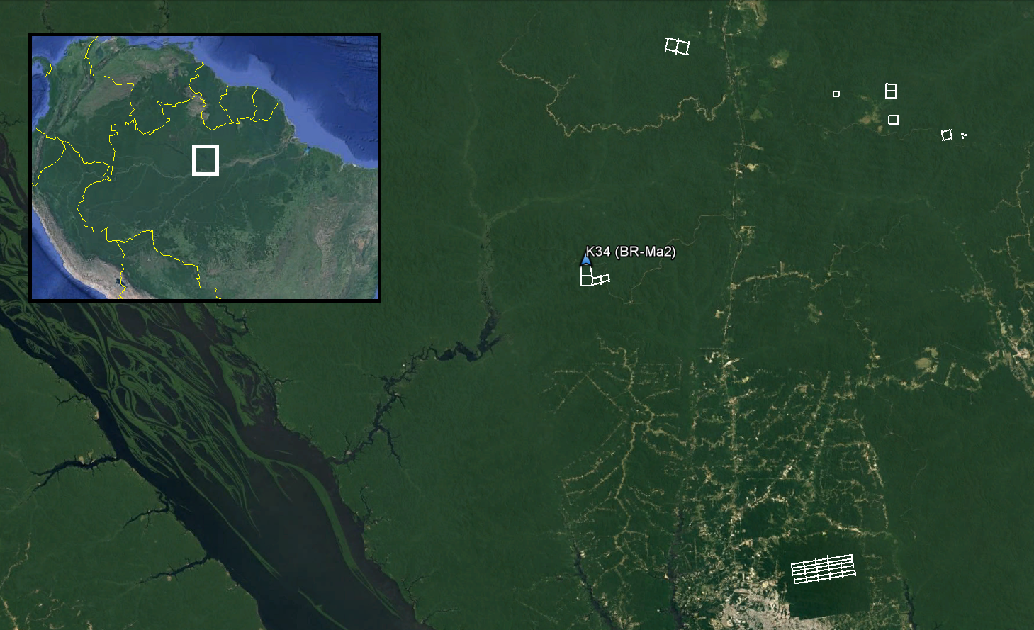
Federal
LiDAR and DTM Data from Forested Land Near Manaus, Amazonas, Brazil, 2008
National Aeronautics and Space Administration —
This data set provides LiDAR point clouds and digital terrain models (DTM) from surveys over the K34 tower site in the Cuieiras Biological Reserve, over forest... -
Federal
VEMAP 2: Monthly Ecosystem Model Responses to U.S. Climate Change, 1994-2100
National Aeronautics and Space Administration —
The Vegetation-Ecosystem Modeling and Analysis Project (VEMAP) was a large, collaborative, multi-institutional, international effort whose goal was to evaluate the... -
Federal
SAFARI 2000 Wetlands Data Set, 1-Deg (Matthews and Fung)
National Aeronautics and Space Administration —
This database, compiled by Matthews and Fung (1987), provides information on the distribution and environmental characteristics of natural wetlands. The database was... -
Federal
SAFARI 2000 Meteorological and Flux Tower Measurements in Maun, Botswana, 2000
National Aeronautics and Space Administration —
To investigate potential contributions of savanna ecosystems to the Earth s carbon balance, an eddy covariance system was used to measure the seasonal variation in... -
Federal
SAFARI 2000 MODIS Water and Heat Fluxes, Maun, Botswana, Dry Season 2001
National Aeronautics and Space Administration —
A physically-based model, Energy: Surface Towards Atmosphere (ESTA), was used to model and map the energy and water balances of a heterogeneous land surface in a... -
Federal
SAFARI 2000 AVHRR-derived Land Surface Temperature Maps, Africa, 1995-2000
National Aeronautics and Space Administration —
Land Surface Temperature (LST) is a key indicator of land surface states, and can provide information on surface-atmosphere heat and mass fluxes, vegetation water... -
Federal
SAFARI 2000 Digital Elevation Model, 1-km (GLOBE)
National Aeronautics and Space Administration —
This data set consists of a southern African subset of the Global Land One-Kilometer Base Elevation (GLOBE) digital elevation model (DEM) data in both ASCII GRID and... -
Federal
PROVE Land Cover and Leaf Area of Jornada Experimental Range, New Mexico, 1997
National Aeronautics and Space Administration —
Field measurement of shrubland ecological properties is important for both site monitoring and validation of remote-sensing information. During the NASA Earth...

Official websites use .gov
A
.gov website belongs to an official government
organization in the United States.
Secure .gov websites use HTTPS
A
lock (
) or https:// means you’ve safely connected to
the .gov website. Share sensitive information only on official,
secure websites.