
-
Federal
MMR Ground Data (FIFE)
National Aeronautics and Space Administration —
Surface reflectance factors, radiances, and temperatures were measured with a Mast-borne Modular Multiband Radiometer (MMR), predominantly in the solar principal... -
Federal
LBA-ECO ND-11 Soil Water Pressure and Flow Measurements under Tree Crops
National Aeronautics and Space Administration —
This data set contains information that can be used to examine water fluxes in soils beneath tree crops in an Amazonian agroforest. The data consists of repeated... -
Federal
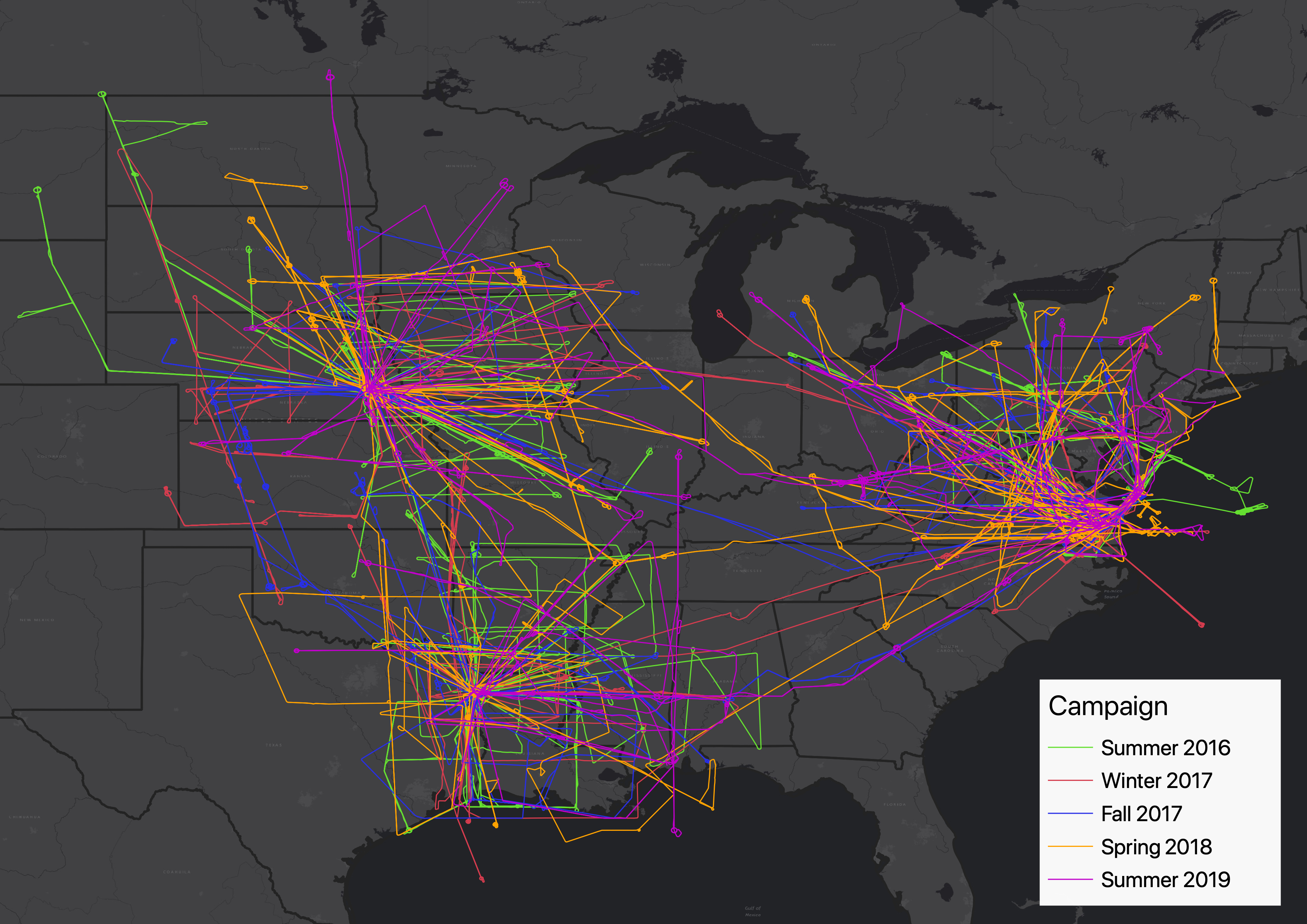
ACT-America: L2 In Situ Atmospheric CO2, CO, CH4, and O3 Concentrations, Eastern USA
National Aeronautics and Space Administration —
This dataset provides atmospheric carbon dioxide (CO2), carbon monoxide (CO), methane (CH4), water vapor (H2O), and ozone (O3) concentrations collected during... -
Federal
Global Annual Soil Respiration Data (Raich and Schlesinger 1992)
National Aeronautics and Space Administration —
This data set is a compilation of soil respiration rates (g C m-2 yr-1) from terrestrial and wetland ecosystems reported in the literature prior to 1992. These rates... -
Federal
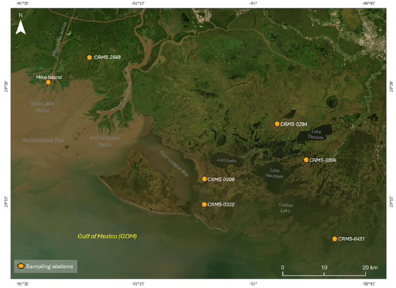
Delta-X: Soil Accretion Rates from Cs-137 Activity and NUMAR Validation, MRD, LA
National Aeronautics and Space Administration —
This dataset holds measurements of Cesium-137 (137Cs) activity sampled from sites in the Atchafalaya and Terrebonne Basins on the southern coast of Louisiana, USA.... -
Federal
BigFoot Land Cover Surfaces for North and South American Sites, 2000-2003
National Aeronautics and Space Administration —
The BigFoot project gathered data for nine EOS Land Validation Sites located from Alaska to Brazil from 2000 to 2003. Each site is representative of one or two... -
Federal
BOREAS Follow-On HMet-04 1996-1998 NSA Meteorological Data
National Aeronautics and Space Administration —
As part of the BOREAS Follow-on, an extended period of data collection was supported in the NSA because of the continued efforts at the NSA-OBS site. This data set... -
Federal
LBA-ECO LC-22 Field Validation of MODIS Deforestation Detection, Brazil, 2003-2004
National Aeronautics and Space Administration —
This data set contains field observations, corresponding GPS points, and point and polygons of deforested areas in the state of Mato Grosso, Brazil, for the period... -
Federal
Soil Bulk Density Data (FIFE)
National Aeronautics and Space Administration —
Soil bulk density is defined as the ratio of the mass of dry solids to the bulk volume of the soil occupied by those dry solids. Bulk density of the soil is an... -
Federal
Wind Profile Data: LIDAR - NOAA (FIFE)
National Aeronautics and Space Administration —
The aim of this wind profile study was to derive wind profiles and momentum fluxes from the National Oceanic and Atmospheric Administration (NOAA)/Wave Propagation... -
Federal
BOREAS TE-10 Leaf Chemistry Data
National Aeronautics and Space Administration —
The BOREAS TE-10 team collected several data sets in support of its efforts to characterize and interpret information on the reflectance, transmittance, gas exchange,... -
Federal
Bowen Ratio Surface Flux: GSFC (FIFE)
National Aeronautics and Space Administration —
The Bowen Ratio Surface Flux Observations (GSFC) Data Set contains data collected using the Bowen Ratio Techniques. The major data collection effort was conducted in... -
Federal
BOREAS RSS-02 Level-1b ASAS Image Data: At-sensor Radiance in BSQ Format
National Aeronautics and Space Administration —
The BOREAS RSS-02 team used the ASAS instrument, mounted on the NASA C-130 aircraft, to create at-sensor radiance images of various sites as a function of spectral... -
Federal
ATom: CO2, CH4, and CO Measurements from Picarro, 2016-2018
National Aeronautics and Space Administration —
This dataset contains atmospheric measurements of CO2, CH4, and CO mixing ratios made with a Picarro G2401 spectrometer during the four ATom campaigns. Picarro G2401... -
Federal
NPP Multi-Biome: Global Primary Production Data Initiative Products, R2
National Aeronautics and Space Administration —
Net primary productivity (NPP) estimates were compiled by the Global Primary Production Data Initiative (GPPDI). The database covers 2,523 individual sites and 5,164... -
Federal
Daily Rainfall Data (FIFE)
National Aeronautics and Space Administration —
The FIFE Daily Rainfall Data Set contains daily precipitation values for 42 rain gauge stations within the Konza LTER portion of the FIFE site (i.e., Northwest... -
Federal
NACP Integrated Wildland and Cropland 30-m Fuel Characteristics Map, U.S.A., 2010
National Aeronautics and Space Administration —
The data set provides a 30-m comprehensive fuelbed characteristics map for both the wildland and cropland areas of the conterminous United States (CONUS) for 2010.... -
Federal
AMS (Automated Met Station) Data (FIFE)
National Aeronautics and Space Administration —
As part of the FIFE staff science data collection effort, the FIFE Information System (FIS) processed and archived 5 minute, near-surface radiometric and... -
Federal
ABoVE: Ignitions, Burned Area, and Emissions of Fires in AK, YT, and NWT, 2001-2018
National Aeronautics and Space Administration —
This dataset provides estimates of daily burned area, carbon emissions, and uncertainty, and daily fire ignition locations for boreal fires in Alaska, U.S., and in... -
Federal
NACP MCI: Cropland Productivity and Biophysical Properties, Nebraska, USA, 2001-2008
National Aeronautics and Space Administration —
This data set provides an integrated collection of (1) ground-based meteorological, radiometric, and vegetation measurements, (2) flux-based estimates of gross...

Official websites use .gov
A
.gov website belongs to an official government
organization in the United States.
Secure .gov websites use HTTPS
A
lock (
) or https:// means you’ve safely connected to
the .gov website. Share sensitive information only on official,
secure websites.