
-
Federal
OCO-2 Level 2 geolocated XCO2 retrievals results, physical model, Retrospective Processing V10r (OCO2_L2_Standard) at GES DISC
National Aeronautics and Space Administration —
Version 10r is the current version of the data set. Older versions will no longer be available and are superseded by Version 10r.In early 2021, the OCO Team... -
Federal
TOMS Earth Probe Total Column Ozone Monthly L3 Global 1 deg x 1.25 deg Lat/Lon Grid V008 (TOMSEPL3mtoz) at GES DISC
National Aeronautics and Space Administration —
This Earth Probe (EP) Total Ozone Mapping Spectrometer (TOMS) version 8 monthly averaged global gridded data product contains total column ozone values. The data are... -
Federal
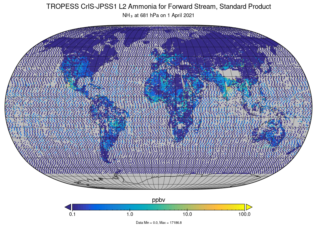
TROPESS CrIS-JPSS1 L2 Ammonia for Forward Stream, Standard Product V1 (TRPSDL2NH3CRS1FS) at GES DISC
National Aeronautics and Space Administration —
The TROPESS CrIS-JPSS1 L2 Ammonia for Forward Stream, Standard Product contains the vertical distribution of the retrieved atmospheric state of ammonia (NH3), formal... -
Federal
GPM SSMIS on F17 (GPROF) Radiometer Precipitation Profiling L3 1 day 0.25 degree x 0.25 degree V07 (GPM_3GPROFF17SSMIS_DAY) at GES DISC
National Aeronautics and Space Administration —
Version 07 is the current version of the data set. Older versions will no longer be available and have been superseded by Version 07.3GPROF products provide global... -
Federal
GPM SSMIS on F16 (GPROF) Climate-based Radiometer Precipitation Profiling 1.5 hours 12 km V07 (GPM_2AGPROFF16SSMIS_CLIM) at GES DISC
National Aeronautics and Space Administration —
Version 07 is the current version of the data set. Older versions will no longer be available and have been superseded by Version 07.The 'CLIM' products differ from... -
Federal
GPM SSMI on F13 (GPROF) Climate-based Radiometer Precipitation Profiling L3 1 month 0.25 degree x 0.25 degree V07 (GPM_3GPROFF13SSMI_CLIM) at GES DISC
National Aeronautics and Space Administration —
Version 07 is the current version of the data set. Older versions will no longer be available and have been superseded by Version 07. The "CLIM" products differ from... -
Federal
GPM PR on TRMM Reflectivity, Precipitation Characteristics and Rate, at Surface and Profile L2 1.5 hours V07 (GPM_2APR) at GES DISC
National Aeronautics and Space Administration —
This is the new, GPM-like, format for TRMM Precipitation Radar L2 data that now incorporates what was known as 2A21, 2A23 and 2A25 datasets.The primary purpose of... -
Federal
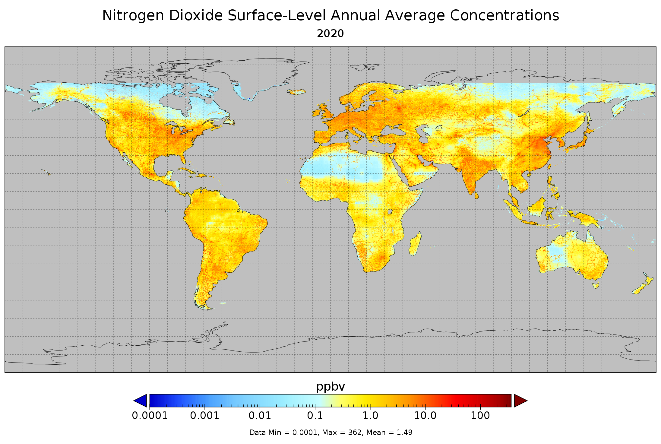
Nitrogen Dioxide Surface-Level Annual Average Concentrations V1 (SFC_NITROGEN_DIOXIDE_CONC) at GES DISC
National Aeronautics and Space Administration —
The Nitrogen Dioxide Surface-Level Annual Average Concentrations Product (SFC_NITROGEN_DIOXIDE_CONC) contains estimated global NO2 surface values derived using a Land... -
Federal
NASA Ocean Biogeochemical Model assimilating satellite chlorophyll data global monthly VR2017 (NOBM_MON) at GES DISC
National Aeronautics and Space Administration —
This is the assimilated monthly data from NASA Ocean Biogeochemical Model (NOBM). The NOBM is a comprehensive, interactive ocean biogeochemical model coupled with a... -
Federal
Carbon Monitoring System Carbon Flux Total Prior L4 V3 (CMSFluxTotalPrior)
National Aeronautics and Space Administration —
This dataset provides the Prior for Total Carbon Flux.The NASA Carbon Monitoring System (CMS) is designed to make significant contributions in characterizing,... -
Federal
Carbon Monitoring System Carbon Flux Ocean Prior L4 V3 (CMSFluxOceanPrior)
National Aeronautics and Space Administration —
This dataset provides the Prior for the Carbon Flux for Ocean.The NASA Carbon Monitoring System (CMS) is designed to make significant contributions in characterizing,... -
Federal
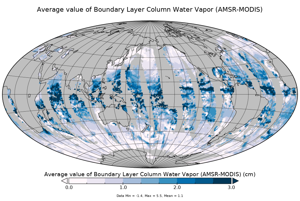
AMSR-MODIS Boundary Layer Water Vapor L3 Daily 1 degree x 1 degree V2 (AMDBLWV) at GES DISC
National Aeronautics and Space Administration —
Version 2 is the current version of this dataset. Version 2 uses an improved methodology to screen out high clouds.This data set provides an estimate the marine... -
Federal
HAQAST Sentinel-5P TROPOMI Nitrogen Dioxide (NO2) CONUS Seasonal Level 3 0.01 x 0.01 Degree Gridded Data V2.4 (HAQ_TROPOMI_NO2_CONUS_S_L3) at GES DISC
National Aeronautics and Space Administration —
This product provides level 3 seasonal averages of tropospheric Nitrogen dioxide (NO2) vertical column density derived from the level 2 Tropospheric Monitoring... -
Federal
GPM MHS on METOP-B (GPROF) Radiometer Precipitation Profiling L2A 1.5 hours 17 km V07 (GPM_2AGPROFMETOPBMHS) at GES DISC
National Aeronautics and Space Administration —
Version 07 is the current version of the data set. Older versions will no longer be available and have been superseded by Version 07. The 2AGPROF (also known as, GPM... -
Federal
GPM AMSUB on NOAA15 (GPROF) Climate-based Radiometer Precipitation Profiling L3 1 day 0.25 degree x 0.25 degree V07 (GPM_3GPROFNOAA15AMSUB_DAY_CLIM) at GES DISC
National Aeronautics and Space Administration —
The "CLIM" products differ from their "regular" counterparts (without the "CLIM" in the name) by the ancillary data they use. They are Climate-Reference products,... -
Federal
GPM IMERG Late Precipitation L3 1 day 0.1 degree x 0.1 degree V07 (GPM_3IMERGDL) at GES DISC
National Aeronautics and Space Administration —
Version 07 is the current version of the data set. Older versions will no longer be available and have been superseded by Version 07.The Integrated Multi-satellitE... -
Federal
Sounder SIPS: JPSS-1 ATMS Level 2 RAMSES2 Standard: Atmosphere, precipitation and surface geophysical state V3 (SNDRJ1ML2RMS) at GES DISC
National Aeronautics and Space Administration —
This level 2 product is generated by the RAMSES (Retrieval Algorithm for Microwave Sounders in Earth Science II algorithm.The RAMSES II algorithm is a microwave only... -
Federal
Sentinel-6A EUMETSAT GNSS-RO Non-Time-Critical Level 1B V1 (S6A_RO_1B_BND_____) at GES DISC
National Aeronautics and Space Administration —
This dataset provides the L1B Global Navigation Satellite System (GNSS) Radio-Occultation (RO) Non-Time-Critical (NTC) retrieval generated by European Organisation... -
Federal
GLDAS Catchment Land Surface Model L4 daily 0.25 x 0.25 degree GRACE-DA1 V2.2 (GLDAS_CLSM025_DA1_D_EP) at GES DISC
National Aeronautics and Space Administration —
NASA Global Land Data Assimilation System Version 2 (GLDAS-2) has three components: GLDAS-2.0, GLDAS-2.1, and GLDAS-2.2. GLDAS-2.0 is forced entirely with the... -
Federal
OCO-3 Level 2 meteorological parameters interpolated from global assimilation model for each sounding, Retrospective Processing V11r (OCO3_L2_Met) at GES DISC
National Aeronautics and Space Administration —
Version 11r is the current version of the data set. Older versions will no longer be available and are superseded by Version 11r.The Orbiting Carbon Observatory -3...

Official websites use .gov
A
.gov website belongs to an official government
organization in the United States.
Secure .gov websites use HTTPS
A
lock (
) or https:// means you’ve safely connected to
the .gov website. Share sensitive information only on official,
secure websites.