
-
Federal
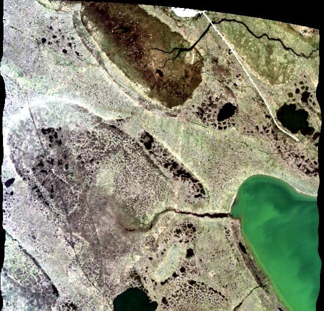
ABoVE: AVIRIS-NG Imaging Spectroscopy for Alaska, Canada, and Iceland, 2017-2022, V3
National Aeronautics and Space Administration —
This dataset supersedes the previously published ABoVE AVIRIS-NG Level 2 surface reflectance files for 2017-2019 surveys of Alaska and northwestern Canada. It also... -
Federal
Deciduous Fractional Cover and Tree Canopy Cover for Boreal North America, 1992-2015
National Aeronautics and Space Administration —
This dataset holds deciduous fraction and tree canopy cover at 30-m resolution over the North American boreal domain for 1992 to 2015. Deciduous fraction is the areal... -
Federal
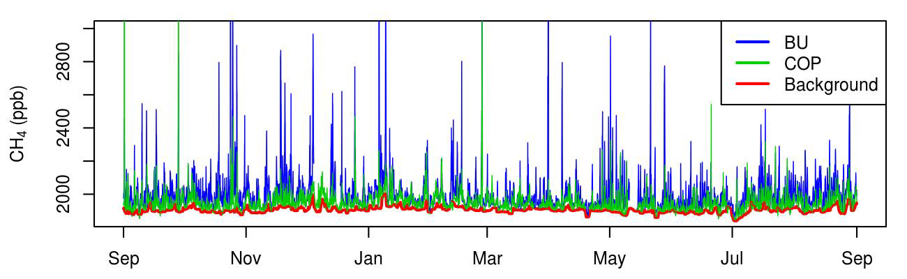
CMS: Atmospheric Methane Concentrations and Prior Emissions, Boston, MA, 2012-2014
National Aeronautics and Space Administration —
This data set provides average hourly measured, modeled enhancements, and background methane (CH4) concentrations, atmospheric ethane (C2H6) measurements, prior CH4... -
Federal
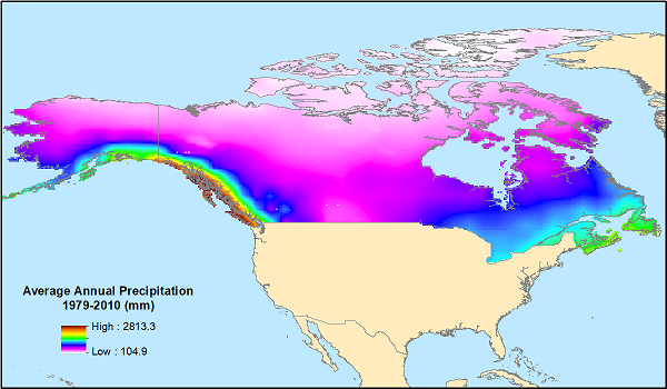
ABoVE: Monthly Hydrological Fluxes for Canada and Alaska, 1979-2018
National Aeronautics and Space Administration —
This dataset provides modeled estimates of monthly hydrological fluxes at 0.25-degree resolution over Alaska and Canada for the years 1979-2018. The estimates were... -
Federal
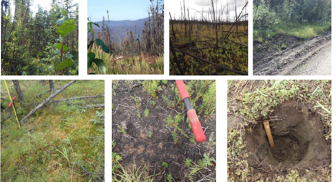
ABoVE: Characterization of Burned and Unburned Spruce Forest Sites, Tanana, AK, 2017
National Aeronautics and Space Administration —
This dataset provides the results of field observations of soil characteristics and depth to permafrost, survey results for Composite Burn Index (CBI) determination,... -
Federal
ABoVE: Soil Moisture and Active Layer Thickness in Alaska and NWT, Canada, 2008-2020
National Aeronautics and Space Administration —
This dataset provides soil thaw depth and moisture (STDM) measurements and dielectric properties measured by different research teams at sites in Alaska, U.S., and... -
Federal
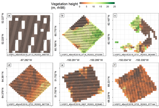
ABoVE: LVIS L3 Gridded Vegetation Structure across North America, 2017 and 2019
National Aeronautics and Space Administration —
This dataset provides Level 3 (L3) footprint-level gridded metrics and attributes collected from NASA's Land, Vegetation, and Ice Sensor (LVIS)-Facility instrument... -
Federal
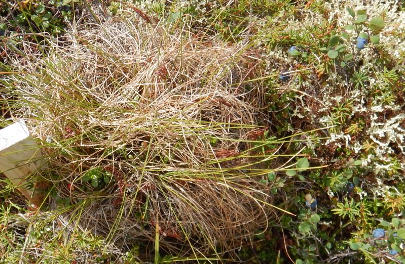
ABoVE: Reflectance Spectra of Tundra Plant Communities across Northern Alaska
National Aeronautics and Space Administration —
This dataset reports full-spectrum (350-2500 nm) reflectance measurements of diverse plant communities at the plot-level and individual plant species at the leaf-... -
Federal
ABoVE: Needle-Level Chlorophyll Fluorescence, Alaska and Idaho, USA, 2017 and 2019
National Aeronautics and Space Administration —
This dataset provides the results of in situ measurements of needle-level chlorophyll fluorescence (ChlF) obtained from a pulse amplitude modulated (PAM) fluorometer... -
Federal
ABoVE: Peak Greenness for Canadian Boreal Forest from Landsat 5 TM Imagery, 1984-2011
National Aeronautics and Space Administration —
This dataset provides a 28-year time series of peak greenness (NDVI) data derived from Landsat 5 TM imagery over the boreal forest region of Canada. Landsat 5 TM... -
Federal
BOREAS TGB-10 Oxidant Concentration Data over the SSA
National Aeronautics and Space Administration —
The BOREAS TGB-10 team collected several trace gas data sets in their efforts to determine the role of biogenic hydrocarbon emissions with respect to boreal forest... -
Federal
BOREAS RSS-17 Xylem Flux Density Measurements at the SSA-OBS Site
National Aeronautics and Space Administration —
As part of its efforts to determine environmental and phenological states from radar imagery, the BOREAS RSS-17 team collected in situ tree xylem flow measurements... -
Federal
BASIN TCP Stable Isotope Composition of CO2 in Terrestrial Ecosystems
National Aeronautics and Space Administration —
This data set reports stable isotope ratio data of CO2 (13C/12C and 18O/16O) associated with photosynthetic and respiratory exchanges across the biosphere-atmosphere... -
Federal
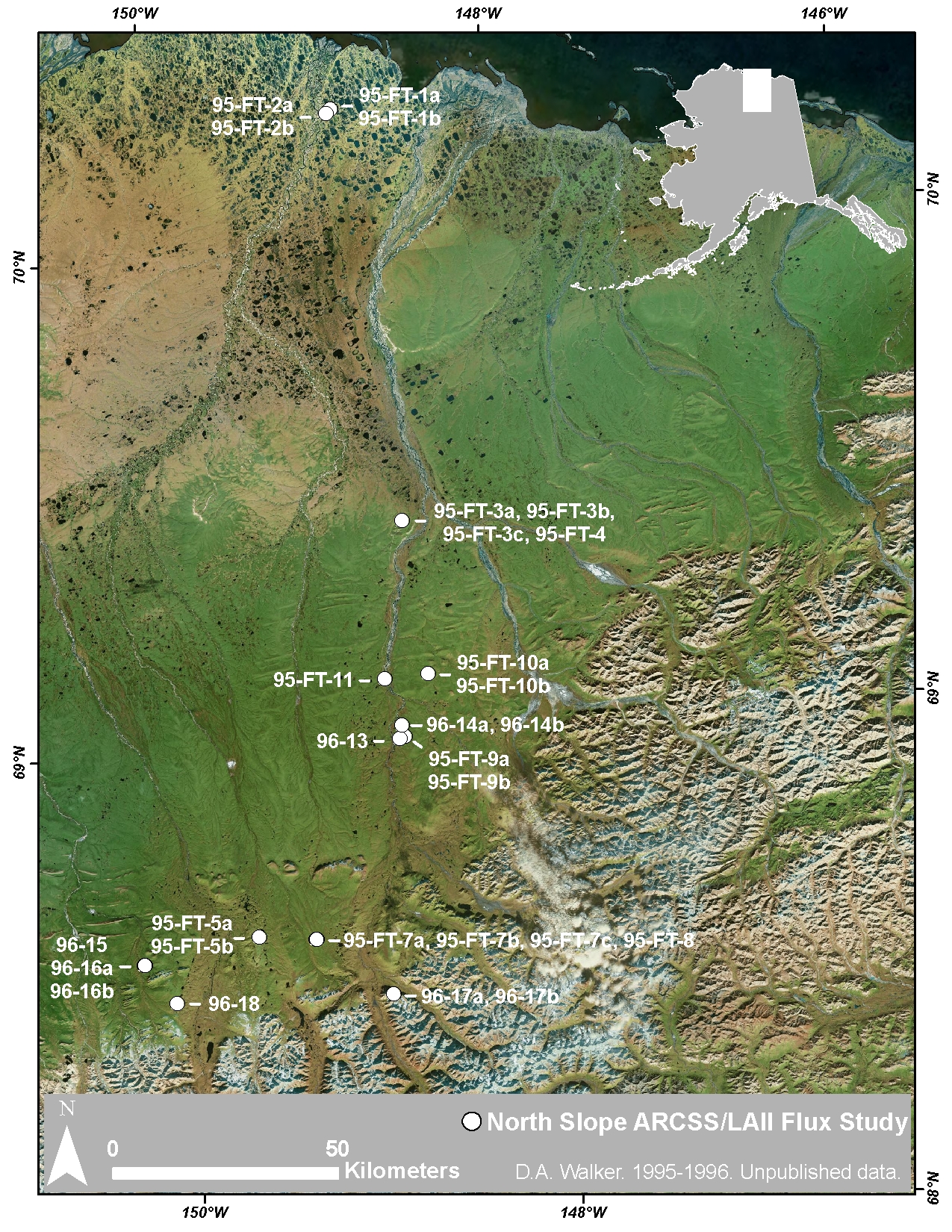
Arctic Vegetation Plots at ARCSS/LAII Flux Sites, North Slope, Alaska, 1995-1996
National Aeronautics and Space Administration —
This dataset provides vegetation cover and environmental plot and soil data collected at flux tower sites of the North Slope Arctic System Science/Land-Atmosphere-Ice... -
Federal
BOREAS HYD-06 Moss/Humus Moisture Data
National Aeronautics and Space Administration —
This data set contains water content measurements of the moss/humus layer, where it existed. These data were collected along various flight lines in the Southern and... -
Federal
ATom: Comprehensive Aerosol Properties, 2016-2018, Version 2
National Aeronautics and Space Administration —
This dataset contains comprehensive measurements of aerosol microphysical, chemical, and optical properties derived for both dry and ambient conditions from in situ... -
Federal
BOREAS NS001 TMS Level-0 Images in BIL Format
National Aeronautics and Space Administration —
For BOREAS, the NS001 TMS imagery, along with the other remotely sensed images, was collected in order to provide spatially extensive information over the primary... -
Federal
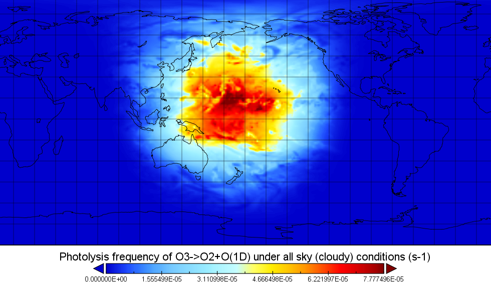
ATom: Global Modeled and CAFS Measured Cloudy and Clear Sky Photolysis Rates, 2016
National Aeronautics and Space Administration —
This dataset provides the results from nine global chemistry-climate or chemistry-transport models that estimated gridded values of atmospheric photolytic rates (J... -
Federal
Aspen Forest Cover by Stratum/Plot (SNF)
National Aeronautics and Space Administration —
The purpose of the Superior National Forest (SNF) study was to improve our understanding of the relationship between remotely sensed observations and important... -
Federal
BigFoot NPP Surfaces for North and South American Sites, 2000-2004
National Aeronautics and Space Administration —
The BigFoot project gathered Net Primary Production (NPP) data for nine EOS Land Validation Sites located from Alaska to Brazil from 2000 to 2004. Each site is...

Official websites use .gov
A
.gov website belongs to an official government
organization in the United States.
Secure .gov websites use HTTPS
A
lock (
) or https:// means you’ve safely connected to
the .gov website. Share sensitive information only on official,
secure websites.