
-
Federal
Ground-Based Global Navigation Satellite System (GNSS) Beidou Broadcast Ephemeris Data (30-second sampling, hourly files) from NASA CDDIS
National Aeronautics and Space Administration —
This dataset consists of ground-based Global Navigation Satellite System (GNSS) Beidou Broadcast Ephemeris Data (hourly files) from the NASA Crustal Dynamics Data... -
Federal
Lidar In-Space Technology Experiment (LITE) L1
National Aeronautics and Space Administration —
LITE_L1 data are LIDAR Vertical profile data along the orbital flight path of STS-64.Lidar In-Space Technology Experiment (LITE) used a three-wavelength (355 nm, 532... -
Federal
FIREX-AQ DC-8 High-Spectral Resolution Lidar (HSRL) Remotely Sensed Data
National Aeronautics and Space Administration —
FIREXAQ_HSRL_AircraftRemoteSensing_DC8_Data are remotely sensed data collected by the High-Spectral Resolution Lidar (HSRL) onboard the DC-8 aircraft during FIREX-AQ.... -
Federal
ENVISAT MERIS Global Binned Cyanobacteria Index (CI) Data, version 5.0
National Aeronautics and Space Administration —
Cyanobacteria Assessment Network (CyAN) is a multi-agency project among EPA, the National Aeronautics and Space Administration (NASA), the National Oceanic and... -
Federal
DC3 Merge Data Files
National Aeronautics and Space Administration —
DC3_Merge_Data are pre-generated merge data files collected during the Deep Convective Clouds and Chemistry (DC3) field campaign. This product contains merged data... -
Federal
Decadal Land Use and Land Cover Classifications across India, 1985, 1995, 2005
National Aeronautics and Space Administration —
This data set provides land use and land cover (LULC) classification products at 100-m resolution for India at decadal intervals for 1985, 1995 and 2005. The data... -
Federal
EMIT L2B Estimated Mineral Identification and Band Depth and Uncertainty 60 m V001
National Aeronautics and Space Administration —
The Earth Surface Mineral Dust Source Investigation (EMIT) instrument measures surface mineralogy, targeting the Earth’s arid dust source regions. EMIT is installed... -
Federal
Aquarius CAP Level 3 Wind Speed Standard Mapped Image 7-Day Data V5.0
National Aeronautics and Space Administration —
Version 5.0 Aquarius CAP Level 3 products are the fourth release of the AQUARIUS/SAC-D mapped salinity and wind speed data based on the Combined Active Passive (CAP)... -
Federal
Ancillary total PM data from the MAIA Surface Monitor Network
National Aeronautics and Space Administration —
The MAIA Surface Monitor Stage 0 files are an ancillary dataset containing processed particulate matter (PM) measurements collected from a global in-situ surface... -
Federal
BOREAS HYD-06 Ground Gravimetric Soil Moisture Data
National Aeronautics and Space Administration —
This data set contains percent soil moisture ground measurements. These data were collected on the ground along the various flight lines flown in the Southern and... -
Federal
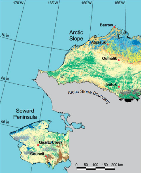
Arctic Vegetation Plots ATLAS Project North Slope and Seward Peninsula, AK, 1998-2000
National Aeronautics and Space Administration —
This data set provides environmental, soil, and vegetation data collected from study sites on the North Slope and Seward Peninsula of Alaska during the Arctic... -
Federal
Aquarius Official Release Level 3 Rain-flagged Sea Surface Salinity Standard Mapped Image Descending Seasonal Climatology Data V5.0
National Aeronautics and Space Administration —
Aquarius Level 3 sea surface salinity (SSS) rain-flagged standard mapped image data contains gridded 1 degree spatial resolution SSS averaged over daily, 7 day,... -
Federal
Autonomous Parsivel Unit (APU) IMPACTS
National Aeronautics and Space Administration —
The Autonomous Parsivel Unit (APU) IMPACTS data were collected in support of the Investigation of Microphysics and Precipitation for Atlantic Coast-Threatening... -
Federal
BOREAS TGB-12 Soil Carbon and Flux Data of NSA-MSA in Raster Format
National Aeronautics and Space Administration —
The BOREAS TGB-12 team made measurements of soil carbon inventories, carbon concentration in soil gases, and rates of soil respiration at several sites. This data set... -
Federal
COMEX: AVIRIS-Classic Facility Instrument Associated Flights and Information, 2014
National Aeronautics and Space Administration —
This dataset lists flight lines and provides data access links and contextual flight information for a subset of the AVIRIS-Classic Facility Instrument Collection... -
Federal
CYGNSS Level 1 Calibrated Raw IF Version 1.0
National Aeronautics and Space Administration —
The CYGNSS Level 1 Calibrated Raw IF Version 1.0 dataset is produced by the CYGNSS Science Team of the University of Michigan, and it contains the first release,... -
Federal
CYGNSS Level 3 Storm Centric Grid Science Data Record Version 1.0
National Aeronautics and Space Administration —
This dataset contains the Version 1.0 Cyclone Global Navigation Satellite System (CYGNSS) Level 3 Storm Centric Grid (SCG) Science Data Record (SDR) which provides... -
Federal
BOREAS TF-03 NSA-OBS Tower Flux, Meteorological, and Soil Temperature Data
National Aeronautics and Space Administration —
The BOREAS TF-03 team collected tower flux, surface meterological, and soil temperature data at the BOREAS NSA-OBS site continuously from the March 1994 through... -
Federal
BOREAS RSS-14 GOES-8 Level-1a Visible, Infrared and Water Vapor Images
National Aeronautics and Space Administration —
The BOREAS RSS-14 team collected and processed several GOES-7 and GOES-8 image data sets that covered the BOREAS study region. The level-1a GOES-8 images were created... -
Federal
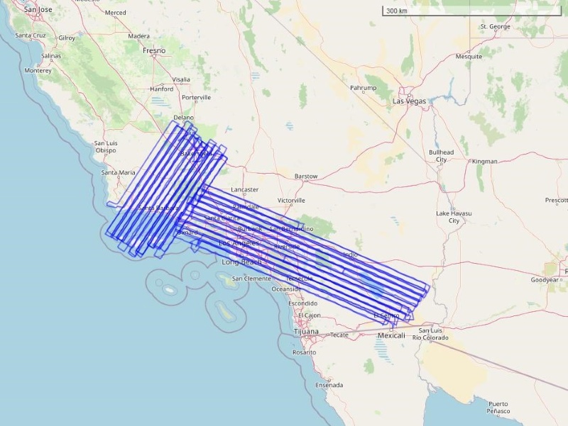
AirMOSS: L1 S-0 Polarimetric Data from AirMOSS P-band SAR, Metolius, 2012-2015
National Aeronautics and Space Administration —
This data set provides level 1 (L1) polarimetric radar backscattering coefficient (sigma-0), multilook complex, polarimetrically calibrated, and georeferenced data...

Official websites use .gov
A
.gov website belongs to an official government
organization in the United States.
Secure .gov websites use HTTPS
A
lock (
) or https:// means you’ve safely connected to
the .gov website. Share sensitive information only on official,
secure websites.