
-
Federal
Waveglider data for the SPURS-1 N. Atlantic field campaign
National Aeronautics and Space Administration —
The SPURS (Salinity Processes in the Upper Ocean Regional Study) project is an oceanographic process study and associated field program that aim to elucidate key... -
Federal
VIIRS/NPP BRDF/Albedo BSA at Solar Noon ShortWave Daily L3 Global 30ArcSec CMG V001
National Aeronautics and Space Administration —
The VNP43D65 Version 1 data product was decommissioned on July 31, 2025. Users are encouraged to use the VNP43D65 and VJ143D65 Version 2 data products.The NASA/NOAA... -
Federal
VIIRS/NPP BRDF/Albedo Model Parameters Daily L3 Global 1km SIN Grid V001
National Aeronautics and Space Administration —
The VNP43MA1 Version 1 data product was decommissioned on July 31, 2025. Users are encouraged to use the VNP43MA1 and VJ143MA1 Version 2 data products.The NASA/NOAA... -
Federal
TROPESS Chemical Reanalysis NO2 Spread 6-Hourly 3-dimensional Product V1 (TRPSCRNO2S6H3D) at GES DISC
National Aeronautics and Space Administration —
The TROPESS Chemical Reanalysis NO2 Spread 6-Hourly 3-dimensional Product contains the nitrogen dioxide ensemble spread, a measure of data assimilation analysis... -
Federal
TROPESS CrIS-JPSS1 L2 Carbon Monoxide for Forward Stream, Summary Product V1 (TRPSYL2COCRS1FS) at GES DISC
National Aeronautics and Space Administration —
The TROPESS CrIS-JPSS1 L2 Carbon Monoxide for Forward Stream, Summary Product contains the vertical distribution of the retrieved atmospheric state of carbon monoxide... -
Federal
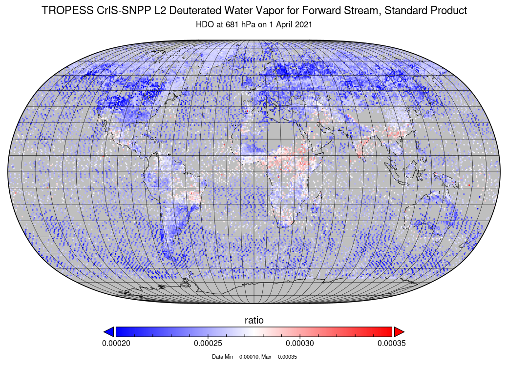
TROPESS CrIS-SNPP L2 Deuterated Water Vapor for Forward Stream, Standard Product V1 (TRPSDL2HDOCRSFS) at GES DISC
National Aeronautics and Space Administration —
The TROPESS CrIS-SNPP L2 Deuterated Water Vapor for Forward Stream, Standard Product contains the vertical distribution of the retrieved atmospheric state of semi-... -
Federal
MISR Level 3 Global Cloud public Product in netCDF format covering a day V002
National Aeronautics and Space Administration —
MI3DCLDN_2 is the Multi-angle Imaging SpectroRadiometer (MISR) Level 3 Global Cloud public Product in netCDF format covering a day version 2. It contains the public... -
Federal
MetOp-B ASCAT Scatterometer Inter-Calibrated ESDR Level 2 Ocean Surface Equivalent Neutral Wind Vectors and Wind Stress Vectors Version 1.1
National Aeronautics and Space Administration —
This dataset contains ocean surface wind vectors (equivalent neutral and true 10m) and wind stress vectors derived from satellite-based scatterometer observations... -
Federal
MISR L1B3 Radiometric Camera-by-camera Cloud Mask Product subset for the RICO region V004
National Aeronautics and Space Administration —
RICMIRCM_004 is the Multi-angle Imaging SpectroRadiometer (MISR) Level 1B3 Radiometric Camera-by-camera Cloud Mask Product subset for the RICO region version 4. This... -
Federal
LBA-ECO CD-08 Radiocarbon Dates for Large Trees from a Forest near Manaus, Brazil
National Aeronautics and Space Administration —
This data set reports the ages and growth rates of trees as determined by radiocarbon dating (14C), selected from a logging operation near the city of Itacoatiara,... -
Federal
LBA-ECO CD-04 Soil Moisture Data, km 83 Tower Site, Tapajos National Forest, Brazil
National Aeronautics and Space Administration —
This data set reports continuous high-resolution frequency-domain reflectometry measurements of soil moisture to 10 m depth and precipitation data near each of the... -
Federal
LBA-ECO CD-10 CO2 Profiles at km 67 Tower Site, Tapajos National Forest
National Aeronautics and Space Administration —
Eddy fluxes of CO2 and H2O are measured at two levels (58m and 47m) using tower-mounted closed-path Licor 6262 analyzers and Campbell CSAT3 sonic anemometers. A third... -
Federal
BARREL 2W Data Processing Unit (HKPG) Analog Housekeeping Voltage, Temperature, Current, and Payload Status, Level 2, 40 s Data
National Aeronautics and Space Administration —
Housekeeping voltage, temperature, current, and payload status values returned every 40 s. NOTE: The analog sensor data in these records are based on the nominal... -
Federal
S-MODE Pre-Pilot Ocean Wave Slope from Visible-Band Polarimetry at the Air-Sea Interaction Tower Version 1
National Aeronautics and Space Administration —
These wave slope data from polarimetry described below are considered preliminary and should not be used for any purpose without consulting Chris Zappa... -
Federal
BOREAS Follow-On DSP-10 Regridded Moss Cover Maps for 1994
National Aeronautics and Space Administration —
Existing 1-km moss cover classifications were reprocessed and are now available at multiple resolutions (2 km, 10x5 minutes, and 0.5 degree). These data were... -
Federal
CALIPSO Lidar Level 2 Vertical Feature Mask (VFM), V4-20
National Aeronautics and Space Administration —
CAL_LID_L2_VFM-Standard-V4-20 is the Cloud-Aerosol Lidar and Infrared Pathfinder Satellite Observations (CALIPSO) Lidar Level 2 Vertical Feature Mask (VFM), Version... -
Federal
QuikSCAT Level 2B Ocean Wind Vectors in 12.5km Slice Composites Version 3
National Aeronautics and Space Administration —
This dataset contains the latest reprocessed version 3 of the Level 2B science-quality ocean surface wind vector retrievals from the QuikSCAT scatterometer. The... -
Federal
Data over the SSA in Raster Format and AEAC Projection
National Aeronautics and Space Administration —
This data set consists of GIS layers that describe the soils of the BOREAS SSA. The original data were submitted as vector layers that were gridded by BOREAS staff to... -
Federal
Aquarius Official Release Level 3 Wind Speed Standard Mapped Image 7-Day Data V5.0
National Aeronautics and Space Administration —
Aquarius Level 3 ocean surface wind speed standard mapped image data contains gridded 1 degree spatial resolution wind speed data averaged over daily, 7 day, monthly,...

Official websites use .gov
A
.gov website belongs to an official government
organization in the United States.
Secure .gov websites use HTTPS
A
lock (
) or https:// means you’ve safely connected to
the .gov website. Share sensitive information only on official,
secure websites.