

423 datasets found
-
Federal
Lunar Grid Reference System Rasters and Shapefiles recent views
Department of the Interior —
USGS is assessing the feasibility of a map projections and grid systmes for lunar surface operations. We propose developing a new Lunar Transverse Mercator (LTM), the... -
Federal
ARECIBO MOON RADIO TELESCOPE DERIVED 12.6 CM RADAR V1.0 recent views
National Aeronautics and Space Administration —
Radar scaled backscatter cross section images of the Moon made with the 12.6 cm wavelength radar at Arecibo Observatory. The data are corrected for antenna beam... -
Federal
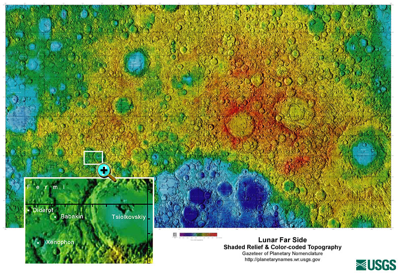
Gazetteer of Planetary Nomenclature: Moon: 1:10 million-scale Shaded Relief and Color-coded Topography: Far Side recent views
National Aeronautics and Space Administration —
These lunar maps display the four different areas of the moon with color-coded topography in low and high resolution approved by the International Astronomical Union...
423 datasets found