

4,207 datasets found for "k98여우알바오피현금알바^✅텔레그램문의superman119※"
-
Federal
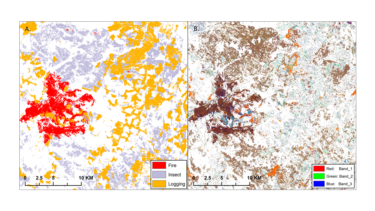
ABoVE: Landsat-derived Annual Disturbance Agents Across ABoVE Core Domain, 1987-2012
National Aeronautics and Space Administration —
This dataset provides spatial data on disturbance agents of fire, insects, and logging in the Arctic Boreal Vulnerability Experiment (ABoVE) core domain at an annual... -
State
i06 Bathy ESA 20190413 SutterBypass
State of California —
This service, (i06_SingleBeam_Bathymetry) is a service containing point feature layers with single beam bathymetric data collected by California Department of Water... -
State
Vegetation - San Mateo County [ds3021]
State of California —
In 2018, the Golden Gate National Parks Conservancy (Parks Conservancy) (https://parksconservancy.org), non-profit support partner to the National Park Service (NPS)... -
State
StructureCharacter
State of California —
Statewide Property Inventory started in 1989 per legislation 11011.15, to begin a pro-active approach to managing the State’s Real Property assets in a computerized... -
State
Vegetation Grasslands - Alameda and Contra Costa County [ds3205]
State of California —
At the request of the East Bay Regional Parks District (EBPRD), Nomad Ecology (Nomad), Benson Bio Consulting (Shelly Benson), and Tukman Geospatial (project manager... -
Federal
NOAA/WDS Paleoclimatology - Margolis fire data from Little Tesuque South plot 2, Northern New Mexico - IMPD USLS2001
National Oceanic and Atmospheric Administration, Department of Commerce —
This archived Paleoclimatology Study is available from the NOAA National Centers for Environmental Information (NCEI), under the World Data Service (WDS) for...
4,207 datasets found for "k98여우알바오피현금알바^✅텔레그램문의superman119※"