

4,129 datasets found for "25a지역스웨디시디비[-텔레popkonDB❤️ㄱ"
-
Federal
VIIRS/NPP BRDF/Albedo Parameter 1 NIR Daily L3 Global 30 ArcSec CMG V002
National Aeronautics and Space Administration —
The NASA/NOAA Suomi National Polar-orbiting Partnership (Suomi NPP) Visible Infrared Imaging Radiometer Suite (VIIRS) Bidirectional Reflectance Distribution Function... -
Federal
Standard Deviation of Monthly Frequency of Dust Storm over Land for Varying Intensities, Based on MODIS Aqua Deep Blue Level 2 Aerosol Products MYD04_L2 Collection 6.1, on a Global 0.1 by 0.1 Degree Grid, Level 3 Version 1 (MYDFDS_SDV_GLB_L3) at GES DISC
National Aeronautics and Space Administration —
Version 1 is the current version of the dataset.This collection MYDFDS_SDV_GLB_L3 provides level 3 standard deviation of climatological monthly frequency of dust... -
Federal
SMEX03 Soil Climate Analysis Network (SCAN): Oklahoma, Version 1
National Aeronautics and Space Administration —
This data set contains measurements taken during the Soil Moisture Experiment 2003 (SMEX03) from sensors at Soil Climate Analysis Network (SCAN) stations located in... -
Federal
SEASAT SCATTEROMETER DEALIASED OCEAN WIND VECTORS (Wentz et al.)
National Aeronautics and Space Administration —
Contains Seasat-A Scatterometer (SASS) wind vector measurements for the entire Seasat mission, from July 1978 until October 1978. The data are global and presented... -
Federal
RLC Forest Fire Images in Russia, 1998-1999
National Aeronautics and Space Administration —
This data set is made up of images of forest fires in Russia from NOAA's Operational Significant Event Imagery (OSEI) archive (http://www.osei.noaa.gov) for the 1998... -
Federal
MODIS/Terra+Aqua BRDF/Albedo Nadir BRDF-Adjusted Ref Daily L3 Global 0.05Deg CMG V006
National Aeronautics and Space Administration —
The MCD43C4 Version 6 data product was decommissioned on July 31, 2023. Users are encouraged to use the MCD43C4 Version 6.1 data product.The Moderate Resolution... -
Federal
Monthly Frequency of Dust Storm over Land for Varying Intensities, Based on MODIS Terra Deep Blue Level 2 Aerosol Products MOD04_L2 Collection 6.1, on a Global 0.1 by 0.1 Degree Grid, Level 3 Version 1 (MODFDS_MON_GLB_L3) at GES DISC
National Aeronautics and Space Administration —
Version 1 is the current version of the dataset.This collection MODFDS_MON_GLB_L3 provides level 3 monthly frequency of dust storms (FDS) over land from 175°W to... -
Federal
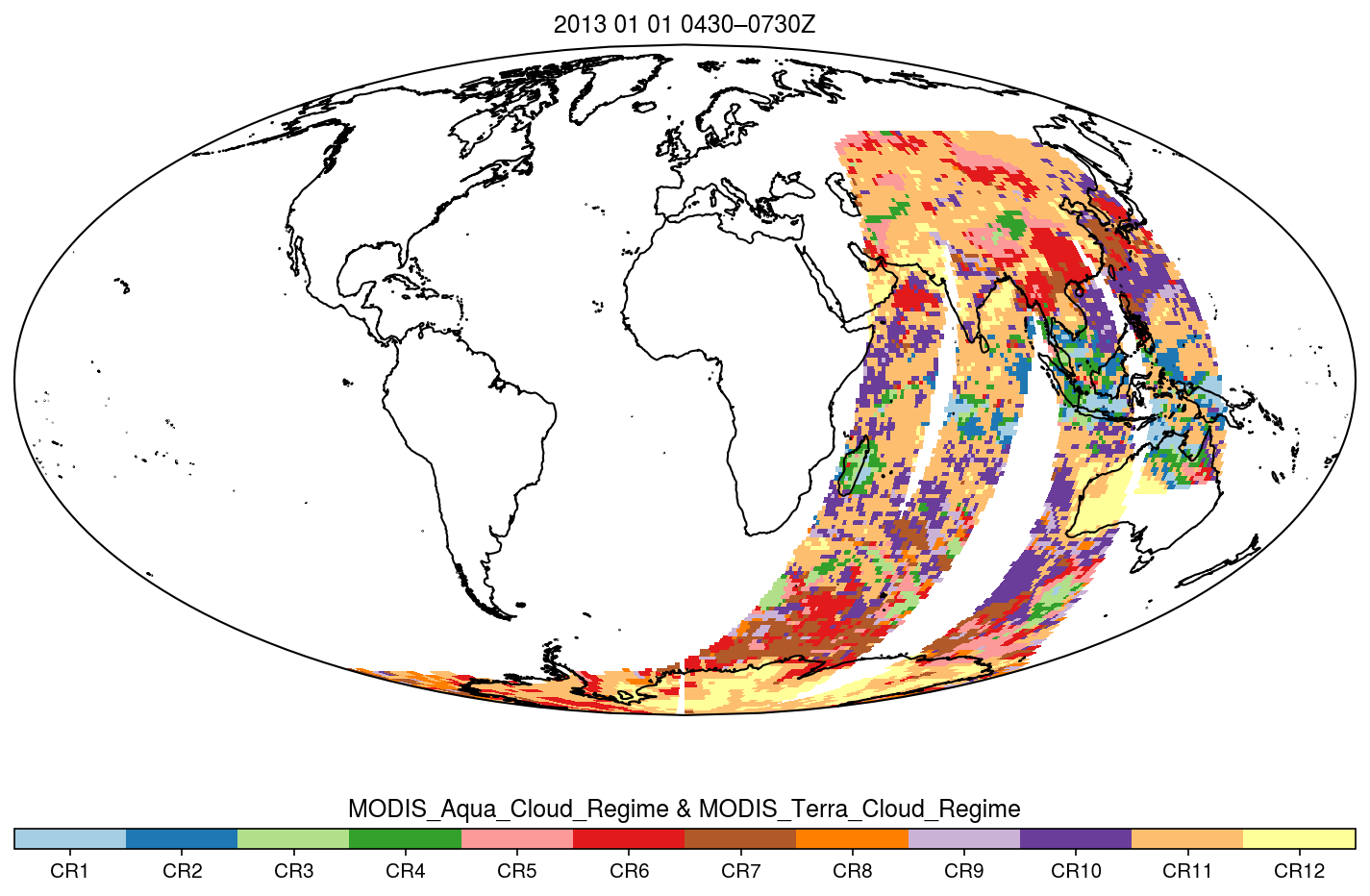
MODIS_CR_Equal_Area_3h
National Aeronautics and Space Administration —
The MODIS Collection 6.1 Equal-Area Three-Hourly Cloud Regime product. This product is a discrete classification of cloud fields at the mesoscale as observed by the... -
Federal
Gamma Ray Data: Peck (FIFE)
National Aeronautics and Space Administration —
Airborne soil moisture measurement is based on the difference between natural terrestrial gamma radiation flux measured for comparatively wet and dry soils. The...
4,129 datasets found for "25a지역스웨디시디비[-텔레popkonDB❤️ㄱ"