
-
Federal
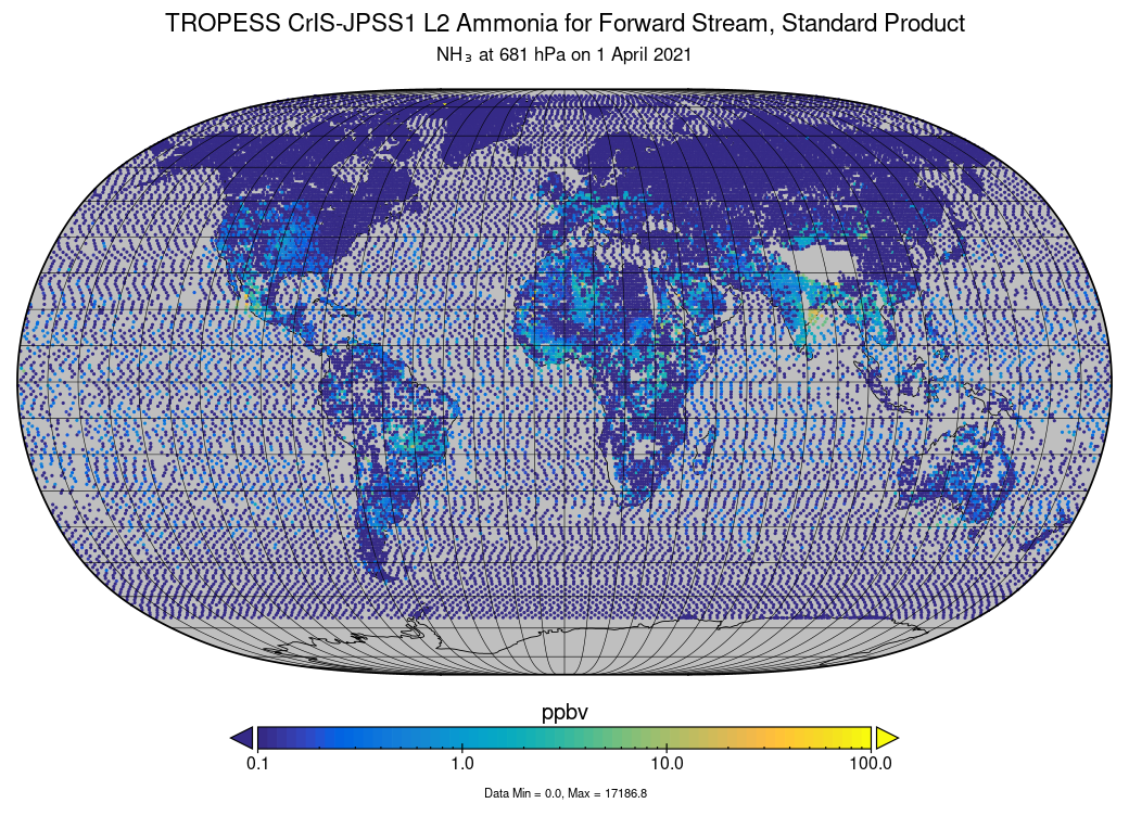
TROPESS CrIS-JPSS1 L2 Ammonia for Forward Stream, Standard Product V1 (TRPSDL2NH3CRS1FS) at GES DISC
National Aeronautics and Space Administration —
The TROPESS CrIS-JPSS1 L2 Ammonia for Forward Stream, Standard Product contains the vertical distribution of the retrieved atmospheric state of ammonia (NH3), formal... -
Federal
Next Generation Weather Radar (NEXRAD) Radar Line-of-Sight
Department of Energy —
The Next Generation Weather Radar (NEXRAD) system is a network of doppler radar operated jointly by the National Weather Service (NWS), the Federal Aviation... -
Federal
Characterization data on the effects of micro-computed tomography-based x-ray radiation on vinyl nitrile foam
National Institute of Standards and Technology —
This dataset contains information from investigating the effects of micro-computed tomographic imaging irradiation on vinyl nitrile foam and code for a finite element... -
Federal
TOVS GLA 5 DAY GRIDS from NOAA-12 V01 (TOVSA5ND) at GES DISC
National Aeronautics and Space Administration —
This dataset (TOVSA5ND) contains the TIROS Operational Vertical Sounder (TOVS) level 3 geophysical parameters derived using data from NOAA-12 and the physical... -
Federal
TROPESS CrIS-SNPP L2 for Mexico City Megacity, Standard Product V1 (TRPSDL2ALLCRSMGMEX) at GES DISC
National Aeronautics and Space Administration —
The TROPESS CrIS-SNPP L2 for Mexico City Megacity, Standard Product contains the vertical distribution of seven retrieved atmospheric gases (CH4, CO, H2O, HDO, NH3,... -
Federal
Aircraft Flux-Filtered: U of Wy. (FIFE)
National Aeronautics and Space Administration —
The University of Wyoming (UW) King Air atmospheric boundary layer measurement missions were flown in 1987 during IFCs 3 and 4. This Boundary Layer Fluxes data set... -
Federal
NWS Daily Climatology Data: 1990 (SNF)
National Aeronautics and Space Administration —
Weather data were collected by the National Weather Service in International Falls, Minnesota. International Falls is about 80 miles from the SNF, but the weather... -
Federal
TROPESS CrIS-SNPP L2 Ammonia for West Coast Fires, Standard Product V1 (TRPSDL2NH3CRSWCF) at GES DISC
National Aeronautics and Space Administration —
The TROPESS CrIS-SNPP L2 Ammonia for West Coast Fires, Standard Product contains the vertical distribution of the retrieved atmospheric state of ammonia (NH3), formal... -
Federal
TOVS LMD MONTHLY GRIDS from NOAA-12 V01 (TOVSBMND) at GES DISC
National Aeronautics and Space Administration —
Level 3 parameters from HIRS/2 and MSU radiances using the Improved Initialization Inversion (3I) classification retrieval scheme by the Laboratoire de Meteorologie... -
Federal
TOVS LMD DAILY GRIDS from NOAA-12 V01 (TOVSBDND) at GES DISC
National Aeronautics and Space Administration —
Level 3 parameters from HIRS/2 and MSU radiances using the Improved Initialization Inversion (3I) classification retrieval scheme by the Laboratoire de Meteorologie... -
Federal
TOVS GLA DAILY GRIDS from NOAA-9 V01 (TOVSADNF) at GES DISC
National Aeronautics and Space Administration —
This dataset (TOVSADNF) contains the TIROS Operational Vertical Sounder (TOVS) level 3 geophysical parameters derived using data from NOAA-9 and the physical... -
Federal
TOVS GLA 5 DAY GRIDS from NOAA-9 V01 (TOVSA5NF) at GES DISC
National Aeronautics and Space Administration —
This dataset (TOVSA5NF) contains the TIROS Operational Vertical Sounder (TOVS) level 3 geophysical parameters derived using data from NOAA-9 and the physical... -
Federal
OCO-2 Level 2 geolocated XCO2 retrievals results, physical model V11.2 (OCO2_L2_Standard) at GES DISC
National Aeronautics and Space Administration —
Version 11.2 is the current version of the data set. Older versions will no longer be available and are superseded by Version 11.2. The Orbiting Carbon Observatory is... -
Federal
FLDAS Noah Land Surface Model L4 Global Monthly 0.1 x 0.1 degree (MERRA-2 and CHIRPS) V001 (FLDAS_NOAH01_C_GL_M) at GES DISC
National Aeronautics and Space Administration —
This dataset contains a series of land surface parameters simulated from the Noah 3.6.1 model in the Famine Early Warning Systems Network (FEWS NET) Land Data... -
Federal
TROPESS CrIS-SNPP L2 for Beijing Megacity, Standard Product V1 (TRPSDL2ALLCRSMGBEI) at GES DISC
National Aeronautics and Space Administration —
The TROPESS CrIS-SNPP L2 for Beijing Megacity, Standard Product contains the vertical distribution of seven retrieved atmospheric gases (CH4, CO, H2O, HDO, NH3, O3... -
Federal
TROPESS CrIS-SNPP L2 for Delhi Megacity, Standard Product V1 (TRPSDL2ALLCRSMGDEL) at GES DISC
National Aeronautics and Space Administration —
The TROPESS CrIS-SNPP L2 for Delhi Megacity, Standard Product contains the vertical distribution of seven retrieved atmospheric gases (CH4, CO, H2O, HDO, NH3, O3 and... -
Federal
Global Forest Ecosystem Structure and Function Data For Carbon Balance Research
National Aeronautics and Space Administration —
A comprehensive global database has been assembled to quantify CO2 fluxes and pathways across different levels of integration (from photosynthesis up to net ecosystem... -
Federal
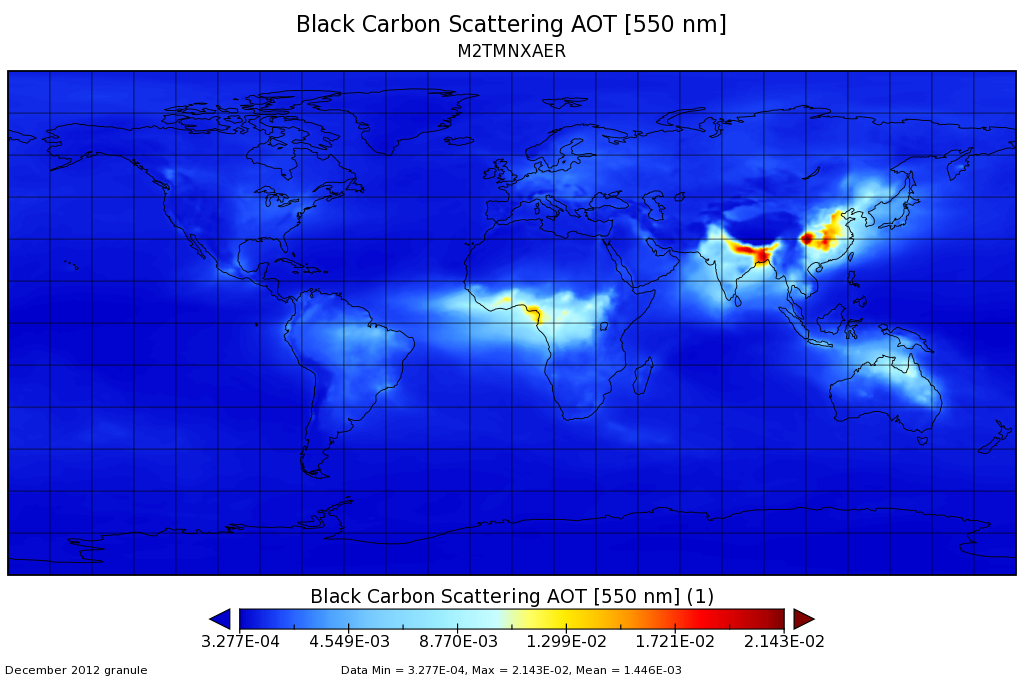
MERRA-2 tavgM_2d_aer_Nx: 2d,Monthly mean,Time-averaged,Single-Level,Assimilation,Aerosol Diagnostics 0.625 x 0.5 degree V5.12.4 (M2TMNXAER) at GES DISC
National Aeronautics and Space Administration —
M2TMNXAER (or tavgM_2d_aer_Nx) is a time-averaged 2-dimensional monthly mean data collection in Modern-Era Retrospective analysis for Research and Applications... -
Federal
TOVS GLA DAILY GRIDS from NOAA-12 V01 (TOVSADND) at GES DISC
National Aeronautics and Space Administration —
This dataset (TOVSADND) contains the TIROS Operational Vertical Sounder (TOVS) level 3 geophysical parameters derived using data from NOAA-12 and the physical... -
Federal
Sources of Methane Emissions (Vista-CA), State of California, USA
National Aeronautics and Space Administration —
This dataset provides spatial data products with identified and organized locations of potential methane (CH4) emitting facilities and infrastructure spanning the...

Official websites use .gov
A
.gov website belongs to an official government
organization in the United States.
Secure .gov websites use HTTPS
A
lock (
) or https:// means you’ve safely connected to
the .gov website. Share sensitive information only on official,
secure websites.