
-
Federal
Wind SMS Suite SupraThermal Ion Composition Spectrometer (SMS/STICS) Ion Angular Flux Maps (AFMs), Level 2 (L2), 30-minute Data in Solar Wind
National Aeronautics and Space Administration —
The data include Wind STICS 30-minute Angular Flux Maps (AFMs) for selected ion species using triple coincidence (H+, He+, He2+, C5+, O+, O6+, and Fe10+) and double... -
Federal
Hurricane and Severe Storm Sentinel (HS3) Statistical Hurricane Intensity Prediction Scheme (SHIPS) Intensity V1
National Aeronautics and Space Administration —
The Hurricane and Severe Storm Sentinel (HS3) Statistical Hurricane Intensity Prediction Scheme (SHIPS) Intensity dataset was obtained from March 18, 2014 through... -
Federal
PEM West A In-Situ DC-8 Meteorology and Navigation Data
National Aeronautics and Space Administration —
PEM-West-A_MetNav_AircraftInSitu_DC8_Data is the in situ meteorology and navigation data collected onboard the DC-8 aircraft during the Pacific Exploratory Mission... -
Federal
SARP 2015 Data
National Aeronautics and Space Administration —
SARP_2015_Data is the data collected onboard the NASA DC-8 aircraft during the 2015 deployment of the Student Airborne Research Program (SARP) mission. Data... -
Federal
NAMMA SMART-COMMIT MOBILE LABORATORIES V1
National Aeronautics and Space Administration —
The NAMMA SMART-COMMIT Mobile Laboratories dataset consists of data obtained from a suite of in situ and remote sensing instruments which measure parameters that... -
Federal
NAMMA PRAIA CAPE VERDE RADIOSONDE V1
National Aeronautics and Space Administration —
The NAMMA Praia Cape Verde Radiosonde data used Sippican MarkIIa DGPS (LOS) radiosondes, which were launched in support of NASA African Monsoon Multidisciplinary... -
Federal
NAMMA SENEGAL RADIOSONDE AND TOWER FLUX DATA V1
National Aeronautics and Space Administration —
The NAMMA Senegal Radiosonde and Tower Flux data includes measurements of humidity, wind speed/direction and velocity. Additionally, the flux data includes... -
Federal
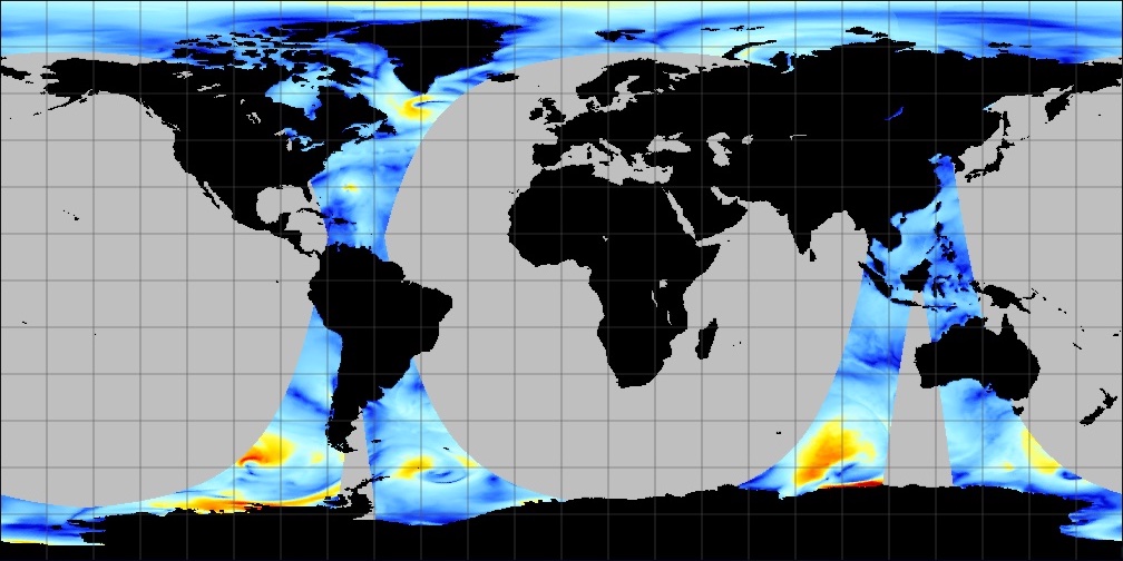
SCATSAT-1 ESDR Level 2 Ancillary Ocean Surface Fields Version 1.1
National Aeronautics and Space Administration —
This dataset contains the first science quality release (post-provisional after v1.0) of the MEaSUREs-funded Earth Science Data Record (ESDR) of ancillary data... -
Federal
MISR Level 3 FIRSTLOOK Global Cloud public Product in netCDF covering a day V002
National Aeronautics and Space Administration —
MI3DCDNF_002 is the Multi-angle Imaging SpectroRadiometer (MISR) Level 3 FIRSTLOOK Global Cloud public Product in netCDF covering a day version 2. It contains the... -
Federal
MISR Level 3 FIRSTLOOK Component Global Cloud Product covering a day V002
National Aeronautics and Space Administration —
This file contains the public MISR Level 3 FIRSTLOOK Component Global Cloud Product covering a day.MI3DCDF_002 is the Multi-angle Imaging SpectroRadiometer (MISR)... -
Federal
MISR Level 3 FIRSTLOOK Component Global Radiance Product covering a day V002
National Aeronautics and Space Administration —
This file contains the MISR Level 3 FIRSTLOOK Component Global Radiance Product covering a day.MI3DRDF_002 is the Multi-angle Imaging SpectroRadiometer (MISR) Level 3... -
Federal
JPL SMAP Level 2B Near Real-time CAP Sea Surface Salinity V5.0 Validated Dataset
National Aeronautics and Space Administration —
This is the PI-produced JPL SMAP-SSS V5.0, level 2B NRT CAP, validated sea surface salinity (SSS) and extreme winds orbital/swath product from the NASA Soil Moisture... -
Federal
HURRICANE AND SEVERE STORM SENTINEL (HS3) GLOBAL HAWK ADVANCED VERTICAL ATMOSPHERIC PROFILING SYSTEM (AVAPS) DROPSONDE SYSTEM V2
National Aeronautics and Space Administration —
The Hurricane and Severe Storm Sentinel (HS3) Global Hawk Advanced Vertical Atmospheric Profiling System (AVAPS) Dropsonde System dataset was collected by the... -
Federal
MISR Derived Case Study Data for Iceland Volcanic Eruptions (Eyjafjallajokull, Grimsvotn, Holuhraun) Including Geometric Plume Height and Qualitative Radiometric Particle Property Information
National Aeronautics and Space Administration —
This dataset comprises MISR-derived output from a comprehensive analysis of Icelandic volcano eruptions (Eyjafjallajokull 2010, Grimsvotn 2011, Holuhraun 2014-2015).... -
Federal
MISR FIRSTLOOK radiometric camera-by-camera Cloud Mask V001
National Aeronautics and Space Administration —
MIRCCMF_001 is the Multi-angle Imaging SpectroRadiometer (MISR) FIRSTLOOK radiometric camera-by-camera Cloud Mask (RCCM) version 1 data product. It was produced using... -
Federal
MISR Level 2 TOA/Cloud Stereo Product subset for the VBBE region V002
National Aeronautics and Space Administration —
VBEMI2ST_002 is the Multi-angle Imaging SpectroRadiometer (MISR) Level 2 TOA/Cloud Stereo Product subset for the VBBE region version 2. It contains the... -
Federal
SARP 2018 Data
National Aeronautics and Space Administration —
SARP_2018_Data is the data collected onboard the NASA DC-8 aircraft during the 2018 deployment of the Student Airborne Research Program (SARP) mission. Data... -
Federal
Puerto Rico Radiosondes CPEX-AW V1
National Aeronautics and Space Administration —
The Puerto Rico Radiosondes CPEX-AW dataset consists of atmospheric pressure, atmospheric temperature, relative humidity, wind speed, and wind direction measurements.... -
Federal
SARP 2024 Data
National Aeronautics and Space Administration —
SARP_2024_Data is the data collected onboard the NASA P-3B and the Dynamic Aviation B200 aircrafts during the 2024 deployment of the Student Airborne Research Program... -
Federal
RapidScat Level 2B Ocean Wind Vectors in 12.5km Slice Composites Version 1.3
National Aeronautics and Space Administration —
This dataset contains the RapidScat Level 2B 12.5km Version 1.3 science-quality ocean surface wind vectors, which are intended as a replacement and continuation of...

Official websites use .gov
A
.gov website belongs to an official government
organization in the United States.
Secure .gov websites use HTTPS
A
lock (
) or https:// means you’ve safely connected to
the .gov website. Share sensitive information only on official,
secure websites.