

32 datasets found for "Watts"
-
Federal
CYGNSS Level 1 Climate Data Record Version 1.2
National Aeronautics and Space Administration —
This Level 1 (L1) dataset contains the Version 1.2 Climate Data Record (CDR) of the geo-located Delay Doppler Maps (DDMs) calibrated into Power Received (Watts) and... -
Federal
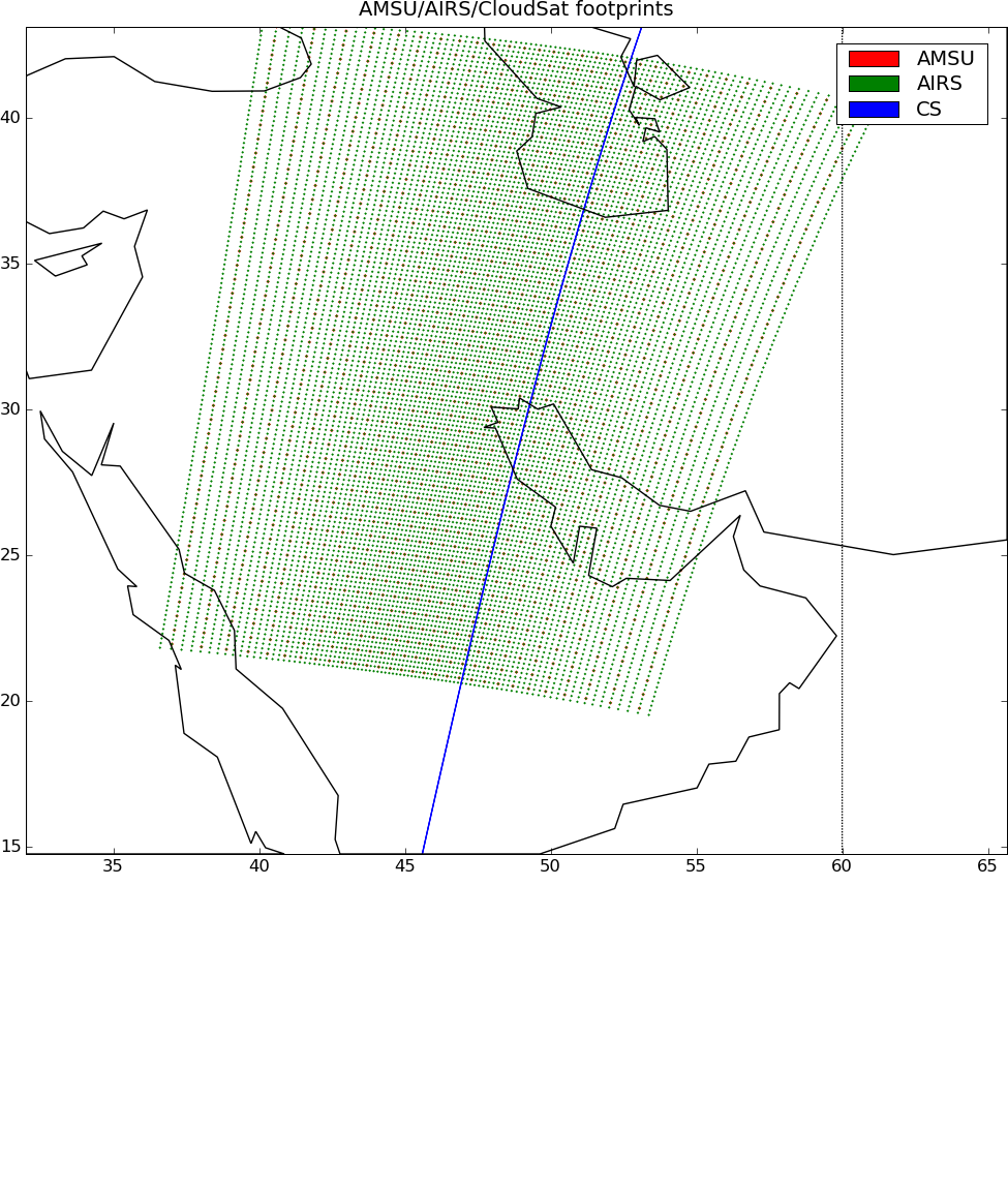
AIRS-CloudSat cloud mask, radar reflectivities, and cloud classification matchups V3.2 (AIRS_CPR_MAT) at GES DISC
National Aeronautics and Space Administration —
This is AIRS-CloudSat collocated subset, in NetCDF-4 format. These data contain collocated: AIRS Level 1b radiances spectra, CloudSat radar reflectivities, and MODIS... -
Federal
AIRS-AMSU variables-CloudSat cloud mask, radar reflectivities, and cloud classification matchups V3.2 (AIRSM_CPR_MAT) at GES DISC
National Aeronautics and Space Administration —
This is AIRS-CloudSat collocated subset, in NetCDF 4 format. These data contain collocated: AIRS/AMSU retrievals at AMSU footprints, CloudSat radar reflectivities,... -
Federal
NOAA GOES-R Series Advanced Baseline Imager (ABI) Level 2 Downward Shortwave Radiation: Surface (DSR)
National Oceanic and Atmospheric Administration, Department of Commerce —
The GOES-R Advanced Baseline Imager (ABI) Downward Shortwave Radiation (DSR): Surface product contains an image with pixel values identifying the instantaneous total... -
Federal
Meteorology and soil temperatures, Hot Weather Creek, Ellesmere Island, NWT, Canada, Version 1
National Aeronautics and Space Administration —
The instrumentation was installed in June 1988 and was initially maintained by the Arctic Adaptation Division Canadian Climate Centre, Atmospheric Environment Service... -
Federal
Sounder SIPS: AQUA AIRS IR + MW Level 2 CLIMCAPS: Cloud Cleared Radiances V2 at GES DISC
National Aeronautics and Space Administration —
The CLIMCAPS (Community Long-term Infrared Microwave Coupled Product System) algorithm is used to analyze data from the AIRS (Atmospheric Infrared Sounder) and AMSU... -
Federal
CYGNSS Level 1 Science Data Record Version 3.0
National Aeronautics and Space Administration —
This Level 1 (L1) dataset contains the Version 3.0 geo-located Delay Doppler Maps (DDMs) calibrated into Power Received (Watts) and Bistatic Radar Cross Section... -
Federal
Bench Testing Data and Report for an Early Prototype Pitch Resonator WEC
Department of Energy —
This dataset encompasses data and documentation from bench tests conducted on an early prototype of a "pitch resonator" wave energy converter (WEC). The testing aimed... -
Federal
AIRS/Aqua L1B Near Real Time (NRT) Infrared (IR) geolocated and calibrated radiances V005 (AIRIBRAD_NRT) at GES DISC
National Aeronautics and Space Administration —
WARNING: On 2021/09/23 the EOS Aqua executed a Deep Space Maneuver (DSM). In the DSM, the spacecraft is turned such that the normal Earth field of regard is deep... -
Federal
NOAA GOES-R Series Advanced Baseline Imager (ABI) Level 2 Reflected Shortwave Radiation Top-of-Atmosphere
National Oceanic and Atmospheric Administration, Department of Commerce —
The GOES-R Advanced Baseline Imager (ABI) Reflected Shortwave Radiation (RSR): TOA product contains an image with pixel values identifying the instantaneous total... -
University
Soil Survey Geographic (SSURGO) database for De Baca County Area, New Mexico
Earth Data Analysis Center, University of New Mexico —
This data set is a digital soil survey and generally is the most detailed level of soil geographic data developed by the National Cooperative Soil Survey. The... -
Federal
Dissolved inorganic carbon, alkalinity, temperature, salinity and other variables collected from discrete sample and profile observations using CTD, bottle and other instruments from THOMAS G. THOMPSON in the North Pacific Ocean from 2004-04-24 to 2004-06-01 (NCEI Accession 0115590)
National Oceanic and Atmospheric Administration, Department of Commerce —
This dataset includes discrete sample and profile data collected from THOMAS G. THOMPSON in the North Pacific Ocean from 2004-04-24 to 2004-06-01. These data include...
32 datasets found for "Watts"