
-
Federal
Coastal Relief Models (CRMs)
National Oceanic and Atmospheric Administration, Department of Commerce —
Coastal Relief Models CRMs provide seamless topographic and bathymetric bare-earth elevation profiles of coastal regions for US states and territories. Extents span... -
Federal
Port Lions, Alaska 8/15 arc-second MHHW Coastal Digital Elevation Model
National Oceanic and Atmospheric Administration, Department of Commerce —
NOAA's National Centers for Environmental Information is building high-resolution digital elevation models (DEMs) to support individual coastal States as part of the... -
Federal
Airborne Gravity Data - Gravity for the Redefinition of the American Vertical Datum (GRAV-D) NGDA
National Oceanic and Atmospheric Administration, Department of Commerce —
Gravity for the Re-definition of the American Vertical Datum (GRAV-D) is a project initiated by NOAA's National Geodetic Survey to collect and monitor gravity data... -
Federal
2020 Cartographic Boundary File (SHP), Current Consolidated City for United States, 1:500,000
U.S. Census Bureau, Department of Commerce —
The 2020 cartographic boundary shapefiles are simplified representations of selected geographic areas from the U.S. Census Bureau's Master Address File /... -
Federal
F00473D: NOS Hydrographic Survey , San Diego Bay, California, 2001-04-13
National Oceanic and Atmospheric Administration, Department of Commerce —
The National Oceanic and Atmospheric Administration (NOAA) has the statutory mandate to collect hydrographic data in support of nautical chart compilation for safe... -
Federal
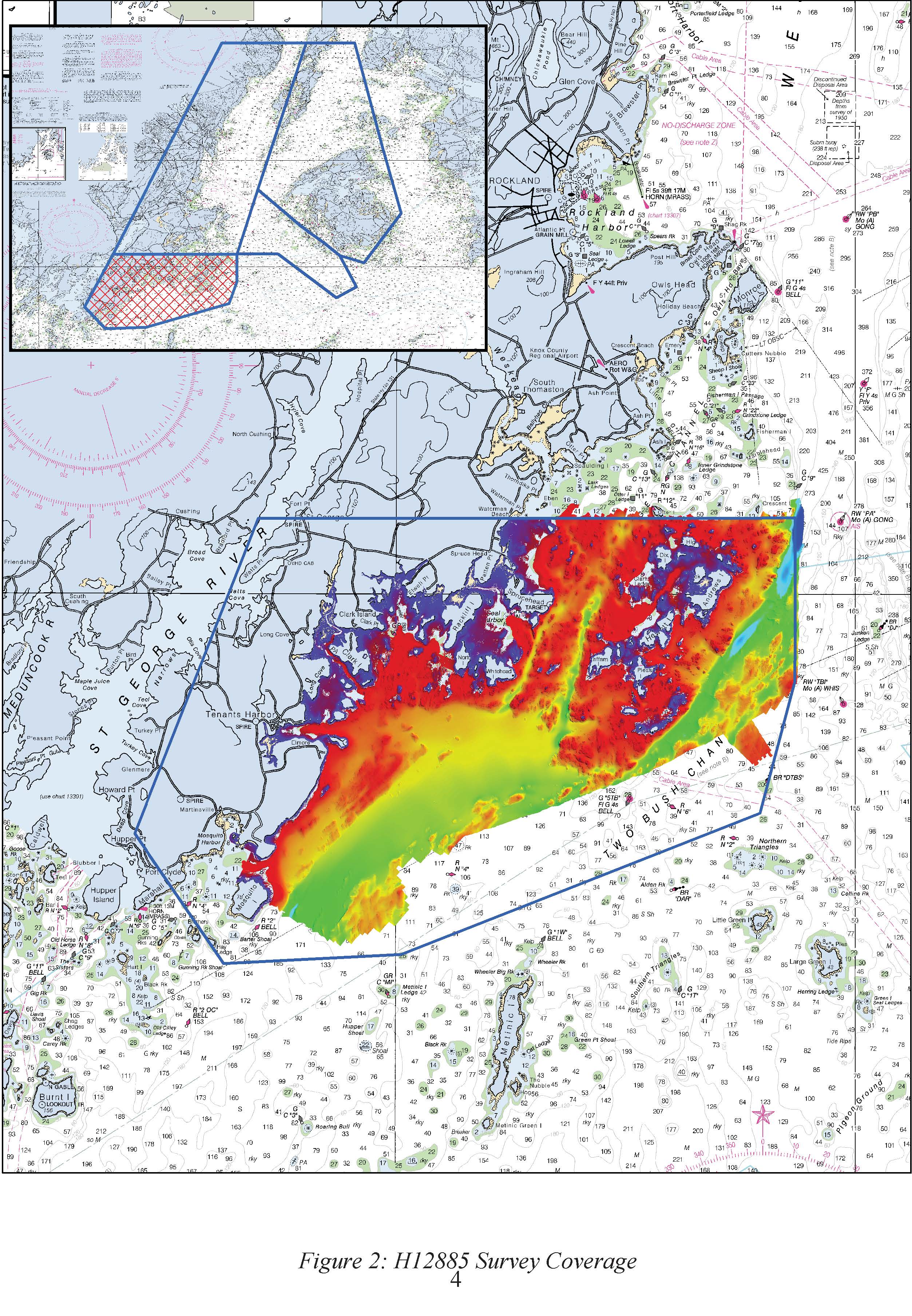
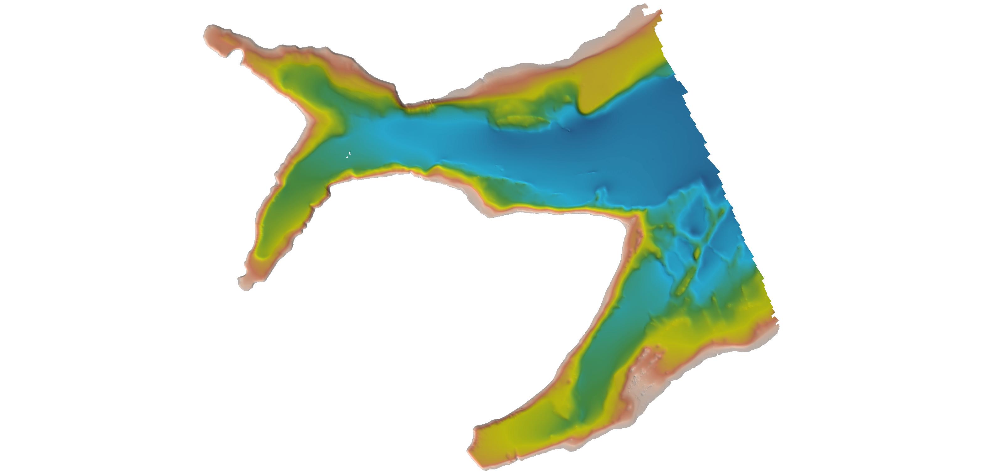
H12885: NOS Hydrographic Survey , 2016-09-29
National Oceanic and Atmospheric Administration, Department of Commerce —
The National Oceanic and Atmospheric Administration (NOAA) has the statutory mandate to collect hydrographic data in support of nautical chart compilation for safe... -
Federal
F00465: NOS Hydrographic Survey , No OPR Phone Conversation(F00465), 2000-05-31
National Oceanic and Atmospheric Administration, Department of Commerce —
The National Oceanic and Atmospheric Administration (NOAA) has the statutory mandate to collect hydrographic data in support of nautical chart compilation for safe... -
Federal
H11195: NOS Hydrographic Survey , Southwest Alaska Peninsula, Alaska, 2003-06-06
National Oceanic and Atmospheric Administration, Department of Commerce —
The National Oceanic and Atmospheric Administration (NOAA) has the statutory mandate to collect hydrographic data in support of nautical chart compilation for safe... -
Federal
H13449: NOS Hydrographic Survey , 2021-07-21
National Oceanic and Atmospheric Administration, Department of Commerce —
The National Oceanic and Atmospheric Administration (NOAA) has the statutory mandate to collect hydrographic data in support of nautical chart compilation for safe... -
Federal
H13838: NOS Hydrographic Survey , 2024-02-03
National Oceanic and Atmospheric Administration, Department of Commerce —
The National Oceanic and Atmospheric Administration (NOAA) has the statutory mandate to collect hydrographic data in support of nautical chart compilation for safe... -
Federal
NOAA TIFF Image- 0.5 meter Backscatter Mosaic of Mid Shelf Reef (St. Thomas), US Virgin Islands, Project NF-05-05, 2005, UTM 20 NAD83
National Oceanic and Atmospheric Administration, Department of Commerce —
This image represents a 0.5 meter resolution backscatter mosaic of the Mid Shelf Reef south of St. Thomas, US Virgin IslandsNOAA's NOS/NCCOS/CCMA Biogeography Team,... -
Federal
National Coral Reef Monitoring Program: Stratified Random Surveys (StRS) of Coral Demography (Adult and Juvenile Corals) across the Hawaiian Archipelago since 2013
National Oceanic and Atmospheric Administration, Department of Commerce —
NCRMP CORAL DEMOGRAPHIC DATA HAS NOW BEEN MERGED INTO A PACIFIC-WIDE METADATA RECORD -- PLEASE REFER TO https://www.fisheries.noaa.gov/inport/item/71550 FOR MOST... -
Federal
H12480: NOS Hydrographic Survey , Eastern Long Island Sound, 2012-10-10
National Oceanic and Atmospheric Administration, Department of Commerce —
The National Oceanic and Atmospheric Administration (NOAA) has the statutory mandate to collect hydrographic data in support of nautical chart compilation for safe... -
Federal
H13207: NOS Hydrographic Survey , 2019-12-04
National Oceanic and Atmospheric Administration, Department of Commerce —
The National Oceanic and Atmospheric Administration (NOAA) has the statutory mandate to collect hydrographic data in support of nautical chart compilation for safe... -
Federal
F00840: NOS Hydrographic Survey , 2021-09-03
National Oceanic and Atmospheric Administration, Department of Commerce —
The National Oceanic and Atmospheric Administration (NOAA) has the statutory mandate to collect hydrographic data in support of nautical chart compilation for safe... -
Federal
H13474: NOS Hydrographic Survey , 2021-10-07
National Oceanic and Atmospheric Administration, Department of Commerce —
The National Oceanic and Atmospheric Administration (NOAA) has the statutory mandate to collect hydrographic data in support of nautical chart compilation for safe... -
Federal
H12140: NOS Hydrographic Survey , Northern Glacier Bay, Alaska, 2009-10-11
National Oceanic and Atmospheric Administration, Department of Commerce —
The National Oceanic and Atmospheric Administration (NOAA) has the statutory mandate to collect hydrographic data in support of nautical chart compilation for safe... -
Federal
H12321: NOS Hydrographic Survey , Central Chesapeake Bay, MD, 2011-05-18
National Oceanic and Atmospheric Administration, Department of Commerce —
The National Oceanic and Atmospheric Administration (NOAA) has the statutory mandate to collect hydrographic data in support of nautical chart compilation for safe... -
Federal
High-Resolution Seismic Profiles from the US Atlantic Continental Margin Atlantic
National Oceanic and Atmospheric Administration, Department of Commerce —
Knudsen 320BR CHIRP subbottom data collected simultaneously with multibeam bathymetry and acoustic backscatter. -
Federal
H13092: NOS Hydrographic Survey , 2017-11-09
National Oceanic and Atmospheric Administration, Department of Commerce —
The National Oceanic and Atmospheric Administration (NOAA) has the statutory mandate to collect hydrographic data in support of nautical chart compilation for safe...

Official websites use .gov
A
.gov website belongs to an official government
organization in the United States.
Secure .gov websites use HTTPS
A
lock (
) or https:// means you’ve safely connected to
the .gov website. Share sensitive information only on official,
secure websites.
.jpg)
.jpg)