

32 datasets found for "Infrastructure"
-
Federal
Sources of Methane Emissions (Vista-LA), South Coast Air Basin, California, USA
National Aeronautics and Space Administration —
This data set provides spatial data products with identified and classified locations of potential methane (CH4) emitting facilities and infrastructure in the South... -
Federal
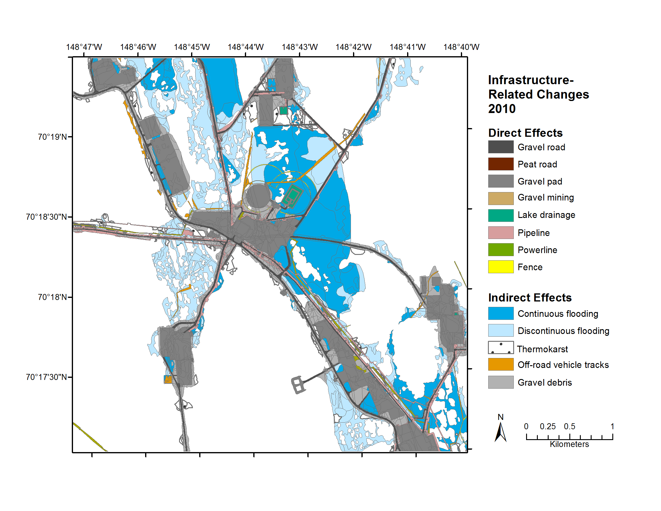
Geobotanical and Impact Map Collection for Prudhoe Bay Oilfield, Alaska, 1972-2010
National Aeronautics and Space Administration —
This data set provides a collection of maps of geoecological characteristics of areas within the Beechey Point quadrangle near Prudhoe Bay on the North slope of... -
Federal
GEDI L2B Canopy Cover and Vertical Profile Metrics Data Global Footprint Level V002
National Aeronautics and Space Administration —
The Global Ecosystem Dynamics Investigation (GEDI) mission aims to characterize ecosystem structure and dynamics to enable radically improved quantification and... -
Federal
Wind Turbine Structure Setbacks: Ordinances (2022) and Extrapolated Trends, 115 Hub Height 170 Rotor Diameter
Department of Energy —
This dataset represents wind energy setback requirements from structures based on existing county ordinances as of April 2022. A setback requirement is a minimum... -
Federal
United States Offshore Wind Supply Curves 2024
Department of Energy —
This data packet contains supply curves, hourly generation profiles, and composite siting exclusion TIFFs for offshore wind (OSW) in the waters of the EEZ off the... -
Federal
LBA-ECO LC-24 Historical Roads of the Legal Amazon: 1968-1993
National Aeronautics and Space Administration —
Understanding the impact of road investments on deforestation is part of a complete evaluation of the expansion of infrastructure for development.We find evidence of... -
Federal
LBA-ECO LC-01 City, Community, and Road Maps, Northern Ecuadorian Amazon: 1990-2002
National Aeronautics and Space Administration —
This data set contains the boundaries of the four major cities in the Northern Ecuadorian Amazon, the locations of primary communities in the colonist settlement... -
Federal
Global Inventory of Methane Emissions from Fuel Exploitation V1 (GFEI_CH4)
National Aeronautics and Space Administration —
This is a global inventory of methane emissions from fuel exploitation (GFEI) created for the NASA Carbon Monitoring System (CMS). The emission sources represented in... -
Federal
GEDI L1B Geolocated Waveform Data Global Footprint Level V002
National Aeronautics and Space Administration —
The Global Ecosystem Dynamics Investigation (GEDI) mission aims to characterize ecosystem structure and dynamics to enable radically improved quantification and... -
Federal
DSCOVR EPIC Level 2 Cloud Version 03
National Aeronautics and Space Administration —
DSCOVR_EPIC_L2_CLOUD_03 is the Deep Space Climate Observatory (DSCOVR) Earth Polychromatic Imaging Camera (EPIC) Level 2 Cloud version 03 data product. The EPIC Level...
32 datasets found for "Infrastructure"