

29 datasets found for "Geodetic Controls"
-
Federal
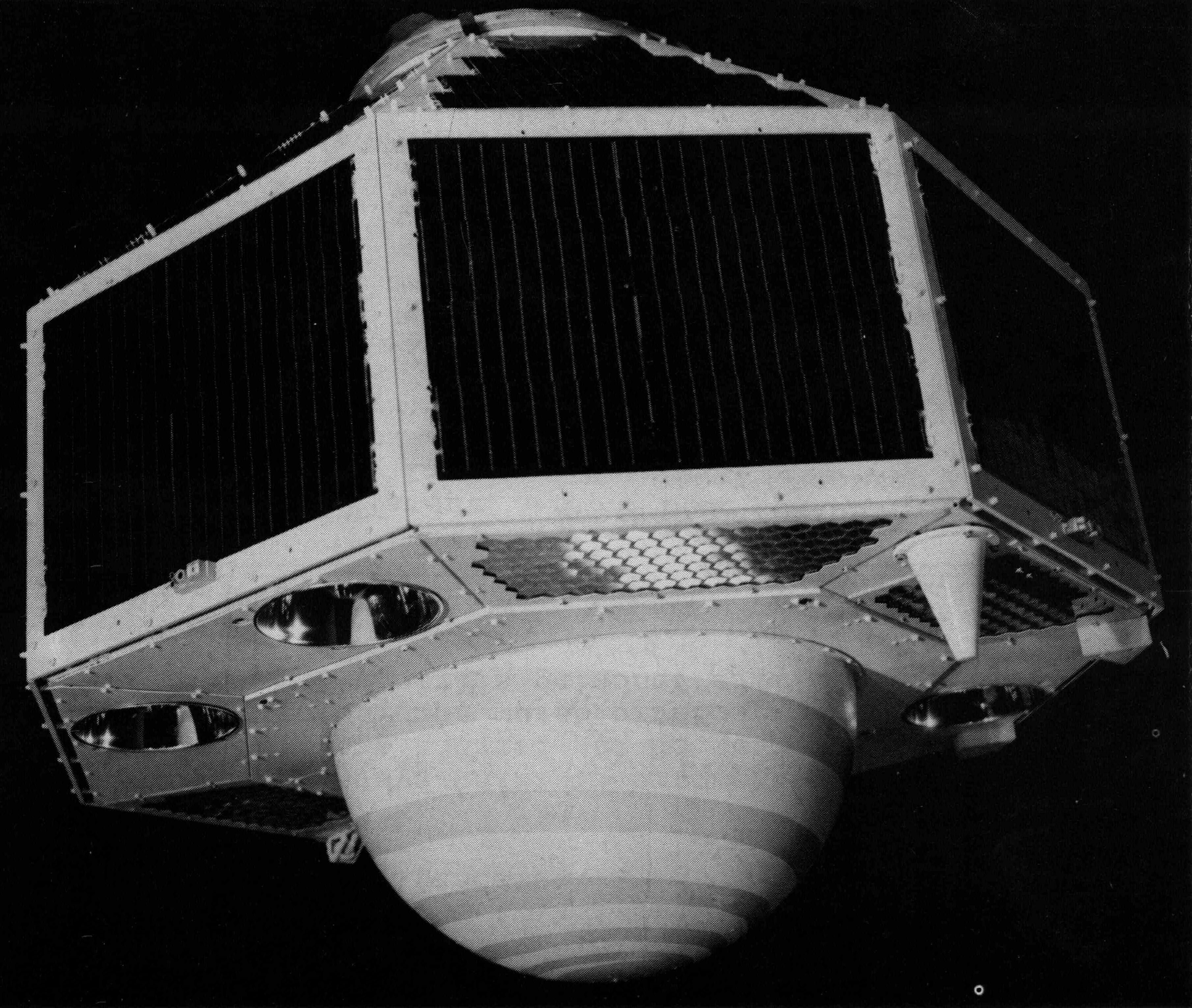
GEOS-2 International Optical Beacon Data Input V001 (GEOS2OBSINPUTINTL) at GES DISC
National Aeronautics and Space Administration —
GEOS2OBSINPUTINTL is the optical beacon system data product which contains reduced raw geodetic optical observations obtained by various international camera systems.... -
Federal
2000 Photo Mosaics and Hyperspectral Imagery for the Main Eight Hawaiian Islands Utilized to Map Shallow Water Benthic Habitats
National Oceanic and Atmospheric Administration, Department of Commerce —
This project is a cooperative effort among the National Ocean Service, National Centers for Coastal Ocean Science, Center for Coastal Monitoring and Assessment; the... -
Federal
EM710 Water Column Sonar Data Collected During SKQ201609S
National Oceanic and Atmospheric Administration, Department of Commerce —
Installation of a Real-Time Seafloor Geodetic and Thermal Observatory at the Cascadia Subduction Zone -
Federal
EM302 Water Column Sonar Data Collected During SKQ201609S
National Oceanic and Atmospheric Administration, Department of Commerce —
Installation of a Real-Time Seafloor Geodetic and Thermal Observatory at the Cascadia Subduction Zone -
Federal
2018-2019 NOAA NGS 4-band Ortho-rectified Mosaic of Chesapeake Bay (Tilghman to Hoopersville, MD)
National Oceanic and Atmospheric Administration, Department of Commerce —
This orthoimagery data set includes 0.3 meter digital orthoimages in 8-bit 4-band (RGB-IR) GeoTIFF tiles. Geographic Extent: 4 counties in Maryland, covering... -
Federal
SCATSAT-1 Scatterometer Inter-Calibrated ESDR Level 2 Ocean Surface Equivalent Neutral Wind Vectors and Wind Stress Vectors Version 1.1
National Aeronautics and Space Administration —
This dataset contains ocean surface wind vectors (equivalent neutral and true 10m) and wind stress vectors derived from satellite-based scatterometer observations... -
Federal
QuikSCAT Scatterometer Inter-Calibrated ESDR Level 2 Ocean Surface Equivalent Neutral Wind Vectors and Wind Stress Vectors Version 1.1
National Aeronautics and Space Administration —
This dataset contains ocean surface wind vectors (equivalent neutral and true 10m) and wind stress vectors derived from satellite-based scatterometer observations... -
Federal
Benthic Habitats of Florida Bay, FL 1991-1995 Biotic
National Oceanic and Atmospheric Administration, Department of Commerce —
In the winter of 1991/92 the National Oceanic and Atmospheric Administration's Office for Coastal Management's Coastal Change Analysis Program (C-CAP) and the State...
29 datasets found for "Geodetic Controls"