
-
Federal
Arctic Boreal Annual Burned Area, Circumpolar Boreal Forest and Tundra, V2, 2002-2022
National Aeronautics and Space Administration —
This dataset provides annual cumulative end-of-season burned area in circumpolar boreal forests and tundra for the years 2002-2022. The data were generated using the... -
Federal
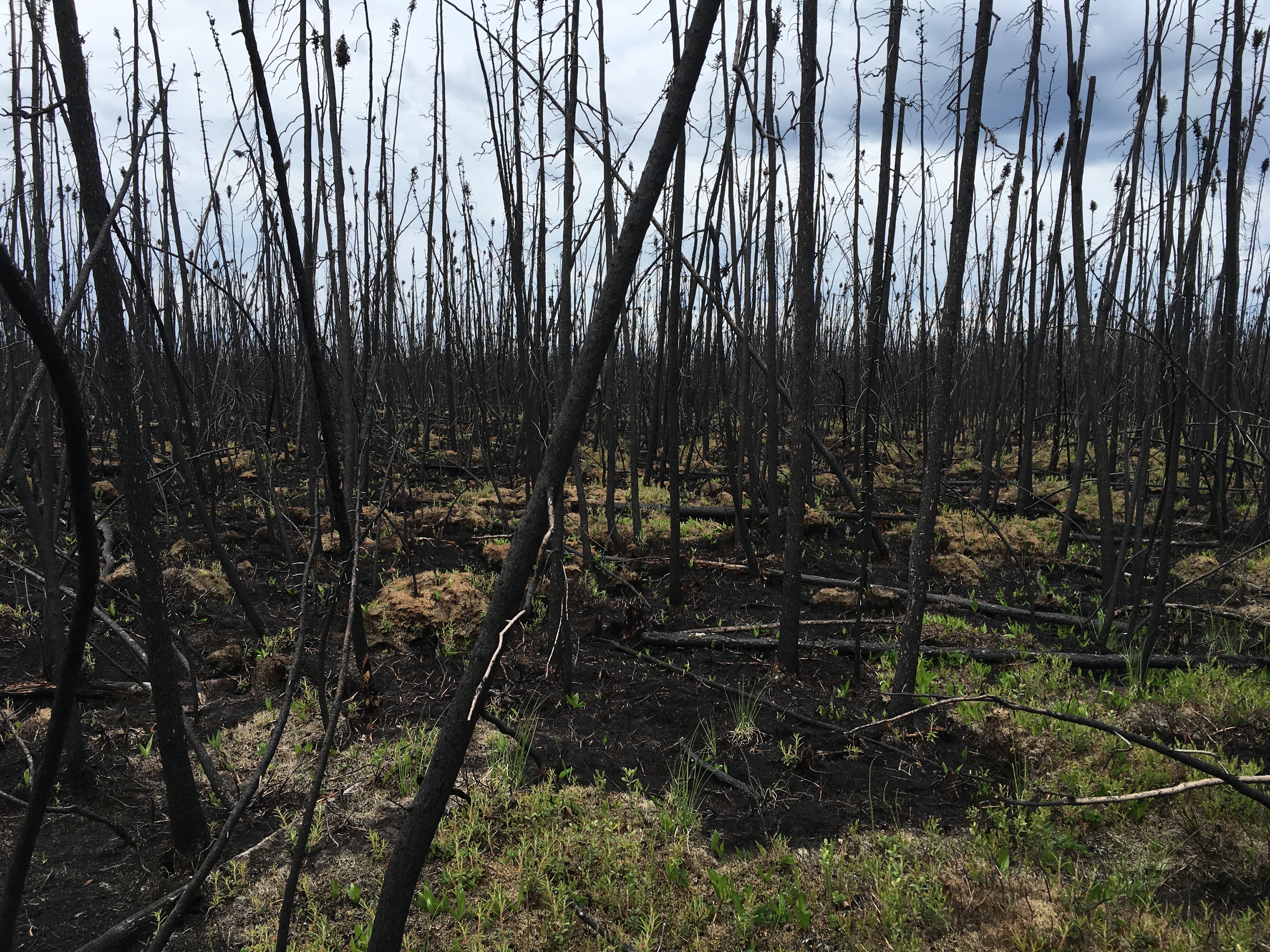
ABoVE: Characterization of Burned and Unburned Boreal Forest Stands, SK, Canada, 2016
National Aeronautics and Space Administration —
This dataset provides the results of field measurements and estimates of carbon stocks and combustion rates that characterize burned and unburned southern boreal... -
Federal
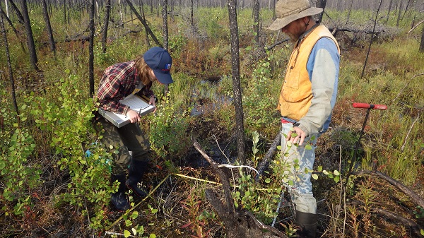
ABoVE: Post-Fire and Unburned Vegetation Community and Field Data, NWT, Canada, 2019
National Aeronautics and Space Administration —
This dataset provides vegetation community characteristics, soil moisture, and biophysical data collected in 2019 from 11 study areas, which contained 28 sites that... -
Federal
ABoVE: Post-Fire and Unburned Vegetation Community and Field Data, NWT, Canada, 2018
National Aeronautics and Space Administration —
This dataset provides vegetation community characteristics and biophysical data collected in 2018 from areas that were burned by wildfire in 2014 and 2015, and from... -
Federal
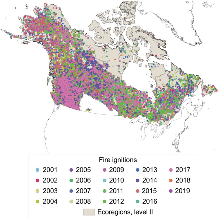
ABoVE: Ignitions of ABoVE-FED Fires in Alaska and Canada
National Aeronautics and Space Administration —
This dataset provides daily fire ignition locations and timing for boreal fires in Alaska, U.S., and Canada between 2001 and 2019. The fire ignition locations and... -
Federal
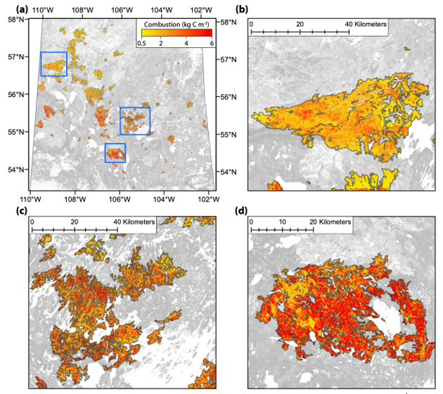
ABoVE: Spatial Estimates of Carbon Combustion from Wildfires across SK, Canada, 2015
National Aeronautics and Space Administration —
This dataset provides spatial estimates of carbon combustion from all 2015 wildfire burned areas across Saskatchewan, Canada, on a 30-m grid. Carbon combustion (kg... -
Federal
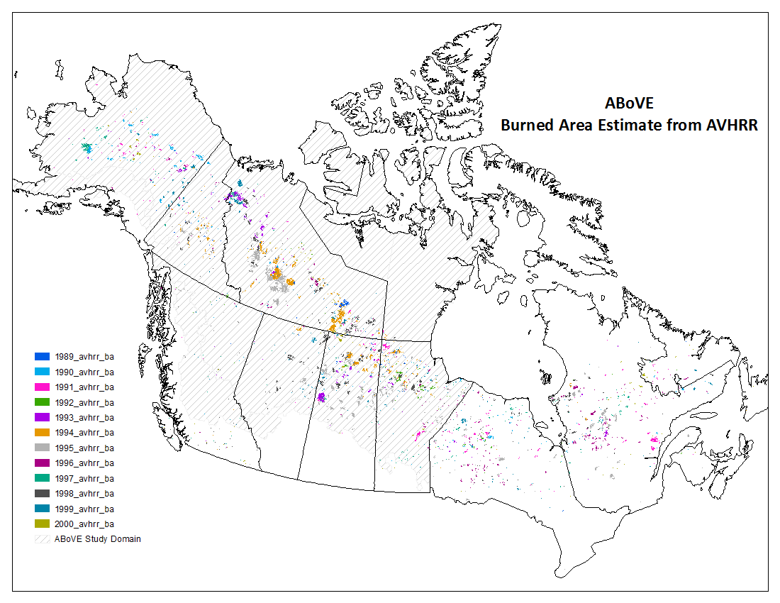
ABoVE: AVHRR-Derived Forest Fire Burned Area-Hot Spots, Alaska and Canada, 1989-2000
National Aeronautics and Space Administration —
This dataset provides annual forest fire burned area and daily hotspot products developed using data acquired from the Advanced Very-High-Resolution Radiometer... -
Federal
MASTER: FireSense, California and Southern US, Spring 2025
National Aeronautics and Space Administration —
This dataset includes Level 1B (L1B) and Level 2 (L2) data products from the MODIS/ASTER Airborne Simulator (MASTER) instrument. The spectral data were collected as... -
Federal
SAFARI 2000 Historical Fire Maps, Kruger National Park, 1992-2001
National Aeronautics and Space Administration —
Kruger National Park (KNP) was established in 1898 to protect wildlife on nearly 2 million hectares of the South African Lowveld. The climate in this region of South... -
Federal
Automation of Field Operations and Services (AFOS) National Weather Service (NWS) Service Records and Retention System (SRRS) Data
National Oceanic and Atmospheric Administration, Department of Commerce —
Service Records and Retention System (SRRS) is historical digital data set DSI-9949, a collection of products created by the U.S. National Weather Service (NWS) and... -
Federal
NOAA GOES-R Series Advanced Baseline Imager (ABI) Level 2 Fire/Hot Spot Characterization (FDC)
National Oceanic and Atmospheric Administration, Department of Commerce —
The GOES-R Advanced Baseline Imager (ABI) Fire (HSC) product contains four images, one in the form of a fire mask, and the other three with pixel values identifying... -
Federal
NCCOS Assessment: Prescribed Fire in Coastal Alabama and Mississippi, 1992-01-01 to 2022-12-31
National Oceanic and Atmospheric Administration, Department of Commerce —
This dataset includes smoke and prescribed fire density from the National Centers for Coastal Ocean Science (NCCOS) Social Science team's Prescribed Fire project in... -
Federal
Data from: Quantifying wildfire risk to the built environment in rangelands of the US Interior West
Department of Agriculture —
OverviewFire increasingly conflicts with the built environment. The Wildland-Urban Interface (WUI) describes areas where vegetation near the built environment... -
Federal
Tree Mortality from Fires and Bark Beetles at 1-km Resolution, Western USA, 2003-2012
National Aeronautics and Space Administration —
This dataset provides annual estimates of tree mortality due to fires and bark beetles from 2003 to 2012 on forestland in the continental western United States. Tree... -
Federal
VIIRS/NPP Burned Area Monthly L4 Global 500m SIN Grid V001
National Aeronautics and Space Administration —
The VNP64A1 Version 1 data product was decommissioned on July 31, 2025. Users are encouraged to use theFederalUnderstory Vegetation Biomass from Selected Burned and Unburned sites in Alaska
National Aeronautics and Space Administration —
This dataset provides measurements of vegetation biomass from 11 locations across Alaska during 2016 to 2018. Vegetation was harvested from plots that were located at...FederalLBA-ECO LC-23 Characterization of Vegetation Fire Dynamics for Brazil: 2001-2003
National Aeronautics and Space Administration —
Satellite fire detection was determined from two sensors—the Advanced Very High Resolution Radiometer (AVHRR) on NOAA-12 and the Moderate Resolution Imaging...FederalLBA-ECO LC-08 Passive Ground-based Fire Data, Para and Mato Grosso Brazil: 2001-2002
National Aeronautics and Space Administration —
This data set reports observations of fires in the vicinity of Maraba, Para, Brazil, from November 3-5th, 2001, and in Mato Grosso, Brazil, between Cuiaba and Alta...FederalLBA-ECO LC-02 GOES-08 Hot Pixel Data from Acre, Brazil: 1998, 2000, and 2001
National Aeronautics and Space Administration —
This data set provides hot pixel data, as an indicator of fires that were detected by the GOES-8 satellite for the state of Acre, Brazil. Image data were collected...FederalBurned and Unburned Field Site Data, Noatak, Seward, and North Slope, AK, 2016-2018
National Aeronautics and Space Administration —
This dataset includes field measurements from unburned and burned 10 m x 10 m and 1 m x 1 m plots in the Noatak, Seward, and North Slope regions of the Alaskan tundra...60 datasets found for "Fire Hazards"

Official websites use .gov
A
.gov website belongs to an official government
organization in the United States.
Secure .gov websites use HTTPS
A
lock (
) or https:// means you’ve safely connected to
the .gov website. Share sensitive information only on official,
secure websites.