
-
Federal
Data from: Avian Sentinels Neural Nest: AI-Powered Bird Monitoring System for Real-Time Detection and Species Identification
Department of Agriculture —
Traditional bird deterrent methods, such as scarecrows, loud noise emitters, and netting, can become less effective over time due to bird habituation. This study... -
Federal
Data and Images from: Numerical Signature Dataset of Thoracic and Elytral Fragments from Curculionidae and Tenebrionidae Beetles for AI-Based Species Identification
Department of Agriculture —
This dataset presents curated and annotated 256×256 pixel image fragments of thoracic and elytral regions from six economically significant species within the beetle... -
Federal
Data and Code from: Smart vision-based monitoring system for AI-driven moth population estimation using camera-equipped trap imaging
Department of Agriculture —
Real-time, image-based monitoring for stored product insect pests could increase timely treatments and protection for postharvest products throughout the supply... -
Federal
Data from: Pyrosequencing-Based Analysis of the Microbiome Associated with the Horn Fly, Haematobia irritans
Department of Agriculture —
The bacterial 16S tag-encoded FLX-titanium amplicon pyrosequencing (bTEFAP) method was used to carry out the classification analysis of bacterial flora in adult... -
Federal
Gridded Species Distribution: Global Amphibian Richness Grids, 2015 Release
National Aeronautics and Space Administration —
The 2015 Release of the Global Amphibian Richness Grids data set of the Gridded Species Distribution collection are aggregations of the presence grids data for the... -
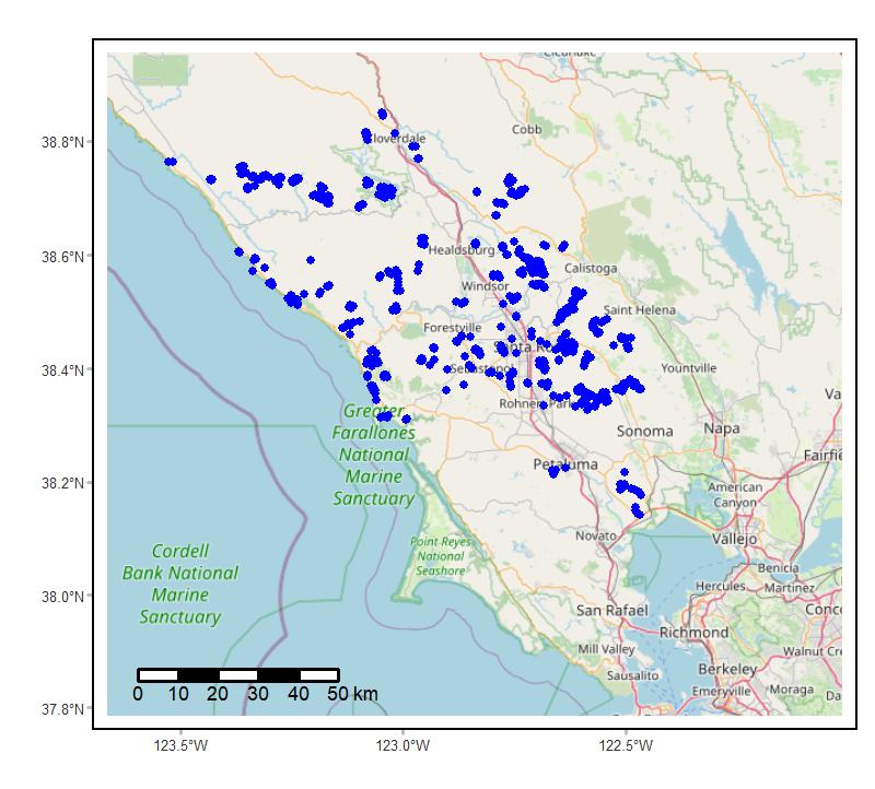
Federal
Soundscapes to Landscapes Acoustic Recordings, Sonoma County, CA, 2017-2022
National Aeronautics and Space Administration —
This dataset holds in situ sound recordings from sites in Sonoma County, California, USA as part of the Soundscapes to Landscapes citizen science project. Recordings... -
Federal
RLC Forest Cover Map of the Former Soviet Union, 1990
National Aeronautics and Space Administration —
This data set is a 1:2.5 million scale forest cover map for the land area of the Former Soviet Union that was completed in 1990 (Garsia 1990). There are forty-five... -
Federal
SAFARI 2000 Estimated BVOC Emissions for Southern African Land Cover Types
National Aeronautics and Space Administration —
Improved vegetation distribution and emission data for Africa south of the equator were developed for the Southern African Regional Science Initiative (SAFARI 2000)... -
Federal
Global Forest Cover Change Water Cover 2000 Global 30m V001
National Aeronautics and Space Administration —
The Land Processes Distributed Active Archive Center (LP DAAC) archives and distributes Global Forest Cover Change (GFCC) data products through the NASA Making Earth... -
Federal
Arctic Vegetation Plots at Atqasuk, Alaska, 1975, 2000, and 2010
National Aeronautics and Space Administration —
This data set provides vegetation species abundance data collected in 1975 from 60 sites on the Arctic Coastal Plain near Atqasuk, Alaska, as well as environmental... -
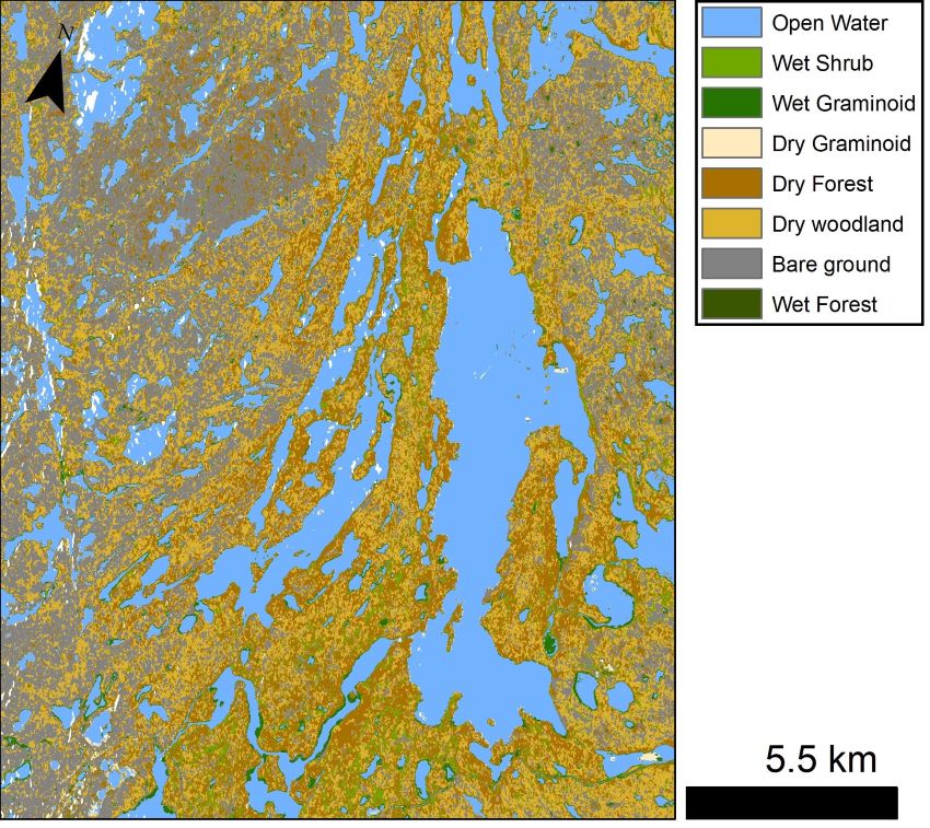
Federal
ABoVE: Wetland Vegetation Classification for Peace-Athabasca Delta, Canada, 2019
National Aeronautics and Space Administration —
This dataset contains land cover classification focused on water and wetland vegetation communities over the Peace-Athabasca Delta, Canada. Four classification maps... -
Federal
ABoVE: Lake and Wetland Classification from L-band SAR, Alaska and Canada, 2017-2019
National Aeronautics and Space Administration —
This dataset contains a high-resolution land cover classification focused on water and wetland vegetation classes over three NASA ABoVE Campaign regions: Yukon Flats,... -
Federal
Phenoregions For Monitoring Vegetation Responses to Climate Change
National Aeronautics and Space Administration —
The overall purpose in this research was to identify the regions of the world best suited for long-term monitoring of biospheric responses to climate change, i.e.... -
Federal
MODIS/Terra Vegetation Continuous Fields Yearly L3 Global 250m SIN Grid V061
National Aeronautics and Space Administration —
The MOD44B Version 6.1 Vegetation Continuous Fields (VCF) yearly product is a global representation of surface vegetation cover as gradations of three ground cover... -
Federal
Snow Properties and Wildlife Tracks in Washington and Alaska
National Aeronautics and Space Administration —
This dataset contains three field seasons of snow-wildlife observations conducted at 707 sites from January 2021 to March 2023 in Washington and Alaska, spanning a... -
Federal
HLS Sentinel-2 Multi-spectral Instrument Vegetation Indices Daily Global 30 m V2.0
National Aeronautics and Space Administration —
The Harmonized Landsat and Sentinel-2 (HLS) project provides consistent data products from the Operational Land Imager (OLI) aboard the joint NASA/USGS Landsat 8 and... -
Federal
Data from: Visualizing Plant Responses: Novel Insights Possible through Affordable Imaging Techniques in the Greenhouse
Department of Agriculture —
Data of image calculation averages, coefficient of variations, and experimental measurements that were presented in the manuscript, Visualizing Plant Responses: Novel... -
Federal
National Aggregates of Geospatial Data Collection: Population, Landscape, And Climate Estimates, Version 4 (PLACE IV)
National Aeronautics and Space Administration —
The National Aggregates of Geospatial Data Collection: Population, Landscape, And Climate Estimates, Version 4 (PLACE IV) provides measures of population (head... -
Federal
MODIS/Terra+Aqua Photosynthetically Active Radiation Daily/3-Hour L3 Global 0.05Deg CMG V062
National Aeronautics and Space Administration —
The MCD18C2 Version 6.2 is a Moderate Resolution Imaging Spectroradiometer (MODIS) Terra and Aqua combined Photosynthetically Active Radiation (PAR) gridded Level 3... -
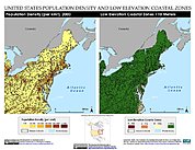
Federal
Low Elevation Coastal Zone (LECZ) Urban-Rural Population Estimates, Global Rural-Urban Mapping Project (GRUMP), Alpha Version
National Aeronautics and Space Administration —
The Low Elevation Coastal Zone (LECZ) Urban-Rural Population Estimates consists of country-level estimates of urban, rural and total population and land area country-...

Official websites use .gov
A
.gov website belongs to an official government
organization in the United States.
Secure .gov websites use HTTPS
A
lock (
) or https:// means you’ve safely connected to
the .gov website. Share sensitive information only on official,
secure websites.